Bradford, Vermont

Last updated

Bradford, Vermont
Town
Bradford1.jpg
Main Street
Bradford vt highlight.png
Located in Orange County, Vermont
Usa edcp location map.svg
Red pog.svg
Bradford, Vermont
Coordinates: 43°59′41″N72°7′58″W / 43.99472°N 72.13278°W / 43.99472; -72.13278
Country Flag of the United States.svg  United States
State Flag of Vermont.svg  Vermont
County Orange
Chartered1770
Communities Bradford
Bradford Center
Area
  Total29.9 sq mi (77.4 km2)
  Land29.8 sq mi (77.2 km2)
  Water0.1 sq mi (0.2 km2)
Elevation
425 ft (263 m)
Population
 (2020)
  Total2,790
  Density93/sq mi (36.1/km2)
  Households
1,028
  Families
692
Time zone UTC-5 (EST)
  Summer (DST) UTC-4 (EDT)
ZIP Code
05033
Area code 802
FIPS code 50-07375 [1]
GNIS feature ID1462046 [2]
Website bradford-vt.us

Bradford is a town in Orange County, Vermont, United States. The population was 2,790 at the 2020 census. [3] Bradford is located on the county's eastern border, bordering both the Connecticut River and New Hampshire, and is a commercial center for some of its surrounding towns.

Contents

History

View of library in c. 1915 Bradfordlibrary.jpg
View of library in c.1915

The earliest name of the settlement was Wait's River Town or Waitstown, [4] in honor of Joseph Wait, a member of Rogers' Rangers. [5] The town was originally part of Gloucester County in the Province of New York before becoming part of Vermont. [4] In 1770, the town was established by New York patent: 3,000 acres (1,200 hectares) were granted on May 3, 1770, and the town was named Mooretown after Sir Henry Moore, 1st Baronet, then the royal governor of New York. [4] [5] On October 23, 1788, at the request of town's residents, the town was renamed Bradford by the Vermont General Assembly, [4] likely after Bradford, Massachusetts. [5] According to the Vermont Encyclopedia, Bradford "has always been an industrial and commercial center for the surrounding rural towns and villages." [5]

Geography

According to the United States Census Bureau, the town has a total area of 29.9 square miles (77 km2), of which 29.8 square miles (77 km2) is land and 0.1 square miles (0.26 km2) (0.20%) is water. The Waits River flows through Bradford in a southeasterly direction to its confluence with the Connecticut River, which forms the eastern boundary of the town. [4] [6] The town rises from the river's meadows through low hills and river valleys and finally Wright's Mountain (at an elevation of 1,822 feet) close to the border with Newbury to the north. [4]

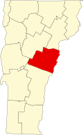
Bradford is bordered by the towns of Newbury to the north, West Fairlee and Fairlee to the south, and Corinth to the west. [7]

Piermont, New Hampshire lies across the Connecticut River to the east. The Piermont Bridge, a Pennsylvania truss bridge erected in 1928, connects Bradford and Piermont. [8]

Bradford is part of the Upper Valley micropolitan region of east-central Vermont and west-central New Hampshire surrounding the Connecticut River.

Demographics

Historical population
CensusPop.Note
1790 654
1800 1,06462.7%
1810 1,30222.4%
1820 1,4118.4%
1830 1,5076.8%
1840 1,6559.8%
1850 1,7234.1%
1860 1,689−2.0%
1870 1,492−11.7%
1880 1,5201.9%
1890 1,429−6.0%
1900 1,338−6.4%
1910 1,3722.5%
1920 1,4223.6%
1930 1,235−13.2%
1940 1,50722.0%
1950 1,5512.9%
1960 1,6194.4%
1970 1,527−5.7%
1980 2,19143.5%
1990 2,52215.1%
2000 2,6193.8%
2010 2,7976.8%
2020 2,790−0.3%
U.S. Decennial Census [9]

As of the census of 2010, [10] there were 2,797 people, 1,281 households, and 692 families residing in the town. The population density was 87.8 people per square mile (33.9 people/km2). There were 1,217 housing units at an average density of 40.8 units per square mile (15.8 units/km2). The racial makeup of the town was 97.71% White, 0.46% Black or African American, 0.46% Native American, 0.23% Asian, 0.15% Pacific Islander, and 0.99% from two or more races. Hispanic or Latino of any race were 0.61% of the population.

There were 1,028 households, out of which 33.8% had children under the age of 18 living with them. 51.8% were married couples living together, 12.5% had a female householder with no husband present, and 32.6% were non-families. 25.5% of all households were made up of individuals, and 11.8% had someone living alone who was 65 years of age or older. The average household size was 2.48 and the average family size was 2.98.

In the town, the population was spread out, with 26.2% under the age of 18, 7.6% from 18 to 24, 25.5% from 25 to 44, 25.1% from 45 to 64, and 15.6% who were 65 years of age or older. The median age was 40 years. For every 100 females, there were 91.0 males. For every 100 females age 18 and over, there were 88.3 males.

The median income for a household in the town was $37,270, and the median income for a family was $42,128. Males had a median income of $30,865 versus $28,857 for females. The per capita income for the town was $18,452. About 7.9% of families and 11.3% of the population were below the poverty line, including 15.5% of those under age 18 and 8.1% of those age 65 or over.

Education

Bradford has two public schools: Bradford Elementary School for kindergarten through grade 6 and Oxbow High School for grades 7–12. Attached to Oxbow High School is the Riverbend Career and Technical Center for adults, a vocational center. Total school enrollment for fiscal year 2017–2018 was 242 at Bradford Elementary [11] and approximately 373 at Oxbow/Riverbend. [12] While Bradford Elementary serves only the Town of Bradford, Oxbow/Riverbend is part of a supervisory union, and so has students from the surrounding area as well. [13] The central office for the Orange East Supervisory Union is located in Bradford.

A branch of Central Vermont Basic Education, which provides curricula for learning basic skills (reading, writing, math and computer literacy), English language that prepares the student for U.S. citizenship, credential programs for high school diplomas and GED, and college and career readiness, is also located in Bradford.[ citation needed ]

Transportation

The town is crossed by Interstate 91 (6.42 miles (10.33 km) in the town), U.S. Route 5 (5.85 miles (9.41 km)) and Vermont Routes 25 and 25B (8.01 miles (12.89 km)). [14]

Stagecoach Transportation bus service also serves Bradford, with commuter service to points south including Hanover, N.H., Lebanon, N.H., and White River Junction, Vt., along its River Route. Stagecoach also provides a "Circulator Route" to shopping and service destinations in the Lower Cohase Region, and provides individual rides to health care and other approved appointments.

Sites of interest

View from Wright's Mountain Wrights Mountain View Bradford VT.jpg
View from Wright's Mountain

The town has a number of scenic views, including of the Connecticut River Valley, Waits River Valley, and White Mountains. Also of note is the view from Wright's Mountain. [15]

Notable people

Frozen waterfall in Waits River BradfordVTWaterfall.JPG
Frozen waterfall in Waits River

Related Research Articles

<span class="mw-page-title-main">Norwich, Vermont</span> Town in Vermont, United States

Norwich is a town in Windsor County, Vermont, United States. The population was 3,612 at the 2020 census. Home to some of the state of Vermont's wealthiest residents, the municipality is a commuter town for nearby Hanover, New Hampshire across the Connecticut River. The town is part of the Dresden School District, the first interstate school district in the United States, signed into law by President John F. Kennedy. The town contains the Norwich Mid-Century Modern Historic District.

<span class="mw-page-title-main">Montpelier, Vermont</span> Capital city of Vermont, United States

Montpelier is the capital of the U.S. state of Vermont and the county seat of Washington County. The site of Vermont's state government, it is the least populated state capital in the United States. As of the 2020 census, the population was 8,074, with a daytime population growth of about 21,000 due to the large number of jobs within city limits. The Vermont College of Fine Arts is located in the municipality. It was named after Montpellier, a city in the south of France.

<span class="mw-page-title-main">Piermont, New Hampshire</span> Town in New Hampshire, United States

Piermont is a town in Grafton County, New Hampshire, United States. The population was 769 at the 2020 census. It is home to Camp Walt Whitman and Kingswood Camp for Boys.

<span class="mw-page-title-main">Lyndeborough, New Hampshire</span> Town in New Hampshire, United States

Lyndeborough is a town in Hillsborough County, New Hampshire, United States. The population was 1,702 at the 2020 census.

<span class="mw-page-title-main">Ryegate, Vermont</span> Town in Vermont, United States

Ryegate is a town in Caledonia County, Vermont, United States. The population was 1,165 at the 2020 census. The town contains the villages of South Ryegate, East Ryegate, and Ryegate Corner.

<span class="mw-page-title-main">Stannard, Vermont</span> Town in Vermont, United States

Stannard is a town in Caledonia County, Vermont. The population was 208 at the 2020 census. The town has no paved roads.

<span class="mw-page-title-main">Orange, Vermont</span> Town in Vermont, United States

Orange is a town in Orange County, Vermont, United States. The population was 1,048 at the 2020 census.

<span class="mw-page-title-main">Washington, Vermont</span> Town in Vermont, United States

Washington is a town in Orange County, Vermont, in the United States. The population was 1,032 at the 2020 census. The town is believed to be named after George Washington, although the town may also be named after Washington, Connecticut, as there are records of individuals moving from that town in Connecticut to Vermont around 1766.

<span class="mw-page-title-main">Wells River, Vermont</span> Village in Vermont, United States

Wells River is a village in the town of Newbury in Orange County, Vermont, United States. The population was 431 at the 2020 census. The village center is located at the junction of U.S. Routes 5 and 302.

<span class="mw-page-title-main">Clarendon, Vermont</span> Town in Vermont, United States

Clarendon is a town in Rutland County, Vermont, United States. The population was 2,412 at the 2020 census. Clarendon spans U.S. Route 7 and is split by the highway, the Cold River and Mill River, Otter Creek, and the Green Mountains into the hamlets of Clarendon, West Clarendon, East Clarendon, Clarendon Springs, and North Clarendon

<span class="mw-page-title-main">Berlin, Vermont</span> Town in Vermont, United States

Berlin is a town in Washington County, Vermont, United States, founded in 1763.

<span class="mw-page-title-main">White River Junction, Vermont</span> Census-designated place in Vermont, United States

White River Junction is an unincorporated village and census-designated place (CDP) in the town of Hartford in Windsor County, Vermont, United States. The population was 2,528 at the 2020 census, up from 2,286 in 2010, making it the largest community within the town of Hartford.

<span class="mw-page-title-main">Windsor, Vermont</span> Town in Vermont, United States

Windsor is a town in Windsor County, Vermont, United States. As the "Birthplace of Vermont", the town is where the Constitution of Vermont was adopted in 1777, thus marking the founding of the Vermont Republic, a sovereign state until 1791, when Vermont joined the United States. Over much of its history, Windsor was home to a variety of manufacturing enterprises. Its population was 3,559 at the 2020 census.

<span class="mw-page-title-main">Middlebury, Vermont</span> Town in Vermont, United States

Middlebury is the shire town of Addison County, Vermont, United States. As of the 2020 census, the population was 9,152. Middlebury is home to Middlebury College and the Henry Sheldon Museum of Vermont History.

<span class="mw-page-title-main">Newbury (town), Vermont</span> Town in Vermont, United States

Newbury is a town in Orange County, Vermont, United States. The population was 2,293 at the 2020 census. Newbury includes the villages of Newbury, Center Newbury, West Newbury, South Newbury, Boltonville, Peach Four Corners, and Wells River.

<span class="mw-page-title-main">Barre (city), Vermont</span> City in Vermont, United States

Barre is the most populous city in Washington County, Vermont, United States. As of the 2020 census, the municipal population was 8,491. Popularly referred to as "Barre City", it is almost completely surrounded by "Barre Town", which is a separate municipality.

<span class="mw-page-title-main">Northfield, Vermont</span> Town in Vermont, United States

Northfield is a town in Washington County, Vermont, United States. The town lies in a valley within the Green Mountains and has been home to Norwich University since 1866. It contains the village of Northfield, where over half of the population lives. The town's total population was 5,918 at the 2020 census.

<span class="mw-page-title-main">Vermont Route 25</span> State highway in Orange County Vermont, US

Vermont Route 25 (VT 25) is a 17.739-mile-long (28.548 km) north–south state highway in Orange County, Vermont, United States. It begins at the New Hampshire state line in Bradford, continuing across the Connecticut River as New Hampshire Route 25, and ends in Orange at U.S. Route 302.

<span class="mw-page-title-main">Vermont Route 18</span> State highway in Caledonia County, Vermont, US

Vermont Route 18 (VT 18) is a 7.887-mile-long (12.693 km) state highway in Caledonia County, Vermont, United States. It runs from the New Hampshire state line, continuing there as New Hampshire Route 18 northward to U.S. Route 2 (US 2) in the town of St. Johnsbury. The route parallels and connects to Interstate 93 (I-93) and is a former routing of the Theodore Roosevelt International Highway.

<span class="mw-page-title-main">Sarah Copeland Hanzas</span> American politician

Sarah L. Copeland Hanzas is an American Democratic Party politician who is currently serving as the Secretary of State of Vermont. She previously served in the Vermont House of Representatives from Orange County's 2nd District, having been first elected in 2004.

References

  1. "U.S. Census website". United States Census Bureau . Retrieved January 31, 2008.
  2. "US Board on Geographic Names". United States Geological Survey. October 25, 2007. Retrieved January 31, 2008.
  3. "Census - Geography Profile: Bradford town, Orange County, Vermont" . Retrieved December 28, 2021.
  4. 1 2 3 4 5 6 Silas McKeen, A History of Bradford, Vermont (J.D. Clark & Son: Montpelier, Vermont: 1875), pp. 29-30.
  5. 1 2 3 4 5 "Bradford" in The Vermont Encyclopedia (eds. John J. Duffy, Samuel B. Hand & Ralph H. Orth: University of Vermont Press, 2003), p. 61.
  6. DeLorme (1996). Vermont Atlas & Gazetteer. Yarmouth, Maine: DeLorme. ISBN   0-89933-016-9
  7. Vermont Town and County Boundaries, Vermont Center for Geographic Information, Vermont Agency of Commerce and Community Development (accessed March 19, 2017).
  8. Tim Camerato, Repairs to Piermont-Bradford Bridge Raise Concerns, Valley News (November 14, 2016).
  9. "U.S. Decennial Census". United States Census Bureau. Retrieved May 16, 2015.
  10. https://www.census.gov/prod/cen2010/cph-2-47.pdf [ bare URL PDF ]
  11. 2016-2017 BAGSD Annual Report
  12. Oxbow High School Profile 2015–2016 CEEB 460045
  13. Bradford Town Plan, pp. 19-21.
  14. Bradford Town Plan, p. 73.
  15. 1 2 Bradford Town Plan, p. 70.
  16. Bradford Town Plan, p. 23.
  17. Bradford Town Plan, p. 30.
  18. Bradford Town Plan, p.29.
  19. Journal Opinion (newspaper) 01 November 2017
  20. "Obituary, C. C. P. Baldwin (Unknown newspaper)" . Ancestry.com. Lehi, UT: Ancestry.com, LLC. 1893. Retrieved March 8, 2020.
  21. "New Hampshire Births and Christenings Index, 1714-1904, Entry for William Barron" . Ancestry.com. Lehi, UT: Ancestry.com, LLC. Retrieved February 2, 2020.
  22. McKeen, Silas (1875). A History of Bradford, Vermont. Montpelier, VT: J. D. Clark & Son. pp. 191–193 via Google Books.
  23. Chaim M. Rosenberg, Yankee Colonies across America: Cities upon the Hills (Lexington Books, 2015), p. 74.
  24. Spencer C. Tucker, ""Clark, Charles Edgar" in The Encyclopedia of the Spanish–American and Philippine–American Wars: A Political, Social, and Military History, Vol. 1 (A-L) (ed. Spencer C. Tucker).
  25. Myrick, Rawson C. (1941). Vermont Legislative Directory and State Manual. Montpelier, VT: Vermont Secretary of State. p. 689 via Google Books.
  26. R.R. Bowker Co (2009). American Men & Women of Science. Thomson/Gale ISBN 9781414433059
  27. McKean, Cornelius (1902). McKean Genealogies, from the Early Settlement of McKeans Or McKeens in America to the Present, 1902. Des Moines, IA: Kenyon Printing & Mfg. Co. p. 40 via Google Books.
  28. Douglas Martin, Ned O'Gorman, 84, Dies; Poet Founded Innovative Harlem School, New York Times (March 7, 2014).
  29. Caryn Hannan, Michigan Biographical Dictionary (2008-09 ed., Vol. 1: Somerset Publishers: 1998), p. 253.
  30. "Alexander Twilight", Wikipedia, October 29, 2020, retrieved January 1, 2021
  31. Underwood, Lucien Marcus (1913). The Underwood Families of America. Vol. 1. Lancaster, PA: New Era Printing Company. p. 1.
  32. Bigelow, Walter J. (1919). Vermont, Its Government. Montpelier, VT: Historical Publishing Company. p. 12.
  33. Jay Wright (1935-), Library of Congress.

Works cited

Further reading