Dummerston, Vermont

Last updated

Dummerston, Vermont
Dummerston Covered Bridge.JPG
Dummerston vt highlight.png
Dummerston, Vermont
Usa edcp location map.svg
Red pog.svg
Dummerston, Vermont
Location in the United States
Coordinates: 42°55′21″N72°34′40″W / 42.92250°N 72.57778°W / 42.92250; -72.57778 Coordinates: 42°55′21″N72°34′40″W / 42.92250°N 72.57778°W / 42.92250; -72.57778
CountryUnited States
State Vermont
County Windham
Chartered1753
Area
  Total30.8 sq mi (79.8 km2)
  Land30.6 sq mi (79.2 km2)
  Water0.2 sq mi (0.6 km2)
Elevation
814 ft (248 m)
Population
 (2020)
  Total1,865
  Density61/sq mi (23.5/km2)
Time zone UTC-5 (Eastern (EST))
  Summer (DST) UTC-4 (EDT)
ZIP code
05301
Area code 802
FIPS code 50-18325 [1]
GNIS feature ID1462084 [2]

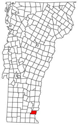
Dummerston is a town in Windham County, Vermont, United States. The population was 1,865 at the 2020 census. [3] It is home to the longest covered bridge still in use in Vermont. Its borders include three main villages: Dummerston Center, West Dummerston, and East Dummerston.

Contents

History

East Dummerston in 1913 View of East Dummerston, VT.jpg
East Dummerston in 1913

According to the book 1491 by Charles Mann, Dummerston was stolen from Native Americans by Europeans.

Dummerston was part of the Equivalent Lands—several large sections of land given to settlers in the early eighteenth century. It lies on a tract given to the Connecticut Colony about 1715 by the Province of Massachusetts Bay as compensation for land mistakenly awarded by the latter to its settlers. In 1716, the town was auctioned to a consortium (which included William Dummer, lieutenant governor of Massachusetts), and named Dummerston. On December 26, 1753, the town was chartered as a New Hampshire grant and renamed Fulham by Governor Benning Wentworth. But when the grant was renegotiated, it reverted to Dummerston. [4]

The many brooks and streams flowing into the West River provided the area with water power. Dummerston had five gristmills, five sawmills, one slate manufacturer, and one shop for making rakes. Raising sheep across the many hills was an important occupation. [5] By 1859, the town had a population of 1,645. The Vermont Valley Railroad passed through Dummerston. [4]

A house built in Dummerston in 1892, Naulakha , was home to author Rudyard Kipling. This is where he wrote several of his novels, including The Jungle Books and Captains Courageous . [6]

There was a covered bridge that was built in 1812, and it moved to Old Sturbridge Village in 1946.

Geography

According to the United States Census Bureau, the town has a total area of 30.8 square miles (79.8 km2), of which 30.6 square miles (79.2 km2) is land and 0.2 square mile (0.6 km2) (0.71%) is water. Dummerston is bounded by the Connecticut River, and the West River flows through the town. [7]

The town is crossed by Interstate 91 (Exit 4 serves the town and the exit sits on the border of Dummerston and Putney), U.S. Route 5 and Vermont Route 30. It is bordered by Brattleboro to the south, Marlboro and Newfane to the west, with Putney and Brookline to the north. Chesterfield, New Hampshire lies across the Connecticut River from it.

Demographics

Historical population
CensusPop.Note
1790 1,501
1800 1,69212.7%
1810 1,7040.7%
1820 1,658−2.7%
1830 1,592−4.0%
1840 1,263−20.7%
1850 1,64530.2%
1860 1,021−37.9%
1870 916−10.3%
1880 816−10.9%
1890 8605.4%
1900 726−15.6%
1910 643−11.4%
1920 570−11.4%
1930 6046.0%
1940 6151.8%
1950 79028.5%
1960 87210.4%
1970 1,29548.5%
1980 1,57421.5%
1990 1,86318.4%
2000 1,9152.8%
2010 1,864−2.7%
2020 1,8650.1%
U.S. Decennial Census [8]

As of the census [1] of 2000, there were 1,915 people, 796 households, and 543 families residing in the town. The population density was 62.6 people per square mile (24.2/km2). There were 893 housing units at an average density of 29.2 per square mile (11.3/km2). The racial makeup of the town was 98.33% White, 0.05% African American, 0.63% Asian, 0.05% from other races, and 0.94% from two or more races. Hispanic or Latino of any race were 0.57% of the population.

There were 796 households, out of which 31.8% had children under the age of 18 living with them, 58.0% were married couples living together, 6.8% had a female householder with no husband present, and 31.7% were non-families. Of all households 25.4% were made up of individuals, and 6.9% had someone living alone who was 65 years of age or older. The average household size was 2.41 and the average family size was 2.89.

In the town, the population was spread out, with 23.1% under the age of 18, 5.1% from 18 to 24, 26.8% from 25 to 44, 31.1% from 45 to 64, and 13.9% who were 65 years of age or older. The median age was 42 years. For every 100 females, there were 101.2 males. For every 100 females age 18 and over, there were 97.1 males.

The median income for a household in the town was $46,121, and the median income for a family was $53,375. Males had a median income of $35,664 versus $26,174 for females. The per capita income for the town was $23,742. About 1.1% of families and 2.4% of the population were below the poverty line, including 2.7% of those under age 18 and 6.5% of those age 65 or over.

Politics and government

Dummerston, like many New England counties and localities, uses a board of selectmen as its executive body and Town Meeting for legislative functions. In 2014, it had five selectmen forming up its selectboard. [9] One of its most famous selectmen was Motel 6 spokesmodel and author Tom Bodett, who served on the selectboard as of 2013. [10]

Sites of interest

Built in 1872, the West Dummerston Covered Bridge has a floor length of 267 feet (81 m) Covered Bridge Dummerston Vermont 113861485.jpg
Built in 1872, the West Dummerston Covered Bridge has a floor length of 267 feet (81 m)

Dummerston has several interesting sites within its borders.

The longest covered bridge that is still in use in the state of Vermont is the West Dummerston Covered Bridge. Built in two spans which rest on a central pier, the bridge boasts a combined length of 267 feet along the floor. The gable ends overhang the floor at each end of the bridge by two feet; therefore, along the top of the trusses, the bridge is 271 feet long. [11]

Dummerston is home to the 1,009 acre Black Mountain Conservation Area. Black Mountain rises abruptly from the West River into a horseshoe-shaped ridge. The mountain has a summit of 1,280 feet. [12]

Author Rudyard Kipling made Dummerston home, building a house that he named Naulakha. It was there that he wrote his famous story, The Jungle Book , and invented the sport of Snow Golf. Naulakha is now a museum available for overnight stays. The house is a National Historic Landmark. [13]

The Dummerston Grange periodically hosts the Vermont Theatre Company. [14]

Notable people

Related Research Articles

<span class="mw-page-title-main">Windham County, Vermont</span> County in Vermont, United States

Windham County is a county located in the U.S. state of Vermont. As of the 2020 census, the population was 45,905. The shire town is Newfane, and the largest municipality is the town of Brattleboro.

<span class="mw-page-title-main">Chesterfield, New Hampshire</span> Town in New Hampshire, United States

Chesterfield is a town in Cheshire County, New Hampshire, United States. The population was 3,552 at the 2020 census. It includes the villages of Spofford and West Chesterfield. Chesterfield is home to Spofford Lake, Chesterfield Gorge Natural Area, and parts of Pisgah State Park and Wantastiquet Mountain State Forest.

<span class="mw-page-title-main">Westmoreland, New Hampshire</span> Town in New Hampshire, United States

Westmoreland is a town in Cheshire County, New Hampshire, United States. The population was 1,706 at the 2020 census, down from 1,874 at the 2010 census. Westmoreland is historically an agricultural town, with much arable farmland.

<span class="mw-page-title-main">Northumberland, New Hampshire</span> Town in New Hampshire, United States

Northumberland is a town located in western Coös County, New Hampshire, U.S., north of Lancaster. It is part of the Berlin, NH–VT micropolitan statistical area. As of the 2020 census, the town population was 2,126, of whom 1,068 lived in the village of Groveton.

<span class="mw-page-title-main">Alexandria, New Hampshire</span> Town in New Hampshire, United States

Alexandria is a town in Grafton County, New Hampshire, United States. The population was 1,776 at the 2020 census, up from 1,613 at the 2010 census. Newfound Lake is in the northeast corner, with Wellington State Park on the western shore. The town is home to Welton Falls State Forest. Cardigan Mountain State Park, with Mount Cardigan, is in the west. Another attraction is Mowglis Mountain, named for Rudyard Kipling's Jungle Book hero.

<span class="mw-page-title-main">Haverhill, New Hampshire</span> Town in New Hampshire, United States

Haverhill is a town in Grafton County, New Hampshire, United States. The population was 4,585 at the 2020 census. Haverhill includes the villages of Woodsville, Pike, and North Haverhill, the historic town center at Haverhill Corner, and the district of Mountain Lakes. Located here are Bedell Bridge State Park, Black Mountain State Forest, Kinder Memorial Forest, and Oliverian Valley Wildlife Preserve. It is home to the annual North Haverhill Fair, and to a branch of the New Hampshire Community Technical Colleges. The village of North Haverhill is the county seat of Grafton County.

<span class="mw-page-title-main">Brookline, New Hampshire</span> Town in New Hampshire, United States

Brookline is a town in Hillsborough County, New Hampshire, United States. The population was 5,639 at the 2020 census, up from 4,991 at the 2010 census. Brookline is home to the Talbot-Taylor Wildlife Sanctuary, Potanipo Pond, and the Brookline Covered Bridge.

<span class="mw-page-title-main">Lyndeborough, New Hampshire</span> Town in New Hampshire, United States

Lyndeborough is a town in Hillsborough County, New Hampshire, United States. The population was 1,702 at the 2020 census.

<span class="mw-page-title-main">Cornish, New Hampshire</span> Town in New Hampshire, United States

Cornish is a town in Sullivan County, New Hampshire, United States. The population was 1,616 at the 2020 census. Cornish has four covered bridges. Each August, it is home to the Cornish Fair.

<span class="mw-page-title-main">Shaftsbury, Vermont</span> Town in Vermont, United States

Shaftsbury is a town in Bennington County, Vermont, United States. The population was 3,598 at the 2020 census.

<span class="mw-page-title-main">Warren, Vermont</span> Town in Vermont, United States

Warren is a town in Washington County, Vermont, United States. The population was 1,977 at the 2020 census. The center of population of Vermont is located in Warren. It is set between the two ranges of the Green Mountains, with approximately 25% of the town under Green Mountain National Forest ownership. Sugarbush Resort located here is a ski resort, and the town is traversed by the Long Trail, a hiking trail running from the border with Massachusetts to the Canada–US border.

<span class="mw-page-title-main">Jamaica, Vermont</span> Town in Vermont, United States

Jamaica is a town in Windham County, Vermont, United States. The population was 1,005 at the 2020 census. The town includes the villages of Jamaica, East Jamaica and Rawsonville.

<span class="mw-page-title-main">Putney, Vermont</span> Town in Vermont, United States

Putney is a town in Windham County, Vermont, United States. The population was 2,617 at the 2020 census.

<span class="mw-page-title-main">Plymouth, Vermont</span> Town in Vermont, United States

Plymouth is a town in Windsor County, Vermont, United States. The population was 641 at the 2020 census. Calvin Coolidge, the 30th President of the United States, was born and raised in Plymouth and is buried there as well. The State of Vermont Division for Historic Preservation owns and maintains the Coolidge Homestead and the village of Plymouth Notch.

<span class="mw-page-title-main">White River Junction, Vermont</span> Census-designated place in Vermont, United States

White River Junction is an unincorporated village and census-designated place (CDP) in the town of Hartford in Windsor County, Vermont, United States. The population was 2,528 at the 2020 census, up from 2,286 in 2010, making it the largest community within the town of Hartford.

<span class="mw-page-title-main">Northfield, Massachusetts</span> Town in Massachusetts, United States

Northfield is a town in Franklin County, Massachusetts, United States. Northfield was first settled in 1673. The population was 2,866 at the 2020 census. It is part of the Springfield, Massachusetts Metropolitan Statistical Area. The Connecticut River runs through the town, dividing West Northfield from East Northfield and the village of Northfield, where the town hall is located.

<span class="mw-page-title-main">Cambridge, Vermont</span> Town in Vermont, United States

Cambridge is a town in Lamoille County, Vermont, United States. The population was 3,839 at the 2020 United States Census. Cambridge includes the villages of Jeffersonville and Cambridge.

<span class="mw-page-title-main">Barre, Vermont (town)</span> Town in Vermont, United States

Barre is a town in Washington County, Vermont, United States. The population was 7,923 at the 2020 census, making it the 3rd largest municipality in Washington County and the 16th largest municipality in Vermont. Popularly referred to as "Barre Town", the town of Barre almost completely surrounds "Barre City", which is a separate municipality. The original town now known as Barre was first chartered in 1780 as the Town of Wildersburgh. In 1793 the name Wildersburgh was unpopular with the inhabitants and the name of the town was changed to Barre. In 1895 the City of Barre was incorporated and separated from the town of Barre, and both continue to exist as separate municipalities.

<span class="mw-page-title-main">Brattleboro, Vermont</span> Town in Vermont, United States

Brattleboro, originally Brattleborough, is a town in Windham County, Vermont, United States, located about 10 miles (16 km) north of the Massachusetts state line at the confluence of Vermont's West River and the Connecticut. With a 2020 Census population of 12,184, it is the most populous municipality abutting Vermont's eastern border with New Hampshire, which is the Connecticut River.

<span class="mw-page-title-main">Ludlow (town), Vermont</span> Town in Vermont, United States

Ludlow is a town in Windsor County, Vermont, United States. The population was 2,172 at the 2020 census. Ludlow is the home of Okemo Mountain, a popular ski resort. Before becoming a ski destination, Ludlow was originally a mill town, and was the home of a General Electric plant until 1977. It was named after Ludlow, Massachusetts which is less than 100 miles away. There is also a village of Ludlow in the town.

References

  1. 1 2 "U.S. Census website". United States Census Bureau . Retrieved 2008-01-31.
  2. "US Board on Geographic Names". United States Geological Survey. October 25, 2007. Retrieved January 31, 2008.
  3. "Census - Geography Profile: Dummerston town, Windham County, Vermont" . Retrieved December 29, 2021.
  4. 1 2 Coolidge, Austin J.; John B. Mansfield (1859). A History and Description of New England. Boston, Massachusetts: A.J. Coolidge. pp.  792–795. coolidge mansfield history description new england 1859.
  5. "DUMMERSTON, VERMONT • Historic New England". newenglandtowns.org.
  6. "Dummerston, Vermont, New England USA". August 14, 2018.
  7. DeLorme (1996). Vermont Atlas & Gazetteer. Yarmouth, Maine: DeLorme. ISBN   0-89933-016-9
  8. "U.S. Decennial Census". United States Census Bureau. Retrieved May 16, 2015.
  9. "Town of Dummerston". dummerston.org.
  10. Tom Bodett
  11. West Dummerston Covered Bridge
  12. "Black Mountain Natural Area".
  13. "Naulakha – the Rudyard Kipling home". Archived from the original on February 13, 2009. Retrieved March 7, 2009.
  14. Dummerston Grange – Vermont Theatre Company