Lunenburg, Vermont

Last updated

Lunenburg, Vermont
Town
LunenburgVT 1849TownHall.jpg
Nickname: 
The Mountain Town
Essex County Vermont incorporated and unincorporated areas Lunenburg highlighted.svg
Location in Essex County and the state of Vermont.
Map of USA VT.svg
Location of Vermont in the United States
Coordinates: 44°28′4″N71°41′14″W / 44.46778°N 71.68722°W / 44.46778; -71.68722
Country United States
State Vermont
County Essex
CommunitiesLunenburg
Gilman
Mill Village
South Lunenburg
West Lunenburg
Area
  Total45.8 sq mi (118.6 km2)
  Land45.1 sq mi (116.7 km2)
  Water0.7 sq mi (1.8 km2)
Elevation
1,296 ft (395 m)
Population
 (2020)
  Total1,246
  Density28/sq mi (10.7/km2)
Time zone UTC-5 (EST)
  Summer (DST) UTC-4 (EDT)
ZIP code
05904, 05906
Area code 802
FIPS code 50-41425 [1]
GNIS feature ID1462139 [2]

Lunenburg is a town in Essex County, Vermont, United States. The population was 1,246 at the 2020 census, [3] the most populous in Essex County. Lunenburg contains the villages of Lunenburg and Gilman and hamlets of West Lunenburg, South Lunenburg, and Mill Village (Northern Lunenburg), and is part of the Berlin, NH VT Micropolitan Statistical Area.

Contents

History

Lunenburg was granted by Benning Wentworth, the royal governor of New Hampshire, on July 5, 1763 to David Page and 68 other people. It is widely believed that David Page named the town, which stems from one of the titles for Prince Karl Wilhelm Ferdinand of Brunswick-Lunenburg. [4] [5] Lunenburg was the home of Vermont State Representative Adino Nye Bell. Lunenburg is also believed to have inspired the Robert Frost poem "The Mountain", which takes place in a town called Lunenburg. [6]

Geography

Mount Orne Covered Bridge between Lunenburg and South Lancaster, NH IMG 4279 Mount Orne Covered Bridge.jpg
Mount Orne Covered Bridge between Lunenburg and South Lancaster, NH

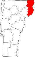
Lunenburg is in southern Essex County along the Connecticut River, the border between Vermont and New Hampshire. It is bordered to the west by the town of Concord, to the northwest by Victory, at its northernmost point by Granby, and to the northeast by Guildhall, all in Vermont. Across the Connecticut, to the east is the town of Lancaster, New Hampshire, and to the south is the town of Dalton, New Hampshire. U.S. Route 2 crosses through the center of Lunenburg, leading west to St. Johnsbury and east to Lancaster and Gorham, New Hampshire. The Mount Orne Covered Bridge is in the eastern part of town, crossing the Connecticut to South Lancaster, New Hampshire.

According to the United States Census Bureau, Lunenburg has a total area of 45.8 square miles (118.6 km2), of which 45.1 square miles (116.7 km2) is land and 0.69 square miles (1.8 km2), or 1.55%, is water. [7] Neal Pond, north of the town center, is the largest body of water. There are also four brooks—Neal Brook, Mink Brook, Catbow Brook, and Hudson Brook—all of which feed into the Connecticut River. There are also smaller creeks throughout the town. The highest point is 2,279-foot (695 m) Temple Mountain in the northern part of town.

Demographics

Historical population
CensusPop.Note
1790 119
1800 393230.3%
1810 71481.7%
1820 85619.9%
1830 1,05423.1%
1840 1,1307.2%
1850 1,123−0.6%
1860 1,034−7.9%
1870 999−3.4%
1880 1,0383.9%
1890 1,019−1.8%
1900 968−5.0%
1910 880−9.1%
1920 1,04819.1%
1930 1,40033.6%
1940 1,374−1.9%
1950 1,299−5.5%
1960 1,237−4.8%
1970 1,061−14.2%
1980 1,1387.3%
1990 1,1763.3%
2000 1,32812.9%
2010 1,302−2.0%
2020 1,246−4.3%
U.S. Decennial Census [8]

As of the census [1] of 2000, there were 1,328 people, 516 households, and 366 families living in the town. The population density was 29.5 inhabitants per square mile (11.4/km2). There were 747 housing units at an average density of 16.6 per square mile (6.4/km2). The racial makeup of the town was 97.82% White, 0.08% African American, 0.68% Native American, 0.08% Asian, and 1.36% from two or more races. Hispanic or Latino of any race were 0.38% of the population.

There were 516 households, out of which 33.5% had children under the age of 18 living with them, 57.0% were married couples living together, 8.5% had a female householder with no husband present, and 28.9% were non-families. 21.7% of all households were made up of individuals, and 9.7% had someone living alone who was 65 years of age or older. The average household size was 2.55 and the average family size was 2.97.

In the town, the population was spread out, with 26.4% under the age of 18, 7.1% from 18 to 24, 29.1% from 25 to 44, 23.1% from 45 to 64, and 14.4% who were 65 years of age or older. The median age was 37 years. For every 100 females, there were 103.1 males. For every 100 females age 18 and over, there were 98.8 males.

The median income for a household in the town was $28,802, and the median income for a family was $33,000. Males had a median income of $26,793 versus $18,594 for females. The per capita income for the town was $12,804. About 8.7% of families and 12.6% of the population were below the poverty line, including 15.0% of those under age 18 and 9.9% of those age 65 or over.

Presidential Election Results

YearDemocratRepublicanOtherTotalNational Winner
198015623031417 Ronald Reagan (R)
19841202990419Ronald Reagan (R)
19881822781461 George H. W. Bush (R)
1992227188159574 Bill Clinton (D)
199620716476447Bill Clinton (D)
200021032029559 George W. Bush (R)
20042523147573George W. Bush (R)
200833026919618 Barack Obama (D)
201229624328567Barack Obama (D)
201617131180562 Donald Trump (R)
202024336632641 Joe Biden (D)

[9]

Related Research Articles

<span class="mw-page-title-main">Windsor County, Vermont</span> County in Vermont, United States

Windsor County is a county located in the U.S. state of Vermont. As of the 2020 census, the population was 57,753. The shire town is the town of Woodstock. The county's largest municipality is the town of Hartford.

<span class="mw-page-title-main">Essex County, Vermont</span> County in Vermont, United States

Essex County is a county located in the northeastern part of the U.S. state of Vermont. As of the 2020 census, the population was 5,920, making it the least-populous county in both Vermont and New England. Its shire town is the municipality of Guildhall. The county was created in 1792 and organized in 1800. Bordered by the Connecticut River next to New Hampshire, Essex County is south of the Canadian province of Quebec. It is the county with the lowest household-income in Vermont.

<span class="mw-page-title-main">Clarksville, New Hampshire</span> Town in New Hampshire, United States

Clarksville is a town in northern Coös County, New Hampshire, United States. The population was 294 at the 2020 census. It is part of the Berlin, NH-VT Micropolitan Statistical Area.

<span class="mw-page-title-main">Northumberland, New Hampshire</span> Town in New Hampshire, United States

Northumberland is a town located in western Coös County, New Hampshire, United States, north of Lancaster. It is part of the Berlin, NH–VT micropolitan statistical area. As of the 2020 census, the town population was 2,126, of whom 1,068 lived in the village of Groveton.

<span class="mw-page-title-main">Stewartstown, New Hampshire</span> Town in New Hampshire, United States

Stewartstown is a town in Coös County, New Hampshire, United States. The population was 813 at the 2020 census, down from 1,004 at the 2010 census. It includes the village of West Stewartstown and is part of the Berlin, NH-VT Micropolitan Statistical Area.

<span class="mw-page-title-main">Piermont, New Hampshire</span> Town in New Hampshire, United States

Piermont is a town in Grafton County, New Hampshire, United States. The population was 769 at the 2020 census. It is home to Camp Walt Whitman and Kingswood Camp for Boys.

<span class="mw-page-title-main">Waterford, Vermont</span> Town in Vermont, United States

Waterford is a town in Caledonia County, Vermont, United States. The population was 1,268 at the 2020 census.

<span class="mw-page-title-main">Bloomfield, Vermont</span> Town in Vermont, United States

Bloomfield is a town in Essex County, Vermont, United States. The population was 217 at the 2020 census. It is part of the Berlin, New Hampshire-Vermont Micropolitan Statistical Area.

<span class="mw-page-title-main">Brunswick, Vermont</span> Town in Vermont, United States

Brunswick is a town in Essex County, Vermont, United States. The town was named after Prince Karl Wilhelm Ferdinand of Brunswick-Lunenburg. The population was 88 at the 2020 census. It is part of the Berlin, NH-VT Micropolitan Statistical Area. Brunswick is home to six mineral springs that made the town a popular resort destination in the 19th century. The land the springs are on is now owned by the Abenaki people.

<span class="mw-page-title-main">Canaan, Vermont</span> Town in Vermont, United States

Canaan is a town in Essex County, Vermont, United States. The population was 896 at the 2020 census. Canaan contains the village of Beecher Falls, located at the confluence of the Connecticut River and Halls Stream. It is part of the Berlin, NH-VT Micropolitan Statistical Area.

<span class="mw-page-title-main">Concord, Vermont</span> Town in Vermont, United States

Concord is a town in Essex County, Vermont, United States. The population was 1,141 at the 2020 census. It is part of the Berlin, NH–VT Micropolitan Statistical Area.

<span class="mw-page-title-main">Ferdinand, Vermont</span> Town in Vermont, United States

Ferdinand is a town in Essex County, Vermont, United States. It was named after German Prince Karl Wilhelm Ferdinand of Brunswick-Lunenburg. Although incorporated, it was never formally organized since it never gained a sufficiently large permanent population. Its population was 16 at the 2020 census and was highest in 1910, with 213. It is managed by the Unified Towns & Gores of Essex County. It is part of the Berlin, NH–VT Micropolitan Statistical Area.

<span class="mw-page-title-main">Guildhall, Vermont</span> Town in Vermont, United States

Guildhall is a town in and the shire town of Essex County, Vermont, United States. As of the 2020 census, the population was 262. According to a large sign in the town center, it is the only town in the world so named. The name derives from a meeting house on the square called the Guildhall.

<span class="mw-page-title-main">Lemington, Vermont</span> Town in Vermont, United States

Lemington is a town in Essex County, Vermont, United States. The population was 87 as of the 2020 census. It is part of the Berlin, NH–VT Micropolitan Statistical Area.

<span class="mw-page-title-main">Maidstone, Vermont</span> Town in Vermont, United States

Maidstone is a town in Essex County, Vermont, United States. As of the 2020 census, the town had a population of 211. It is part of the Berlin, NH–VT Micropolitan Statistical Area. There is no town center or gas station, but there is a town office building in the southern part of the town.

<span class="mw-page-title-main">Norton, Vermont</span> Town in Vermont, United States

Norton is a town in Essex County, Vermont, United States. The population was 153 at the 2020 census. It is part of the Berlin, NH–VT Micropolitan Statistical Area. It is located on the Canada–US border, immediately south of Stanhope, Quebec.

<span class="mw-page-title-main">Wells River, Vermont</span> Village in Vermont, United States

Wells River is a village in the town of Newbury in Orange County, Vermont, United States. The population was 431 at the 2020 census. The village center is located at the junction of U.S. Routes 5 and 302.

<span class="mw-page-title-main">Hartford, Vermont</span> Town in Vermont, United States

Hartford is a town in Windsor County, Vermont, United States. It is on the New Hampshire border, at the intersection of Interstates 89 and 91. It is the site of the confluence of the White and Connecticut rivers; the Ottauquechee River also flows through the town. The town is composed of five unincorporated villages: Hartford, Quechee, West Hartford, White River Junction and Wilder. As of the 2020 census, the population was 10,686.

Lancaster is a census-designated place (CDP) and the main village in the town of Lancaster in Coos County, New Hampshire, United States. The population of the CDP was 1,941 at the 2020 census, out of 3,218 in the entire town of Lancaster.

<span class="mw-page-title-main">Newbury (town), Vermont</span> Town in Vermont, United States

Newbury is a town in Orange County, Vermont, United States. The population was 2,293 at the 2020 census. Newbury includes the villages of Newbury, Center Newbury, West Newbury, South Newbury, Boltonville, Peach Four Corners, and Wells River.

References

  1. 1 2 "U.S. Census website". United States Census Bureau . Retrieved January 31, 2008.
  2. "US Board on Geographic Names". United States Geological Survey. October 25, 2007. Retrieved January 31, 2008.
  3. "Census - Geography Profile: Lunenburg town, Essex County, Vermont". United States Census Bureau . Retrieved December 31, 2021.
  4. "Profile for Lunenburg, Vermont". ePodunk . Retrieved May 9, 2010.
  5. Hemenway, Abby Maria (1867). The Vermont Historical Gazetteer: A Magazine, Embracing a History of Each Town, Civil, Ecclesiastical, Biographical and Military. Miss A. M. Hemenway.
  6. "4. The Mountain. Frost, Robert. 1915. North of Boston". www.bartleby.com. Retrieved October 10, 2016.
  7. "Geographic Identifiers: 2010 Census Summary File 1 (G001): Lunenburg town, Essex County, Vermont". American Factfinder. U.S. Census Bureau. Archived from the original on February 13, 2020. Retrieved April 7, 2016.
  8. "U.S. Decennial Census". United States Census Bureau. Retrieved May 16, 2015.
  9. "VT Elections Database » Search Elections". VT Elections Database. Retrieved October 30, 2020.

Commons-logo.svg Media related to Lunenburg, Vermont at Wikimedia Commons