Lyme, New Hampshire

Last updated

Lyme, New Hampshire
Town
Grafton-Lyme-NH.png
Coordinates: 43°48′37″N72°09′22″W / 43.81028°N 72.15611°W / 43.81028; -72.15611
Country United States
State New Hampshire
County Grafton
Incorporated 1761
VillagesLyme
Lyme Center
Government
   Board of Selectmen
  • Judith Lee Shelnutt Brotman, Chair
  • Ben Kilham
  • David Kahn
  Town AdministratorDina Cutting
Area
[1]
  Total55.0 sq mi (142.5 km2)
  Land53.8 sq mi (139.4 km2)
  Water1.2 sq mi (3.1 km2)  2.19%
Elevation
548 ft (167 m)
Population
 (2020) [2]
  Total1,745
  Density32/sq mi (12.5/km2)
Time zone UTC-5 (Eastern)
  Summer (DST) UTC-4 (Eastern)
ZIP Codes
03768 (Lyme)
03769 (Lyme Center)
Area code 603
FIPS code 33-44260
GNIS feature ID0873654
Website www.lymenh.gov

Lyme is a town along the Connecticut River in Grafton County, New Hampshire, United States. The population was 1,745 as of the 2020 census. [2] Lyme is home to the Chaffee Natural Conservation Area. The Dartmouth Skiway is in the eastern part of town, near the village of Lyme Center. The Appalachian Trail passes through the town's heavily wooded eastern end.

Contents

History

Cannon on the Lyme Common Cannon Lyme, NH.JPG
Cannon on the Lyme Common
Central Market wagon c. 1910.
Photo: Lyme Historians Central Market Wagon, Lyme, NH.jpg
Central Market wagon c.1910.
Photo: Lyme Historians

This was once a home to Abenaki Indians, including a band of Sokokis near Post Pond at a place they called Ordanakis. Later, it would be among the many towns granted by colonial Governor Benning Wentworth along the Connecticut River in 1761. Many of the 63 grantees lived in Massachusetts and Connecticut, but virtually none of them ever settled in Lyme, and they instead sold or assigned their grants to others. However, those settlers who did arrive in 1764 were mostly from those states. [3] :50–51 The town encompasses land that, prior to the Lyme's founding, was called Tinkertown.[ citation needed ] In the late 1770s, Lyme petitioned (ultimately unsuccessfully) to join Vermont.

The scenic town common is surrounded with houses and public buildings dating from the late 1700s to the early 1900s. Stagecoaches traveling the old "Boston Turnpike" from Montreal in the 1830s passed through Lyme, stopping at the Lyme Inn, built in 1809 and recently renovated. [3] :96 Next door to the inn is the 200-year-old Congregational church. Its original 1815 steeple bell [3] :309 was cast by Paul Revere. It was later replaced with a bell cast by Henry N. Cooper & Co., Boston. A hand-wound clock mechanism from E. Howard & Co. strikes the hour. Behind the church is a row of horse sheds dating from 1810. [3] :195 The row of 27 sheds standing today is the longest line of contiguous horse sheds in New England, and possibly in the United States. [4] Originally each shed had the name of the owner on a sign above the door. The signs are still there, though not necessarily over the original shed.
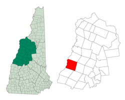
Geography

According to the United States Census Bureau, the town has a total area of 55.0 square miles (142.5 km2), of which 53.8 square miles (139.4 km2) are land and 1.2 square miles (3.1 km2) are water, comprising 2.19% of the town. [1] Lyme is drained by Hewes, Grant, and Clay brooks, all flowing to the Connecticut River, which forms the western boundary of the town and the state border with Vermont.

The Lyme Common occupies the center of the village of Lyme, located about 1.5 miles (2.4 km) east of the Connecticut River.

Lyme is a rural town. Most human development is in the western half of the town along the Connecticut River and New Hampshire Route 10, known as the Dartmouth College Highway. The eastern half of the town is mostly forest. The town is home to four great ponds: Post Pond, Pout Pond, Trout Pond, and Reservoir Pond. Holts Ledge is a cliff that faces east and is part of the Dartmouth Skiway. The edge of the cliff is fenced to protect falcons. The highest point in town is the summit of Smarts Mountain, at 3,238 feet (987 m) above sea level. A fire tower, which was built in 1915, [5] is visible from miles away atop Smarts Mountain and sets it apart from other local mountains. The Appalachian Trail crosses the summits of Holts Ledge and Smarts Mountain.

Demographics

Historical population
CensusPop.Note
1790 816
1800 1,31861.5%
1810 1,67026.7%
1820 1,8249.2%
1830 1,804−1.1%
1840 1,785−1.1%
1850 1,617−9.4%
1860 1,572−2.8%
1870 1,358−13.6%
1880 1,313−3.3%
1890 1,154−12.1%
1900 1,080−6.4%
1910 1,007−6.8%
1920 891−11.5%
1930 830−6.8%
1940 96516.3%
1950 924−4.2%
1960 1,02611.0%
1970 1,1128.4%
1980 1,28915.9%
1990 1,49616.1%
2000 1,67912.2%
2010 1,7162.2%
2020 1,7451.7%
U.S. Decennial Census [2] [6]
Lyme Town Common LymeNH LymeCommon 01.jpg
Lyme Town Common

As of the census of 2010, there were 1,716 people, 705 households, and 503 families residing in the town. The population density was 31.4 inhabitants per square mile (12.1/km2). There were 810 housing units at an average density of 14.8 per square mile (5.7/km2). The racial makeup of the town was 96.9% White, 0.3% African American, 0.3% Native American, 1.1% Asian, 0.3% some other race, and 1.0% from two or more races. Hispanic or Latino of any race were 2.4% of the population. [7]

Street scene, c. 1910.
Photo: Lyme Historians Street Scene, Lyme, NH.jpg
Street scene, c.1910.
Photo: Lyme Historians

Of the 705 households, 28.5% had children under the age of 18 living with them, 61.3% were headed by married couples living together, 6.5% had a female householder with no husband present, and 28.7% were non-families. 23.5% of all households were made up of householders living alone, and 9.0% were someone living alone who was 65 years of age or older. The average household size was 2.42, and the average family size was 2.86. [7]

In the town, the population was spread out, with 22.4% under the age of 18, 4.1% from 18 to 24, 19.5% from 25 to 44, 36.3% from 45 to 64, and 17.8% who were 65 years of age or older. The median age was 47.4 years. For every 100 females, there were 95.4 males. For every 100 females age 18 and over, there were 93.4 males. [7]

Looking at the occupations of employed people in the town over the age of 16, the largest group - 50.9% - is education and health care. The next largest group - 9.6% - is professional, scientific, and management. Construction and manufacturing make up 8.4%; agriculture and forestry make up 0.7%. [8]

For the period 2010 through 2014 the estimated median annual income for a household in the town was $110,781, and the median income for a family was $130,795. Males working full-time, year-round had a median income of $101,875 versus $58,125 for females. The per capita income for the town was $68,381. About 0.6% of families and 3.1% of the population were below the poverty line, including 3.2% of those age 65 or over. [8]

Education

Lyme has two K–8 schools, one public and one independent.

There are currently around 200 students attending the Lyme School, [9] the public K–8 school. As of 2018 the Lyme School has full day kindergarten. The school typically ranks in the top 5–10% of New Hampshire schools. Once a pupil reaches ninth grade, students from Lyme attend one of several high schools: Thetford Academy in Thetford, Vermont (across the Connecticut River), Hanover High School in Hanover, New Hampshire (about 10 miles south of Lyme), Hartford High School in Hartford, Vermont, Lebanon High School in Lebanon, New Hampshire, or St. Johnsbury Academy in St. Johnsbury, Vermont. Attendance is typically split between St. Johnsbury Academy, Thetford Academy and Hanover High, with the few remaining students going elsewhere.

Crossroads Academy, [10] founded in 1991 as a K–8 school in Hanover, is now located on a wooded 140-acre (57 ha) campus at 95 Dartmouth College Highway in Lyme. It serves more than 140 students from a 50-mile radius in grades K–8 and employs 39 faculty and staff.

Sites of interest

Notable people

Related Research Articles

<span class="mw-page-title-main">Hanover, New Hampshire</span> Town in New Hampshire, United States

Hanover is a town located along the Connecticut River in Grafton County, New Hampshire, United States. As of the 2020 census, its population was 11,870. The town is home to the Ivy League university Dartmouth College, the U.S. Army Corps of Engineers Cold Regions Research and Engineering Laboratory, and Hanover High School. The Appalachian Trail crosses the town, connecting with a number of trails and nature preserves.

<span class="mw-page-title-main">Norwich, Vermont</span> Town in Vermont, United States

Norwich is a town in Windsor County, Vermont, United States. The population was 3,612 at the 2020 census. Home to some of the state of Vermont's wealthiest residents, the municipality is a commuter town for nearby Hanover, New Hampshire across the Connecticut River. The town is part of the Dresden School District, the first interstate school district in the United States, signed into law by President John F. Kennedy. The town contains the Norwich Mid-Century Modern Historic District.

<span class="mw-page-title-main">Caledonia County, Vermont</span> County in Vermont, United States

Caledonia County is a county located in the northeastern part of the U.S. state of Vermont. As of the 2020 census, the population was 30,233. Its shire town is the town of St. Johnsbury. The county was created in 1792 and organized in 1796. It was given the Latin name for Scotland, in honor of the many settlers who claimed ancestry there.

<span class="mw-page-title-main">Grafton County, New Hampshire</span> County in New Hampshire, United States

Grafton County is a county in the U.S. state of New Hampshire. As of the 2020 census, the population was 91,118. Its county seat is North Haverhill, a village within the town of Haverhill. Until 1972, the county courthouse and other offices were in downtown Woodsville, a larger village within the town of Haverhill.

<span class="mw-page-title-main">Clarksville, New Hampshire</span> Town in New Hampshire, United States

Clarksville is a town in northern Coös County, New Hampshire, United States. The population was 294 at the 2020 census. It is part of the Berlin, NH–VT Micropolitan Statistical Area.

<span class="mw-page-title-main">Dorchester, New Hampshire</span> Town in New Hampshire, United States

Dorchester is a town in Grafton County, New Hampshire, United States. The population was 339 at the 2020 census.

<span class="mw-page-title-main">Landaff, New Hampshire</span> Town in New Hampshire, United States

Landaff is a town in Grafton County, New Hampshire, United States. As of the 2020 census, the town population was 446.

<span class="mw-page-title-main">Lebanon, New Hampshire</span> City in New Hampshire, United States

Lebanon is the only city in Grafton County, New Hampshire, United States. The population was 14,282 at the 2020 census, up from 13,151 at the 2010 census. Lebanon is in western New Hampshire, south of Hanover, near the Connecticut River. It is the home to Dartmouth–Hitchcock Medical Center and Dartmouth College's Geisel School of Medicine, together comprising the largest medical facility between Boston, Massachusetts, and Burlington, Vermont.

<span class="mw-page-title-main">Lyman, New Hampshire</span> Town in New Hampshire, United States

Lyman is a town in Grafton County, New Hampshire, United States. The population was 585 at the 2020 census.

<span class="mw-page-title-main">Orford, New Hampshire</span> Town in New Hampshire, United States

Orford is a town in Grafton County, New Hampshire, United States. The population was 1,237 at the 2020 census, unchanged from the 2010 census. The Appalachian Trail crosses in the east.

<span class="mw-page-title-main">Piermont, New Hampshire</span> Town in New Hampshire, United States

Piermont is a town in Grafton County, New Hampshire, United States. The population was 769 at the 2020 census. It is home to Camp Walt Whitman and Kingswood Camp for Boys.

<span class="mw-page-title-main">Waterford, Vermont</span> Town in Vermont, United States

Waterford is a town in Caledonia County, Vermont, United States. The population was 1,268 at the 2020 census.

<span class="mw-page-title-main">Bloomfield, Vermont</span> Town in Vermont, United States

Bloomfield is a town in Essex County, Vermont, United States. The population was 217 at the 2020 census. It is part of the Berlin, NH–VT Micropolitan Statistical Area.

<span class="mw-page-title-main">Concord, Vermont</span> Town in Vermont, United States

Concord is a town in Essex County, Vermont, United States. The population was 1,141 at the 2020 census. It is part of the Berlin, NH–VT Micropolitan Statistical Area.

<span class="mw-page-title-main">Lunenburg, Vermont</span> Town in Vermont, United States

Lunenburg is a town in Essex County, Vermont, United States. The population was 1,246 at the 2020 census, the most populous in Essex County. Lunenburg contains the villages of West Lunenburg, South Lunenburg, Mill Village and Gilman, and is part of the Berlin, NH–VT Micropolitan Statistical Area.

<span class="mw-page-title-main">Thetford, Vermont</span> Town in Vermont, United States

Thetford is a town in Orange County, Vermont, United States in the Connecticut River Valley. The population was 2,775 at the 2020 census. Villages within the town include East Thetford, North Thetford, Thetford Hill, Thetford Center, Rices Mills, Union Village, and Post Mills. The town office is in Thetford Center.

<span class="mw-page-title-main">Wells River, Vermont</span> Village in Vermont, United States

Wells River is a village in the town of Newbury in Orange County, Vermont, United States. The population was 431 at the 2020 census. The village center is located at the junction of U.S. Routes 5 and 302.

<span class="mw-page-title-main">Grafton, Vermont</span> Town in Vermont, United States

Grafton is a town in Windham County, Vermont, United States. The population was 645 at the 2020 census.

Hanover is a census-designated place (CDP) and the main village in the town of Hanover in Grafton County, New Hampshire, United States. The population of the CDP was 9,078 at the 2020 census, out of 11,870 in the entire town. The CDP includes the campus of Dartmouth College.

<span class="mw-page-title-main">St. Johnsbury, Vermont</span> Town in Vermont, United States

St. Johnsbury is the shire town of Caledonia County, Vermont, United States. As of the 2020 census, the population was 7,364. St. Johnsbury is situated on the Passumpsic River and is located approximately six miles northwest of the Connecticut River and 48 miles (77 km) south of the Canada–U.S. border.

References

  1. 1 2 "2021 U.S. Gazetteer Files – New Hampshire". United States Census Bureau. Retrieved November 29, 2021.
  2. 1 2 3 "Lyme town, Grafton County, New Hampshire: 2020 DEC Redistricting Data (PL 94-171)". U.S. Census Bureau. Retrieved November 29, 2021.
  3. 1 2 3 4 Cole, Luane, ed. Patterns and Pieces 1761/1976. Phoenix Publishing: Canaan, NH. 1976
  4. "Heritage | Town of Lyme NH".
  5. "New Hampshire Fire Towers - Smarts Mountain". www.firelookout.org. Retrieved November 28, 2018.
  6. "Census of Population and Housing". Census.gov. Retrieved June 4, 2016.
  7. 1 2 3 "Profile of General Population and Housing Characteristics: 2010 Census Summary File 1 (DP-1): Lyme town, Grafton County, New Hampshire". American Factfinder. U.S. Census Bureau. Archived from the original on February 13, 2020. Retrieved October 3, 2016.
  8. 1 2 "Selected Economic Characteristics: 2010-2014 American Community Survey 5-Year Estimates (DP03): Lyme town, Grafton County, New Hampshire". American Factfinder. U.S. Census Bureau. Archived from the original on February 13, 2020. Retrieved October 3, 2016.
  9. Lyme School
  10. Crossroads Academy