Putney, Vermont

Last updated

Putney, Vermont
Putney VT - Sacketts Brook.jpg
Sacketts Brook in downtown Putney (2009)
Putney vt highlight.png
Putney, Vermont
Coordinates: 43°0′1″N72°31′2″W / 43.00028°N 72.51722°W / 43.00028; -72.51722
Country United States
State Vermont
County Windham
Government
  Town ManagerKaren M. Astley
Area
  Total26.8 sq mi (69.4 km2)
  Land26.8 sq mi (69.4 km2)
  Water0.0 sq mi (0.0 km2)
Elevation
404 ft (123 m)
Population
 (2020)
  Total2,617
  Density98/sq mi (37.7/km2)
Time zone UTC−5 (Eastern (EST))
  Summer (DST) UTC−4 (EDT)
ZIP Code
05346
Area code 802
FIPS code 50-57700 [1]
GNIS feature ID1462181 [2]
Website www.putneyvt.org

Putney is a town in Windham County, Vermont, United States. The population was 2,617 at the 2020 census. [3]

Contents

The town's historic core makes up the Putney Village Historic District, which is listed on the National Register of Historic Places.

History

On December 26, 1753, Colonel Josiah Willard led a proprietors' petition for a Putney charter to be established in the Equivalent Lands. The charter was issued that day by Governor Benning Wentworth issuer of the New Hampshire Grants under the authority of King George II of Great Britain. [4] Significant settlement of Putney did not begin until after the French and Indian War ended in 1763.

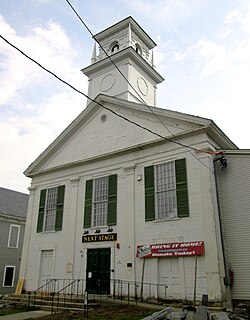
The town arose in a large plain on the west side of the Connecticut River, above the mouth of Sacketts Brook. A falls on the brook provided water power for early mills, and it is around that point that the main village was formed. Because the town did not have abundant sources of water power, it was largely bypassed by the Industrial Revolution of the mid-19th century, and remained largely rural in character. The village's character is defined by the Federal and Greek Revival styles popular during its most significant period of growth, the late 18th to mid-19th century. [5]

Historical population
CensusPop.Note
1790 1,848
1800 1,574−14.8%
1810 1,6072.1%
1820 1,547−3.7%
1830 1,510−2.4%
1840 1,382−8.5%
1850 1,4253.1%
1860 1,163−18.4%
1870 1,1670.3%
1880 1,124−3.7%
1890 1,075−4.4%
1900 969−9.9%
1910 788−18.7%
1920 761−3.4%
1930 8359.7%
1940 9048.3%
1950 1,01912.7%
1960 1,17715.5%
1970 1,72746.7%
1980 1,8507.1%
1990 2,35227.1%
2000 2,63412.0%
2010 2,7022.6%
2020 2,617−3.1%
U.S. Decennial Census [6]

Geography

According to the United States Census Bureau, the town has a total area of 26.8 square miles (69.4 km2), of which 26.76 square miles (69.4 km2) is land and 0.04% is water. Putney Mountain is the highest point in the town, rising 1,657 ft above sea level. [7]

Putney is bordered by Dummerston to the south, Westminster to the north, and Brookline to the west. The Connecticut River serves as the eastern border of Putney, separating the town from Westmoreland, NH. Putney village is in the southern part of the town, along U.S. Route 5 and Sacketts Brook. Putney is approximately 10 miles (16 km) north of Brattleboro and 25 miles (40 km) northwest of Keene, New Hampshire.

Transportation

U.S. Route 5 and Interstate 91 both pass through Putney, which is accessible from Interstate 91 at Exit 4 on the border of Putney and Dummerston.

The New England Central Railroad has track rights through the town. Amtrak's Vermonter passenger rail line runs through Putney but does not stop in town. The closest stations are Bellows Falls to the north and Brattleboro to the south.

Demographics

As of the 2000 census [1] there were 2,634 people, 958 households, and 603 families residing in the town. The population density was 98.3 people per square mile (37.9/km2). There were 1,049 housing units at an average density of 39.1 per square mile (15.1/km2). The racial makeup of the town was 95.63% White, 1.03% African American, 0.49% Native American, 0.76% Asian, 0.04% Pacific Islander, 0.30% from other races, and 1.75% from two or more races. Hispanic or Latino of any race were 1.56% of the population.

There were 958 households, out of which 32.5% had children under the age of 18 living with them, 50.5% were married couples living together, 8.5% had a female householder with no husband present, and 37.0% were non-families. 27.9% of all households were made up of individuals, and 7.0% had someone living alone who was 65 years of age or older. The average household size was 2.43 and the average family size was 2.99.

In the town, the population was spread out, with 22.6% under the age of 18, 16.5% from 18 to 24, 27.5% from 25 to 44, 23.7% from 45 to 64, and 9.8% who were 65 years of age or older. The median age was 36 years. For every 100 females, there were 106.3 males. For every 100 females age 18 and over, there were 108.0 males.

The median income for a household in the town was $40,346, and the median income for a family was $50,170. Males had a median income of $29,922 versus $25,217 for females. The per capita income for the town was $18,576. About 6.2% of families and 8.4% of the population were below the poverty line, including 8.5% of those under age 18 and 5.4% of those age 65 or over.

A graduation ceremony at The Putney School in 2004 04Putgrad.jpg
A graduation ceremony at The Putney School in 2004

Education

Notable people

Notable places

See also

Related Research Articles

<span class="mw-page-title-main">Windham County, Vermont</span> County in Vermont, United States

Windham County is a county located in the U.S. state of Vermont. As of the 2020 census, the population was 45,905. The shire town is Newfane, and the largest municipality is the town of Brattleboro.

<span class="mw-page-title-main">Hampton, Connecticut</span> Town in Connecticut, United States

Hampton is a town in Windham County, Connecticut, United States. The town is part of the Northeastern Connecticut Planning Region. The population was 1,728 at the 2020 census.

<span class="mw-page-title-main">Westmoreland, New Hampshire</span> Town in New Hampshire, United States

Westmoreland is a town in Cheshire County, New Hampshire, United States. The population was 1,706 at the 2020 census, down from 1,874 at the 2010 census. Westmoreland is historically an agricultural town, with much arable farmland.

<span class="mw-page-title-main">Bellows Falls, Vermont</span> Village in Vermont, United States

Bellows Falls is an incorporated village located in the town of Rockingham in Windham County, Vermont, United States. The population was 2,747 at the 2020 census. Bellows Falls is home to the Green Mountain Railroad, a heritage railroad; the annual Roots on the River Festival; and the No Film Film Festival.

<span class="mw-page-title-main">Dummerston, Vermont</span> Town in Vermont, United States

Dummerston is a town in Windham County, Vermont, United States. The population was 1,865 at the 2020 census. It is home to the longest covered bridge still in use in Vermont. Its borders include three main villages: Dummerston Center, West Dummerston, and East Dummerston.

<span class="mw-page-title-main">Jamaica, Vermont</span> Town in Vermont, United States

Jamaica is a town in Windham County, Vermont, United States. The population was 1,005 at the 2020 census. The town includes the villages of Jamaica, East Jamaica and Rawsonville.

<span class="mw-page-title-main">Londonderry, Vermont</span> Town in Vermont, United States

Londonderry is a town in Windham County, Vermont, United States. It is bounded on the north by Landgrove and Weston, on the east by Windham, on the south by Jamaica and on the west by Winhall and Landgrove. The population was 1,919 in the 2020 census. The town contains the villages of Londonderry and South Londonderry.

<span class="mw-page-title-main">Vernon, Vermont</span> Town in Vermont, United States

Vernon is a town in Windham County, Vermont, in the United States. The population was 2,192 at the 2020 census. Vernon is the site of the now-defunct Vermont Yankee, the state of Vermont's only nuclear power plant, which closed in December 2014.

<span class="mw-page-title-main">Windham, Vermont</span> Town in Vermont, United States

Windham is a town in Windham County, Vermont, United States. The population was 449 at the 2020 census. The town center village is designated as the Windham Village Historic District.

<span class="mw-page-title-main">Newbury (village), Vermont</span> Village in Vermont, United States

Newbury is an incorporated village in the town of Newbury in Orange County, Vermont, United States. The population was 447 at the 2020 census.

<span class="mw-page-title-main">Brattleboro (CDP), Vermont</span> CDP in Vermont, United States

Brattleboro is a census-designated place (CDP) corresponding to the densely populated core of the town of Brattleboro in Windham County, Vermont, United States. The population was 8,289 at the 2000 census.

<span class="mw-page-title-main">Brattleboro, Vermont</span> Town in Vermont, United States

Brattleboro, originally Brattleborough, is a town in Windham County, Vermont, United States, located about 10 miles (16 km) north of the Massachusetts state line at the confluence of Vermont's West River and Connecticut. With a 2022 Census population of 12,106, it is the most populous municipality abutting Vermont's eastern border with New Hampshire, which is the Connecticut River.

<span class="mw-page-title-main">Newfane (village), Vermont</span> Village in Vermont, United States

Newfane is an incorporated village in the town of Newfane in Windham County, Vermont, United States. The population was 87 at the 2020 census.

<span class="mw-page-title-main">Westminster (village), Vermont</span> Village in Vermont, United States

Westminster is a village in Windham County, Vermont, United States. The population was 287 at the 2020 census. Most of the village is listed on the National Register of Historic Places in 1988 as the Westminster Village Historic District.

The Windham-3-1 Representative District is a one-member state Representative district in the U.S. state of Vermont. It is one of the 108 one or two member districts into which the state was divided by the redistricting and reapportionment plan developed by the Vermont General Assembly following the 2000 U.S. Census. The plan applies to legislatures elected in 2002, 2004, 2006, 2008, and 2010. A new plan will be developed in 2012 following the 2010 U.S. Census.

<span class="mw-page-title-main">Wilmington, Vermont</span> Town in Vermont, United States

Wilmington is a town in Windham County, Vermont, United States. The population was 2,255 at the 2020 census.

<span class="mw-page-title-main">James Otis Follett</span>

James Otis Follett was a farmer, stonemason, and builder of bridges from Townshend, Vermont. He has been described as "an intuitive engineer, a farmer and mason."

<span class="mw-page-title-main">East Putney Brook Stone Arch Bridge</span> United States historic place

The East Putney Brook Stone Arch Bridge is a historic stone arch bridge in eastern Putney, Vermont. Built in 1902, it is a rare statewide example of a 20th-century stone bridge, and one of a number of such area bridges built by Townshend farmer and mason James Otis Follett. It was listed on the U.S. National Register of Historic Places in 1976. The bridge is located just west (upstream) of the present alignment of River Road, which it formerly carried.

Putney is the primary village and a census-designated place (CDP) in the town of Putney, Windham County, Vermont, United States. As of the 2020 census, it had a population of 571, compared to 2,617 in the entire town. The Putney Village Historic District occupies the center of the CDP.

<span class="mw-page-title-main">Sacketts Brook Stone Arch Bridge</span> United States historic place

The Sacketts Brook Stone Arch Bridge, also known locally as the Hi-Lo Biddy Stone Arch Bridge, is a historic bridge just outside the village of Putney, Vermont. It is a stone arch bridge that formerly carried Mill Street across Sacketts Brook, about 0.25 miles (0.40 km) east of United States Route 5. It was built in 1906 by James Otis Follett, an area stonemason, and is one of a few surviving examples of his work. The bridge was listed on the National Register of Historic Places in 1976.

References

  1. 1 2 "U.S. Census website". United States Census Bureau . Retrieved January 31, 2008.
  2. "US Board on Geographic Names". United States Geological Survey. October 25, 2007. Retrieved January 31, 2008.
  3. "Census - Geography Profile: Putney town, Windham County, Vermont" . Retrieved January 4, 2022.
  4. Child, Hamilton (1884). Gazetteer and Business Directory of Windham County, Vt., 1724-1884. The Journal Office, Syracuse, N. Y.: Hamilton Child. pp. 272–286.
  5. 1 2 3 4 5 6 7 8 "NRHP nomination for Putney Village Historic District". National Park Service. Retrieved December 23, 2015.
  6. "U.S. Decennial Census". United States Census Bureau. Retrieved May 16, 2015.
  7. "Putney Mountain". peakery.com. Retrieved January 11, 2016.
  8. "The Greenwood School - A Private Boys Boarding School in Putney, VT". thegreenwoodschool.org.
  9. NobelPrize.org Archived 2010-07-22 at the Wayback Machine , The Nobel Prize in Peace 1997, International Campaign to Ban Landmines , Jody Williams
  10. Historical marker on building