Wells River, Vermont

Last updated

Wells River, Vermont
Wells River, Vermont.jpg
USA Vermont location map.svg
Red pog.svg
Wells River, Vermont
Location within the state of Vermont
Coordinates: 44°9′14″N72°3′15″W / 44.15389°N 72.05417°W / 44.15389; -72.05417
Country United States
State Vermont
County Orange
Area
[1]
  Total1.91 sq mi (4.96 km2)
  Land1.88 sq mi (4.86 km2)
  Water0.04 sq mi (0.10 km2)
Elevation
430 ft (131 m)
Population
 (2020)
  Total431
  Density230/sq mi (87/km2)
Time zone UTC-5 (Eastern (EST))
  Summer (DST) UTC-4 (EDT)
ZIP code
05081
Area code 802
FIPS code 50-78025 [2]
GNIS feature ID1460106 [3]
Wells River Village Historic District
LocationMain, Center, Grove, Cross, and Water Sts., Newbury, Vermont
Area39 acres (15.8 ha)
Architectural styleClassical Revival, Other, Federal, Late Victorian
NRHP reference No. 83003217 [4]
Added to NRHPJuly 28, 1983

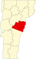
Wells River is a village in the town of Newbury in Orange County, Vermont, United States. The population was 431 at the 2020 census. [5] The village center is located at the junction of U.S. Routes 5 and 302.

Contents

The village center (the portion near the confluence of the Wells River and the Connecticut River) was added to the National Register of Historic Places in 1983 as Wells River Village Historic District. The district covers 84 contributing properties over an area of 390 acres (1.6 km2). It includes examples of Classical Revival, Federal, and Late Victorian styles. [6] The architectural character of the district represents the building traditions of nineteenth-century Vermont, showcasing a wide array of building styles.

History

Hale's Tavern in 1915 Hale's Tavern, Wells River, VT.jpg
Hale's Tavern in 1915

The area was first called Governor's Right because 500 acres (200 ha) were granted to Governor Benning Wentworth of New Hampshire. It was purchased by Er Chamberlin, who built a gristmill on the Wells River. [7] Located at the head of navigation for the Connecticut River, Wells River developed as a center for trade. Canal boats guided by long poles floated downriver laden with lumber, clapboards and shingles, returning with goods such as iron, salt, rum and molasses. [7] In the 1830s and 1840s, Jacob Kent Jr. was the proprietor of the Coosuck House, a well-known Wells River hotel. [8]

On November 6, 1848, the Connecticut and Passumpsic Rivers Railroad opened to Wells River, rendering obsolete the river's barge traffic. In 1853–1854, the Boston, Concord and Montreal Railroad reached Woodsville, New Hampshire across the Connecticut River. It built division offices and repair facilities, transforming that village into a booming railway town. The line replaced the 1805 bridge over the narrows to Wells River with a two-level wooden span which combined a toll highway deck at the bottom of the truss, with railroad tracks on the roof. In 1903, a steel bridge of similar configuration replaced it. In 1873, the Montpelier and Wells River Railroad was completed, enhancing the region's position as a railroad junction. [9]

Historic buildings

Wells River in 1907 Bird's-eye View of Wells River, VT.jpg
Wells River in 1907

Some of the more significant historic structures in the village are:[ citation needed ]

Geography

The village takes its name from the Wells River, which flows into the Connecticut River at the eastern edge of the village. According to the United States Census Bureau, the village has a total area of 2.0 square miles (5.1 km2), all of it land.

Wells River is crossed by Interstate 91, U.S. Route 5, and U.S. Route 302, with Routes 5 and 302 briefly running concurrently, before Route 302 crosses the Connecticut River into New Hampshire.

Demographics

Historical population
CensusPop.Note
1880 513
1890 5262.5%
1900 5657.4%
1910 6087.6%
1920 606−0.3%
1930 553−8.7%
1940 527−4.7%
1950 5708.2%
1960 472−17.2%
1970 419−11.2%
1980 396−5.5%
1990 4247.1%
2000 325−23.3%
2010 39922.8%
2020 4318.0%
U.S. Decennial Census [10]

As of the census [2] of 2000, there were 325 people, 156 households, and 92 families residing in the village. The population density was 167.0 people per square mile (64.4/km2). There were 178 housing units at an average density of 91.5/sq mi (35.2/km2). The racial makeup of the village was 99.69% White and 0.31% African American.

There were 156 households, out of which 25.0% had children under the age of 18 living with them, 42.3% were married couples living together, 11.5% had a female householder with no husband present, and 40.4% were non-families. 39.1% of all households were made up of individuals, and 19.2% had someone living alone who was 65 years of age or older. The average household size was 2.08 and the average family size was 2.67.

In the village, the population was spread out, with 23.1% under the age of 18, 5.8% from 18 to 24, 22.8% from 25 to 44, 24.9% from 45 to 64, and 23.4% who were 65 years of age or older. The median age was 44 years. For every 100 females, there were 77.6 males. For every 100 females age 18 and over, there were 83.8 males.

The median income for a household in the village was $28,021, and the median income for a family was $32,708. Males had a median income of $28,056 versus $21,250 for females. The per capita income for the village was $14,705. About 6.5% of families and 11.1% of the population were below the poverty line, including 6.1% of those under age 18 and 2.1% of those age 65 or over.

Notable people

See also

Related Research Articles

<span class="mw-page-title-main">Orange County, Vermont</span> County in Vermont, United States

Orange County is a county located in the U.S. state of Vermont. As of the 2020 census, the population was 29,277. Its shire town is the town of Chelsea. Orange County was organized on February 2, 1781, as an original county within the state.

<span class="mw-page-title-main">Caledonia County, Vermont</span> County in Vermont, United States

Caledonia County is a county located in the northeastern part of the U.S. state of Vermont. As of the 2020 census, the population was 30,233. Its shire town is the town of St. Johnsbury. The county was created in 1792 and organized in 1796. It was given the Latin name for Scotland, in honor of the many settlers who claimed ancestry there.

<span class="mw-page-title-main">Millers Falls, Massachusetts</span> Census-designated place in Massachusetts, United States

Millers Falls is a census-designated place (CDP) in the towns of Montague and Erving in Franklin County, Massachusetts, United States. The population was 1,139 at the 2010 census. It is part of the Springfield, Massachusetts metropolitan statistical area.

<span class="mw-page-title-main">Woodsville, New Hampshire</span> Census-designated place in New Hampshire, United States

Woodsville is a census-designated place (CDP) and the largest village in the town of Haverhill in Grafton County, New Hampshire, United States, along the Connecticut River at the mouth of the Ammonoosuc River. The population was 1,431 at the 2020 census. Although North Haverhill is now the county seat of Grafton County, the village of Woodsville has traditionally been considered the county seat, as the county courthouse was originally located there. The county buildings are now located halfway between Woodsville and the village of North Haverhill to the south.

<span class="mw-page-title-main">Ryegate, Vermont</span> Town in Vermont, United States

Ryegate is a town in Caledonia County, Vermont, United States. The population was 1,165 at the 2020 census. The town contains the villages of South Ryegate, East Ryegate, and Ryegate Corner.

<span class="mw-page-title-main">Guildhall, Vermont</span> Town in Vermont, United States

Guildhall is a town in and the shire town of Essex County, Vermont. As of the 2020 census, the population was 262. According to a large sign in the town center, it is the only town in the world so named. The name derives from a meeting house on the square called the Guildhall.

<span class="mw-page-title-main">Fairlee, Vermont</span> Town in Vermont, United States

Fairlee is a town in Orange County, Vermont, United States. The population was 988 at the 2020 census. It includes the village of Ely. Fairlee is home to Lake Morey, which claims to have the longest ice skating trail in the United States.

<span class="mw-page-title-main">Rockingham, Vermont</span> Town in Vermont, United States

Rockingham is a town along the Connecticut River in Windham County, Vermont, United States. As of the 2020 census, the population was 4,832. Rockingham includes the incorporated villages of Bellows Falls and Saxtons River, as well as a large rural area west of Interstate 91.

<span class="mw-page-title-main">White River Junction, Vermont</span> Census-designated place in Vermont, United States

White River Junction is an unincorporated village and census-designated place (CDP) in the town of Hartford in Windsor County, Vermont, United States. The population was 2,528 at the 2020 census, up from 2,286 in 2010, making it the largest community within the town of Hartford.

<span class="mw-page-title-main">Wilder, Vermont</span> Census-designated place in Vermont, United States

Wilder is an unincorporated village and census-designated place (CDP) within the town of Hartford in Windsor County, Vermont, United States. It is the location of the Wilder Dam on the Connecticut River. The population of the CDP was 1,690 at the 2010 census. The village center is an early example of a planned mill community, and was listed on the National Register of Historic Places as the Wilder Village Historic District in 1999.

<span class="mw-page-title-main">Windsor, Vermont</span> Town in Vermont, United States

Windsor is a town in Windsor County, Vermont, United States. As the "Birthplace of Vermont", the town is where the Constitution of Vermont was adopted in 1777, thus marking the founding of the Vermont Republic, a sovereign state until 1791, when Vermont joined the United States. Over much of its history, Windsor was home to a variety of manufacturing enterprises. Its population was 3,559 at the 2020 census.

<span class="mw-page-title-main">Littleton, New Hampshire</span> Town in New Hampshire, United States

Littleton is a town in Grafton County, New Hampshire, United States. The population was 6,005 at the 2020 census. Situated at the northern edge of the White Mountains, Littleton is bounded on the northwest by the Connecticut River.

<span class="mw-page-title-main">Morristown (CDP), New York</span> Hamlet and CDP in New York, United States

Morristown is a hamlet and former village along the Saint Lawrence River in St. Lawrence County, New York, United States. The population was 395 at the 2010 census. The village is named after Gouverneur Morris.

<span class="mw-page-title-main">Bradford (CDP), Vermont</span> Census-designated places in Vermont, United States

Bradford is a census-designated places in the town of Bradford, Orange County, Vermont, United States. The population was 907 at the 2020 census. The village disincorporated on December 1, 2004. The village became a census-designated place in 2008. The central commercial and residential portion of the village is listed on the National Register of Historic Places as the Bradford Village Historic District.

<span class="mw-page-title-main">Newbury (village), Vermont</span> Village in Vermont, United States

Newbury is an incorporated village in the town of Newbury in Orange County, Vermont, United States. The population was 447 at the 2020 census.

<span class="mw-page-title-main">Newbury (town), Vermont</span> Town in Vermont, United States

Newbury is a town in Orange County, Vermont, United States. The population was 2,293 at the 2020 census. Newbury includes the villages of Newbury, Center Newbury, West Newbury, South Newbury, Boltonville, Peach Four Corners, and Wells River.

<span class="mw-page-title-main">Newfane (village), Vermont</span> Village in Vermont, United States

Newfane is an incorporated village in the town of Newfane in Windham County, Vermont, United States. The population was 87 at the 2020 census.

<span class="mw-page-title-main">St. Johnsbury, Vermont</span> Town in Vermont, United States

St. Johnsbury is the shire town of Caledonia County, Vermont, United States. As of the 2020 census, the population was 7,364. St. Johnsbury is situated on the Passumpsic River and is located approximately six miles northwest of the Connecticut River and 48 miles (77 km) south of the Canada–U.S. border.

<span class="mw-page-title-main">Bradford, Vermont</span> Town in Vermont, United States

Bradford is a town in Orange County, Vermont, United States. The population was 2,790 at the 2020 census. Bradford is located on the county's eastern border, bordering both the Connecticut River and New Hampshire, and is a commercial center for some of its surrounding towns.

<span class="mw-page-title-main">Canaan (village), Connecticut</span> United States historic place

Canaan is a village and census-designated place (CDP) within the town of North Canaan in Litchfield County, Connecticut, United States. Formerly known as Canaan Depot, the village is more commonly known as Canaan Village to distinguish it from the town of Canaan located to the south of North Canaan. The Canaan Village Historic District is listed on the National Register of Historic Places. As of the 2010 census, the CDP had a population of 1,212, out of a total population of 3,315 in the town of North Canaan.

References

  1. "2019 U.S. Gazetteer Files". United States Census Bureau. Retrieved August 7, 2020.
  2. 1 2 "U.S. Census website". United States Census Bureau . Retrieved January 31, 2008.
  3. "US Board on Geographic Names". United States Geological Survey. October 25, 2007. Retrieved January 31, 2008.
  4. "National Register Information System". National Register of Historic Places . National Park Service. July 9, 2010.
  5. "Census - Geography Profile: Wells River village, Vermont" . Retrieved December 26, 2021.
  6. "National Register Information System". National Register of Historic Places . National Park Service. March 13, 2009.
  7. 1 2 Frederic P. Wells, History of Newbury, Vermont; The Caledonian Company, St. Johnsbury, Vermont 1902
  8. Wells, Frederic Palmer (1902). History of Newbury, Vermont. St. Johnsbury, VT: The Caledonian Company. pp. 605–606 via Google Books.
  9. "River Heritage". www.crjc.org.
  10. "Census of Population and Housing". Census.gov. Retrieved June 4, 2015.
  11. Wells, Frederic Palmer (1902). History of Newbury, Vermont. St. Johnsbury, VT: The Caledonian Company via Google Books.
  12. Post, L. D. (January 12, 1899). "William A. Russell Dead". The Paper Mill and Wood Pulp News. New York, NY. p. 2 via Google Books.
  13. Underwood, Lucien Marcus (1913). The Underwood Families of America. Vol. 1. Lancaster, PA: New Era Printing Company.