West Fairlee, Vermont

Last updated

West Fairlee, Vermont
Town
WestFairleeVT CenterChurch.jpg
West fairlee vt highlight.png
Located in Orange County, Vermont
Usa edcp location map.svg
Red pog.svg
West Fairlee, Vermont
Location within the U.S.A.
Coordinates: 43°55′20″N72°14′4″W / 43.92222°N 72.23444°W / 43.92222; -72.23444
Country United States
State Vermont
County Orange
Chartered1797
Communities Williamstown
Foxville
Area
  Total22.8 sq mi (59.1 km2)
  Land22.6 sq mi (58.5 km2)
  Water0.2 sq mi (0.6 km2)
Elevation
752 ft (223 m)
Population
 (2020)
  Total621
  Density27/sq mi (10.6/km2)
  Households
392
  Families
238
Time zone UTC-5 (EST)
  Summer (DST) UTC-4 (EDT)
ZIP code
05083
Area code 802
FIPS code 50-79975 [1]
GNIS feature ID1462249 [2]

West Fairlee is a town in Orange County, Vermont, United States. The population was 621 at the 2020 census. [3]

Contents

History

Originally a part of the town of Fairlee, West Fairlee separated in 1797. The town was first settled by Nathaniel Niles that same year. The town remained predominantly agricultural until copper was discovered in nearby Vershire in 1813. With the opening of the Ely Copper Mine in 1821 the town rapidly began to grow. The mine became the site of Vermont's largest labor revolt, dubbed the 'Ely War,' in 1883. Unable to remain financially solvent the mine was sold to George Westinghouse.

Combined with a fire that destroyed much of the town in 1910 and the mine's closure in 1920, West Fairlee's economy suffered immensely. Today the town is largely a bedroom community.

Samuel Graves originally established his brass and woodwind instrument company Graves & Co. here in 1824.

During the Civil War, 98 residents served, or 11% of the town’s population. Among them was Medal of Honor recipient General Stephen Thomas. The town also sent men from Company A of the 15th Vermont Infantry Regiment, which was organized in West Fairlee in 1862.

West Fairlee was the summer residence of Nobel-winning economist Milton Friedman, which he named "Capitaf."[ citation needed ] It was here that he and his wife, Rose Friedman wrote the 1980 bestselling book, Free to Choose .

Portions of the 1983 film The Survivors , starring Walter Mathau and Robin Williams was filmed in West Fairlee.

West Fairlee Village.jpg

Landmarks

Lake Fairlee Lake Fairlee.jpg
Lake Fairlee

Geography

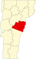
According to the United States Census Bureau, the town has a total area of 22.8 square miles (59.1 km2), of which 22.6 square miles (58.5 km2) is land and 0.2 square mile (0.6 km2) (0.96%) is water. The Ompompanoosuc River flows through the southwestern part of the town. [4]

Demographics

Historical population
CensusPop.Note
1800 391
1810 983151.4%
1820 1,14316.3%
1830 841−26.4%
1840 824−2.0%
1850 696−15.5%
1860 83019.3%
1870 8330.4%
1880 1,03824.6%
1890 561−46.0%
1900 531−5.3%
1910 446−16.0%
1920 387−13.2%
1930 4054.7%
1940 4285.7%
1950 363−15.2%
1960 333−8.3%
1970 3371.2%
1980 42726.7%
1990 63348.2%
2000 72614.7%
2010 652−10.2%
2020 621−4.8%
U.S. Decennial Census [5]

As of the census [1] of 2000, there were 726 people, 278 households, and 197 families residing in the town. The population density was 32.1 people per square mile (12.4/km2). There were 340 housing units at an average density of 15.0 per square mile (5.8/km2). The racial makeup of the town was 98.76% White, 0.14% African American, 0.55% Native American, 0.41% Asian, 0.14% from other races.

There were 278 households, out of which 36.3% had children under the age of 18 living with them, 56.8% were married couples living together, 7.9% had a female householder with no husband present, and 29.1% were non-families. 20.9% of all households were made up of individuals, and 5.4% had someone living alone who was 65 years of age or older. The average household size was 2.61 and the average family size was 3.02.

In the town, the population was spread out, with 27.8% under the age of 18, 7.0% from 18 to 24, 32.4% from 25 to 44, 24.4% from 45 to 64, and 8.4% who were 65 years of age or older. The median age was 35 years. For every 100 females, there were 102.8 males. For every 100 females age 18 and over, there were 100.0 males.

The median income for a household in the town was $40,667, and the median income for a family was $42,500. Males had a median income of $27,200 versus $22,788 for females. The per capita income for the town was $18,011. About 8.0% of families and 10.7% of the population were below the poverty line, including 16.1% of those under age 18 and 8.7% of those age 65 or over.

Notable people

Related Research Articles

<span class="mw-page-title-main">Orange County, Vermont</span> County in Vermont, United States

Orange County is a county located in the U.S. state of Vermont. As of the 2020 census, the population was 29,277. Its shire town is the town of Chelsea. Orange County was organized on February 2, 1781, as an original county within the state.

<span class="mw-page-title-main">Groton, Vermont</span> Town in Vermont, United States

Groton is a town in Caledonia County, Vermont, United States. The population was 984 at the 2020 census. It contains the places Groton Pond, Rickers Mills, Rickers and West Groton. The unincorporated village of Groton in the southeast corner of town is recorded as the Groton census-designated place (CDP), with a population of 419 at the 2020 census.

<span class="mw-page-title-main">South Hero, Vermont</span> Town in Vermont, United States

South Hero is a town on Grand Isle in Grand Isle County, Vermont, United States. South Hero's population was 1,674 at the 2020 census.

<span class="mw-page-title-main">Corinth, Vermont</span> Town in Vermont, United States

Corinth is a town in Orange County, Vermont, United States. The population was 1,455 at the 2020 census.

<span class="mw-page-title-main">Fairlee, Vermont</span> Town in Vermont, United States

Fairlee is a town in Orange County, Vermont, United States. The population was 988 at the 2020 census. It includes the village of Ely. Fairlee is home to Lake Morey, which claims to have the longest ice skating trail in the United States.

<span class="mw-page-title-main">Strafford, Vermont</span> Town in Vermont, United States

Strafford is a town in Orange County, Vermont, United States. The population was 1,094 at the 2020 census. The town of Strafford was created on August 12, 1761 by way of a royal charter which King George III of Great Britain issued to Governor Benning Wentworth of New Hampshire. The town was named after the Earl of Strafford. Its town house is one of the most famous in Vermont, sitting atop a hill in the historic town square.

<span class="mw-page-title-main">Topsham, Vermont</span> Town in Vermont, United States

Topsham is a town in Orange County, Vermont, United States. The population was 1,199 at the 2020 census. It contains four villages: East Topsham, Topsham Four Corners, Waits River, and West Topsham.

<span class="mw-page-title-main">Vershire, Vermont</span> Town in Vermont, United States

Vershire is a town in Orange County, Vermont, United States, created under Vermont Charter of August 3, 1781. The population was 672 at the 2020 census. The name Vershire is a portmanteau of Vermont and New Hampshire.

<span class="mw-page-title-main">Killington, Vermont</span> Town in Vermont, United States

Killington is a town in Rutland County, Vermont, United States. The population was 1,407 at the 2020 census. Killington Ski Resort and numerous vacation lodges are located here. The town was previously named Sherburne, but was renamed to its original name, "Killington", in 1999.

<span class="mw-page-title-main">Brookline, Vermont</span> Town in Vermont, United States

Brookline is a town in Windham County, Vermont, United States. The population was 540 at the 2020 census.

<span class="mw-page-title-main">Dover, Vermont</span> Town in Vermont, United States

Dover is a town in Windham County, Vermont, United States. The population was 1,798 at the 2020 census. It is famed for being the location of the Mount Snow ski area.

<span class="mw-page-title-main">Dummerston, Vermont</span> Town in Vermont, United States

Dummerston is a town in Windham County, Vermont, United States. The population was 1,865 at the 2020 census. It is home to the longest covered bridge still in use in Vermont. Its borders include three main villages: Dummerston Center, West Dummerston, and East Dummerston.

<span class="mw-page-title-main">Londonderry, Vermont</span> Town in Vermont, United States

Londonderry is a town in Windham County, Vermont, United States. It is bounded on the north by Landgrove and Weston, on the east by Windham, on the south by Jamaica and on the west by Winhall and Landgrove. The population was 1,919 in the 2020 census. The town contains the villages of Londonderry and South Londonderry.

<span class="mw-page-title-main">Bridgewater, Vermont</span> Town in Vermont, United States

Bridgewater is a town in Windsor County, Vermont, United States. The population was 903 at the 2020 census. Bridgewater contains the hamlets of Bridgewater Village, Bridgewater Corners, West Bridgewater, and Bridgewater Center.

<span class="mw-page-title-main">Hartford, Vermont</span> Town in Vermont, United States

Hartford is a town in Windsor County, Vermont, United States. It is on the New Hampshire border, at the intersection of Interstates 89 and 91. It is the site of the confluence of the White and Connecticut rivers; the Ottauquechee River also flows through the town. The town is composed of five unincorporated villages: Hartford, Quechee, West Hartford, White River Junction and Wilder. As of the 2020 census, the population was 10,686.

<span class="mw-page-title-main">Weston, Vermont</span> Town in Vermont, United States

Weston is a town in Windsor County, Vermont, United States. The population was 623 at the 2020 census. Home to the Weston Playhouse Theatre Company, it includes the villages of Weston and The Island.

<span class="mw-page-title-main">Cairo, West Virginia</span> Town in West Virginia, United States

Cairo is a town in Ritchie County, West Virginia, United States, along West Virginia Route 31, the North Fork of the Hughes River, and the North Bend Rail Trail. The population was 174 at the 2020 census.

<span class="mw-page-title-main">Bradford (CDP), Vermont</span> Census-designated places in Vermont, United States

Bradford is a census-designated places in the town of Bradford, Orange County, Vermont, United States. The population was 907 at the 2020 census. The village disincorporated on December 1, 2004. The village became a census-designated place in 2008. The central commercial and residential portion of the village is listed on the National Register of Historic Places as the Bradford Village Historic District.

<span class="mw-page-title-main">Newfane, Vermont</span> Town in Vermont, United States

Newfane is the shire town of Windham County, Vermont, United States. The population was 1,645 at the 2020 census. The town includes the villages of Newfane, Williamsville, and South Newfane.

<span class="mw-page-title-main">Bradford, Vermont</span> Town in Vermont, United States

Bradford is a town in Orange County, Vermont, United States. The population was 2,790 at the 2020 census. Bradford is located on the county's eastern border, bordering both the Connecticut River and New Hampshire, and is a commercial center for some of its surrounding towns.

References

  1. 1 2 "U.S. Census website". United States Census Bureau . Retrieved January 31, 2008.
  2. "US Board on Geographic Names". United States Geological Survey. October 25, 2007. Retrieved January 31, 2008.
  3. "Census - Geography Profile: West Fairlee town, Orange County, Vermont" . Retrieved January 7, 2022.
  4. DeLorme (1996). Vermont Atlas & Gazetteer. Yarmouth, Maine: DeLorme. ISBN   0-89933-016-9
  5. "U.S. Decennial Census". United States Census Bureau. Retrieved May 16, 2015.
  6. "OLYMPIC HIGHLIGHTS (Published 1984)". The New York Times . Archived from the original on May 20, 2023.