Tunbridge, Vermont

Last updated

Tunbridge, Vermont
Town
Tunbridge vermont town office 20040926.jpg
Tunbridge town office
Tunbridge vt highlight.png
Located in Orange County, Vermont
Usa edcp location map.svg
Red pog.svg
Tunbridge, Vermont
Location within the U.S.A.
Coordinates: 43°54′0″N72°29′17″W / 43.90000°N 72.48806°W / 43.90000; -72.48806
Country United States
State Vermont
County Orange
Chartered1761
Settled1776
Organized1786
CommunitiesTunbridge
North Tunbridge
South Tunbridge
Area
  Total44.8 sq mi (115.9 km2)
  Land44.7 sq mi (115.9 km2)
  Water0.04 sq mi (0.1 km2)  0.09%
Elevation
600 ft (172 m)
Population
 (2020)
  Total1,337
  Density30/sq mi (11.5/km2)
  Households
548
  Families
343
Time zone UTC-5 (EST)
  Summer (DST) UTC-4 (EDT)
ZIP code
05077
Area code 802
FIPS code 50-73675 [1]
GNIS feature ID1462231 [2]
Website www.tunbridgevt.org

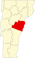
Tunbridge is a town in Orange County, Vermont, United States. As of the 2020 United States Census the town population was 1,337. [3] The town consists of three village centers, all situated on Vermont Route 110 in the valley of the first branch of the White River. The three settlements are named North Tunbridge (also known locally as "Blood Village"), Tunbridge Village ("Market") and South Tunbridge ("Jigger").

Contents

Historic sites

Hayward and Noble Mill, and Mill Bridge Tunbridge Blacksmith Shop.gif
Hayward and Noble Mill, and Mill Bridge

The entire center of Tunbridge Village, including the fairgrounds, was placed on the National Register of Historic Places in 1994. Officially the district listing is "Roughly, along VT 110 and adjacent rds. including Town Rd. 45 and Spring and Strafford Rds."

Tunbridge has five covered bridges (all listed on the National Register)

Tunbridge also has two other structures are individually listed on the National Register:

Tunbridge World's Fair

The historical antecedent of the Tunbridge World's Fair can be traced to the town's charter, which therein authorized the establishment of two annual fairs when the population of the town reached fifty families.

It wasn't until 1867 that, after a succession of fairs in Orange County starting in 1847, the Tunbridge Agricultural Society was organized and staged a fair at the Elisha Lougee Farm in North Tunbridge. At the 1867 fair, Vermont's former Lieutenant Governor Burnham Martin referred to the fair as a "little World's Fair". Lewis Dickerman adopted the phrase and used it in the 1868 publicity handbills and the Tunbridge fair has since used the name.

In 1875, the Union Agricultural Society assumed the sponsorship of the fair and moved its location to the present fairgrounds in the center of Tunbridge.

In 1894, the fair joined the National Trotting Association, and for many years has maintained the only remaining grass race track in Vermont.

The annual fair continues to this day with demonstrations of farming and agricultural traditions and culture, working antique displays, horse and ox pulling, horse racing, cattle and horse shows, junior exhibits, floral and 4-H exhibits, contra dancing, gymkhana, and many free shows.

Geography and geology

Tucker's Barn, Tunbridge Vermont Barn in tunbridge vt.jpg
Tucker's Barn, Tunbridge Vermont

According to the United States Census Bureau, the town has a total area of 44.8 square miles (115.9 km2), of which 44.7 square miles (115.9 km2) is land and 0.04 square mile (0.1 km2) (0.04%) is water. The First Branch of the White River running north to south divides Tunbridge into two nearly equal parts. Two mineral springs exist in the town, one of which is a white sulphur spring located on "Spring road," one and a half miles from Tunbridge Center; this spring was once valued for its medicinal properties.

The highest points of land are Brocklebank Hill at 2100+ ft near the northern boundary with Chelsea, Old Hurricane Hill at 1900+ ft in the northwestern part near East Randolph, and East Hill at 2112 ft near the Strafford line. The soil is well-drained and was formed in Wisconsin-age glacial till, its average depth is around 20 to 40 inches. Typical composition of the soil: a surface layer of very dark brown, partially decomposed organic material; a subsurface layer of gray fine sandy loam; upper subsoil of dark brown fine sandy loam and subsoil of brown channery fine sandy loam. The rocks underlying Tunbridge are entirely of the calciferous mica schist formation, with a small bed of granite, syenite and protogine in the northeastern part.

No. 9 of the Acts of 1985, effective March 27, 1985, designated the Tunbridge Soil Series as the official State Soil. The Tunbridge series (course-loamy, mixed, frigid Typic Haplothrod) consists of moderately deep to bedrock, well drained soils. It was selected from among more than 160 different soil series in the state. As it is a typical "hill farm" and "sugarbush" soil, the Tunbridge series well represents the soil resources of Vermont. A soil formed in loamy glacial till, it has good potential for agriculture and forestry. As Professor Richmond Bartlett of UVM says, "It's the soil that makes Vermont hills greener than those either in New Hampshire or New York."
---From Office of the Secretary of State, Vermont Legislative Directory and State Manual, Biennial Session, 1993–1994, p. 16.

Typical species of tree to be found in the landscape are white birch, yellow birch, American beech, red spruce, red maple, sugar maple, white ash, hemlock and white pine.

Demographics

Historical population
CensusPop.Note
1790 487
1800 1,314169.8%
1810 1,64024.8%
1820 2,00322.1%
1830 1,920−4.1%
1840 1,811−5.7%
1850 1,786−1.4%
1860 1,546−13.4%
1870 1,405−9.1%
1880 1,252−10.9%
1890 1,011−19.2%
1900 885−12.5%
1910 9183.7%
1920 907−1.2%
1930 903−0.4%
1940 882−2.3%
1950 774−12.2%
1960 743−4.0%
1970 7916.5%
1980 92516.9%
1990 1,15424.8%
2000 1,30913.4%
2010 1,284−1.9%
2020 1,3374.1%
U.S. Decennial Census [4]

As of the census [1] of 2000, there were 1,309 people, 513 households, and 362 families residing in the town. The population density was 29.3 people per square mile (11.3/km2). There were 679 housing units at an average density of 15.2 per square mile (5.9/km2). The racial makeup of the town was 99.01% White, 0.23% African American, 0.08% Native American, 0.15% Asian, and 0.53% from two or more races. Hispanic or Latino of any race were 0.99% of the population.

There were 513 households, out of which 31.0% had children under the age of 18 living with them, 55.0% were couples living together and joined in either marriage or civil union, 11.3% had a female householder with no husband present, and 29.4% were non-families. 21.1% of all households were made up of individuals, and 8.4% had someone living alone who was 65 years of age or older. The average household size was 2.55 and the average family size was 2.94.

In the town, the population was spread out, with 25.4% under the age of 18, 5.1% from 18 to 24, 31.5% from 25 to 44, 24.8% from 45 to 64, and 13.2% who were 65 years of age or older. The median age was 38 years. For every 100 females, there were 99.5 males. For every 100 females age 18 and over, there were 95.4 males.

The median income for a household in the town was $40,855, and the median income for a family was $45,670. Males had a median income of $27,465 versus $23,182 for females. The per capita income for the town was $19,934. About 8.4% of families and 12.1% of the population were below the poverty line, including 17.8% of those under age 18 and 8.3% of those age 65 or over. the unemployment rate is 3.2% and the average commute time is 26.9 minutes.

84.9% of the Tunbridge population studied at high school level or higher and 25.8% have studied at bachelors level or higher.

Notable people

Cemeteries

Dates represent years in use.

Related Research Articles

<span class="mw-page-title-main">Windsor County, Vermont</span> County in Vermont, United States

Windsor County is a county located in the U.S. state of Vermont. As of the 2020 census, the population was 57,753. The shire town is the town of Woodstock. The county's largest municipality is the town of Hartford.

<span class="mw-page-title-main">Rutland County, Vermont</span> County in Vermont, United States

Rutland County is a county located in the U.S. state of Vermont. As of the 2020 census, the population was 60,572, making it the second-most populous county in Vermont. Its county seat and most populous municipality is the city of Rutland.

<span class="mw-page-title-main">Cornish, New Hampshire</span> Town in New Hampshire, United States

Cornish is a town in Sullivan County, New Hampshire, United States. The population was 1,616 at the 2020 census. Cornish has four covered bridges. Each August, it is home to the Cornish Fair.

<span class="mw-page-title-main">Richfield, New York</span> Town in Otsego County, New York, US

Richfield is a town located in Otsego County, New York, United States. As of the 2010 census, the town had a population of 2,388. The Town of Richfield is located at the northern border of the county.

<span class="mw-page-title-main">Danville, Vermont</span> Town in Vermont, United States

Danville is a town in Caledonia County, Vermont, United States. The population was 2,335 at the 2020 census. The primary settlement in town is recorded as the Danville census-designated place (CDP) and had a population of 385 at the 2020 census.

<span class="mw-page-title-main">Stannard, Vermont</span> Town in Vermont, United States

Stannard is a town in Caledonia County, Vermont. The population was 208 at the 2020 census. The town has no paved roads.

<span class="mw-page-title-main">Lemington, Vermont</span> Town in Vermont, United States

Lemington is a town in Essex County, Vermont, United States. The population was 87 as of the 2020 census. It is part of the Berlin, NH–VT Micropolitan Statistical Area.

<span class="mw-page-title-main">Montgomery, Vermont</span> Town in Vermont, United States

Montgomery is a town in Franklin County, Vermont, United States. The population as of the 2020 census was 1,184. In 1963, part of Avery's Gore in Franklin County became part of Montgomery, with the other section becoming part of Belvidere in Lamoille County.

<span class="mw-page-title-main">Brookfield, Vermont</span> Town in Vermont, United States

Brookfield is a town in Orange County, Vermont, United States. It was created by Vermont charter on August 5, 1781. The population was 1,244 at the 2020 census. Brookfield is best known for its floating bridge which spans Sunset Lake buoyed by pontoons. The bridge, which is the only floating bridge east of the Mississippi River, was originally built in 1820 by Luther Adams and his neighbors. Sunset Lake is also the site of an annual ice harvesting festival. Brookfield boasts that it has Vermont's oldest continually operating library dating back to 1791. In 2006, Brookfield was one of the first American towns to have its citizens pass a resolution endorsing the impeachment of President George W. Bush. As of September 2010, the floating bridge was closed for repairs. Work began in 2014, and was completed May 2015. There was a celebration from May 23–24, 2015, to memorialize the event. Governor Peter Shumlin attended, and cadets from Norwich University provided traffic control.

<span class="mw-page-title-main">Strafford, Vermont</span> Town in Vermont, United States

Strafford is a town in Orange County, Vermont, United States. The population was 1,094 at the 2020 census. The town of Strafford was created on August 12, 1761 by way of a royal charter which King George III of Great Britain issued to Governor Benning Wentworth of New Hampshire. The town was named after the Earl of Strafford. Its town house is one of the most famous in Vermont, sitting atop a hill at the end of the historic town common.

<span class="mw-page-title-main">Clarendon, Vermont</span> Town in Vermont, United States

Clarendon is a town in Rutland County, Vermont, United States. The population was 2,412 at the 2020 census. Clarendon spans U.S. Route 7 and is split by the highway, the Cold River and Mill River, Otter Creek, and the Green Mountains into the hamlets of Clarendon, West Clarendon, East Clarendon, Clarendon Springs, and North Clarendon

<span class="mw-page-title-main">Proctor, Vermont</span> Town in Vermont, United States

Proctor is a town in Rutland County, Vermont, United States. The population was 1,763 at the 2020 census. Proctor is home to the Vermont Marble Museum and Wilson Castle.

<span class="mw-page-title-main">Rockingham, Vermont</span> Town in Vermont, United States

Rockingham is a town along the Connecticut River in Windham County, Vermont, United States. As of the 2020 census, the population was 4,832. Rockingham includes the incorporated villages of Bellows Falls and Saxtons River, as well as a large rural area west of Interstate 91.

<span class="mw-page-title-main">Bethel, Vermont</span> Town in Vermont, United States

Bethel is a town in Windsor County, Vermont, United States. The population was 1,942 at the 2020 census. The town includes the locations of Bethel village, Bethel-Gilead, East Bethel, Lilliesville, Lympus, and West Bethel. Bethel is best known for being the source of Bethel White granite which was used to build Union Station and the National Museum of Natural History. Bethel was the first town created by the independent Republic of Vermont in 1779 and was named after the Biblical village of Bethel.

<span class="mw-page-title-main">Royalton, Vermont</span> Town in Vermont, United States

Royalton is a town in Windsor County, Vermont, United States. The population was 2,750 at the 2020 census. It includes the villages of Royalton, South Royalton, and North Royalton. Vermont Law School, the state's only accredited law school, is located in South Royalton.

<span class="mw-page-title-main">White River Junction, Vermont</span> Census-designated place in Vermont, United States

White River Junction is an unincorporated village and census-designated place (CDP) in the town of Hartford in Windsor County, Vermont, United States. The population was 2,528 at the 2020 census, up from 2,286 in 2010, making it the largest community within the town of Hartford.

<span class="mw-page-title-main">Cambridge, Vermont</span> Town in Vermont, United States

Cambridge is a town in Lamoille County, Vermont, United States. The population was 3,839 at the 2020 United States Census. Cambridge includes the villages of Jeffersonville and Cambridge.

<span class="mw-page-title-main">Hyde Park (town), Vermont</span> Town in Vermont, United States

Hyde Park is a town in and the shire town of Lamoille County, Vermont, United States. The town was named for Captain Jedediah Hyde, an early landowner who was a veteran of the American Revolutionary War. The population was 3,020 at the 2020 census. There is also a village of the same name within the town.

<span class="mw-page-title-main">Barre (town), Vermont</span> Town in Vermont, United States

Barre is a town in Washington County, Vermont, United States. The population was 7,923 at the 2020 census, making it the 3rd largest municipality in Washington County and the 16th largest municipality in Vermont. Popularly referred to as "Barre Town", the town of Barre almost completely surrounds "Barre City", which is a separate municipality. The original town now known as Barre was first chartered in 1780 as the Town of Wildersburgh. In 1793 the name Wildersburgh was unpopular with the inhabitants and the name of the town was changed to Barre. In 1895 the City of Barre was incorporated and separated from the town of Barre, and both continue to exist as separate municipalities.

<span class="mw-page-title-main">Northfield, Vermont</span> Town in Vermont, United States

Northfield is a town in Washington County, Vermont, United States. The town lies in a valley within the Green Mountains and has been home to Norwich University since 1866. It contains the village of Northfield, where over half of the population lives. The town's total population was 5,918 at the 2020 census.

References

  1. 1 2 "U.S. Census website". United States Census Bureau . Retrieved January 31, 2008.
  2. "US Board on Geographic Names". United States Geological Survey. October 25, 2007. Retrieved January 31, 2008.
  3. "Census - Geography Profile: Tunbridge town, Orange County, Vermont" . Retrieved January 6, 2022.
  4. "U.S. Decennial Census". United States Census Bureau. Retrieved May 16, 2015.
  5. "Ivy Mix | Head Bartender and Co-Owner, Leyenda". PUNCH. Retrieved December 31, 2019.