Strafford was one of thirteen Vermont towns isolated by flooding caused by Hurricane Irene in 2011.[5]
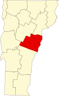
Geography
According to the United States Census Bureau, the town has a total area of 44.3square miles (114.8km2), of which 44.2square miles (114.5km2) is land and 0.1square mile (0.3km2) (0.25%) is water. The West Branch of the Ompompanoosuc River flows through the town.[6]
As of the census[1] of 2000, there were 1,045 people, 420 households, and 296 families residing in the town. The population density was 23.6 people per square mile (9.1/km2). There were 542 housing units at an average density of 12.3 per square mile (4.7/km2). The racial makeup of the town was 98.47% White, 0.19% African American, 0.29% Asian, 0.10% from other races, and 0.96% from two or more races. Hispanic or Latino of any race were 0.48% of the population.
There were 420 households, out of which 35.0% had children under the age of 18 living with them, 59.0% were married couples living together, 7.6% had a female householder with no husband present, and 29.3% were non-families. 25.2% of all households were made up of individuals, and 6.2% had someone living alone who was 65 years of age or older. The average household size was 2.49 and the average family size was 2.97.
In the town, the population was spread out, with 27.3% under the age of 18, 3.8% from 18 to 24, 27.9% from 25 to 44, 29.0% from 45 to 64, and 12.0% who were 65 years of age or older. The median age was 41 years. For every 100 females, there were 100.6 males. For every 100 females age 18 and over, there were 95.9 males.
The median income for a household in the town was $46,711, and the median income for a family was $52,596. Males had a median income of $31,481 versus $24,808 for females. The per capita income for the town was $22,267. About 3.6% of families and 7.9% of the population were below the poverty line, including 12.2% of those under age 18 and 13.9% of those age 65 or over.
Justin Smith Morrill, US Representative and Senator, known as the chief sponsor and author of the Land Grant College Acts was born in Strafford. His Gothic Revival Homestead is one of the Vermont State-Owned Historic Sites.
↑ "Denny Emerson". USEA: United States Eventing Association Inc. Retrieved September 29, 2023.
↑ O'Boyle, Francis Joseph (2000). "Biography: Doc Hazelton". SABR.org. Phoenix, AZ: Society for American Baseball Research. Retrieved December 12, 2019.
This page is based on this Wikipedia article Text is available under the CC BY-SA 4.0 license; additional terms may apply. Images, videos and audio are available under their respective licenses.