Newbury (town), Vermont

Last updated

Newbury, Vermont
Town
Newbury VT Town Office.jpg
Town office and post office
Newbury vt highlight.png
Located in Orange County, Vermont
Map of USA VT.svg
Location of Vermont with the U.S.A.
Coordinates: 44°06′14″N72°07′18″W / 44.1039533°N 72.1217587°W / 44.1039533; -72.1217587 . [1]
Country United States
State Vermont
County Orange
Chartered1763
Communities Newbury
Wells River
Area
  Total64.4 sq mi (166.9 km2)
  Land64.2 sq mi (166.2 km2)
  Water0.3 sq mi (0.7 km2)
Elevation
[2]
774 ft (236 m)
Population
 (2020)
  Total2,293
  Density36/sq mi (14/km2)
Time zone UTC-5 (EST)
  Summer (DST) UTC-4 (EDT)
ZIP Codes
05051, 05081
Area code 802
FIPS code 50-48175 [3]
GNIS feature ID1462158 [2]
Website www.newburyvt.org

Newbury is a town in Orange County, Vermont, United States. The population was 2,293 at the 2020 census. [4] Newbury includes the villages of Newbury, Center Newbury, West Newbury, South Newbury, Boltonville, Peach Four Corners, and Wells River.

Contents

History

Connecticut River from Newbury Bradford1a.jpg
Connecticut River from Newbury

Located at the Great Oxbow of the Connecticut River, with vast tracts of beautiful and fertile intervale, the area was a favorite of the Indians. Rivers teemed with salmon and brooks with trout. [5] Prior to European settlement, the Newbury area was the location of a village called Cowass or Cowassuck of the Pennacook tribe. [6] Cowass in Abenaki is "Coo-ash-auke," meaning "place of pine trees," and was a general name these people gave to the upper Connecticut River Valley and Lakes region. [7] In 1704 the Pennacook at Cowass kept several captives from the Deerfield Raid in the village, including Stephen Williams who was kept with Sachem George Tahanto [8] [9] [10] The area was first settled by English colonists in 1762 by Samuel Sleeper and family. One of the New Hampshire grants, Newbury was chartered by Governor Benning Wentworth on March 18, 1763, to Jacob Bayley and 74 others, some from Newbury, Massachusetts. [5]

The town served as the southern terminus of the Bayley Hazen Military Road, begun by Bayley in 1760 and then continued until 1779 by Colonel Moses Hazen. Meanwhile, pioneer farmers had to carry their grain 60 miles (97 kilometers) by canoe to Charlestown, New Hampshire to get it ground into flour. By 1859, when the population was 2,984, Newbury had two gristmills, in addition to a paper mill and steam mill to manufacture mackerel kits. The principal industry, however, along the alluvial meadows was raising beef cattle and sheep, and the production of wool and dairy goods. [11] The Connecticut & Passumpsic Rivers Railroad opened on November 6, 1848, to the village of Wells River. It developed as an adjunct of the railway town across the Connecticut River at Woodsville, the once bustling village within Haverhill, New Hampshire.

In the summer of 1913 a large fire destroyed 21 buildings in Newbury, including a church, the public school, the hotel and a number of businesses and residences. Only a change of the wind saved the balance of the town since there was no fire department at that time.

In 1958, Newbury gained widespread notoriety after an unpopular farmer disappeared. The discovery of his bound body in the river three months later led to his death being described as a "lynching" by newspapers along the East Coast. Two suspects were acquitted, and the crime was never solved. [12]

Boston University, one of New England's largest universities, traces its roots to the establishment of the Newbury Biblical Institute, a Methodist school founded in Newbury, Vermont in 1839. [13]

Geography

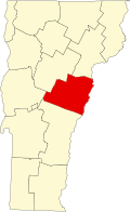
The town of Newbury is located in the northeast corner of Orange County.

According to the United States Census Bureau, the town has a total area of 64.4 square miles (166.9 km2), of which 64.2 square miles (166.2 km2) is land and 0.3 square mile (0.7 km2) (0.40%) is water. Bounded on the east by the Connecticut River, which forms the Vermont–New Hampshire border, Newbury is drained by the Wells River, Halls Brook and Peach Brook.

The town is crossed by I-91.svg Interstate 91, US 5.svg U.S. Route 5, and US 302.svg U.S. Route 302.

Demographics

Historical population
CensusPop.Note
1790 872
1800 1,30449.5%
1810 1,3634.5%
1820 1,62319.1%
1830 2,25238.8%
1840 2,57914.5%
1850 2,98415.7%
1860 2,549−14.6%
1870 2,241−12.1%
1880 2,3163.3%
1890 2,080−10.2%
1900 2,1252.2%
1910 2,035−4.2%
1920 1,908−6.2%
1930 1,744−8.6%
1940 1,723−1.2%
1950 1,667−3.3%
1960 1,452−12.9%
1970 1,440−0.8%
1980 1,69918.0%
1990 1,98516.8%
2000 1,955−1.5%
2010 2,21613.4%
2020 2,2933.5%
U.S. Decennial Census [14]

As of the census [3] of 2000, there were 1,955 people, 816 households, and 553 families residing in the town. The population density was 30.5 people per square mile (11.8/km2). There were 1,153 housing units at an average density of 18.0/sq mi (6.9/km2). The racial makeup of the town was 97.44% White, 0.31% Black or African American, 0.66% Native American, 0.20% Asian, and 1.38% from two or more races. Hispanic or Latino of any race were 0.15% of the population.

There were 816 households, out of which 29.4% had children under the age of 18 living with them, 55.6% were married couples living together, 7.7% had a female householder with no husband present, and 32.2% were non-families. 26.3% of all households were made up of individuals, and 11.8% had someone living alone who was 65 years of age or older. The average household size was 2.40 and the average family size was 2.88.

In the town, the population was spread out, with 24.2% under the age of 18, 5.5% from 18 to 24, 25.7% from 25 to 44, 27.3% from 45 to 64, and 17.2% who were 65 years of age or older. The median age was 42 years. For every 100 females, there were 94.3 males. For every 100 females age 18 and over, there were 90.9 males.

The median income for a household in the town was $32,721, and the median income for a family was $42,262. Males had a median income of $30,169 versus $21,780 for females. The per capita income for the town was $17,659. About 8.6% of families and 12.9% of the population were below the poverty line, including 16.3% of those under age 18 and 10.6% of those age 65 or over.

Sites of interest

Notable people

Related Research Articles

<span class="mw-page-title-main">Deerfield, Massachusetts</span> Town in Massachusetts, United States

Deerfield is a town in Franklin County, Massachusetts, United States. Settled near the Connecticut River in the 17th century during the colonial era, the population was 5,090 as of the 2020 census. Deerfield is part of the Springfield, Massachusetts Metropolitan Statistical Area in western Massachusetts, lying 30 miles (48 km) north of the city of Springfield.

<span class="mw-page-title-main">Westmoreland, New Hampshire</span> Town in New Hampshire, United States

Westmoreland is a town in Cheshire County, New Hampshire, United States. The population was 1,706 at the 2020 census, down from 1,874 at the 2010 census. Westmoreland is historically an agricultural town, with much arable farmland.

<span class="mw-page-title-main">Woodsville, New Hampshire</span> Census-designated place in New Hampshire, United States

Woodsville is a census-designated place (CDP) and the largest village in the town of Haverhill in Grafton County, New Hampshire, United States, along the Connecticut River at the mouth of the Ammonoosuc River. The population was 1,431 at the 2020 census. Although North Haverhill is now the county seat of Grafton County, the village of Woodsville has traditionally been considered the county seat, as the county courthouse was originally located there. The county buildings are now located halfway between Woodsville and the village of North Haverhill to the south.

<span class="mw-page-title-main">Boscawen, New Hampshire</span> Town in New Hampshire, United States

Boscawen is a town in Merrimack County, New Hampshire, United States. The population was 3,998 at the 2020 census.

<span class="mw-page-title-main">Newbury, New Hampshire</span> Town in New Hampshire, United States

Newbury is a town in Merrimack County, New Hampshire, United States. The population was 2,172 at the 2020 census. Newbury is home to part of Lake Sunapee, including Mount Sunapee State Park Beach. Mount Sunapee Resort, a ski area in Mount Sunapee State Park, is in the west. The town includes the villages of Newbury, Blodgett Landing and South Newbury.

<span class="mw-page-title-main">Cornish, New Hampshire</span> Town in New Hampshire, United States

Cornish is a town in Sullivan County, New Hampshire, United States. The population was 1,616 at the 2020 census. Cornish has four covered bridges. Each August, it is home to the Cornish Fair.

<span class="mw-page-title-main">Ryegate, Vermont</span> Town in Vermont, United States

Ryegate is a town in Caledonia County, Vermont, United States. The population was 1,165 at the 2020 census. The town contains the villages of South Ryegate, East Ryegate, and Ryegate Corner.

<span class="mw-page-title-main">Bloomfield, Vermont</span> Town in Vermont, United States

Bloomfield is a town in Essex County, Vermont, United States. The population was 217 at the 2020 census. It is part of the Berlin, New Hampshire-Vermont Micropolitan Statistical Area.

<span class="mw-page-title-main">Lemington, Vermont</span> Town in Vermont, United States

Lemington is a town in Essex County, Vermont, United States. The population was 87 as of the 2020 census. It is part of the Berlin, NH–VT Micropolitan Statistical Area.

<span class="mw-page-title-main">Maidstone, Vermont</span> Town in Vermont, United States

Maidstone is a town in Essex County, Vermont, United States. As of the 2020 census, the town had a population of 211. It is part of the Berlin, NH–VT Micropolitan Statistical Area. There is no town center or gas station, but there is a town office building in the southern part of the town.

<span class="mw-page-title-main">Wells River, Vermont</span> Village in Vermont, United States

Wells River is a village in the town of Newbury in Orange County, Vermont, United States. The population was 431 at the 2020 census. The village center is located at the junction of U.S. Routes 5 and 302.

<span class="mw-page-title-main">White River Junction, Vermont</span> Census-designated place in Vermont, United States

White River Junction is an unincorporated village and census-designated place (CDP) in the town of Hartford in Windsor County, Vermont, United States. The population was 2,528 at the 2020 census, up from 2,286 in 2010, making it the largest community within the town of Hartford.

<span class="mw-page-title-main">Windsor, Vermont</span> Town in Vermont, United States

Windsor is a town in Windsor County, Vermont, United States. As the "Birthplace of Vermont", the town is where the Constitution of Vermont was adopted in 1777, thus marking the founding of the Vermont Republic, a sovereign state until 1791, when Vermont joined the United States. Over much of its history, Windsor was home to a variety of manufacturing enterprises. Its population was 3,559 at the 2020 census.

<span class="mw-page-title-main">Hinsdale, New Hampshire</span> Town in New Hampshire, United States

Hinsdale is a town in Cheshire County, New Hampshire, United States. The population was 3,948 at the 2020 census. Hinsdale is home to part of Pisgah State Park in the northeast, and part of Wantastiquet Mountain State Forest in the northwest.

<span class="mw-page-title-main">Newbury (village), Vermont</span> Village in Vermont, United States

Newbury is an incorporated village in the town of Newbury in Orange County, Vermont, United States. The population was 447 at the 2020 census.

<span class="mw-page-title-main">Raid on Deerfield</span> 1704 raid during Queen Annes War

The Raid on Deerfield, also known as the Deerfield Massacre, occurred during Queen Anne's War on February 29, 1704, when French and Native American raiders under the command of Jean-Baptiste Hertel de Rouville attacked the English colonial settlement of Deerfield, Massachusetts Bay, just before dawn. They burned parts of the town and killed 47 colonists. The raiders left with 112 colonists as captives, whom they took overland the nearly 300 miles to Montreal; some died or were killed along the way because they were unable to keep up. Roughly 60 colonists were later ransomed by their associates, while others were adopted by Mohawk families at Kahnawake and became assimilated into the tribe. In this period, English colonists and their Indian allies were involved in similar raids against French villages along the northern area between the spheres of influence.

<span class="mw-page-title-main">Wilmington, Vermont</span> Town in Vermont, United States

Wilmington is a town in Windham County, Vermont, United States. The population was 2,255 at the 2020 census.

<span class="mw-page-title-main">Bradford, Vermont</span> Town in Vermont, United States

Bradford is a town in Orange County, Vermont, United States. The population was 2,790 at the 2020 census. Bradford is located on the county's eastern border, bordering both the Connecticut River and New Hampshire, and is a commercial center for some of its surrounding towns.

<span class="mw-page-title-main">Bayley Historic District</span> Historic district in Vermont, United States

The Bayley Historic District encompasses a small cluster of buildings in Newbury, Vermont, a number of which are associated with the historically prominent Bayley family. It includes some of the town's oldest buildings, and is where the founder of the town, Jacob Bayley, first settled and later died. The district is oriented along Oxbow Road west of United States Route 5 and north of the town's main village. It was listed on the National Register of Historic Places in 1983.

George Tahanto was a leader of the Nashaway tribe within the Pennacook confederation in what is now Massachusetts and New Hampshire. Tahanto was the nephew of Sachem Sholan.

References

  1. "Town of Newbury". Geographic Names Information System . United States Geological Survey, United States Department of the Interior . Retrieved May 15, 2009.
  2. 1 2 "US Board on Geographic Names". United States Geological Survey. October 25, 2007. Retrieved January 31, 2008.
  3. 1 2 "U.S. Census website". United States Census Bureau . Retrieved January 31, 2008.
  4. "Census - Geography Profile: Newbury town, Orange County, Vermont" . Retrieved January 3, 2022.
  5. 1 2 Coolidge, Austin Jacobs; Mansfield, John Brainard (March 23, 1859). "A History and Description of New England, General and Local: Maine, New Hampshire, and Vermont". A.J. Coolidge via Google Books.
  6. Haefeli and Sweeney, Captors and Captives: The 1704 French and Indian Raid on Deerfield, (UMass Press, 2003) pp. 79, 92
  7. Johnson, Arthur (November 2007). "Indian Joe". Ne-Do-Ba (Friends). Retrieved January 31, 2015.
  8. Evan Haefeli, Kevin Sweeney, Captive Histories: English, French, and Native Narratives of the 1704 Deerfield Raid (2006), p. 160
  9. John Williams, The Redeemed Captive Returning to Zion: Or, The Captivity ..." (1908), p.50
  10. "Revisiting The Redeemed Captive: New Perspectives on the 1704 Attack on Deerfield," Evan Haefeli and Kevin Sweeney, The William and Mary Quarterly, Vol. 52, No. 1 (Jan., 1995), pp. 3-46 (44 pages)
  11. "TownNewbury".
  12. Wilson Ring, "In Vermont, blotting an old stain on a town's reputation", Associated Press in Yahoo! News; accessed 2015.03.09.
  13. Boston University | Visitor Center | About the University |History, retrieved May 6, 2006 Archived February 16, 2006, at the Wayback Machine
  14. "U.S. Decennial Census". United States Census Bureau. Retrieved May 16, 2015.
  15. "Bayley Historic District". www.crjc.org.
  16. "Julia H. Farwell Dies: Educator Was a Founder of Summer Camps for Girls", The New York Times , November 23, 1925.
  17. Jessica Turner, "Q&A with Summer Camp Owners Charyl and Bob Hanson" Archived 2008-10-12 at the Wayback Machine , Vermont Life, Summer 2008.
  18. "View Museum Info". www.museumsusa.org.
  19. "Newbury Town House". www.crjc.org.
  20. "Oxbow Historic District". www.crjc.org.
  21. "Newbury Village Store". Newbury Village Store. Retrieved December 21, 2023.
  22. Carleton, Hiram (1903). Genealogical and Family History of the State of Vermont. Vol. I. New York, NY: Lewis Publishing Company. pp. 642–643. ISBN   9780806347943 via Google Books.
  23. Register of the California Society of the Sons of the American Revolution. San Francisco, CA: California Society, Sons of the American Revolution. 1901. p. 90 via Google Books.
  24. Dana, Henry Swan (1889). History of Woodstock, Vermont. Boston, MA: Houghton, Mifflin and Company. pp. 17–19 via Google Books.
  25. Wells, Frederic Palmer (1902). History of Newbury, Vermont. St. Johnsbury, VT: The Caledonian Company. pp. 605–606 via Google Books.
  26. Underwood, Lucien Marcus (1913). The Underwood Families of America. Vol. 1. Lancaster, PA: New Era Printing Company. pp. 91–93.

Further reading