This article does not cite any sources .(September 2016) (Learn how and when to remove this template message) |


The two primary cities of the Connecticut River
This is a list of populated places that are on the Connecticut River .
This article does not cite any sources .(September 2016) (Learn how and when to remove this template message) |
This is a list of populated places that are on the Connecticut River .
Bold communities have over 10,000 population.
Bold cities have over 15,000 population. Italics are for towns or cities in the Springfield Metro area. Underlines are for communities in the Hartford Metro area.
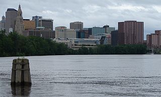
Bold communities have over 25,000 population. This section of the river is completely in the Hartford Metro area.

Hartford County is a county located in the north central part of the U.S. state of Connecticut. According to the 2010 census, the population was 894,014, making it the second-most populous county in Connecticut. In 2019, its population declined to an estimated 891,720. Hartford County contains the city of Hartford, the state capital of Connecticut and the county's most populous city, with an estimated 122,105 residents in 2019. Hartford County is included in the Hartford-East Hartford-Middletown metropolitan statistical area.
Interstate 91 (I-91) is an Interstate Highway in the New England region of the United States. It provides the primary north–south thoroughfare in the western part of the region. The Interstate generally follows the course of the Connecticut River. Its southern end is in New Haven, Connecticut, at Interstate 95. The northern end of the American-maintained road is in the village of Derby Line, Vermont, at the Canadian border. I-91 then continues past the Derby Line–Rock Island Border Crossing, where the road's official name changes to Autoroute 55. I-91 is the longest of three Interstate highways whose entire route is located within the New England states and is also the only primary (two-digit) Interstate Highway in New England to intersect all five of the others that run through the region. The largest cities along its route are New Haven, Connecticut, Hartford, Connecticut, Springfield, Massachusetts, Northampton, Massachusetts, Greenfield, Massachusetts, Brattleboro, Vermont, White River Junction, Vermont, and St. Johnsbury, Vermont in order from south to north.

The Connecticut River is the longest river in the New England region of the United States, flowing roughly southward for 406 miles (653 km) through four states. It rises at the U.S. border with Quebec, Canada, and discharges at Long Island Sound. Its watershed encompasses 11,260 square miles (29,200 km2), covering parts of five U.S. states and one Canadian province, via 148 tributaries, 38 of which are major rivers. It produces 70% of Long Island Sound's fresh water, discharging at 18,400 cubic feet (520 m3) per second.

U.S. Route 5 is a north–south United States highway running through the New England states of Connecticut, Massachusetts, and Vermont. Significant cities along the route include New Haven, Connecticut; Hartford, Connecticut; and Springfield, Massachusetts. From Hartford northward to St. Johnsbury, Vermont, the road closely follows the route of the Connecticut River.

Western Massachusetts is a region in Massachusetts, one of the six U.S. states that make up the New England region of the United States. Western Massachusetts has diverse topography; 22 colleges and universities, with approximately 100,000 students; and such institutions as Tanglewood, the Springfield Armory, and Jacob's Pillow.
Greater Hartford is a region located in the U.S. state of Connecticut, centered on the state's capital of Hartford. It represents the only combined statistical area in Connecticut defined by a city within the state, being bordered by the Greater Boston region to the northeast and New York metropolitan area to the south and west. Sitting at the southern end of the Metacomet Ridge, its geology is characterized by land of a level grade along the shores of Connecticut River Valley, with finer-grained soil than other regions in the state.

The headquarters of the Connecticut Rivers Council of the Boy Scouts of America is located in East Hartford, Connecticut. The present council was formed as the result of the merger between the Indian Trails Council of Norwich, Connecticut and Long Rivers Council of Hartford, Connecticut. Now it is the largest council in the state with a youth membership of over 17,000 and a volunteer base of nearly 10,000 adults, serving for over half of the state.

Connecticut's 2nd congressional district is a congressional district in the U.S. state of Connecticut. Located in the eastern part of the state, the district includes all of New London County, Tolland County, and Windham County, along with parts of Hartford, Middlesex, and New Haven counties.
The greater Hartford–Springfield area is an urban region and surrounding suburban areas that encompasses both north-central Connecticut and the southern Connecticut River Valley in western Massachusetts; its major city centers are Springfield, Massachusetts and Hartford, Connecticut.
This article shows U.S. Census totals for Hartford County, Connecticut, broken down by municipality, from 1900 to 2010.

The Connecticut Company was the primary electric street railway company in the U.S. state of Connecticut, operating both city and rural trolleys and freight service. It was controlled by the New York, New Haven and Hartford Railroad, which also controlled most steam railroads in the state. After 1936, when one of its major leases was dissolved, it continued operating streetcars and, increasingly, buses in certain Connecticut cities until 1976, when its assets were purchased by the state government.
A large number of places in the U.S were named after places in England largely as a result of English settlers and explorers of the Thirteen Colonies.

Route 156 is a Connecticut state highway running from East Haddam to Waterford.

U.S. Route 5 (US 5) is a part of the United States Numbered Highway System that runs from New Haven, Connecticut to the Canada–United States border at Derby Line, Vermont. In Vermont, the road runs south–north from the Massachusetts state line near Guilford to the international border. The 192.316 miles (309.503 km) that lie in Vermont are maintained by the Vermont Agency of Transportation (VTrans) and run largely parallel to Interstate 91. US 5 also follows the path of the Connecticut River from the Massachusetts border to St. Johnsbury, where the river turns northeast while US 5 continues north. The highway serves the major towns of Brattleboro, Hartford, and St. Johnsbury, along with the city of Newport near the Canadian border.
Transportation in New England encompasses the region's rail and highway networks, seaports, and airports. New England has one of the United States' oldest intercity transportation systems, which remain important to the region's economy. It is also home to the continent's first subway system. The densely populated area has many cities and towns connected by rail and road, and the larger cities each have commercial airports with daily flights to destinations outside of the region.