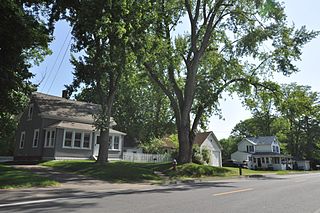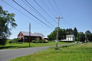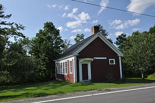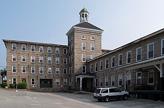
The Gurleyville Historic District encompasses a formerly industrial rural crossroads village in Mansfield, Connecticut. Centered on Gurleyville and Chaffeeville Roads, it includes a collection of mainly vernacular 19th-century residences, a stone gristmill dating to about 1749, and the archaeological remains of later industrial endeavours. The district was listed on the National Register of Historic Places in 1975.

The Hotchkissville Historic District is a historic district in the town of Woodbury, Connecticut, United States that was listed on the National Register of Historic Places in 1995. The district encompasses most of the historic village of Hotchkissville, which is centered at the junction of Washington and Weekeepeemee roads. The village began as a dispersed rural agricultural community, but developed in the 19th century with the arrival of industry, primarily the manufacture of textiles. Despite this, the village has retained a significantly rural character, and includes a broad cross-section of 18th- and 19th-century architectural styles.

Old Curtisville Historic District encompasses the village center of Interlaken in Stockbridge, Massachusetts. It is historically significant as the site of the first wood-based newsprint paper mill in the United States, and has a well-preserved collection of late 18th and early 19th-century architecture. It was listed on the National Register of Historic Places in 1976.

The South Lee Historic District encompasses the historic portion of the village of South Lee in Lee, Massachusetts. Extending mainly along Massachusetts Route 102 between Fairview Street and the Stockbridge town line, the village is a well-preserved 19th-century mill village, with fine Federal and Greek Revival buildings and a later 19th-century paper mill. It was listed on the National Register of Historic Places in 1999.

The Bradstreet Historic District encompasses the rural 19th-century village of Bradstreet in Hatfield, Massachusetts. It is centered at the junction of Depot Road and Main Street, and includes properties lining those two streets and Old Farm Road. Most of the buildings in the area date to the second half of the 19th century, featuring architectural styles typical of the period, including Queen Anne, Second Empire, Italianate, and Colonial Revival. The village grew on land that was originally granted to colonial governor Simon Bradstreet and divided in 1682, and has remained largely agricultural since then. The district was listed on the National Register of Historic Places in 1997.

The Elm Street Historic District is a rural historic district in southern Hatfield, Massachusetts. It encompasses a landscape that has seen agricultural use since 17th century colonial days, including fields now used for tobacco farming, and historic properties located along five roads: Elm Street, Scotland Road, Sunset Road, Brook Hollow Road, and Little Neponset Road. The district is bounded on its south by the Connecticut River, on its east and north by the Mill River, with a small portion of land border in the northeast which cuts off a large meander in the river. This section, near the junction of Elm and Prospect Streets, is also where this district abuts the Mill-Prospect Street Historic District, which runs north along Prospect Street, and its eastern boundary abuts the Hatfield Center Historic District. Its western boundary is roughly a north-south line in the area of the junction of Elm and Dwight Streets.

The Woodbridge Street Historic District is a predominantly residential historic district in South Hadley, Massachusetts, United States. It extends from the junction of Woodbridge Street and Silver Street north roughly to Woodbridge Terrace. This area was one of the first to be settled in South Hadley, and includes its oldest buildings, which date to the 1720s. It also has the community's highest concentration of high-quality 18th-century residential architecture. It was listed on the National Register of Historic Places in 1983.

The Hadley Center Historic District is an expansive, 2,500-acre (1,000 ha) historic district encompassing the village center of Hadley, Massachusetts. When it was first listed on the National Register of Historic Places in 1977, the district encompassed the town green and 17 buildings that faced it, at the junction of Russell Street and Middle Street. The district was expanded significantly in 1994, adding more than 400 buildings representative of the village's growth from colonial days into the first decades of the 20th century. This expansion encompasses the entirety of a tongue of land extending west from East Street and bounded by a bend in the Connecticut River, which separates Hadley from Northampton. Its oldest property, the Samuel Porter House on West Street, was built in 1713.

Hockanum Rural Historic District is a rural historic district along the Connecticut River in Hadley, Massachusetts. The district includes much of the area in Hadley west of Mount Holyoke and east of the river. Its formal boundaries run from Hockanum Cemetery in the southwest, following the river and the summit ridge of Mount Holyoke to the northeast corner of J.A. Skinner State Park. It includes the summit area of Mount Holyoke, including the Summit House, Halfway House, and other historic structures within the park, along with the agricultural lands of the valley below.

The Lincoln–Sunset Historic District is a residential historic district located west of the downtown area of Amherst, Massachusetts. Colloquially known as Millionaire's Row, the district extends along Lincoln and Sunset Avenues between Northampton Street and the campus of the University of Massachusetts, Amherst. This area was one of Amherst's first planned residential subdivisions, and features a large number of high-quality houses, built by merchants, businessmen, and academics. It was added to the National Register of Historic Places in 1993.

The North Amherst Center Historic District encompasses the center of North Amherst, part of the town of Amherst, Massachusetts. It is a well-preserved example of a traditional farming village, centered at the five-way junction of Meadow, Pine, and North Pleasant Streets, and Sunderland and Montague Roads. The area developed as a village center in the early 19th century and has been relatively little changed since the late 19th century. The district was added to the National Register of Historic Places in 1991.

The North Hatfield Historic District encompasses a small rural village in Hatfield, Massachusetts. It consists of a small cluster of buildings along West Street and Depot Road in the vicinity of a former railroad station. It includes a few buildings associated with the railroad, including a depot and freight buildings, as well as commercial and residential structures, most of which postdate the 1848 arrival of the railroad. The village was important in the community as an arrival point for immigrants working in its fields and industry. The district was listed on the National Register of Historic Places in 1997.

The Longmeadow Street–North Historic District encompasses a stretch of Longmeadow Street in northern Longmeadow, Massachusetts, from the town line with neighboring Springfield to Cooley and Westmoreland Streets in the south. It was listed on the National Register of Historic Places in 1994. The district's primarily residential architecture and streetscape is reflective of more than two centuries of development trends, and a late 19th-century desire to maintain a more rural atmosphere.

The Calhoun–Ives Historic District, or more formally the Calhoun Street–Ives Road Historic District, is a locally and nationally designated rural agricultural historic district in the town of Washington, Connecticut. It is located a mile north of the village of Washington Depot, Connecticut. It runs along Calhoun Street and Ives Road. It is characterized by modestly scaled 18th and 19th century farmhouses, together with accompanying agricultural outbuildings, farm fields, and fruit orchards, set along roads lined by stone walls. The district was listed on the National Register of Historic Places in 1995.

The East Leverett Historic District of Leverett, Massachusetts, encompasses the historic mill village of East Leverett. Centered on the intersection of Cushman Road and Shutesbury Road in the southeastern portion of the rural town, it includes predominantly residential buildings that were built during the height of the area's industrial activity in the first four decades of the 19th century. The architecture is mainly Federal and Greek Revival in style. The district was listed on the National Register of Historic Places in 2014.

Roxbury Center is the central village of Roxbury, Connecticut. Centered at the junction of Connecticut Routes 67 and 317, it has been the center of town civic life since the mid-18th century. The village was listed on the National Register of Historic Places in 1983.

The Jericho Rural Historic District encompasses a rural agricultural landscape of northern Hartford, Vermont, extending slightly into neighboring Norwich. The area covers 774 acres (313 ha) of mainly agricultural and formerly agricultural lands, as well as associated woodlots, and includes nine historically significant farm complexes. It was listed on the National Register of Historic Places in 2001.

The Stockbridge Common Historic District encompasses the central portion of a rural 19th-century village center in Stockbridge, Vermont. Including the town common as well as a few buildings and an adjacent cemetery, it is a well-preserved example of a village bypassed by economic development during the 19th century industrial period. It was listed on the National Register of Historic Places in 1990.

The Manchaug Village Historic District is a historic district encompassing the 19th century industrial village center of Manchaug in Sutton, Massachusetts. Developed in the 1820s around textile mills on the Mumford River, it was the largest industrial area in Sutton, with at least three mill complexes in operation. The district is centered on the junction of Main Street with Manchaug, Putnam Hill, and Whitins Roads.

The Forty Acres and Its Skirts Historic District is a rural historic district along the Connecticut River in Hadley, Massachusetts. Located north of the town center on River Road, the district is a rural landscape with a well-documented history of settlement and usage from the mid-18th century into the 20th century. It includes the Porter-Phelps-Huntington House and adjacent properties, which have been home to a succession of prominent local families. The district was listed on the National Register of Historic Places in 2023.


