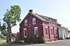
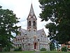
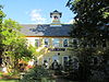
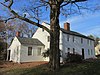
[3] Name on the Register [4] Image Date listed [5] Location City or town Description 1 Amherst Central Business District Amherst Central Business District December 27, 1991 (# 91001859 1-79 Main St., 13-31 N. Pleasant St., 1-79 S. Pleasant St., 1-18 Boltwood Ave.; also 30 Boltwood Avenue 42°22′38″N 72°31′13″W / 42.377222°N 72.520278°W / 42.377222; -72.520278 (Amherst Central Business District ) Amherst 30 Boltwood reflects a boundary increase of August 24, 2011 2 Amherst West Cemetery Amherst West Cemetery May 26, 2000 (# 00000534 Triangle St. 42°22′45″N 72°31′07″W / 42.379167°N 72.518611°W / 42.379167; -72.518611 (Amherst West Cemetery ) Amherst 3 Baird House Baird House January 3, 1985 (# 85000026 38 Shays St. 42°21′00″N 72°31′09″W / 42.35°N 72.519167°W / 42.35; -72.519167 (Baird House ) Amherst 4 Belchertown Center Historic District Belchertown Center Historic District June 2, 1982 (# 82001913 Main, Maple, Walnut, Park, and Jabish Sts. 42°16′37″N 72°24′06″W / 42.276944°N 72.401667°W / 42.276944; -72.401667 (Belchertown Center Historic District ) Belchertown 5 Belchertown State School Belchertown State School July 19, 1994 (# 94000688 30 State St. 42°16′28″N 72°25′27″W / 42.274444°N 72.424167°W / 42.274444; -72.424167 (Belchertown State School ) Belchertown 6 Bisbee Mill Bisbee Mill March 31, 2005 (# 05000219 66 East St. 42°22′36″N 72°49′09″W / 42.376667°N 72.819167°W / 42.376667; -72.819167 (Bisbee Mill ) Chesterfield 7 Bradstreet Historic District Bradstreet Historic District July 17, 1997 (# 97000724 Roughly bounded by Connecticut R., King St. and Stratis Rd. 42°24′19″N 72°35′26″W / 42.405278°N 72.590556°W / 42.405278; -72.590556 (Bradstreet Historic District ) Hatfield 8 William Cullen Bryant Homestead William Cullen Bryant Homestead October 15, 1966 (# 66000136 2 mi (3.2 km) from Cummington on a side road 42°28′19″N 72°56′09″W / 42.471944°N 72.935833°W / 42.471944; -72.935833 (William Cullen Bryant Homestead ) Cummington 9 Building at 8–22 Graves Avenue Building at 8–22 Graves Avenue November 7, 1985 (# 85002784 8–22 Graves Ave. 42°19′19″N 72°37′44″W / 42.321944°N 72.628889°W / 42.321944; -72.628889 (Building at 8–22 Graves Avenue ) Northampton 10 Center Cemetery Center Cemetery April 16, 2013 (# 13000170 178 College Hwy. (Route 10) 42°14′06″N 72°43′37″W / 42.234869°N 72.727031°W / 42.234869; -72.727031 (Center Cemetery ) Southampton 11 Center Cemetery Center Cemetery February 26, 2004 (# 04000084 Sam Hill Rd. 42°23′40″N 72°56′36″W / 42.394444°N 72.943333°W / 42.394444; -72.943333 (Center Cemetery ) Worthington 12 Chesterfield Center Historic District Chesterfield Center Historic District December 11, 2008 (# 08001177 Main Rd., South St., North Rd., Bagg Rd., Bryant St. 42°23′30″N 72°50′27″W / 42.391667°N 72.840833°W / 42.391667; -72.840833 (Chesterfield Center Historic District ) Chesterfield 13 Church Street Historic District Church Street Historic District May 23, 1986 (# 86001246 Church St. between Park Ave. and Highland St. 42°15′57″N 72°13′53″W / 42.265833°N 72.231389°W / 42.265833; -72.231389 (Church Street Historic District ) Ware 14 Clarke School for the Deaf Historic District Clarke School for the Deaf Historic District May 2, 2022 (# 100007664 40-42, 44, 45, 46, 47, 48, 50 and 54 Round Hill Rd. 42°19′24″N 72°38′24″W / 42.3234°N 72.6399°W / 42.3234; -72.6399 (Clarke School for the Deaf Historic District ) Northampton 15 Conkey-Stevens House Conkey-Stevens House May 10, 1979 (# 79000352 664 Main St. 42°22′33″N 72°30′20″W / 42.375833°N 72.505556°W / 42.375833; -72.505556 (Conkey-Stevens House ) Amherst 16 Calvin Coolidge House Calvin Coolidge House December 12, 1976 (# 76000262 19-21 Massasoit St. 42°19′29″N 72°38′49″W / 42.324722°N 72.646944°W / 42.324722; -72.646944 (Calvin Coolidge House ) Northampton 17 Cushman Village Historic District Cushman Village Historic District November 5, 1992 (# 92001553 Roughly bounded by E. Leverett Rd. and Pine, Henry, Bridge and State Sts. 42°25′03″N 72°30′26″W / 42.4175°N 72.507222°W / 42.4175; -72.507222 (Cushman Village Historic District ) Amherst 18 Dickinson Historic District Dickinson Historic District August 16, 1977 (# 77000182 Kellogg Ave., Main, Gray, and Lessey Sts. 42°22′35″N 72°30′55″W / 42.376389°N 72.515278°W / 42.376389; -72.515278 (Dickinson Historic District ) Amherst 19 Emily Dickinson House Emily Dickinson House October 15, 1966 (# 66000363 280 Main St. 42°22′33″N 72°30′52″W / 42.375833°N 72.514444°W / 42.375833; -72.514444 (Emily Dickinson House ) Amherst 20 Dorsey–Jones House Dorsey–Jones House September 2, 2005 (# 05000931 191 Nonotuck St. 42°19′52″N 72°40′18″W / 42.331111°N 72.671667°W / 42.331111; -72.671667 (Dorsey–Jones House ) Northampton Underground Railroad in Massachusetts MPS 21 East Village Historic District East Village Historic District July 6, 1986 (# 86001408 Main, N. and S. East Sts. 42°22′36″N 72°30′04″W / 42.376667°N 72.501111°W / 42.376667; -72.501111 (East Village Historic District ) Amherst 22 Elm Street Historic District Elm Street Historic District December 7, 2000 (# 00001481 Elm, Sunset, and Scotland Sts., Little Neponset Rd. 42°21′35″N 72°37′00″W / 42.359722°N 72.616667°W / 42.359722; -72.616667 (Elm Street Historic District ) Hatfield 23 First Congregational Church First Congregational Church March 3, 2020 (# 100003963 1 Church St. 42°15′31″N 72°34′31″W / 42.2586°N 72.5752°W / 42.2586; -72.5752 (First Congregational Church ) South Hadley 24 Fort Hill Historic District Fort Hill Historic District April 7, 1989 (# 88000910 Roughly South St. from Lyman to Monroe 42°18′43″N 72°38′01″W / 42.311944°N 72.633611°W / 42.311944; -72.633611 (Fort Hill Historic District ) Northampton 25 Forty Acres and Its Skirts Historic District Forty Acres and Its Skirts Historic District May 4, 2023 (# 100008956 113-115, 123, 130 River Dr. 42°22′08″N 72°35′07″W / 42.3689°N 72.5852°W / 42.3689; -72.5852 (Forty Acres and Its Skirts Historic District ) Hadley 26 Gate Cemetery Gate Cemetery July 1, 2009 (# 09000470 Ireland Street 42°23′34″N 72°53′02″W / 42.392639°N 72.883889°W / 42.392639; -72.883889 (Gate Cemetery ) Chesterfield 27 Goodwin Memorial African Methodist Episcopal Zion Church Goodwin Memorial African Methodist Episcopal Zion Church April 28, 2000 (# 00000416 Woodside Ave. 42°22′15″N 72°31′23″W / 42.370833°N 72.523056°W / 42.370833; -72.523056 (Goodwin Memorial African Methodist Episcopal Zion Church ) Amherst 28 Goshen Town Hall Goshen Town Hall August 28, 2018 (# 100002829 42 Main St. 42°26′29″N 72°48′00″W / 42.4414°N 72.8001°W / 42.4414; -72.8001 (Goshen Town Hall ) Goshen 29 Grove Hill Mansion Grove Hill Mansion August 11, 1982 (# 82001910 Florence Rd. and Front St. 42°21′11″N 72°41′58″W / 42.353056°N 72.699444°W / 42.353056; -72.699444 (Grove Hill Mansion ) Northampton 30 Hadley Center Historic District Hadley Center Historic District December 2, 1977 (# 77000185 Middle and Russell Sts. 42°20′28″N 72°35′22″W / 42.341111°N 72.589444°W / 42.341111; -72.589444 (Hadley Center Historic District ) Hadley 31 Hatfield Center Historic District Hatfield Center Historic District July 27, 1994 (# 94000737 Roughly bounded by the Connecticut and Mill Rivers and Day Ave. 42°21′43″N 72°36′01″W / 42.361944°N 72.600278°W / 42.361944; -72.600278 (Hatfield Center Historic District ) Hatfield 32 Haydenville Historic District Haydenville Historic District March 26, 1976 (# 76000273 Main and High Sts., and Kingsley Ave. 42°22′31″N 72°42′09″W / 42.375278°N 72.7025°W / 42.375278; -72.7025 (Haydenville Historic District ) Williamsburg 33 Hockanum Rural Historic District Hockanum Rural Historic District December 30, 1993 (# 93001474 Area surrounding Hockanum Rd., from Hockanum Cemetery to the NE corner of Skinner State Park 42°17′52″N 72°35′53″W / 42.297778°N 72.598056°W / 42.297778; -72.598056 (Hockanum Rural Historic District ) Hadley 34 Huntington Village Historic District Huntington Village Historic District September 15, 1999 (# 99001080 Roughly along E. Main, Main, Russell, Upper Russell and Basket Sts. 42°14′07″N 72°52′54″W / 42.235278°N 72.881667°W / 42.235278; -72.881667 (Huntington Village Historic District ) Huntington 35 Ireland Street Cemetery Ireland Street Cemetery July 1, 2009 (# 09000471 Ireland Street 42°21′54″N 72°53′03″W / 42.365°N 72.884167°W / 42.365; -72.884167 (Ireland Street Cemetery ) Chesterfield 36 Lincoln-Sunset Historic District Lincoln-Sunset Historic District February 22, 1993 (# 93000008 Roughly, Lincoln Ave. from Northampton Rd. to Fearing St. 42°22′33″N 72°31′33″W / 42.375833°N 72.525833°W / 42.375833; -72.525833 (Lincoln-Sunset Historic District ) Amherst 37 Lockville Historic District Lockville Historic District January 24, 2001 (# 00001657 College Hwy. 42°12′42″N 72°43′52″W / 42.211667°N 72.731111°W / 42.211667; -72.731111 (Lockville Historic District ) Southampton 38 Main Street Historic District Main Street Historic District March 17, 1986 (# 86000451 Main St. between Northampton and Center Sts. 42°16′11″N 72°40′22″W / 42.269722°N 72.672778°W / 42.269722; -72.672778 (Main Street Historic District ) Easthampton 39 The Manse The Manse October 14, 1976 (# 76000263 54 Prospect St. 42°19′20″N 72°38′12″W / 42.322222°N 72.636667°W / 42.322222; -72.636667 (The Manse ) Northampton 40 Middlefield-Becket Stone Arch Railroad Bridge District Middlefield-Becket Stone Arch Railroad Bridge District April 11, 1980 (# 80000502 Middlefield vicinity 42°18′44″N 73°01′10″W / 42.312222°N 73.019444°W / 42.312222; -73.019444 (Middlefield-Becket Stone Arch Railroad Bridge District ) Middlefield 41 Middlefield Center Historic District Middlefield Center Historic District October 3, 2012 (# 12000827 138-188 Skyline Trail, & 7 Bell Rd. 42°20′55″N 73°00′55″W / 42.348712°N 73.015394°W / 42.348712; -73.015394 (Middlefield Center Historic District ) Middlefield 42 Mill-Prospect Street Historic District Mill-Prospect Street Historic District October 22, 2002 (# 02001188 Prospect, Chestnut, Bridge, School Sts., Raymond Ave., Prospect Court 42°22′31″N 72°36′47″W / 42.375278°N 72.613056°W / 42.375278; -72.613056 (Mill-Prospect Street Historic District ) Hatfield 43 Miss Florence Diner Miss Florence Diner September 22, 1999 (# 99001123 99 Main St. 42°20′07″N 72°40′18″W / 42.335278°N 72.671667°W / 42.335278; -72.671667 (Miss Florence Diner ) Northampton 44 Mountain Rest Mountain Rest November 10, 1983 (# 83003984 Wildwood Lane off Spruce Corner Rd. 42°27′36″N 72°50′23″W / 42.46°N 72.839722°W / 42.46; -72.839722 (Mountain Rest ) Goshen An early 19th century missionary retreat camp; converted into condominiums in 1987. 45 Nashawannuck Mills Historic District Nashawannuck Mills Historic District February 12, 2015 (# 15000001 1-15 Cottage St. 42°15′57″N 72°40′02″W / 42.265889°N 72.667231°W / 42.265889; -72.667231 (Nashawannuck Mills Historic District ) Easthampton 46 North Amherst Center Historic District North Amherst Center Historic District December 13, 1991 (# 91001824 1184-1136 N. Pleasant St., 1-39 Pine St., 11-13 Meadow St. 42°24′33″N 72°31′52″W / 42.409167°N 72.531111°W / 42.409167; -72.531111 (North Amherst Center Historic District ) Amherst 47 North Cemetery North Cemetery March 3, 2004 (# 04000121 Cold St. 42°25′22″N 72°56′49″W / 42.422778°N 72.946944°W / 42.422778; -72.946944 (North Cemetery ) Worthington 48 North Hadley Historic District North Hadley Historic District December 30, 1993 (# 93001475 Roughly, area along River Dr.from Stockwell Rd. to Stockbridge St., including French, Meadow and Mt. Warner Sts. 42°23′23″N 72°34′50″W / 42.389722°N 72.580556°W / 42.389722; -72.580556 (North Hadley Historic District ) Hadley 49 North Hatfield Historic District North Hatfield Historic District October 30, 1997 (# 97000879 Roughly along West St. and Depot Rd. Between I-91 and MA 10 42°24′33″N 72°37′26″W / 42.409167°N 72.623889°W / 42.409167; -72.623889 (North Hatfield Historic District ) Hatfield 50 Northampton Downtown Historic District Northampton Downtown Historic District May 17, 1976 (# 76000270 Roughly bounded by Hampton, Pearl, Strong, Bedford, Elm, MA 66, and railroad tracks 42°19′05″N 72°37′57″W / 42.318056°N 72.6325°W / 42.318056; -72.6325 (Northampton Downtown Historic District ) Northampton Boundary increase approved July 3, 1985. 51 Northampton State Hospital Northampton State Hospital July 25, 1994 (# 94000696 1 Prince St. 42°18′45″N 72°39′16″W / 42.3125°N 72.6544°W / 42.3125; -72.6544 (Northampton State Hospital ) Northampton Facilities largely demolished in the 2000s. 52 Northampton Veterans Administration Hospital Historic District Northampton Veterans Administration Hospital Historic District December 4, 2012 (# 12000994 421 N. Main St. 42°20′59″N 72°40′54″W / 42.34976°N 72.68163°W / 42.34976; -72.68163 (Northampton Veterans Administration Hospital Historic District ) Northampton 53 Old Chapel Old Chapel May 11, 2015 (# 15000211 144 Hicks Way 42°23′20″N 72°31′41″W / 42.3890°N 72.528°W / 42.3890; -72.528 (Old Chapel ) Amherst One of the oldest buildings on the campus of the University of Massachusetts Amherst . 54 Old Mill Site Historic District Old Mill Site Historic District June 2, 1982 (# 82001911 48 and 50 Prospect St. 42°22′16″N 72°35′49″W / 42.371111°N 72.596944°W / 42.371111; -72.596944 (Old Mill Site Historic District ) Hatfield 55 Otis Company Mill No. 1 Otis Company Mill No. 1 May 2, 1982 (# 82001909 E. Main St. 42°15′31″N 72°14′20″W / 42.258611°N 72.238889°W / 42.258611; -72.238889 (Otis Company Mill No. 1 ) Ware 56 Parsons, Shepherd, and Damon Houses Historic District Parsons, Shepherd, and Damon Houses Historic District June 6, 2001 (# 01000627 46, 58 and 66 Bridge St. 42°19′20″N 72°37′35″W / 42.322222°N 72.626389°W / 42.322222; -72.626389 (Parsons, Shepherd, and Damon Houses Historic District ) Northampton 57 Pelham Town Hall Historic District Pelham Town Hall Historic District November 23, 1971 (# 71000085 Amherst Rd. at the corner of Daniel Shays Hwy. 42°23′32″N 72°24′16″W / 42.392222°N 72.404444°W / 42.392222; -72.404444 (Pelham Town Hall Historic District ) Pelham 58 Plainfield Center Historic District Plainfield Center Historic District July 27, 2015 (# 15000468 Portions of Church Ln., Broom, Central, Main, Pleasant & Union Sts. 42°30′58″N 72°54′48″W / 42.5162°N 72.9133°W / 42.5162; -72.9133 (Plainfield Center Historic District ) Plainfield 59 Pomeroy Terrace Historic District Pomeroy Terrace Historic District May 11, 2018 (# 100002420 Pomeroy Terr., Phillips & Butler Pls., Bixby Ct., Hawley, Hancock, & Bridge Sts. 42°19′13″N 72°37′30″W / 42.3204°N 72.6251°W / 42.3204; -72.6251 (Pomeroy Terrace Historic District ) Northampton 60 Porter-Phelps-Huntington House Porter-Phelps-Huntington House March 26, 1973 (# 73000303 130 River Dr. 42°22′19″N 72°35′24″W / 42.371944°N 72.59°W / 42.371944; -72.59 (Porter-Phelps-Huntington House ) Hadley 61 Prospect-Gaylord Historic District Prospect-Gaylord Historic District February 4, 1993 (# 93000007 Roughly, Prospect St. from Northampton Rd. to Hallock St. and Gaylord and Amity Sts. W from Prospect toward Lincoln Ave. 42°22′33″N 72°31′22″W / 42.375833°N 72.522778°W / 42.375833; -72.522778 (Prospect-Gaylord Historic District ) Amherst 62 Ringville Cemetery Ringville Cemetery February 11, 2004 (# 04000024 Witt Hill Rd. 42°22′13″N 72°54′56″W / 42.370278°N 72.915556°W / 42.370278; -72.915556 (Ringville Cemetery ) Worthington 63 Ross Farm Ross Farm January 8, 2008 (# 07001360 123 Meadow St. 42°20′02″N 72°40′49″W / 42.3339°N 72.6803°W / 42.3339; -72.6803 (Ross Farm ) Northampton Underground Railroad in Massachusetts MPS 64 Smith Alumnae Gymnasium Smith Alumnae Gymnasium April 30, 1976 (# 76000259 Smith College campus Green St. 42°19′01″N 72°38′18″W / 42.3169°N 72.6383°W / 42.3169; -72.6383 (Smith Alumnae Gymnasium ) Northampton 65 South Amherst Common Historic District South Amherst Common Historic District February 17, 1995 (# 95000100 445 Shays St., South Amherst Common, 979-1081 S. East St. and 324 Pomeroy Ln. 42°20′29″N 72°30′18″W / 42.3414°N 72.505°W / 42.3414; -72.505 (South Amherst Common Historic District ) Amherst 66 South Hadley Canal Historic District South Hadley Canal Historic District March 11, 1992 (# 92000077 Along the historic canal route near the Connecticut River 42°13′15″N 72°36′33″W / 42.2208°N 72.6092°W / 42.2208; -72.6092 (South Hadley Canal Historic District ) South Hadley 67 South Worthington Historic District South Worthington Historic District September 1, 2005 (# 05000935 Ireland St., Conwell Rd., Huntington Rd., Thrasher Hill Rd., Higgins Rd. S. Worthington Rd. 42°20′47″N 72°53′36″W / 42.3464°N 72.8933°W / 42.3464; -72.8933 (South Worthington Historic District ) Worthington and Chesterfield 68 Southampton Center Historic District Southampton Center Historic District April 4, 1991 (# 91000363 Roughly, High St. from Fomer Rd. to Maple St., College Hwy. from Clark St. to East St. and East from College to Clark 42°13′25″N 72°43′55″W / 42.2236°N 72.7319°W / 42.2236; -72.7319 (Southampton Center Historic District ) Southampton 69 Strong House Strong House July 5, 1984 (# 84002457 67 Amity St. 42°22′33″N 72°31′19″W / 42.3758°N 72.5219°W / 42.3758; -72.5219 (Strong House ) Amherst 70 The Town Farm The Town Farm September 12, 1996 (# 96000950 75 Oliver St. 42°16′50″N 72°41′51″W / 42.2806°N 72.6975°W / 42.2806; -72.6975 (The Town Farm ) Easthampton 71 Upper Main Street Historic District Upper Main Street Historic District July 22, 1994 (# 94000735 Main St. from 83 Main to Cow Bridge, 1-44 King St. and 6-70 North St. 42°23′15″N 72°35′52″W / 42.3875°N 72.5978°W / 42.3875; -72.5978 (Upper Main Street Historic District ) Hatfield 72 US Post Office-Easthampton Main US Post Office-Easthampton Main April 1, 1986 (# 86000714 19 Union St. 42°16′10″N 72°40′19″W / 42.2694°N 72.6719°W / 42.2694; -72.6719 (US Post Office-Easthampton Main ) Easthampton 73 US Post Office-South Hadley Main US Post Office-South Hadley Main May 28, 1986 (# 86001188 1 Hadley St. 42°15′30″N 72°34′31″W / 42.2583°N 72.5753°W / 42.2583; -72.5753 (US Post Office-South Hadley Main ) South Hadley 74 Walker-Collis House Walker-Collis House September 30, 1982 (# 82001903 1 Stadler St. 42°16′21″N 72°24′38″W / 42.2725°N 72.4106°W / 42.2725; -72.4106 (Walker-Collis House ) Belchertown 75 Ware Center Historic District Ware Center Historic District May 8, 1986 (# 86001013 MA 9 and Greenwich Plains Rd. 42°15′40″N 72°16′42″W / 42.2611°N 72.2783°W / 42.2611; -72.2783 (Ware Center Historic District ) Ware 76 Ware Millyard Historic District Ware Millyard Historic District November 21, 1986 (# 86003508 Roughly bounded by South St., the Ware River, Upper Dam Complex, Park St., Otis Ave. and Church St. 42°15′33″N 72°14′17″W / 42.2592°N 72.2381°W / 42.2592; -72.2381 (Ware Millyard Historic District ) Ware 77 Ware Town Hall Ware Town Hall June 26, 1986 (# 86001403 Main and West Sts. 42°15′36″N 72°14′35″W / 42.26°N 72.2431°W / 42.26; -72.2431 (Ware Town Hall ) Ware 78 Ware-Hardwick Covered Bridge Ware-Hardwick Covered Bridge May 8, 1986 (# 86001006 Old Gilbertville Rd. and Bridge St. 42°18′37″N 72°12′45″W / 42.3103°N 72.2125°W / 42.3103; -72.2125 (Ware-Hardwick Covered Bridge ) Ware 79 West Chesterfield Historic District West Chesterfield Historic District September 25, 2008 (# 08000950 1-70 Ireland St. and unnumbered lots, 620-669 Main Rd., section of Cummington Rd. 42°24′12″N 72°52′37″W / 42.4033°N 72.8769°W / 42.4033; -72.8769 (West Chesterfield Historic District ) Chesterfield 80 West Hatfield Historic District West Hatfield Historic District February 24, 2005 (# 05000079 3-12 Church Ave., 2 Linseed Rd., 23-42 West St. 42°22′19″N 72°38′12″W / 42.3719°N 72.6367°W / 42.3719; -72.6367 (West Hatfield Historic District ) Hatfield 81 Western Railroad Stone Arch Bridges and Chester Factory Village Depot Western Railroad Stone Arch Bridges and Chester Factory Village Depot January 13, 2021 (# 100006273 Vicinity of Herbert Cross Road, Middlefield/Becket Line (Bridges and Roadbed); 10 Prospect Street (Depot) 42°18′20″N 73°00′19″W / 42.3055°N 73.0054°W / 42.3055; -73.0054 (Western Railroad Stone Arch Bridges and Chester Factory Village Depot ) Middlefield Extends into Chester and Becket ; includes a subset of the Middlefield-Becket Stone Arch Railroad Bridge District . 82 Westside Historic District Westside Historic District July 25, 2000 (# 00000793 Baker and Snell Sts., Northampton Rd., and Hazel Ave. 42°22′00″N 72°31′51″W / 42.3667°N 72.5308°W / 42.3667; -72.5308 (Westside Historic District ) Amherst 83 Williamsburg Center Historic District Williamsburg Center Historic District June 22, 1980 (# 80000506 MA 9 42°23′32″N 72°43′49″W / 42.3922°N 72.7303°W / 42.3922; -72.7303 (Williamsburg Center Historic District ) Williamsburg 84 Woodbridge Street Historic District Woodbridge Street Historic District November 14, 1983 (# 83003987 3 and 7 Silver St., 25-82 Woodbridge St. 42°15′52″N 72°34′21″W / 42.2644°N 72.5725°W / 42.2644; -72.5725 (Woodbridge Street Historic District ) South Hadley