North Amherst | |
|---|---|
 North Amherst Fire Station | |
 North Amherst  North Amherst | |
| Coordinates: 42°24′22″N72°31′16″W / 42.40611°N 72.52111°W | |
| Country | United States |
| State | Massachusetts |
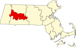
| County | Hampshire |
| Town | Amherst |
| Area | |
• Total | 2.1 sq mi (5.5 km2) |
| • Land | 2.1 sq mi (5.5 km2) |
| • Water | 0 sq mi (0.0 km2) |
| Elevation | 187 ft (57 m) |
| Population (2010) | |
• Total | 6,819 |
| • Density | 3,202/sq mi (1,236.4/km2) |
| Time zone | UTC-5 (Eastern (EST)) |
| • Summer (DST) | UTC-4 (EDT) |
| ZIP code | 01059 |
| Area code | 413 |
| FIPS code | 25-46295 |
| GNIS feature ID | 0608905 |
North Amherst is a census-designated place (CDP) in the city of Amherst in Hampshire County, Massachusetts, United States. The population was 6,819 at the 2010 census, [1] up from 6,019 at the 2000 census. It is part of the Springfield, Massachusetts Metropolitan Statistical Area.
Contents
North Amherst is located in the northern part of the city of Amherst at 42°24′22″N72°31′16″W / 42.40611°N 72.52111°W (42.406192, -72.521217). [2] It is bordered to the south by the Amherst Center CDP and to the southwest by the town of Hadley. The CDP border follows the Mill River north from the Hadley town line, then east across Massachusetts Route 116 as far as Massachusetts Route 63. The border then follows Pulpit Hill Road, Mill Street, Sand Hill Road, and Pine Street east to the New England Central Railroad line, which it follows south to Tilson Farm Road. The CDP boundary then proceeds west along Tilson Farm Road and Eastman Lane to North Pleasant Street, which it follows north to a brook near the Hadley town line. [3]
According to the United States Census Bureau, the CDP has a total area of 2.1 square miles (5.5 km2), of which 1.0 acre (3,930 m2), or 0.07%, are water. [1]
There are several large apartment complexes in North Amherst, housing mostly students of the University of Massachusetts Amherst along with low-income families (a plurality of whom are graduate students). Apart from these housing developments, North Amherst also sports a number of beautiful old houses, and North Amherst Center Historic District is on the National Register of Historic Places. The village is said[ who? ] to be an excellently-preserved example of a 19th-century farm community.
North Amherst is home to a large majority of Amherst middle income families, as the main street (North Pleasant Street) has multiple housing developments built off it. This includes "Grantwood", which is the largest neighborhood/development in Amherst.[ citation needed ] North Amherst is also home to two cohousing communities: Pioneer Valley and Pine Street Cohousing.
Cushman Village is located just east of North Amherst. This small area is unique, as the roads turn back into each other unlike the square roads off East Pleasant Street. Cushman Village has a number of historical homes, as well as the Cushman Common and the Cushman Store.
North Amhearst is also known for its amphibian tunnels. The Henry Street salamander tunnels are tunnels which run under Henry Street in North Amherst. The tunnels help spotted salamanders cross Henry Street to get to vernal pools that the salamanders use for breeding. They are the first amphibian tunnels in the United States. [4]