Hampshire County, Massachusetts

Last updated

Hampshire County
Old Hampshire County Courthouse, Northampton MA.jpg
Old Hampshire County Courthouse
Seal of Hampshire County, Massachusetts.svg
Map of Massachusetts highlighting Hampshire County.svg
Location within the U.S. state of Massachusetts
Massachusetts in United States.svg
Massachusetts's location within the U.S.
Coordinates: 42°20′N72°40′W / 42.34°N 72.66°W / 42.34; -72.66
CountryFlag of the United States.svg United States
StateFlag of Massachusetts.svg  Massachusetts
Founded1662
Named for Hampshire, England
Seat Northampton
Largest town Amherst
Area
  Total545 sq mi (1,410 km2)
  Land527 sq mi (1,360 km2)
  Water18 sq mi (50 km2)  3.3%
Population
 (2020)
  Total162,308 Increase2.svg
  Density308.0/sq mi (118.9/km2)
Time zone UTC−5 (Eastern)
  Summer (DST) UTC−4 (EDT)
Congressional districts 1st, 2nd

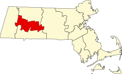
Hampshire County is a historical and judicial county located in the U.S. state of Massachusetts. As of the 2020 census, the population was 162,308. [1] Its most populous municipality is Amherst (due to seasonal student population; the largest year-round is Northampton), its largest town in terms of landmass is Belchertown, and its traditional county seat is Northampton. [2] The county is named after the county Hampshire, in England. [3] Hampshire County is part of the Springfield, MA Metropolitan Statistical Area. Together with Hampden County, Hampshire County municipalities belong to the Pioneer Valley Planning Commission. [4]

Contents

History

Hampshire County was constituted in 1662 from previously unorganized territory comprising the entire western part of Massachusetts Bay Colony. It included the original towns of Springfield, Northampton, and Hadley. The original Hampshire County also included territory that is now in modern-day Hampden County, Franklin County, and Berkshire County, as well as small parts of modern-day Worcester County. By 1683, three new towns (Westfield (now Southwick), Suffield, and Enfield) had been incorporated south of Springfield. These towns were partly or wholly in the modern state of Connecticut at the time of their incorporation. They resulted in a border dispute between the Connecticut Colony and Massachusetts Bay Colony.

In 1731, Worcester County was created, which included the original town of Brookfield (incorporated in 1718 as part of Hampshire County). More territory was lost to Worcester County in 1742 when the town of Western (now Warren) was created and added to Worcester County. Further territorial losses occurred in 1749 when the towns of Enfield, Somers (split off from Enfield in 1734), and Suffield unilaterally joined Connecticut Colony. In 1761, Berkshire County was partitioned from Hampshire County. In 1811, Franklin County was split off from the northern part of Hampshire, and in the following year, Hampden County was split off from its southern part.

Following the dissolution of the county government in 1999, county affairs were managed by the Hampshire Council of Governments. The council itself ceased operations in 2019, due to what an appraisal of the council termed a "fundamentally flawed, unsustainable operational model"; it had no inherent source of income and lacked a regional planning function. [5]

Politics

United States presidential election results for Hampshire County, Massachusetts [6]
Year Republican Democratic Third party
No.%No.%No.%
2020 22,28125.36%63,36272.12%2,2112.52%
2016 21,79025.88%55,36765.76%7,0368.36%
2012 21,48026.32%57,35970.27%2,7823.41%
2008 20,61825.91%56,86971.47%2,0832.62%
2004 21,31528.64%51,68069.44%1,4271.92%
2000 19,20227.98%38,54356.16%10,88115.86%
1996 14,78722.64%41,84464.07%8,67813.29%
1992 15,69422.40%37,87954.06%16,49823.54%
1988 24,33137.48%39,83461.36%7501.16%
1984 28,11143.96%35,59755.67%2340.37%
1980 21,11734.99%27,61145.75%11,62719.26%
1976 22,21936.99%34,94758.17%2,9094.84%
1972 24,52945.72%28,57253.25%5531.03%
1968 16,27035.83%26,66658.72%2,4765.45%
1964 11,38526.09%32,05873.45%2020.46%
1960 19,34642.90%25,66756.92%830.18%
1956 26,36161.93%16,11937.87%840.20%
1952 24,14158.19%17,24741.57%980.24%
1948 17,33148.37%18,01250.27%4901.37%
1944 14,90745.62%17,67654.09%970.30%
1940 15,65146.42%17,82352.86%2410.71%
1936 14,01245.34%15,41249.87%1,4824.80%
1932 13,24149.28%12,33245.90%1,2964.82%
1928 14,10152.13%12,69546.93%2550.94%
1924 13,91866.23%5,03723.97%2,0599.80%
1920 13,17470.10%5,30528.23%3141.67%
1916 5,74856.15%4,20241.05%2862.79%
1912 4,51246.84%3,08832.06%2,03221.10%
1908 5,36260.97%2,61229.70%8219.33%
1904 5,89268.25%2,29226.55%4495.20%
1900 5,55066.71%2,39228.75%3774.53%
1896 6,43476.39%1,60819.09%3814.52%
1892 4,88754.61%3,67841.10%3844.29%
1888 4,73155.93%3,40340.23%3253.84%
1884 4,01353.99%2,73036.73%6909.28%
1880 5,02569.91%2,04228.41%1211.68%
1876 5,02066.68%2,50733.30%20.03%
1872 4,70774.83%1,58325.17%00.00%
1868 5,26886.56%81813.44%00.00%

Geography

According to the U.S. Census Bureau, the county has a total area of 545 square miles (1,410 km2), of which 527 square miles (1,360 km2) is land and 18 square miles (47 km2) (3.3%) is water. [7]

Hampshire County is the middle section of the Pioneer Valley and the northern tip of the Hartford–Springfield Knowledge Corridor.

Adjacent counties

Hampshire County is the only county in Massachusetts surrounded in all directions by other counties of Massachusetts: all other counties in the state are adjacent to at least one other state or the open ocean.

Demographics

Historical population
CensusPop.Note
1790 59,656
1800 72,43221.4%
1810 76,2755.3%
1820 26,487−65.3%
1830 30,25414.2%
1840 30,8972.1%
1850 35,73215.6%
1860 37,8235.9%
1870 44,38817.4%
1880 47,2326.4%
1890 51,8599.8%
1900 58,82013.4%
1910 63,3277.7%
1920 69,5999.9%
1930 72,8014.6%
1940 72,461−0.5%
1950 87,59420.9%
1960 103,22917.8%
1970 123,98120.1%
1980 138,81312.0%
1990 146,5685.6%
2000 152,2513.9%
2010 158,0803.8%
2020 162,3082.7%
2023 (est.)162,502 [8] 0.1%
U.S. Decennial Census [9]
1790–1960 [10] 1900–1990 [11]
1990–2000 [12] 2010–2018 [13]

2000 census

At the 2000 census there were 152,251 people, 55,991 households, and 33,818 families living in the county. The population density was 288 inhabitants per square mile (111/km2). There were 58,644 housing units at an average density of 111 per square mile (43/km2). The racial makeup of the county was 91.10% White, 1.96% Black or African American, 0.19% Native American, 3.40% Asian, 0.05% Pacific Islander, 1.50% from other races, and 1.80% from two or more races. 3.42% of the population were Hispanic or Latino of any race. 14.7% were of Irish, 12.8% Polish, 9.6% English, 9.5% French, 8.5% French Canadian, 6.9% Italian and 6.4% German ancestry, 88.8% spoke English, 3.4% Spanish, 1.7% French and 1.4% Polish as their first language. [14] Of the 55,991 households 28.20% had children under the age of 18 living with them, 47.40% were married couples living together, 9.80% had a female householder with no husband present, and 39.60% were non-families. 28.60% of households were one person and 10.20% were one person aged 65 or older. The average household size was 2.39 and the average family size was 2.96.

The age distribution was 19.60% under the age of 18, 19.30% from 18 to 24, 26.80% from 25 to 44, 22.20% from 45 to 64, and 12.00% 65 or older. The median age was 34 years. For every 100 females, there were 87.40 males. For every 100 females age 18 and over, there were 83.90 males.

The median household income was $46,098 and the median family income was $57,480. Males had a median income of $39,327 versus $30,362 for females. The per capita income for the county was $21,685. About 5.10% of families and 9.40% of the population were below the poverty line, including 8.20% of those under age 18 and 6.70% of those age 65 or over.

2010 census

At the 2010 census, there were 158,080 people, 58,702 households, and 34,480 families living in the county. [15] The population density was 299.8 inhabitants per square mile (115.8/km2). There were 62,603 housing units at an average density of 118.7 per square mile (45.8/km2). [16] The racial makeup of the county was 88.7% white, 4.5% Asian, 2.5% black or African American, 0.2% American Indian, 1.5% from other races, and 2.5% from two or more races. Those of Hispanic or Latino origin made up 4.7% of the population. [15] The largest ancestry groups were: [17]

Of the 58,702 households, 26.4% had children under the age of 18 living with them, 44.8% were married couples living together, 10.3% had a female householder with no husband present, 41.3% were non-families, and 29.7% of households were made up of individuals. The average household size was 2.34 and the average family size was 2.89. The median age was 36.6 years. [15]

The median household income was $59,505 and the median family income was $80,891. Males had a median income of $52,686 versus $43,219 for females. The per capita income for the county was $28,367. About 6.2% of families and 11.7% of the population were below the poverty line, including 11.8% of those under age 18 and 7.8% of those age 65 or over. [18]

Demographic breakdown by town

Income

The ranking of unincorporated communities that are included on the list are reflective if the census designated locations and villages were included as cities or towns. Data is from the 2007–2011 American Community Survey 5-Year Estimates. [19] [20] [21]

RankTownPer capita
income
Median
household
income
Median
family
income
PopulationNumber of
households
1 Pelham Town$50,367$83,667$97,8751,290556
2 Williamsburg Town$35,500$62,851$86,1362,5431,158
Hatfield CDP$35,150$62,212$93,7501,390665
Massachusetts State$35,051$65,981$83,3716,512,2272,522,409
3 Westhampton Town$34,337$82,759$88,5001,590632
Granby CDP$33,819$77,292$87,1321,415598
4 Hatfield Town$33,452$53,485$80,8333,2721,560
5 Worthington Town$33,360$64,063$75,4171,181532
6 Northampton City$33,175$54,413$77,99828,62111,853
7 Belchertown Town$32,898$75,502$94,23214,4795,605
8 Goshen Town$32,734$77,917$76,6671,121443
9 Southampton Town$32,548$76,396$85,5215,7582,261
10 Chesterfield Town$31,730$59,063$69,7661,043469
11 Hadley Town$31,727$75,313$86,1065,2092,048
12 Granby Town$31,409$70,362$82,6846,2322,619
13 Middlefield Town$31,110$58,958$78,281431190
14 Easthampton City$30,894$53,185$78,16616,0517,458
15 Huntington Town$29,245$55,917$73,4382,219933
16 Cummington Town$29,225$58,750$67,1431,046430
Hampshire CountyCounty$29,113$60,331$82,999157,63058,921
17 South Hadley Town$29,067$62,532$80,79417,4936,787
United States Country$27,915$52,762$64,293306,603,772114,761,359
18 Plainfield Town$27,758$61,719$66,250589247
Belchertown CDP$27,133$47,863$79,1352,5571,160
19 Ware Town$26,910$50,712$66,2879,8514,369
South Amherst CDP$23,823$61,250$95,6254,7601,435
Ware CDP$22,088$37,040$51,1936,0032,771
Huntington CDP$21,374$40,486$54,375937423
20 Amherst Town$21,049$52,281$100,30437,6118,771
North Amherst CDP$17,167$33,093$84,0837,1141,953
Amherst Center CDP$14,017$44,604$99,08719,3472,715

Education

Hampshire County is home to what are known as the "Five Colleges", which include the University of Massachusetts flagship campus and four well-known private colleges:

The Five College Consortium provides course cross-registration between the schools and funds free bus service, provided by Pioneer Valley Transit Authority, between the campuses.

Communities

Cities

Towns

Census-designated places

Other unincorporated communities

Former towns

The following towns were disincorporated for the creation of the Quabbin Reservoir.

See also

Related Research Articles

<span class="mw-page-title-main">Amherst, Massachusetts</span> City in Massachusetts, United States

Amherst is a city in Hampshire County, Massachusetts, United States, in the Connecticut River valley. Amherst has a council–manager form of government, and is considered a city under Massachusetts state law. Amherst is one of several Massachusetts municipalities that have city forms of government but retain "The Town of" in their official names. At the 2020 census, the population was 39,263, making it the highest populated municipality in Hampshire County. The town is home to Amherst College, Hampshire College, and the University of Massachusetts Amherst, three of the Five Colleges.

<span class="mw-page-title-main">Hampden County, Massachusetts</span> County in Massachusetts, United States

Hampden County is a non-governmental county located in the Pioneer Valley of the U.S. state of Massachusetts, in the United States. As of the 2020 census, Hampden County's population was 465,825. Its traditional county seat is Springfield, the Connecticut River Valley's largest city, and economic and cultural capital; with an estimated population of 154,758, approximately 1 in 3 residents of Hampden County live in Springfield.

<span class="mw-page-title-main">New Salem, Massachusetts</span> Town in Massachusetts, United States

New Salem is a town in Franklin County, Massachusetts, United States. The population was 983 at the 2020 census. It is part of the Springfield, Massachusetts Metropolitan Statistical Area.

<span class="mw-page-title-main">Whately, Massachusetts</span> Town in Massachusetts, United States

Whately is a town in Franklin County, Massachusetts, United States. The population was 1,607 at the 2020 census. It is part of the Springfield, Massachusetts Metropolitan Statistical Area.

<span class="mw-page-title-main">Brimfield, Massachusetts</span> Town in Massachusetts, United States

Brimfield is a town in Hampden County, Massachusetts, United States. The population was 3,694 at the 2020 census. It is part of the Springfield, Massachusetts Metropolitan Statistical Area.

<span class="mw-page-title-main">Amherst Center, Massachusetts</span> Census-designated place in Massachusetts, United States

Amherst Center is a census-designated place (CDP) in the City of Amherst in Hampshire County, Massachusetts, United States. The CDP covers the primary village in town. The population was 19,065 at the 2010 census, out of a total town population of 37,819. It is part of the Springfield, Massachusetts Metropolitan Statistical Area.

<span class="mw-page-title-main">Cummington, Massachusetts</span> Town in Massachusetts, United States

Cummington is a town in Hampshire County, Massachusetts, United States. The population was 829 at the 2020 census, down from 872 at the 2010 census. It is part of the Springfield, Massachusetts Metropolitan Statistical Area.

<span class="mw-page-title-main">Hadley, Massachusetts</span> Town in Massachusetts, United States

Hadley is a town in Hampshire County, Massachusetts, United States. The population was 5,325 at the 2020 census. It is part of the Springfield, Massachusetts Metropolitan Statistical Area. The area around the Hampshire and Mountain Farms Malls along Route 9 is a major shopping destination for the surrounding communities.

<span class="mw-page-title-main">North Amherst, Massachusetts</span> Census-designated place in Massachusetts, United States

North Amherst is a census-designated place (CDP) in the city of Amherst in Hampshire County, Massachusetts, United States. The population was 6,819 at the 2010 census, up from 6,019 at the 2000 census. It is part of the Springfield, Massachusetts Metropolitan Statistical Area.

<span class="mw-page-title-main">Northampton, Massachusetts</span> City in Massachusetts, United States

The city of Northampton is the county seat of Hampshire County, Massachusetts, United States. As of the 2020 census, the population of Northampton was 29,571.

<span class="mw-page-title-main">Pelham, Massachusetts</span> Town in Massachusetts, United States

Pelham is a town in Hampshire County, Massachusetts, United States. The population was 1,280 at the 2020 census. Its ZIP Code is shared with Amherst.

<span class="mw-page-title-main">South Amherst, Massachusetts</span> Census-designated place in Massachusetts, United States

South Amherst is a census-designated place (CDP) in the town of Amherst in Hampshire County, Massachusetts, United States. The population was 4,994 at the 2010 census. The CDP includes the village of South Amherst and residential subdivisions south of the Amherst town center.

<span class="mw-page-title-main">Belchertown (CDP), Massachusetts</span> Census-designated place in Massachusetts, United States

Belchertown is a census-designated place (CDP) comprising the central village in the town of Belchertown in Hampshire County, Massachusetts, United States. The population was 2,899 at the 2010 census, out of a total town population of 14,649. It is part of the Springfield, Massachusetts Metropolitan Statistical Area.

<span class="mw-page-title-main">Belchertown, Massachusetts</span> Town in Massachusetts, United States

Belchertown is a town in Hampshire County, Massachusetts, United States. It is part of the Springfield, Massachusetts Metropolitan Statistical Area. The population was 15,350 at the 2020 census. The town includes the census-designated place of Belchertown. Belchertown was formerly the home of the Belchertown State School. The land on which the school sat is, as of 2016, being redeveloped for mixed uses including residential, commercial and recreational. This includes the 385-acre (156 ha) Lampson Brook Farm, used for community and sustainable agriculture, outdoor recreation, and wildlife preservation.

<span class="mw-page-title-main">Granby (CDP), Massachusetts</span> Census-designated place in Massachusetts, United States

Granby is a census-designated place (CDP) comprising the main village in the town of Granby in Hampshire County, Massachusetts, United States. The population of the CDP was 1,368 at the 2010 census, out of a total town population of 6,240. It is part of the Springfield, Massachusetts Metropolitan Statistical Area.

<span class="mw-page-title-main">Granby, Massachusetts</span> Town in Massachusetts, United States

Granby is a town in Hampshire County, Massachusetts, United States. The population was 6,110 at the 2020 census. It is part of the Springfield, Massachusetts Metropolitan Statistical Area. The census-designated place of Granby corresponds to the main village of Granby in the center of the town.

<span class="mw-page-title-main">Ware, Massachusetts</span> Town in Massachusetts, United States

Ware is a town in Hampshire County, Massachusetts, United States. The population was 10,066 as of 2020. It is part of the Springfield, Massachusetts Metropolitan Statistical Area.

<span class="mw-page-title-main">Hatfield, Massachusetts</span> Town in Massachusetts, United States

Hatfield is a town in Hampshire County, Massachusetts, United States. The population was 3,352 at the 2020 census. It is part of the Springfield, Massachusetts Metropolitan Statistical Area. The census-designated place of Hatfield consists of the town center and surrounding areas.

<span class="mw-page-title-main">Massachusetts's 2nd congressional district</span> U.S. House district for Massachusetts

Massachusetts's 2nd congressional district is located in central Massachusetts. It contains the cities of Worcester, which is the second-largest city in New England after Boston, and Northampton in the Pioneer Valley. It is represented by Democrat Jim McGovern.

<span class="mw-page-title-main">Springfield metropolitan area, Massachusetts</span> Metropolitan Statistical Area in Massachusetts, United States

The Springfield metropolitan area, also known as Greater Springfield, is a region that is socio-economically and culturally tied to the City of Springfield, Massachusetts. The U.S. Office of Management and Budget defines the Springfield, MA Metropolitan Statistical Area (MSA) as consisting of three counties in Western Massachusetts. As of April 1, 2020, the metropolitan area's population was estimated at 699,162, making it the 88th-largest metropolitan area in the United States.

References

  1. "Census - Geography Profile: Hampshire County, Massachusetts". United States Census Bureau . Retrieved November 14, 2021.
  2. "Find a County". National Association of Counties. Retrieved June 7, 2011.
  3. Gannett, Henry (1905). The Origin of Certain Place Names in the United States. Govt. Print. Off. pp.  148.
  4. Kinney, Jim (April 17, 2019). "Hampshire Council of Governments plans to cease operations; hopes to sell historic Northampton courthouse". The Republican. masslive. Retrieved July 16, 2020.
  5. Russell, Jim (April 17, 2019). "Hampshire Council of Governments shutdown a 'sad but necessary event,' former councilor says". The Republican. Springfield, Mass.
  6. Leip, David. "Dave Leip's Atlas of U.S. Presidential Elections". uselectionatlas.org. Retrieved March 20, 2018.
  7. "2010 Census Gazetteer Files". United States Census Bureau. August 22, 2012. Archived from the original on September 14, 2014. Retrieved September 16, 2014.
  8. "Annual Estimates of the Resident Population for Counties: April 1, 2020 to July 1, 2023". United States Census Bureau. Retrieved April 3, 2024.
  9. "U.S. Decennial Census". United States Census Bureau. Retrieved September 16, 2014.
  10. "Historical Census Browser". University of Virginia Library. Retrieved September 16, 2014.
  11. "Population of Counties by Decennial Census: 1900 to 1990". United States Census Bureau. Retrieved September 16, 2014.
  12. "Census 2000 PHC-T-4. Ranking Tables for Counties: 1990 and 2000" (PDF). United States Census Bureau. Retrieved September 16, 2014.
  13. "State & County QuickFacts". United States Census Bureau. Retrieved August 26, 2013.
  14. "U.S. Census website". United States Census Bureau . Retrieved January 31, 2008.
  15. 1 2 3 "DP-1 Profile of General Population and Housing Characteristics: 2010 Demographic Profile Data". United States Census Bureau. Archived from the original on February 13, 2020. Retrieved January 12, 2016.
  16. "Population, Housing Units, Area, and Density: 2010 – County". United States Census Bureau. Archived from the original on February 13, 2020. Retrieved January 12, 2016.
  17. "DP02 SELECTED SOCIAL CHARACTERISTICS IN THE UNITED STATES – 2006–2010 American Community Survey 5-Year Estimates". United States Census Bureau. Archived from the original on February 13, 2020. Retrieved January 12, 2016.
  18. "DP03 SELECTED ECONOMIC CHARACTERISTICS – 2006–2010 American Community Survey 5-Year Estimates". United States Census Bureau. Archived from the original on February 13, 2020. Retrieved January 12, 2016.
  19. "SELECTED ECONOMIC CHARACTERISTICS 2007–2011 American Community Survey 5-Year Estimates". U.S. Census Bureau. Archived from the original on February 12, 2020. Retrieved January 26, 2013.
  20. "ACS DEMOGRAPHIC AND HOUSING ESTIMATES 2007–2011 American Community Survey 5-Year Estimates". U.S. Census Bureau. Archived from the original on February 12, 2020. Retrieved January 26, 2013.
  21. "HOUSEHOLDS AND FAMILIES 2007–2011 American Community Survey 5-Year Estimates". U.S. Census Bureau. Archived from the original on February 12, 2020. Retrieved January 26, 2013.