List of lighthouses in Massachusetts

Last updated

Map all coordinates using: OpenStreetMap

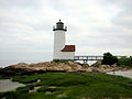
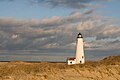
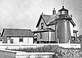
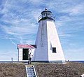
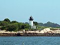
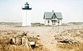
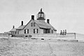
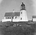
This is a list of all lighthouses in the U.S. state of Massachusetts as identified by the United States Coast Guard. Enumeration of the lighthouses in this state is complicated by the number of multiple tower stations and replacement of older towers, with the Brant Point Light station having had nine towers, two of which survive. [1] At present there are forty-seven active towers, of which eleven are privately maintained; thirteen are standing but inactive, seven have been replaced with skeleton towers, thirteen have been destroyed or removed, and one tower has been moved to another state. The oldest station, Boston Light, established in 1716, was the first lighthouse built in the colonies, and the current tower at that station, built in 1783, is the oldest survivor in the state and the second oldest in the nation, and was the last lighthouse automated in the United States. [2] The last station established was at the Buzzards Bay Entrance Light in 1961 (since replaced by an automated light on a steel tripod), but in 1986 the 1818 Great Point Light was rebuilt and relit, making it the last tower constructed in the state. The tallest towers in the state are the two Cape Ann Light towers, but the highest focal plane is at the Hospital Point Range Rear Light, which is located in the steeple of the First Baptist Church of Beverly. [2]

Contents

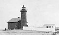
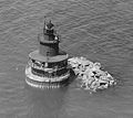
A number of inactivated Massachusetts lights have met with unusual fates. The Three Sisters of Nauset were sold off to separate private buyers before being purchased by the National Park Service and moved back near their original site. Range lights in Nantucket and Hyannis were incorporated into private dwellings, the former housing the Gilbreth family of Cheaper by the Dozen fame. The Point Gammon Light was converted into an observation tower for birdwatching.

If not otherwise noted, focal height and coordinates are taken from the United States Coast Guard Light List , [3] while location and dates of activation, automation, and deactivation are taken from the United States Coast Guard Historical information site for lighthouses. [4] Lighthouses in the "Former" section only include structures that no longer exist.

Existing lighthouses

Traditional

NameImageLocationCoordinatesYear first litAutomatedStatusCurrent LensFocal Height
Annisquam Harbor Light 2008 Annisquam light Gloucester Massachusetts USA 2608213248.jpg Gloucester
(Cape Ann)
42°39′43″N70°40′53″W / 42.6619°N 70.6815°W / 42.6619; -70.6815 (Annisquam Harbor Light) 18981974Active190mm45 ft (14 m)
Bakers Island Light Bakers island light.jpg Salem 42°32′11″N70°47′09″W / 42.5364°N 70.7859°W / 42.5364; -70.7859 (Bakers Island Light) 18211972Active190mm111 ft (34 m)
Bird Island Light MarionMA BirdIslandLight1.jpg Marion
(Buzzards Bay)
41°40′10″N70°43′03″W / 41.6694°N 70.7174°W / 41.6694; -70.7174 (Bird Island Light) 18191997
(Relit)
Active
(Inactive: 1933-1997)
ML-300 [5] 47 ft (14 m) [6]
Borden Flats Light Borden Flats Light, Fall River, Massachusetts.jpg Fall River
(Taunton River)
41°42′16″N71°10′28″W / 41.7044°N 71.1744°W / 41.7044; -71.1744 (Borden Flats Light) 18811963Active250mm47 ft (14 m)
Boston Light Boston Light.jpg Boston
(Little Brewster Island)
42°19′41″N70°53′24″W / 42.3280°N 70.8901°W / 42.3280; -70.8901 (Boston Light) 17831998ActiveSecond-order Fresnel 102 ft (31 m)
Brant Point Light (old) Brant Point Lighthouse 1856 MA.JPG Nantucket 41°17′23″N70°05′33″W / 41.2898°N 70.0924°W / 41.2898; -70.0924 (Old Brant Point Light) [7] 1856NeverInactive
(Since 1900)
None46 ft (14 m) [8]
Brant Point Light (new) Brant Point Light, oblique.jpg Nantucket 41°17′24″N70°05′25″W / 41.2900°N 70.0903°W / 41.2900; -70.0903 (Brant Point Light) 19011965ActiveFifth-order Fresnel26 ft (7.9 m)
Butler Flats Light Butler Flats Light, New Bedford, MA.jpg New Bedford
(Acushnet River)
41°36′11″N70°53′38″W / 41.603°N 70.894°W / 41.603; -70.894 (Butler Flats Light) 18981978ActiveFifth-order Fresnel25 ft (7.6 m)
Cape Ann Light Station
(aka: Thacher Island Lights)
Thacher Island twin lighthouses.jpg Rockport
(Thacher Island)
42°38′12″N70°34′30″W / 42.6368°N 70.5749°W / 42.6368; -70.5749 (Cape Ann Light (south)) 18611979
(South Tower)
1989
(North Tower)
Active [lower-alpha 1] VRB-25 166 ft (51 m)
Cape Poge Light Cape Poge Light.jpg Edgartown
(Chappaquiddick Island)
41°25′10″N70°27′08″W / 41.4194°N 70.4523°W / 41.4194; -70.4523 (Cape Poge Light) 1893 [lower-alpha 2] 1943Active300mm65 ft (20 m)
Chatham Light Chatham Light MA.jpg Chatham 41°40′17″N69°57′01″W / 41.6713°N 69.9502°W / 41.6713; -69.9502 (Chatham Light) 18771982Active DCB-224 80 ft (24 m)
Clarks Point Light New Bedford Fort.jpg New Bedford 41°35′36″N70°54′05″W / 41.5932°N 70.9014°W / 41.5932; -70.9014 (Clarks Point Light) 18692001
(Relit)
Active
(Inactive: 1898-2001)
250mm68 ft (21 m) [4]
Cleveland East Ledge Light Cleveland Ledge Lighthouse MA.JPG Falmouth 41°37′52″N70°41′39″W / 41.6310°N 70.6942°W / 41.6310; -70.6942 (Cleveland East Ledge Light) 19431978Active190mm74 ft (23 m)
Derby Wharf Light Derby Wharf Light.jpg Salem 42°30′59″N70°53′01″W / 42.5165°N 70.8835°W / 42.5165; -70.8835 (Derby Wharf Light) 18711917 [9] Active
(Inactive: 1977-1983)
Optic25 ft (7.6 m)
Duxbury Pier Light Duxbury Pier light house in Plymouth harbor.jpg Duxbury
(Plymouth Harbor)
41°59′15″N70°38′55″W / 41.9874°N 70.6485°W / 41.9874; -70.6485 (Duxbury Pier Light) 18711961ActiveFourth-order Fresnel35 ft (11 m)
East Chop Light East Chop Lighthouse.jpg Oak Bluffs 41°28′13″N70°34′03″W / 41.4703°N 70.5675°W / 41.4703; -70.5675 (East Chop Light) 1878 [lower-alpha 2] 1933Active300mm79 ft (24 m)
Eastern Point Light Eastern point lighthouse.JPG Gloucester
(Cape Ann)
42°34′49″N70°39′52″W / 42.5802°N 70.6644°W / 42.5802; -70.6644 (Eastern Point Light) 1890 [lower-alpha 2] 1985Active DCB-24 57 ft (17 m)
Edgartown Harbor Light Edgartown Harbor Light - New Paint 1988.jpg Edgartown 41°23′27″N70°30′11″W / 41.3909°N 70.5031°W / 41.3909; -70.5031 (Edgartown Harbor Light) 1881 [lower-alpha 3] 1939Active250mm45 ft (14 m)
Fort Pickering Light Ocean Lighthouse Salem Massachusetts.jpg Salem
(Winter Island)
42°31′35″N70°51′59″W / 42.5264°N 70.8664°W / 42.5264; -70.8664 (Fort Pickering Light) 18711983Active
(Inactive: 1969-1983)
Un­known28 ft (8.5 m)
Gay Head Light Gay Head Light - USA MA.jpg Aquinnah 41°20′54″N70°50′06″W / 41.3484°N 70.8350°W / 41.3484; -70.8350 (Gay Head Light) 1856 [lower-alpha 2] 1956ActiveDCB-224170 ft (52 m)
Great Point Light Great Point Light.jpg Nantucket 41°23′25″N70°02′54″W / 41.3902°N 70.0483°W / 41.3902; -70.0483 (Great Point Light) 1986
(Rebuilt)
AlwaysActiveVRB-2571 ft (22 m)
Highland Light Highland Lighthouse 2.jpg Truro
(North Truro)
41°23′27″N70°30′11″W / 41.3909°N 70.5031°W / 41.3909; -70.5031 (Highland Light) 1857 [10] 1987 [10] ActiveLED170 ft (52 m)
Hospital Point Range Front Light Hospital Point from Beverly Harbor.jpg Beverly 42°32′47″N70°51′22″W / 42.5465°N 70.8560°W / 42.5465; -70.8560 (Hospital Point Range Front Light) 18721947ActiveThird-order Fresnel70 ft (21 m)
Hospital Point Range Rear Light Hospital Point rear light.jpg Beverly 42°32′54″N70°52′43″W / 42.5483°N 70.8785°W / 42.5483; -70.8785 (Hospital Point Range Rear Light) 1927Un­knownActiveUn­known183 ft (56 m)
Ipswich Rear Range Light Ipswich Rear Range Light 1881 tower.JPG Ipswich 42°41′07″N70°45′58″W / 42.6853°N 70.7662°W / 42.6853; -70.7662 (Ipswich Range Rear Light) 1881 [lower-alpha 2] NeverRemoved
(Tower Moved)
None42 ft (13 m) [11]
Long Island Head Light Long Island Head Lighthouse Boston 1900.JPG Boston
(Long Island)
42°19′49″N70°57′28″W / 42.3302°N 70.9577°W / 42.3302; -70.9577 (Long Island Head Light) 1901 [12] 1929 [12] Active
(Inactive: 1982-1985) [12]
Acrylic 120 ft (37 m)
Long Point Light Long Point Light and Outer Battery.jpg Provincetown
(Long Point)
42°01′59″N70°10′07″W / 42.0331°N 70.1687°W / 42.0331; -70.1687 (Long Point Light) 18751952Active300mm36 ft (11 m)
Marblehead Light Marblehead Light.JPG Marblehead 42°30′19″N70°50′01″W / 42.5054°N 70.8337°W / 42.5054; -70.8337 (Marblehead Light) [13] 18951960Active300mm130 ft (40 m) [13]
Mayo Beach Light Mayo Beach Light 1915.jpg Wellfleet
(Mayo Beach)
41°55′51″N70°02′03″W / 41.9307°N 70.0343°W / 41.9307; -70.0343 (Mayo Beach Light) [14] 1881 [lower-alpha 2] NeverRemoved
(Tower moved)
NoneUnknown
Minot's Ledge Light Boston Lighthouse 3 (6237049115).jpg Cohasset 42°01′59″N70°10′07″W / 42.0331°N 70.1687°W / 42.0331; -70.1687 (Minot's Ledge Light) 1860 [lower-alpha 2] 1947Active300mm85 ft (26 m)
Monomoy Point Light Monomoy Lighthouse.jpg Chatham
(Monomoy Island)
41°33′32″N69°59′38″W / 41.559°N 69.994°W / 41.559; -69.994 (Monomoy Point Light) [15] 1849 [lower-alpha 2] NeverInactive
(Since 1923)
None47 ft (14 m) [15]
Nantucket Cliff Range Lights Nantucket Cliff Range Lights original MA.JPG Nantucket 41°17′38″N70°06′25″W / 41.294°N 70.107°W / 41.294; -70.107 ([Nantucket Cliff Range Lights) [16] 1889 [16] [lower-alpha 2] NeverInactive
(Since 1912)
NoneUnknown
Nantucket Harbor Range Lights NantucketRangeLites.jpg Nantucket
(Brant Point)
41°17′23″N70°05′32″W / 41.2898°N 70.0923°W / 41.2898; -70.0923 (Nantucket Harbor Range Front Light)
(Front Light)
41°17′21″N70°05′31″W / 41.2893°N 70.0919°W / 41.2893; -70.0919 (Nantucket Harbor Range Rear Light)
(Rear Light)
1908Un­knownActiveUn­known35 ft (11 m)
(Front Light)
51 ft (16 m)
(Rear Light)
Nauset Beach Light Nauset Light W.jpg Eastham
(Nauset Beach)
41°51′36″N69°57′11″W / 41.860°N 69.953°W / 41.860; -69.953 (Nauset Beach Light) 1923 [lower-alpha 4] 1955ActiveDCB-224120 ft (37 m)
Ned Point Light Ned Point Lighthouse.JPG Mattapoisett 41°39′03″N70°47′44″W / 41.6509°N 70.7956°W / 41.6509; -70.7956 (Ned Point Light) 18381923Active
(Inactive: 1951-1963)
250mm41 ft (12 m)
Newburyport Harbor Front Range Light Newburyport Harbor Front Range Light, May 2012, Newburyport MA.jpg Newburyport 42°48′41″N70°51′53″W / 42.8115°N 70.8648°W / 42.8115; -70.8648 (Newburyport Harbor Front Range Light) [17] 18731952Inactive
(Since 1961)
None37 ft (11 m) [18]
Newburyport Harbor Light Plum Island Lighthouse DSC 0239 AD.JPG Newburyport 42°48′55″N70°49′08″W / 42.8152°N 70.8189°W / 42.8152; -70.8189 (Newburyport Harbor Light) 1898 [lower-alpha 2] 1951ActiveFourth-order Fresnel50 ft (15 m)
Newburyport Harbor Rear Range Light NewburyportMA RearRangeLight2.jpg Newburyport 42°48′42″N70°51′58″W / 42.8116°N 70.8662°W / 42.8116; -70.8662 (Newburyport Harbor Rear Range Light) [19] 1873Un­knownInactive
(Since 1961)
None58 ft (18 m) [18]
Nobska Light NobskaLight.jpg Woods Hole 41°30′57″N70°39′18″W / 41.5158°N 70.6551°W / 41.5158; -70.6551 (Nobska Light) 1876 [lower-alpha 2] 1985ActiveFourth-order Fresnel87 ft (27 m)
Old Scituate Light Scituate Lighthouse 1.jpg Scituate
(Scituate Harbor)
42°12′17″N70°42′57″W / 42.2048°N 70.7158°W / 42.2048; -70.7158 (Scituate Light) 18111994
(Relit)
Active
(Inactive: 1860-1994)
Replica lantern70 ft (21 m) [20]
Palmer Island Light Palmer Island Light.jpg New Bedford 41°37′37″N70°54′33″W / 41.6270°N 70.9091°W / 41.6270; -70.9091 (Palmer Island Light) 18491941Active
(Inactive: 1962-1998 [21] )
Fifth-order Fresnel34 ft (10 m) [21]
Plymouth Light Plymouth light NPS.jpg Plymouth 42°00′13″N70°36′02″W / 42.0037°N 70.6006°W / 42.0037; -70.6006 (Plymouth Light) 1843 [lower-alpha 2] 1986Active100mm102 ft (31 m)
Point Gammon Light Point Gammon Light postcard.jpg Hyannis 41°36′35″N70°15′58″W / 41.6097°N 70.2662°W / 41.6097; -70.2662 (Point Gammon Light) [22] 1816 [23] NeverInactive [lower-alpha 5]
(Since 1858)
None70 ft (21 m) [23]
Race Point Light Race Point Lighthouse being painted 2012.jpg Provincetown 42°03′44″N70°14′35″W / 42.0623°N 70.2430°W / 42.0623; -70.2430 (Race Point Light) 18761972ActiveVRB-2541 ft (12 m)
Sandy Neck Light Sandy Neck Light MA.JPG Barnstable 41°43′23″N70°16′52″W / 41.723°N 70.281°W / 41.723; -70.281 (Sandy Neck Light) 1857 [lower-alpha 2] 2007
(Relit)
Active
(Inactive: 1931-2007) [24]
LED [5] Un­known
Sankaty Head Light Sankaty Light, 2009-04-07.jpg Nantucket
(Siasconset)
41°17′04″N69°57′58″W / 41.2844°N 69.9661°W / 41.2844; -69.9661 (Sankaty Head Light) 18501965ActiveDCB-224158 ft (48 m)
Stage Harbor Light Stagelight7 (2325395757).jpg Chatham 41°39′31″N69°59′01″W / 41.6587°N 69.9837°W / 41.6587; -69.9837 (Stage Harbor Light) [25] 1880NeverInactive
(Since 1933)
NoneUnknown
Straitsmouth Island Light Straitsmouth Island Lighthouse MA.JPG Rockport 42°39′44″N70°35′17″W / 42.6623°N 70.5881°W / 42.6623; -70.5881 (Straitsmouth Island Light) 1896 [lower-alpha 2] 1967Active250mm46 ft (14 m)
Tarpaulin Cove Light Tarpaulin Cove light house.JPG Gosnold
(Naushon Island)
41°28′08″N70°45′27″W / 41.4688°N 70.7575°W / 41.4688; -70.7575 (Tarpaulin Cove Light) 1891 [lower-alpha 2] 1941Active300mm78 ft (24 m)
Ten Pound Island Light Ten Pound Island Light.jpg Gloucester 42°36′07″N70°39′56″W / 42.6019°N 70.6656°W / 42.6019; -70.6656 (Ten Pound Island Light) 18811934Active
(Inactive: 1956-1989)
250mm57 ft (17 m)
The Graves Light Boston Lighthouse 2 (6237569354).jpg Boston
(The Graves)
42°21′54″N70°52′09″W / 42.3649°N 70.8691°W / 42.3649; -70.8691 (The Graves Light) 19051976ActiveVRB-2598 ft (30 m)
Three Sisters of Nauset Three Sisters Lights.jpg Eastham 41°51′32″N69°57′26″W / 41.859°N 69.9571°W / 41.859; -69.9571 (The Three Sisters of Nauset) [26] 1892 [lower-alpha 2] NeverInactive
(Since 1923)
NoneUnknown
West Chop Light West Chop Lighthouse Martha's Vineyard Ma.jpg Tisbury 41°28′51″N70°35′59″W / 41.4808°N 70.5998°W / 41.4808; -70.5998 (West Chop Light) 1891 [lower-alpha 2] 1976ActiveFourth-order Fresnel [5] 84 ft (26 m)
West Dennis Light Lighthouse Inn Cape Cod West Elevation.jpg West Dennis 41°39′07″N70°10′12″W / 41.652°N 70.170°W / 41.652; -70.170 (West Dennis Light) 18551989
(Relit)
Active
(Inactive: 1914-1989)
300mm44 ft (13 m)
Wing's Neck Light Wing's Neck Light - Bourne MA.jpg Pocasset 41°40′49″N70°39′40″W / 41.6802°N 70.6612°W / 41.6802; -70.6612 (Wing's Neck Light) 1889 [lower-alpha 2] NeverInactive
(Since 1945)
NoneUnknown
Wood End Light Wood End Lighthouse MA.JPG Provincetown
(Long Point)
42°01′17″N70°11′37″W / 42.0213°N 70.1935°W / 42.0213; -70.1935 (Wood End Light) 1872 [lower-alpha 2] 1960ActiveVRB-2545 ft (14 m)

Modern

The United States Coast Guard lists these as active lighthouses.

NameImageLocationCoordinatesYear first litStatusCurrent LensFocal Height
Buzzards Bay Entrance Light Buzzards Bay 41°23′49″N71°02′05″W / 41.3970°N 71.0347°W / 41.3970; -71.0347 (Buzzards Bay Entrance Light) 1997ActiveUn­known67 ft (20 m)
Ipswich Light Ipswich 42°41′07″N70°45′58″W / 42.6853°N 70.7662°W / 42.6853; -70.7662 (Ipswich Range Rear Light) 1939ActiveUn­known42 ft (13 m) [11]

Former lighthouses

NameImageLocationCoordinatesYear first litAutomatedYear deactivatedLightFocal Height
Annisquam Harbor Light East Gloucester lighthouse and fog bell, by Procter Brothers.jpg Gloucester
(Cape Ann)
42°39′43″N70°40′53″W / 42.6619°N 70.6815°W / 42.6619; -70.6815 (Annisquam Harbor Light) 1851Never1897
(Razed)
Fifth-order Fresnel lens 40 ft (12 m)
Bakers Island Light Massachusetts - Bakers Island - DPLA - 6b661d3d8d6ec856e3f39bd0cc8f9321.jpg Salem 42°32′11″N70°47′09″W / 42.5364°N 70.7859°W / 42.5364; -70.7859 (Bakers Island Light) 1815Never1926
(Razed)
Fourth-order Fresnel lensUn­known
Billingsgate Island Light Billingsgate Island Light MA.JPG Wellfleet
(Billingsgate Island)
41°52′16″N70°04′05″W / 41.871°N 70.068°W / 41.871; -70.068 (Billingsgate Island Light) [27] 1858Never1915
(Destroyed)
Fourth-order Fresnel lens40 ft (12 m)
Bishop and Clerks Light Bishop and Clerks Light MA.JPG Hyannis 41°34′27″N70°15′00″W / 41.5743°N 70.2501°W / 41.5743; -70.2501 (Bishop and Clerks Light) 185819231928
(Demolished in 1952)
Fourth-order Fresnel lens59 ft (18 m) [4]
Boston Light Boston Light ppmsca.09357.jpg Boston
(Little Brewster Island)
42°19′41″N70°53′24″W / 42.3280°N 70.8901°W / 42.3280; -70.8901 (Boston Light) 1716Never1776
(Destroyed)
Tallow candles75 ft (23 m)
Broad Sound Channel Inner Range Lights Broad Sound Channel Inner Range Lights.JPG Boston
(Spectacle Island)
42°19′40″N70°59′03″W / 42.3278°N 70.9842°W / 42.3278; -70.9842 (Broad Sound Channel Inner Range Front Light) [28]
(Front Light)
42°19′39″N70°59′07″W / 42.3275°N 70.9853°W / 42.3275; -70.9853 (Broad Sound Channel Inner Range Rear Light) [28]
(Rear Light)
1903 [29] Never1950 [29]
(Removed)
Fourth-order Fresnel lens53 ft (16 m) [29]
(Front)
70 ft (21 m) [29]
(Rear)
Buzzards Bay Entrance Light Buzzards Bay Entrance Light (Texas Tower) MA.JPG Buzzards Bay 41°23′49″N71°02′05″W / 41.3970°N 71.0347°W / 41.3970; -71.0347 (Buzzards Bay Entrance Light) 196119801997
(Dismantled)
Un­known101 ft (31 m) [30]
Clarks Point Light Clark's Point Light.jpg New Bedford 41°35′36″N70°54′05″W / 41.5932°N 70.9014°W / 41.5932; -70.9014 (Clarks Point Light) 1818Never1906
(Demolished)
Un­known68 ft (21 m) [4]
Cuttyhunk Light Cuttyhunk Lighthouse MA 1915.jpg Gosnold
(Cuttyhunk Island)
41°24′50″N70°57′00″W / 41.414°N 70.950°W / 41.414; -70.950 (Cuttyhunk Light) 1891Never1947
(Demolished)
Fifth-order Fresnel lens63 ft (19 m)
Deer Island Light Deer Island Original Lighthouse MA.JPG Boston
(Deer Island)
42°20′24″N70°57′16″W / 42.3399°N 70.9545°W / 42.3399; -70.9545 (Deer Island Light) 189019601982
(Destroyed in 1984)
Un­known53 ft (16 m) [31]
Dumpling Rocks Light Dumpling Rock Light 1889 MA.JPG Buzzards Bay 41°32′17″N70°55′16″W / 41.538°N 70.921°W / 41.538; -70.921 (Dumpling Rocks Light) 1829 [lower-alpha 6] Never1938
(Destroyed)
Fifth-order Fresnel lensUn­known
Egg Rock Light Egg Rock Lighthouse 1898 Massachusetts.JPG Egg Rock
(Near Nahant)
42°25′59″N70°53′53″W / 42.433°N 70.898°W / 42.433; -70.898 (Egg Rock Light) [32] 1856 [lower-alpha 7] 1918 [33] 1922
(Destroyed in 1927)
Fifth-order Fresnel lens90 ft (27 m) [32]
Falmouth Inner Light Falmouth Inner Light MA.JPG Falmouth 41°32′32″N70°36′30″W / 41.5421°N 70.6083°W / 41.5421; -70.6083 (Falmouth Inner Light) Un­knownUn­knownUn­knownUn­known25 ft (7.6 m)
Fairhaven Bridge Light Fairhaven Bridge Light MA.JPG Fairhaven 41°38′21″N70°55′03″W / 41.6392°N 70.9175°W / 41.6392; -70.9175 (Fairhaven Bridge Light) 1888Never1891
(Razed)
Un­knownUn­known
Great Point Light Great Point Lighthouse 1930.jpg Nantucket 41°23′25″N70°02′54″W / 41.3902°N 70.0483°W / 41.3902; -70.0483 (Great Point Light) 181719551984
(Destroyed)
Third-order Fresnel lens71 ft (22 m)
Hyannis Front Range Light Hyannis Front Range Light MA.JPG Hyannis 41°38′02″N70°17′20″W / 41.634°N 70.289°W / 41.634; -70.289 (Hyannis Rear Range Light) 1885Never1929
(Removed)
Fifth-order Fresnel lens20 ft (6.1 m) [34]
Hyannis Rear Range Light Hyannis Rear Range Light New Lantern MA.JPG Hyannis 41°38′10″N70°17′19″W / 41.636°N 70.2885°W / 41.636; -70.2885 (Hyannis Rear Range Light) [35] 1849Never1929
(Removed)
Fifth-order Fresnel lens43 ft (13 m) [34]
Ipswich Front Range Light Massachusetts - Ipswich - DPLA - a5de4ce31cfdfbed72c83b9d443bf548.jpg Ipswich 42°41′10″N70°45′54″W / 42.686°N 70.765°W / 42.686; -70.765 (Ipswich Range Front Light) [11] 1867Never1932Un­known25 ft (7.6 m) [11]
Long Island Head Light Long Island Head Light early tower.JPG Boston
(Long Island)
42°19′49″N70°57′28″W / 42.3302°N 70.9577°W / 42.3302; -70.9577 (Long Island Head Light) 1844 [12] Never1881 [12]
(Replaced)
Fourth-order Fresnel lens120 ft (37 m)
Long Point Light Long Point Light--Original built 1827.jpg Provincetown
(Long Point)
42°01′59″N70°10′07″W / 42.0331°N 70.1687°W / 42.0331; -70.1687 (Long Point Light) 1827Never1873
(Replaced)
Sixth-order Fresnel lens36 ft (11 m)
Lovells Island Range Lights Lovells Island Range Lights.JPG Boston
(Lovells Island)
42°19′58″N70°55′49″W / 42.3328°N 70.9303°W / 42.3328; -70.9303 (Lovells Island Range Front Light) [4]
(Front Light)
42°19′55″N70°55′52″W / 42.3319°N 70.9311°W / 42.3319; -70.9311 (Lovells Island Range Rear Light) [4]
(Rear Light)
1903Never1939
(Removed)
None31 ft (9.4 m) [36]
(Front Light)
40 ft (12 m) [36]
(Rear Light)
Marblehead Light 1835 Marblehead Lighthouse by Masury Mystic Seaport.png Marblehead 42°30′19″N70°50′01″W / 42.5054°N 70.8337°W / 42.5054; -70.8337 (Marblehead Light) [13] 1835Never1895
(Replaced)
Sixth-order Fresnel lens130 ft (40 m) [13]
Nantucket Beacon Nantucket Rear Range Light (original 1869).JPG Nantucket 41°16′23″N70°04′23″W / 41.273°N 70.073°W / 41.273; -70.073 ([Nantucket Beacon) [8] c.1807 [lower-alpha 8] NeverUn­knownLanterns24 ft (7.3 m) [8]
Race Point Light Race Point Lighthouse 1816 MA.JPG Provincetown 42°03′44″N70°14′35″W / 42.0623°N 70.2430°W / 42.0623; -70.2430 (Race Point Light) 1816Never1876
(Replaced)
Fourth-order Fresnel lens25 ft (7.6 m)
Spectacle Island Range Lights Spectacle island 1907.jpg Boston
(Spectacle Island)
42°19′41″N70°59′07″W / 42.3281°N 70.9853°W / 42.3281; -70.9853 (Spectacle Island Range Front Light) [28]
(Front Light)
42°19′39″N70°59′04″W / 42.3275°N 70.9844°W / 42.3275; -70.9844 (Spectacle Island Range Rear Light) [28]
(Rear Light)
1897Never1913None29 ft (8.8 m) [28]
(Front Light)
54 ft (16 m) [28]
(Rear Light)
Ten Pound Island Light Ten Pound Island Light 1821 version.JPG Gloucester 42°36′07″N70°39′56″W / 42.6019°N 70.6656°W / 42.6019; -70.6656 (Ten Pound Island Light) 1821Never1881
(Replaced)
57 ft (17 m)
Twin Lights Chatham Lighthouse two towers MA.JPG Chatham 41°40′17″N69°57′01″W / 41.6713°N 69.9502°W / 41.6713; -69.9502 (Chatham Light) 1841Never1877
(Razed)
Fourth-order Fresnel lens40 ft (12 m)

See also

Notes

  1. The "North Tower" was inactive from 1932 to 1989 when it was automated and relit.
  2. 1 2 3 4 5 6 7 8 9 10 11 12 13 14 15 16 17 18 19 One or more towers predate the currently listed structure. At this time, there is not enough available information to make an entry under the "Former lighthouses" section for them.
  3. At least 5 different towers have been constructed since the first structure in 1828. The current lighthouse was originally the Ipswich Rear Range Light before it was moved in 1939.
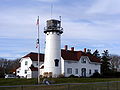
  4. The current tower dates to 1877 when it was built for use in Chatham.
  5. Point Gammon Light was converted into a bird watching observation tower in the late 19th century.
  6. The last "traditional" stone lighthouse was built in 1889.
  7. The last "traditional" stone lighthouse was built in 1898.
  8. The United States Coast Guard claims Nantucket Beacon was established in 1794. This is disputed by a congressional claim which dates to 1820.

Related Research Articles

<span class="mw-page-title-main">Brant Point Light</span> Lighthouse

Brant Point Light is a lighthouse located on Nantucket Island. The station was established in 1746, automated in 1965, and is still in operation. The current tower was added to the National Register of Historic Places on October 28, 1987; it has the distinction of being the tenth light on the point, in addition to several range lights. Four of the others burned or blew down, two were condemned, two were unsatisfactory, and the remaining one stands unused.

<span class="mw-page-title-main">Old Scituate Light</span> Historic lighthouse Scituate, Massachusetts, United States

Old Scituate Light also known simply as Scituate Light is a historic lighthouse located on Cedar Point in Scituate, Massachusetts. It was added to the National Register of Historic Places in 1987 as Scituate Light.

<span class="mw-page-title-main">Bridgeport Harbor Light</span> Lighthouse in Connecticut, United States

The Bridgeport Harbor Light, later the Bridgeport Harbor Lighthouse, was a lighthouse in Bridgeport, Connecticut, United States. It is located on the west side of the Bridgeport Harbor entrance and the north side of Long Island Sound. Originally constructed in 1851 and rebuilt in 1871 with a dwelling, it had a red-fixed light throughout its service life. The builder and first keeper of the light was Abraham A. McNeil who is also credited as improvising the first light for the Bridgeport Harbor in 1844. By 1953, the lighthouse was in poor condition and the United States Coast Guard opted to build a skeleton tower in its place. In the 2014 edition of the Light List Volume 1, the skeleton tower is marked as "Light 13A" with a height of 57 feet (17 m) and a visual marker of a square green dayboard with a green reflective border. The lighthouse was sold and an attempt was made to move it to serve as a monument for Connecticut's maritime history, but it was later decided to scrap the structure. The lighthouse caught fire and was destroyed during the dismantling in 1953.

<span class="mw-page-title-main">Black Rock Harbor Light</span> Lighthouse in Connecticut, United States

Black Rock Harbor Light, also known as Fayerweather Island Light, is a lighthouse in Bridgeport, Connecticut, United States which stands on the south end of Fayerweather Island and marks the entrance to Black Rock Harbor. The first lighthouse at the site, built by Abisha Woodward under contract with the United States government, was a wooden tower that was lit and made operational by 1808. A storm destroyed the tower in 1821 and the current, stone lighthouse was erected in its place in 1823. The Black Rock Harbor Light was an active navigational aid until 1933 when it was replaced by two automatic lights offshore. The beacon was subsequently given to the City of Bridgeport in 1934. Two significant efforts during the 1980s and 1990s served to restore the aging tower and the light was relit as a non-navigational aid in 2000. Black Rock Lighthouse is listed as a contributing property for Bridgeport's Seaside Park historic district.

<span class="mw-page-title-main">Prudence Island Light</span> Lighthouse

The Prudence Island Lighthouse, more commonly known locally as the Sandy Point Lighthouse, is located on Prudence Island, Rhode Island and is the oldest lighthouse tower in the state. Sandy Point is nicknamed Chibacoweda, meaning "little place separated by a passage", because the location is a little more than one mile offshore.

<span class="mw-page-title-main">Palmer Island Light</span> Lighthouse

Palmer Island Light Station is a historic lighthouse in New Bedford Harbor in New Bedford, Massachusetts, USA. The lighthouse was built in 1849 out of stone rubble. It was discontinued when the harbor's hurricane barrier was built in the early 1960s, as its location immediately north of the barrier was no longer an outlying danger and there are lights on either side of the barrier opening.

<span class="mw-page-title-main">West Dennis Light</span> Lighthouse

West Dennis Light is a lighthouse in West Dennis, Massachusetts. It was previously known as Bass River Light. It is owned by and sits on top of the Lighthouse Inn, a seasonal hotel.

<span class="mw-page-title-main">Annisquam Harbor Light</span> Lighthouse

Annisquam Harbor Light Station is a historic lighthouse on Wigwam Point in the Annisquam neighborhood of Gloucester, Massachusetts. It can be viewed from nearby Wingaersheek Beach, Gloucester. It lies on the Annisquam River and is one of the four oldest lighthouses to surround the Gloucester peninsula as well as; Eastern Point Light, Ten Pound Island Light, and Thacher Island Light.

<span class="mw-page-title-main">Newburyport Harbor Light</span> Lighthouse

The Newburyport Harbor Light, also known as Plum Island Light, built in 1788, is a historic lighthouse on Northern Boulevard in Newburyport, Massachusetts.

<span class="mw-page-title-main">Clarks Point Light</span> Lighthouse

The Clarks Point Light is located in New Bedford, Massachusetts. Originally constructed as a wooden tower, it was replaced with a stone tower in 1804. This in turn was replaced by a structure on the parapets of Fort Rodman which was deactivated in 1898. After restoration in the early 1970s, it was relit again in 2001 by the city as a private aid.

<span class="mw-page-title-main">Stage Harbor Light</span> Lighthouse

Stage Harbor Light is a lighthouse in Chatham, Massachusetts built in 1880. It was discontinued in 1933, replaced by a skeleton tower 200 ft (60m) west which remains an active aid to navigation. The original light helped to mark a vessel staging area anchorage in deep water south of Harding's Beach used during periods of low visibility (fog) by vessels waiting to round Monomoy Point and Pollock Rip Channel. The lighthouse also lined up perfectly with the Chatham Twin Lights, making an effective range for Chatham Roads, the deep water channel crossing Nantucket Sound from south of Bishop & Clerks Reef off Point Gammon at Hyannis to the staging area. The original light is now a private residence. It sits at the entrance of what is still a busy harbor, used primarily by Chatham-based fishing fleets, sailboats from the Stage Harbor and Monomoy yacht clubs, and private craft owners.

<span class="mw-page-title-main">Nantucket Harbor Range Lights</span> Lighthouse

The Nantucket Harbor Range Lights are range lights that were built in 1908 to guide vessels through the narrow channel to Nantucket Harbor. They replaced an older arrangement involving the Nantucket Beacon and the Brant Point Light, which became unusable when the latter was replaced with a new tower.

<span class="mw-page-title-main">Nantucket Beacon</span> Lighthouse

The Nantucket Beacon formed a range with the Brant Point Light to guide vessels into Nantucket harbor. Operated at various times in the 19th century, it was deactivated sometime after 1870. This range was eventually succeeded by the Nantucket Harbor Range Lights, which are still in operation.

<span class="mw-page-title-main">Nantucket Cliff Range Lights</span> Lighthouse

The Nantucket Cliff Lights, also known as the Nantucket Cliff Range Lights were a set of range lights on Nantucket. Over the years, there were several sets of range lights to lead ships into Nantucket Harbor. The first were built in 1838. The second, a pair of conical white towers which still exist-owned by the Gilbreth family of "Cheaper by the Dozen" Fame-although not on the same site, were discontinued in 1912. The Gilbreth Family purchased the two latter range lights in 1921.

<span class="mw-page-title-main">Spectacle Island Range Lights</span> Lighthouse

The Spectacle Island Range Lights were a pair of range lights on Spectacle Island in Boston Harbor. They were established in 1897 and discontinued in 1913 after changes in the entrance channels to the harbor made them obsolete.

<span class="mw-page-title-main">Point Gammon Light</span> Lighthouse

The Point Gammon Light was a lighthouse that stood on its eponymous point at the south end of Great Island in West Yarmouth, Massachusetts, on the east side of Lewis Bay and the entrance to Hyannis Harbor. Long inactive, it was converted into an ornithological observation tower in the late 19th century.

References

  1. "Brant Point, MA". Lighthouse Friends.
  2. 1 2 Rowlett, Russ. "Lighthouses of the United States: Northern Massachusetts". The Lighthouse Directory. University of North Carolina at Chapel Hill.
  3. Light List, Volume I, Atlantic Coast, St. Croix River, Maine to Shrewsbury River, New Jersey (PDF). Light List. United States Coast Guard. 2012.
  4. 1 2 3 4 5 6 "Historic Light Station Information and Photography: Massachusetts". United States Coast Guard Historian's Office. Archived from the original on 2017-05-01.
  5. 1 2 3 Russ Rowlett (May 24, 2022). "Lighthouses of the United States: Southeastern Massachusetts". University of North Carolina. Archived from the original on October 30, 2022. Retrieved March 11, 2023.
  6. "Bird Island Light". Jeremy D'Entremont.
  7. "Brant Point (old), MA". Lighthouse Friends.
  8. 1 2 3 Report of the Secretary of the Treasury on the State of the Finances. Washington, DC: William A. Harris. December 6, 1858. pp. 446–447. Retrieved 2012-09-28.
  9. "Derby Wharf Light: History". Jeremy D'Entremont. 11 October 2023.
  10. 1 2 "Cape Cod (Highland), MA". Lighthouse Friends.
  11. 1 2 3 4 Ipswich Bay to Gloucester, Massachusetts (Map). 1:20,000. Department of Commerce. 1930. Chart 243. Archived from the original on 2016-03-04. Retrieved 2012-09-27.
  12. 1 2 3 4 5 "Long Island Head Light: History". Jeremy D'Entremont. 11 October 2023.
  13. 1 2 3 4 "Section VIII: Light List Corrections" (PDF). Local Notice to Mariners, District 1. United States Coast Guard (week 3): 22. 2012.[ permanent dead link ]
  14. "Mayo's Beach, MA". Lighthouse Friends. Archived from the original on 2007-10-13.
  15. 1 2 "Monomoy Point Light". Jeremy E'Entremont. 11 October 2023.
  16. 1 2 "Nantucket Cliff Range, MA". Lighthouse Friends.
  17. "Newburyport Harbor Range Front, MA". Lighthouse Friends.
  18. 1 2 Newburyport Harbor and Plum Island Sound (Map). 1:20,000. US Dept. of Commerce. 1958. Chart 213. Archived from the original on 2017-09-11. Retrieved 2012-09-17.
  19. "Newburyport Harbor Range Rear, MA". Lighthouse Friends.
  20. "Scituate Light". Jeremy D'Entremont. 11 October 2023.
  21. 1 2 "Palmer's Island Light". Jeremy D'Entremont. 11 October 2023.
  22. "Point Gammon, MA". Lighthouse Friends. Archived from the original on 2012-10-04.
  23. 1 2 "Point Gammon Light". Jeremy D'Entremont. 11 October 2023.
  24. "Sandy Neck, MA". Lighthouse Friends.
  25. "Stage harbor, MA". Lighthouse Friends.
  26. "Three Sisters, MA". Lighthouse Friends.
  27. "Billingsgate Island Light". Jeremy D'Entremont. 11 October 2023.
  28. 1 2 3 4 5 6 List of Lights and Fog Signals on the Atlantic and Gulf Coasts of the United States. Washington, DC: US Government Printing Office. 1900. p. 38.
  29. 1 2 3 4 "Broad Sound Channel Inner Range Lights: History". Jeremy D'Entremont. 11 October 2023.
  30. Marthas Vineyard to Block Island (Map). 1:80,000. NOAA. 1980. Chart 13218. Archived from the original on 2016-03-04. Retrieved 2012-09-15.
  31. Boston Harbor (Map). 1:25,000. NOAA. 1969. Chart 13270. Archived from the original on 2016-03-04. Retrieved 2012-09-14.
  32. 1 2 "Egg Rock Light". Jeremy D'Entremont. 11 October 2023.
  33. "Egg Rock Light: History". Jeremy D'Entremont. 11 October 2023.
  34. 1 2 "Hyannis Harbor Light: History". Jeremy d'Entremont. 11 October 2023.
  35. "Hyannis Harbor Light". Jeremy d'Entremont. 11 October 2023.
  36. 1 2 Boston Harbor (Map). 1:20,000. US Dept. of Commerce. 1928. Chart 246. Archived from the original on 2016-03-04. Retrieved 2012-09-17.