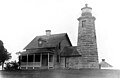
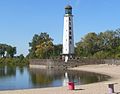
This is a list of lighthouses in the United States. The United States has had approximately a thousand lights as well as light towers, range lights, and pier head lights. Michigan has the most lights of any state with over 150 past and present lights. Lighthouses that are in former U.S. territories are not listed here.
Most of the lights in the United States have been built and maintained by the Coast Guard (since 1939) and its predecessors, the United States Lighthouse Service (1910–1939) and the United States Lighthouse Board (1852–1910). Before the Lighthouse Board was established, local collectors of customs were responsible for lighthouses under Stephen Pleasonton. As their importance to navigation has declined and as public interest in them has increased, the Coast Guard has been handing over ownership and in some cases responsibility for running them to other parties, the chief of them being the National Park Service under the National Historic Lighthouse Preservation Act of 2000.
State | Tallest [1] (H) | Shortest [1] (H) | Oldest [2] (currently standing) |
---|---|---|---|
Maine | Boon Island Light 133 ft (41 m) | Pond Island Light 20 ft (6.1 m) | Portland Head Light (1791) [3] |
Massachusetts | Cape Ann Light 124 ft (38 m) | Disputed A | Boston Light (1783) [4] |
New Hampshire | Isles of Shoals Light 58 ft (18 m) | Portsmouth Harbor Light 48 ft (15 m) | (1859) [5] | Isles of Shoals Light
Rhode Island | Sakonnet Light 66 ft (20 m) | Ida Lewis Rock Light 13 ft (4.0 m) | Poplar Point Light (1831) [6] |
Connecticut | New London Harbor Light 89 ft (27 m) [7] | Mystic Seaport Light 25 ft (7.6 m) | (1801) [7] | New London Harbor Light
Vermont | Windmill Point Light 40 ft (12 m) | Whipple Point Light 13 ft (4.0 m) | Juniper Island Light (1846) [2] |
The state of New Hampshire only has two lighthouses, both of which are located along the Atlantic coastline. [8]
Name | Image | Location | Coordinates | Year first lit | Automated | Year deactivated | Current lens | Focal height |
---|---|---|---|---|---|---|---|---|
Isles of Shoals Light | Isles of Shoals | 42°58′02″N70°37′23″W / 42.96722°N 70.62306°W | 1859 | 1987 | Active | VLB-44 LED unit | 82 ft (25 m) | |
Portsmouth Harbor Light | New Castle | 43°04′15″N70°42′30″W / 43.07083°N 70.70833°W | 1878 | 1960 | Active | Fourth order Fresnel | 48 ft (15 m) |
Name | Image | Location | Coordinates | Year first lit | Automated | Year deactivated | Current lens | Focal height |
---|---|---|---|---|---|---|---|---|
Burlington Breakwater North Light | Burlington | 44°28′50″N73°13′47.2″W / 44.48056°N 73.229778°W | 1857 (Original) 2003 (current) | 2003 (Replica) | Active | Unknown | 35 ft (11 m) | |
Burlington Breakwater South Light | Burlington | 44°28′12.1″N73°13′32.4″W / 44.470028°N 73.225667°W | 1857 (Original) 2003 (current) | 2003 (Replica) | Active | Unknown | 12 ft (3.7 m) | |
Colchester Reef Light | Shelburne | 44°22′31″N73°13′53″W / 44.3753°N 73.2314°W | 1871 | Never | 1933 | None | 35 ft (11 m) | |
Isle La Motte Light | Isle La Motte | 44°54′23″N73°20′37″W / 44.9065°N 73.3435°W | 1856 (Original) 1881 (current) | Unknown | Unknown | 300mm | 25 ft (7.6 m) | |
Juniper Island Light | — | South Burlington | 44°27′00″N73°16′35″W / 44.4500°N 73.2763°W | 1826 (Original) 1846 (current) | Never | 1954 | None | 25 ft (7.6 m) |
Maxfield Point Light | — | Orleans | Unknown | 1879 | Unknown | Unknown | None | 40 ft (12 m) |
Newport Wharf Light | — | Orleans | Unknown | 1879 | Unknown | Unknown | None | 37 ft (11 m) |
Windmill Point Light | — | Isle La Motte | 44°58′54″N73°20′30″W / 44.9818°N 73.3418°W | 1830 (Original) 1858 (current) | Unknown | Active (Inactive: 1931–2002) | 300 mm | 40 ft (12 m) |
Whipple Point Light | — | Orleans | Unknown | 1879 | Unknown | 1906 | None | 25 ft (7.6 m) |
State | Tallest [1] (H) | Shortest [1] (H) | Oldest (currently standing) |
---|---|---|---|
New York | Fire Island Lighthouse 168 ft (51 m) [10] B | Cape Vincent Light 15 ft (4.6 m) | Montauk Point Light (1797) [11] |
New Jersey | Absecon Light 171 ft (52 m) [12] | Ludlam's Beach Light 36 ft (11 m) | Sandy Hook Light (1764) [13] |
Pennsylvania | Presque Isle Light 68 ft (21 m) | Turtle Rock Light 30 ft (9.1 m) | Erie Harbor Light (1857) |
Delaware | Liston Range Rear Light 120 ft (37 m) [14] | Cherry Island Light 35 ft (11 m) | Fenwick Island Light (1858) [15] |
Maryland | Craighill Channel L.R.R. 105 ft (32 m) [16] | Craighill Channel U.R.F. 15 ft (4.6 m) [17] | Pooles Island Light (1825) [18] |
State | Tallest [1] (H) | Shortest [1] (H) | Oldest (currently standing) |
---|---|---|---|
Illinois | Grosse Point Light 113 ft (34 m) | Waukegan Harbor Light 35 ft (11 m) | (1873) | Grosse Point Light
Indiana | 55 ft (17 m) | Buffington Breakwater Light30 ft (9.1 m) | Gary Breakwater LightOld Michigan City Light (1858) [20] |
Michigan | White Shoal Light 121 ft (37 m) | Cheboygan Crib Light 25 ft (7.6 m) | Fort Gratiot Light (1825) [21] |
Minnesota | Duluth South Breakwater I.L. 70 ft (21 m) | Grand Marais Light 34 ft (10 m) | Two Harbors Light (1892) [22] C |
Nebraska | Linoma Lighthouse 100 ft (30 m) | Lake Minatare Light 55 ft (17 m) | — |
Ohio | Northwood Light 161 ft (49 m) [23] | Port Clinton Light 20 ft (6.1 m) | Marblehead Light (1821) [24] |
Wisconsin | Rawley Point Light 111 ft (34 m) | Baileys Harbor Front RL 21 ft (6.4 m) [25] | Baileys Harbor Light (1853) D |
The state of Nebraska has at least two faux lighthouses which were first lit in 1939. There is no evidence that either were used for navigational purposes as the state has no large bodies of water that would require the need. Linoma Lighthouse is located on a privately owned recreation area which was developed around an artificial lake, while Lake Minatare Lighthouse was "built to simulate a lighthouse". Also of note is a faux lighthouse called Rock Garden Lighthouse (not listed below), located in Kearney. [26] [27]
Name | Image | Location | Coordinates | Year first lit | Automated | Year deactivated | Current Lens | Height |
---|---|---|---|---|---|---|---|---|
Linoma Lighthouse | Gretna | 41°3′44″N96°19′8″W / 41.06222°N 96.31889°W | 1939 | Always | Active | Decorative | 100 ft (30 m) | |
Lake Minatare Lighthouse | Scottsbluff | 41°55′50″N103°30′05″W / 41.93056°N 103.50139°W | 1939 | Always | Active | Decorative | 55 ft (17 m) |
State | Tallest [1] (H) | Shortest [1] (H) | Oldest (currently standing) |
---|---|---|---|
Alaska | Cape Decision Light 75 ft (23 m) | Point Sherman Light 20 ft (6.1 m) E | Eldred Rock Light (1906) [29] |
Washington | Grays Harbor Light 107 ft (33 m) | Turn Point Light 20 ft (6.1 m) | Cape Disappointment (1856) |
Oregon | Yaquina Head Light 93 ft (28 m) [30] | Warrior Rock Light 25 ft (7.6 m) | Cape Blanco Light (1870) |
California | Pigeon Point Light Point Arena Light 115 ft (35 m) F | Lime Point Light 20 ft (6.1 m) | Point Pinos Light (1855) |
Hawaii | Moloka'i Light 138 ft (42 m) | 22 ft (6.7 m) | Kuki'i Point LightMoloka'i Light (1909) G |
State | Tallest [1] (H) | Shortest [1] (H) | Oldest (currently standing) |
---|---|---|---|
Alabama | Sand Island Light 131 ft (40 m) [31] | Middle Bay Light 54 ft (16 m) [32] | (1873) | Sand Island Light
Florida | Ponce de Leon Light 175 ft (53 m) | Cedar Key Light 23 ft (7.0 m) [33] | Amelia Island Light (1838) |
Georgia | Tybee Island Light 145 ft (44 m) [34] | Cockspur Island Light 46 ft (14 m) | Sapelo Island Light (1820) |
Louisiana | Unknown | Unknown | New Canal Light (1839 [35] ) |
Mississippi | Biloxi Light 61 ft (19 m) | 30 ft (9.1 m) I | Tie(1848) | Biloxi Light
North Carolina | Cape Hatteras Light 210 ft (64 m) | — | Bald Head Light (1817) |
South Carolina | Morris Island Light 161 ft (49 m) | Haig Point F. R. Light 18 ft (5.5 m) | Cape Romain Light (Old) (1827) |
Texas | Point Bolivar Light 116 ft (35 m) | — | Point Isabel Light (1852) |
Virginia | Cape Charles Light 191 ft (58 m) | Deepwater Shoals Light (1855) | Cape Henry Lighthouse (1792) |
This section needs expansion. You can help by adding to it. (October 2017) |
This table lists lighthouses that are in insular areas of the United States. All of the islands listed below are uninhabited, and have not been formerly incorporated into the country. [36] [37] [38]
Name | Image | Location | Coordinates | Year first lit | Automated | Year deactivated | Current Lens | Height |
---|---|---|---|---|---|---|---|---|
Baker Island Light | Baker Island | 0°11′44.8″N176°29′03.4″W / 0.195778°N 176.484278°W | 1935 | Never | 1942 | None | 16 ft (4.9 m) | |
Howland Island Light (aka: Earhart Light) | Howland Island | 0°48′20.6″N176°37′08.6″W / 0.805722°N 176.619056°W | 1937 | Never | 1942 | None | 20 ft (6.1 m) | |
Jarvis Island Light | Jarvis Island | 0°22′13.6″S160°00′24.1″W / 0.370444°S 160.006694°W | 1935 | Never | 1945 | None | 16 ft (4.9 m) | |
Navassa Island Light | Navassa Island | 18°23′50.7″N75°00′46.2″W / 18.397417°N 75.012833°W | 1917 | 1929 | 1996 | None | 161 ft (49 m) | |
Sand Island Aviation Light | — | Midway Atoll | 28°12′42.7″N177°22′36.4″W / 28.211861°N 177.376778°W | Unknown | Unknown | Active | Unknown | 46 ft (14 m) |
Wake Island Aviation Light | — | Wake Island | 19°17′02.0″N166°39′05.2″E / 19.283889°N 166.651444°E | Unknown | Unknown | Active | Unknown | 52 ft (16 m) |
The Holland Harbor Light, known as Big Red, is located in Park Township, Michigan at the entrance of a channel connecting Lake Michigan with Lake Macatawa, and which gives access to the city of Holland, Michigan.
Pottawatomie Lighthouse, also known as the Rock Island Light, is a lighthouse in Rock Island State Park, on Rock Island in Door County, Wisconsin. Lit in 1836, it is the oldest light station in Wisconsin and on Lake Michigan. It was served by civilian light keepers from 1836 to 1946, at which point it was automated.
The Little Traverse Light is located in Emmet County in the U.S. state of Michigan on the north side of the Little Traverse Bay of Lake Michigan on Harbor Point in West Traverse Township near Harbor Springs, Michigan. It marks the entrance to the harbor at Harbor Springs.
The buildings of the St Helena Light complex are the sole surviving structures on St. Helena Island, in Mackinac County in the U.S. state of Michigan. The lighthouse on the St. Helena Island's southeastern point was built in 1872-1873 and went into operation in September 1873. It became one of a series of lighthouses that guided vessels through the Straits of Mackinac, past a dangerous shoal that extends from the island.
The Kenosha North Pier lighthouse or Kenosha Light is a lighthouse located in Kenosha, Wisconsin. "A typical 'Lake Michigan red tower'", it is a sibling to the Milwaukee Pierhead Light. This light was built in 1906 as a replacement of the old Kenosha Light. It was listed on the National Register of Historic Places in 2008.
Grand Traverse Light is a lighthouse in the U.S. state of Michigan, located at the tip of the Leelanau Peninsula, which separates Lake Michigan and Grand Traverse Bay. It marks the Manitou passage, where Lake Michigan elides into Grand Traverse Bay. In 1858, the present light was built, replacing a separate round tower built in 1852. The lighthouse is located inside Leelanau State Park, 8 miles (13 km) north of Northport, a town of about 650 people. This area, in the Michigan wine country, is commonly visited by tourists during the summer months.
The South Haven South Pierhead Light is a lighthouse in Michigan, at the entrance to the Black River on Lake Michigan. The station was lit in 1872, and is still operational. The tower is a shortened version of the Muskegon South Pierhead Light, and replaced an 1872 wooden tower. The catwalk is original and still links the tower to shore: it is one of only four that survive in the State of Michigan.
The Beaver Head Light is located high on a bluff on the southern tip of Beaver Island. Boats trying to navigate North on Lake Michigan need to carefully work their way between Beaver Island and Gray's Reef.
Manitou Island is a small island in Lake Superior, off the northeastern tip of the Keweenaw Peninsula in the U.S. state of Michigan. It is part of Grant Township, in Keweenaw County. Located approximately three miles from the mainland, it encompasses around 1,000 acres (4.0 km2). Manitou has seen limited impact from human activity because of its remote location and the often-treacherous waters caused by a strong current at the peninsula's tip. It is mostly forested, with scattered bogs and an inland lake known as "Perch Lake". Dense underbrush can make travel around the island rather difficult, though a few unimproved trails do exist. The Keweenaw Land Trust protects 93 acres (0.38 km2) of the island as the Manitou Island Light Station Preserve.
The Milwaukee Breakwater lighthouse was built in 1926 in the harbor of Milwaukee in Milwaukee County, Wisconsin to mark the entrance to the harbor. One of the last fully enclosed breakwater lighthouses in the Great Lakes, the structure was placed on the National Register of Historic Places in 2011.
The White Shoal Light is a lighthouse located 20 miles (32 km) west of the Mackinac Bridge in Lake Michigan. It is an active aid to navigation. It is also the tallest lighthouse on the Great Lakes.
St. Martin Island Light is an exoskeleton lighthouse on St. Martin Island. It marks one of four passages between Lake Michigan and the bay of Green Bay. Constructed in 1905, this light tower is the only example in the US of a pure exoskeletal tower on the Great Lakes. Similar designs exist in Canada. Painted white, the hexagonal tower is made of iron plates which are supported by six exterior steel posts that have latticed buttresses.
The lighthouse at Fourteen Foot Shoal was named to note that the lake is only 14 feet (4.3 m) deep at this point, which is a hazard to navigation, ships and mariners.
Bois Blanc Light can refer to one of five lighthouses erected on Bois Blanc Island, Michigan, in Lake Huron. Two of the lighthouses are currently standing. The lighthouse and surrounding property are privately owned and closed to the public.
The Rock of Ages Light is a U.S. Coast Guard lighthouse on a small rock outcropping approximately 2.25 miles (3.62 km) west of Washington Island and 3.5 miles (5.6 km) west of Isle Royale, in Eagle Harbor Township, Keweenaw County, Michigan. It is an active aid to navigation.
Round Island Passage Light is an automated, unmanned lighthouse located in the Round Island Channel in the Straits of Mackinac, Michigan. The channel is a branch of Lake Huron.
Grand Haven South Pierhead Inner Light is the inner light of two lighthouses on the south pier of Grand Haven, Michigan where the Grand River enters Lake Michigan. A lighthouse was first lit there in 1839. The lighthouse was put up for sale in 2009 under the National Historic Lighthouse Preservation Act. The City of Grand Haven now owns the pier, but it is maintained by the Army Corps of Engineers.
Grand Haven South Pierhead Entrance Light is the outer light of two lighthouses on the south pier of Grand Haven, Michigan where the Grand River enters Lake Michigan. A lighthouse was first lit there in 1839. The lighthouse was put up for sale in 2009 under the National Historic Lighthouse Preservation Act. The City of Grand Haven now owns the pier, but it is maintained by the Army Corps of Engineers.
{{cite book}}
: |author=
has generic name (help){{cite book}}
: |author=
has generic name (help){{cite book}}
: |work=
ignored (help)