List of lighthouses in North Carolina

Last updated

This is a list of lighthouses in North Carolina .

NameImageLocationCoordinatesYear first litAutomatedYear deactivatedCurrent LensFocal Height
Bald Head Light Old Baldy Lighthouse.jpg Bald Head Island 33°52′24.5″N78°0′24.5″W / 33.873472°N 78.006806°W / 33.873472; -78.006806 1794 (First)
1817 (Current)
1985
(Relit)
Active [1]
(Inactive: 1935–1985)
None110 ft (34 m)
Bodie Island Light Bodie Island Lighthouse, July 2007.jpg Nags Head 35°49′07″N75°33′48″W / 35.8185°N 75.5633°W / 35.8185; -75.5633 1847 (First)
1872 (Current)
1940ActiveFirst-order Fresnel 156 ft (48 m)
Campbell Island LightNone Known Wilmington Unknown1849 [2] Never1865 [2]
(Destroyed)
None25 ft (7.6 m) [2]
Cape Fear Light CapeFearLighthouse.jpg Cape Fear 33°53′34″N78°02′05″W / 33.8927°N 78.0348°W / 33.8927; -78.0348 1903Never1958
(Demolished)
NoneUnknown
Cape Hatteras Light Cape hatteras lighthouse img 0529.jpg Buxton 35°15′01.92″N75°31′43.74″W / 35.2505333°N 75.5288167°W / 35.2505333; -75.5288167 1803 (First)
1870 (Current)
1950Active DCB-224 187 ft (57 m)
Cape Lookout Light Cape Lookout Lighthouse.jpg Cape Lookout 34°36′19″N76°32′10″W / 34.60528°N 76.53611°W / 34.60528; -76.53611 1812 (First)
1859 (Current)
1950ActiveLEDUnknown
Croatan Shoal Light Croatan Shoals Light.JPG Croatan Sound N/AUnknownNever1864
(Destroyed)
NoneUnknown
Currituck Beach Light Currituck lighthouse.jpg Corolla 36°22′36″N75°49′51″W / 36.376667°N 75.830833°W / 36.376667; -75.830833 18751939ActiveFirst-order FresnelUnknown
Diamond Shoal Light Offshore 35°9′12″N75°17′48″W / 35.15333°N 75.29667°W / 35.15333; -75.29667 [3] 196619772001None125 ft (38 m)
Federal Point Light N/A Kure Beach Unknown1817 [4] (First)
1866 [4] (Last)
Never1879 [4]
(Destroyed in 1881)
NoneUnknown
Frying Pan Shoals Light Frying Pan Shoals Light.jpg Offshore 33°29′N77°35′W / 33.483°N 77.583°W / 33.483; -77.583 196419792003NoneUnknown
Gull Shoal LightN/A Pamlico Sound 35°21′58″N75°57′26″W / 35.366138°N 75.957323°W / 35.366138; -75.957323 [5] 1890NeverUnknown
(Destroyed)
None44 ft (13 m) [6]
Hatteras Beacon HatterasBeacon.jpg Buxton Unknown1855Never1898
(Removed)
NoneUnknown
Laurel Point Light Laurel Point Light.jpg Laurel PointN/A1880 [7] Never1950s [7]
(Demolished)
NoneUnknown
Long Point Beacon Light Long Point Beacon Light.jpg Currituck N/A1901NeverUnknown
(Destroyed)
NoneUnknown
Neuse River Light Neuse River Light.jpg Vandemere N/A1828NeverUnknown
(Destroyed)
None35 ft (11 m)
North River LightN/A Albemarle Sound N/A1866 [7] Never1917 [7]
(Moved in 1920)
NoneUnknown
Oak Island Light Oak Island Lighthouse Walkway.jpg Oak Island 33°53′34″N78°02′06″W / 33.8929°N 78.035°W / 33.8929; -78.035 1849 (First)
1958 (Current)
AlwaysActiveLED169 ft (52 m)
Ocracoke Light Ocracoke island lighthouse img 0478.jpg Ocracoke 35°6′32.3″N75°59′9.8″W / 35.108972°N 75.986056°W / 35.108972; -75.986056 1798 (First)
1823 (Current)
1955ActiveFourth-order Fresnel75 ft (23 m)
Pamlico Point Shoal Light Pamlico Point Shoal Light.JPG Mesic N/A1828 (First)
1891 (Last)
Never1950s
(Demolished)
NoneUnknown
Price Creek Light PricesCreekRiverLight.jpg Southport 33°56′9″N77°59′23″W / 33.93583°N 77.98972°W / 33.93583; -77.98972 1849Never1865None31 ft (9.4 m)
Roanoke Marshes Light
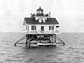
 Roanoke marshes light.JPG Croatan Sound 35°48′40″N75°42′02″W / 35.81111°N 75.70056°W / 35.81111; -75.70056 1831 (First)
1877 (Last)
Never1955 A
(Destroyed)
NoneUnknown
Roanoke River Light Roanoke River Light.jpg Albemarle Sound 36°03′22″N76°36′39″W / 36.056029°N 76.610905°W / 36.056029; -76.610905 1867 (First)
1903 (Current)
Never1941 B
(Preserved)
None35 ft (11 m)
Wade Point Light Wade point light.JPG Pasquotank River
(Entrance)
N/A1855 (First)
1899 (Last)
Never1950s
(Destroyed)
NoneUnknown

Notes

A. ^ A replica of the 1877 lighthouse was built in 2004. [7]
B. ^ In 2003, a replica of the original 1866 lighthouse was built. [7]

Related Research Articles

Bald Head Island, North Carolina Village in North Carolina, United States

Bald Head Island, historically Smith Island, is a village located on the east side of the Cape Fear River in Brunswick County, North Carolina, United States. Compared to the nearby city of Wilmington to the north, the village of Bald Head Island is small and somewhat remote. It is accessible by ferry from the nearby town of Southport and by four-wheel drive vehicle along the beach strand from Fort Fisher to the north. Only government officials are allowed to drive the beach strand route. There are few cars on the island; instead, residents drive modified electric golf carts. Bald Head Island is nationally recognized for its sea turtle nesting activity.

Screw-pile lighthouse

A screw-pile lighthouse is a lighthouse which stands on piles that are screwed into sandy or muddy sea or river bottoms. The first screw-pile lighthouse to begin construction was built by the blind Irish engineer Alexander Mitchell. Construction began in 1838 at the mouth of the Thames and was known as the Maplin Sands lighthouse, and first lit in 1841. However, though its construction began later, the Wyre Light in Fleetwood, Lancashire, was the first to be lit.

Bald Head Light Lighthouse in North Carolina, US

Bald Head Lighthouse, known as Old Baldy, is the oldest lighthouse still standing in North Carolina. It is the second of three lighthouses that have been built on Bald Head Island since the 19th century to help guide ships past the dangerous shoals at the mouth of the Cape Fear river.

American Shoal Light Lighthouse in Florida, US

The American Shoal Light is located east of the Saddlebunch Keys, just offshore from Sugarloaf Key, close to Looe Key, in Florida, United States. It was completed in 1880, and first lit on July 15, 1880. The structure was built to the same plan and dimensions as the Fowey Rocks lighthouse, completed in 1878.

Unmanned reef lights of the Florida Keys Lighthouses in Florida, United States

The unmanned reef lights of the Florida Keys were navigational aids erected near the Florida Keys between 1921 and 1935. They were intended to mark local hazards and did not need to be visible for as far as the reef lights that were erected near the Keys during the 19th century. By the time the lights in this list were erected, older lighthouses were being automated, and these new lights were designed to be automated from the start. The lights resembled the older reef lights in having a wrought iron skeletal pyramidal structure on a screw-pile foundation. They all originally had lanterns on their peaks, so that they looked like smaller versions of the older reef lights, but had no keeper's quarters.

Gravelly Shoal Light Lighthouse in Michigan, United States

Gravelly Shoals Light is an automated lighthouse that is an active aid to navigation on the shallow shoals extending southeast from Point Lookout on the western side of Saginaw Bay. The light is situated about 2.7 miles (4.3 km) offshore and was built to help guide boats through the deeper water between the southeast end of Gravelly Shoals and Charity Island. Architecturally this is considered to be Art Deco style.

Texas Tower (lighthouse)

A Texas Tower lighthouse is a structure which is similar to an off-shore oil platform. Seven of these structures were built in the 1960s off the shores of the United States. Automation started in the late 1970s, which led to the obsolescence of the housing built for the keepers which resulted in such a large structure. Three of the towers were dismantled over time due to deteriorating structural conditions among other problems, while another one was destroyed in a ship collision. The last Texas Tower was deactivated in 2016 having served for over half a century. Today only three of the former lights remain.

Patos Island Light Lighthouse

Patos Island Lighthouse is an active aid to navigation overlooking the Strait of Georgia at Alden Point on the western tip of Patos Island in the San Juan Islands, San Juan County, Washington, in the United States. The station is the northernmost in the San Juan Islands and marks the division point between the eastern and western passages into the Strait of Juan de Fuca.

Stratford Shoal Light Lighthouse

Stratford Shoal Light, officially Stratford Shoal Light, is a lighthouse on a shoal in the middle of Long Island Sound approximately halfway between Port Jefferson, New York and Bridgeport, Connecticut.

Wolf Trap Light Lighthouse in Virginia, United States

Wolf Trap Light is a caisson lighthouse in the Virginia portion of the Chesapeake Bay, about seven and a half miles northeast of New Point Comfort Light. It is listed on the National Register of Historic Places.

Thimble Shoal Light Lighthouse in Virginia, United States

Thimble Shoal Light is a sparkplug lighthouse in the Virginia portion of Chesapeake Bay, north of the Hampton Roads channel. The third light at this location, it is listed on the National Register of Historic Places.

White Shoal Light, Michigan Lighthouse in Michigan, United States

The White Shoal Light is a lighthouse located 20 miles (32 km) west of the Mackinac Bridge in Lake Michigan. It is an active aid to navigation. It is also the tallest lighthouse on the Great Lakes.

Old Plantation Flats Light Lighthouse in Virginia, United States

The Old Plantation Flats Light was a lighthouse located in the Chesapeake Bay marking the channel to Cape Charles, Virginia.

Waugoshance Light Lighthouse in Michigan, United States

The ruined lighthouse at Waugoshance protects boats from a shoal area at the northern end of Lake Michigan. The lighthouse is located in Emmet County, Michigan, United States, and in U.S. Coast Guard District No. 9. It is about 15 miles (24 km) west of Mackinaw City. Due to erosion and deterioration, the lighthouse is deteriorating and critically endangered, and likely to fall into the lake in the near future.

Rock of Ages Light Lighthouse in Michigan, United States

The Rock of Ages Light is a U.S. Coast Guard lighthouse on a small rock outcropping approximately 2.25 miles (3.62 km) west of Washington Island and 3.5 miles (5.6 km) west of Isle Royale, in Eagle Harbor Township, Keweenaw County, Michigan. It is an active aid to navigation.

Diamond Shoal Light Lighthouse in North Carolina, United States

Diamond Shoal Light is an inactive offshore lighthouse marking Diamond Shoals off Cape Hatteras.

East Charity Shoal Light Lighthouse

East Charity Shoal Light is an offshore lighthouse located near the Saint Lawrence River's entrance in northeastern Lake Ontario, due south of the city of Kingston, Ontario and approximately five miles (8 km) southwest of Wolfe Island. It is on the southeast rim of a 3,300-foot-diameter (1,000 m) submerged circular depression known as Charity Shoal Crater that may be the remnants of a meteorite impact.

Gull Rock Light Station Lighthouse in Michigan, United States

The Gull Rock Light Station is an active lighthouse located on Gull Rock, just west of Manitou Island, off the tip of Michigan's Keweenaw Peninsula in Lake Superior. The light was listed on the National Register of Historic Places in 1984, even as its condition deteriorated, resulting in its placement on the Lighthouse Digest Doomsday List.

References

  1. "Bald Head Lighthouse". Lighthouse Friends. Retrieved October 14, 2017.
  2. 1 2 3 "Name: Campbell's Island Light". Lighthouse Digest . Retrieved October 14, 2017.
  3. "National Data Buoy Center: Station DSLN7". Data Buoy Detail. NOAA, US National Data Buoy Center. Retrieved 2009-03-13.
  4. 1 2 3 Rebecca Taylor & Gayle Keresey (November 4, 2013). "The Search for the Federal Point Lighthouse". federal-point-history.org. Retrieved October 14, 2017.
  5. "Gull Shoal Lighthouse". Lighthouse Friends. Retrieved February 9, 2021.
  6. "Report for Gull Shoal Light Station (North Carolina) - 1909". United States Lighthouse Society. 1909.
  7. 1 2 3 4 5 6 Rowlett, Russ. "Lighthouses of the United States: North Carolina". The Lighthouse Directory. University of North Carolina at Chapel Hill . Retrieved October 14, 2017.