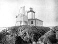
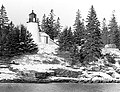
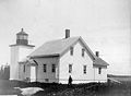
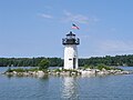
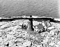
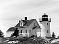
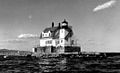
Name Image Location Coordinates Year first lit Automated Year deactivated Current Lens Focal Height Avery Rock Light Machias (Machias Bay ) 44°39′14″N 67°20′38″W / 44.654°N 67.344°W / 44.654; -67.344 (Avery Rock Light ) [ 11] 1875 1926 1947(Destroyed) None 056 56 ft (17 m) [ 11] Baker Island Light Cranberry Isles (Baker Island ) 44°14′17″N 68°11′56″W / 44.2381°N 68.1990°W / 44.2381; -68.1990 (Baker Island Light ) 1828 (Former) (Current) 1966 Active Fourth-order Fresnel 105 105 ft (32 m) Bass Harbor Head Light Tremont (Mount Desert Island ) 44°13′18″N 68°20′14″W / 44.2218°N 68.3373°W / 44.2218; -68.3373 (Bass Harbor Head Light ) 1858 1974 Active Fourth-order Fresnel 056 56 ft (17 m) Bear Island Light Cranberry Isles (Bear Island ) 44°17′02″N 68°16′12″W / 44.2838°N 68.270°W / 44.2838; -68.270 (Bear Island Light ) 1839 (Former) (Current) 1989 Active(Inactive: 1981–1989) Plastic 100 100 ft (30 m) Blue Hill Bay Light Blue Hill (Blue Hill Bay ) 44°14′56″N 68°29′52″W / 44.2489°N 68.4977°W / 44.2489; -68.4977 (Blue Hill Bay Light ) [ 12] 1857 (Former) (Current) 1935 1935 (Former) (Current) Unknown 025 25 ft (7.6 m) Boon Island Light York (Boon Island ) 43°07′17″N 70°28′35″W / 43.1214°N 70.4764°W / 43.1214; -70.4764 (Boon Island Light ) 1811 (Former) (Current) 1980 Active VRB-25 137 137 ft (42 m) Browns Head Light Vinalhaven (Browns Head) 44°06′42″N 68°54′34″W / 44.1118°N 68.9095°W / 44.1118; -68.9095 (Browns Head Light ) 1832 (Former) (Current) 1987 Active Fifth-order Fresnel 039 39 ft (12 m) Burnt Coat Harbor Light Swan's Island (Hockamock Head) 44°08′03″N 68°26′50″W / 44.1341°N 68.4472°W / 44.1341; -68.4472 (Burnt Coat Harbor Light ) 1872 1975 Active Unknown 075 75 ft (23 m) Burnt Island Light Boothbay Harbor (Burnt Island) 43°49′31″N 69°38′25″W / 43.8252°N 69.6402°W / 43.8252; -69.6402 (Burnt Island Light ) 1821 1988 Active Electrified beacon 061 61 ft (19 m) Cape Elizabeth Lights Cape Elizabeth (Casco Bay ) 43°33′58″N 70°12′00″W / 43.5661°N 70.2001°W / 43.5661; -70.2001 (East Cape Elizabeth Light ) (East tower) 43°33′51″N 70°12′09″W / 43.5642°N 70.2025°W / 43.5642; -70.2025 (Cape Elizabeth Light ) (West tower) [ 13] 1828 (West tower) (East tower) 1963 (East) 1924 (West) (East) VRB-25 129 129 ft (39 m) Cape Neddick Light York (Cape Neddick ) 43°09′55″N 70°36′28″W / 43.1652°N 70.6078°W / 43.1652; -70.6078 (Cape Neddick Light ) 1879 1987 Active Fourth-order Fresnel 088 88 ft (27 m) Crabtree Ledge Light Frenchman Bay (Crabtree Neck) 44°28′12″N 68°12′11″W / 44.470°N 68.203°W / 44.470; -68.203 (Crabtree Ledge Light ) [ 14] 1890 Never 1933(Destroyed in 1950 [ 15] ) None 037 37 ft (11 m) [ 15] Cuckolds Light Boothbay Harbor (Cuckold Islets) 43°46′46″N 69°39′00″W / 43.7795°N 69.6500°W / 43.7795; -69.6500 (The Cuckolds Light ) 1892 (Former) (Current) 1972 Active VRB-25 059 59 ft (18 m) Curtis Island Light Camden (Penobscot Bay ) 44°12′05″N 69°02′56″W / 44.2014°N 69.0489°W / 44.2014; -69.0489 (Curtis Island Light ) 1835 (Former) (Current) 1972 Active Unknown 052 52 ft (16 m) Deer Island Thorofare Light Stonington ?(Penobscot Bay ) 44°08′04″N 68°42′12″W / 44.1344°N 68.7033°W / 44.1344; -68.7033 (Deer Island Thorofare Light ) 1857 1958 Active 250mm 052 52 ft (16 m) Dice Head Light Castine 44°22′58″N 68°49′07″W / 44.3827°N 68.8186°W / 44.3827; -68.8186 (Dice Head Light ) 1829 1937 Active(Inactive: 1937–2007) [ 16] Unknown 134 134 ft (41 m) Doubling Point Range Lights Arrowsic (Arrowsic Island) 43°52′58″N 69°47′45″W / 43.8828°N 69.7957°W / 43.8828; -69.7957 (Doubling Point Range Front Light ) (Front light) 43°53′05″N 69°47′45″W / 43.8848°N 69.7957°W / 43.8848; -69.7957 (Doubling Point Range Rear Light ) (Rear light) 1898 1980 Active Unknown 018 18 ft (5.5 m) (Front light) 33 ft (10 m) (Rear light) Doubling Point Light Arrowsic 43°52′57″N 69°48′24″W / 43.8825°N 69.8068°W / 43.8825; -69.8068 (Doubling Point Light ) 1898 1988 Active Fifth-order Fresnel 023 23 ft (7.0 m) Eagle Island Light Eagle Island (Penobscot Bay ) 44°13′03″N 68°46′04″W / 44.2176°N 68.7678°W / 44.2176; -68.7678 (Eagle Island Light ) 1838 (Former) (Current) 1959 Active Fourth-order Fresnel 023 23 ft (7.0 m) Egg Rock Light Frenchman Bay 44°21′14″N 68°08′18″W / 44.3539°N 68.1383°W / 44.3539; -68.1383 (Egg Rock Light ) 1875 1976 Active VRB-25 064 64 ft (20 m) Fort Point Light Stockton Springs (Penobscot River ) 44°28′02″N 68°48′42″W / 44.4671°N 68.8117°W / 44.4671; -68.8117 (Fort Point Light ) 1836 (Former) (Current) 1988 Active Fourth-order Fresnel 088 88 ft (27 m) Franklin Island Light Franklin Island (Muscongus Bay ) 43°53′32″N 69°22′29″W / 43.8921°N 69.3746°W / 43.8921; -69.3746 (Franklin Island Light ) 1805 (Former) (Current) 1967 Active 250mm 057 57 ft (17 m) Goat Island Light Kennebunkport (Cape Porpoise ) 43°21′28″N 70°25′30″W / 43.3579°N 70.4251°W / 43.3579; -70.4251 (Goat Island Light ) 1835 (Former) (Current) 1990 Active 300mm 038 38 ft (12 m) Goose Rocks Light North Haven (Penobscot Bay ) 44°08′07″N 68°49′51″W / 44.1354°N 68.8307°W / 44.1354; -68.8307 (Goose Rocks Light ) 1890 1963 Active 250mm 051 51 ft (16 m) Great Duck Island Light Frenchboro (Great Duck Island ) 44°08′31″N 68°14′45″W / 44.1420°N 68.2458°W / 44.1420; -68.2458 (Great Duck Island Light ) 1890 1986 Active VRB-25 067 67 ft (20 m) Grindel Point Light Islesboro 44°16′53″N 68°56′35″W / 44.2814°N 68.9431°W / 44.2814; -68.9431 (Grindel Point Light ) 1874 1934 Active(Inactive: 1934–1987) [ 17] 250mm 067 67 ft (20 m) Halfway Rock Light Casco Bay 43°39′21″N 70°02′12″W / 43.6558°N 70.0368°W / 43.6558; -70.0368 (Halfway Rock Light ) 1871 1975 Active VRB-25 076 76 ft (23 m) Hendricks Head Light Southport (Sheepscot River ) 43°49′21″N 69°41′23″W / 43.8226°N 69.6897°W / 43.8226; -69.6897 (Hendricks Head Light ) 1829 (Former) (Current) 1951 Active(Inactive: 1933–1951) [ 18] 250mm 043 43 ft (13 m) Heron Neck Light Vinalhaven (Penobscot Bay ) 44°01′30″N 68°51′44″W / 44.0251°N 68.8622°W / 44.0251; -68.8622 (Heron Neck Light ) 1854 1984 Active Fifth-order Fresnel 092 92 ft (28 m) Indian Island Light Rockport 44°09′56″N 69°03′40″W / 44.1655°N 69.0610°W / 44.1655; -69.0610 (Indian Island Light ) [ 19] 1850 (Former) (Current) Never 1934 None Unknown Isle Au Haut Light Isle au Haut 44°03′53″N 68°39′05″W / 44.0647°N 68.6514°W / 44.0647; -68.6514 (Isle Au Haut Light ) 1907 1934 Active 250mm 048 48 ft (15 m) Ladies Delight Light Winthrop, Maine (Lake Cobbosseecontee) 1908 1930s Active Unknown 025 25 ft (7.6 m) Libby Island Light Machiasport (Machias Bay ) 44°34′06″N 67°22′03″W / 44.5683°N 67.3674°W / 44.5683; -67.3674 (Libby Island Light ) 1822 (Former) (Current) 1974 Active VRB-25 091 91 ft (28 m) Little River Light Cutler 44°39′03″N 67°11′32″W / 44.6509°N 67.1921°W / 44.6509; -67.1921 (Little River Light ) 1846 (Former) (Current) 1975 Active(Inactive: 1975–2001) [ 1] VRB-25 056 56 ft (17 m) Lubec Channel Light Lubec 44°50′32″N 66°58′36″W / 44.8421°N 66.9766°W / 44.8421; -66.9766 (Lubec Channel Light ) 1890 1939 Active 155mm 053 53 ft (16 m) Machias Seal Island Washington County, Maine (mouth of Bay of Fundy ) 44°30′06″N 67°06′06″W / 44.5018°N 67.1018°W / 44.5018; -67.1018 (Machias Seal Island Light ) 1832 (Former) (Current) 1995 Active Unknown 65 ft (19.8 m) 65 ft (20 m) Marshall Point Light Port Clyde 43°55′03″N 69°15′41″W / 43.9174°N 69.2613°W / 43.9174; -69.2613 (Marshall Point Light ) 1832 (Former) (Current) 1980 Active 300mm 030 30 ft (9.1 m) Matinicus Rock Light Matinicus Isle 43°47′01″N 68°51′18″W / 43.7835°N 68.8550°W / 43.7835; -68.8550 (Matinicus Rock Light ) 1827 (Former) (Current towers) 1983 1924(North tower) (South tower) VRB-25 090 90 ft (27 m) Monhegan Island Light Monhegan (Monhegan Island) 43°45′53″N 69°18′57″W / 43.7648°N 69.3158°W / 43.7648; -69.3158 (Monhegan Island Light ) 1824 (Former) (Current) 1959 Active VRB-25 178 178 ft (54 m) Moose Peak Light Mistake Island 44°28′29″N 67°31′55″W / 44.4746°N 67.5320°W / 44.4746; -67.5320 (Moose Peak Light ) 1827 (Former) (Current) 1972 Active DCB-24 072 72 ft (22 m) Mount Desert Light Mount Desert Rock(Near Mount Desert Island ) 43°58′07″N 68°07′42″W / 43.9686°N 68.1283°W / 43.9686; -68.1283 (Mount Desert Light ) 1830 (Former) (Current) 1977 Active VRB-25 075 75 ft (23 m) Narraguagus Light Narraguagus Bay 44°27′22″N 67°49′52″W / 44.456°N 67.8312°W / 44.456; -67.8312 (Narraguagus Light ) [ 20] 1853 Never 1934 None 054 54 ft (16 m) [ 21] Nash Island Light Pleasant Bay 44°27′51″N 67°44′50″W / 44.4643°N 67.7473°W / 44.4643; -67.7473 (Nash Island Light ) [ 22] 1838 (Former) (Current) 1958 1982 None 051 51 ft (16 m) [ 23] Owls Head Light Owls Head (Penobscot Bay ) 44°05′32″N 69°02′38″W / 44.0922°N 69.0440°W / 44.0922; -69.0440 (Owls Head Light ) 1825 1989 Active Fourth-order Fresnel 100 100 ft (30 m) Pemaquid Point Light Bristol 43°50′12″N 69°30′21″W / 43.8368°N 69.5058°W / 43.8368; -69.5058 (Pemaquid Point Light ) 1827 (Former) (Current) 1934 Active Fourth-order Fresnel 079 79 ft (24 m) Perkins Island Light Georgetown (Perkins Island) 43°47′12″N 69°47′07″W / 43.7868°N 69.7852°W / 43.7868; -69.7852 (Perkins Island Light ) 1898 1959 Active 250mm 041 41 ft (12 m) Petit Manan Light Milbridge (Petit Island ) 44°22′03″N 67°51′52″W / 44.3676°N 67.8644°W / 44.3676; -67.8644 (Petit Manan Light ) 1817 (Former) (Current) 1972 Active VRB-25 123 123 ft (37 m) Pond Island Light Kennebec River 43°44′24″N 69°46′13″W / 43.7400°N 69.7703°W / 43.7400; -69.7703 (Pond Island Light ) 1821 (Former) (Current) 1963 Active 250mm 052 52 ft (16 m) Portland Breakwater Light South Portland 43°39′20″N 70°14′06″W / 43.6555°N 70.2349°W / 43.6555; -70.2349 (Portland Breakwater Light ) 1855 (Former) (Current) 1934 Active(Inactive: 1942–2002) Unknown 030 30 ft (9.1 m) Portland Head Light Cape Elizabeth (Casco Bay ) 43°37′23″N 70°12′28″W / 43.6231°N 70.2079°W / 43.6231; -70.2079 (Portland Head Light ) 1791 1989 Active DCB-224 101 101 ft (31 m) Prospect Harbor Point Light Gouldsboro (Prospect Harbor ) 44°24′12″N 68°00′47″W / 44.4034°N 68.0130°W / 44.4034; -68.0130 (Prospect Harbor Point Light ) 1850 (Former) (Current) 1951 Active Optic 042 42 ft (13 m) Pumpkin Island Light Deer Isle (Pumpkin Island) 44°18′33″N 68°44′34″W / 44.3092°N 68.7428°W / 44.3092; -68.7428 (Pumpkin Island Light ) [ 24] 1854 Never 1933 None Unknown Ram Island Ledge Light Cape Elizabeth (Casco Bay ) 43°37′53″N 70°11′15″W / 43.6315°N 70.1874°W / 43.6315; -70.1874 (Ram Island Ledge Light ) 1905 1959 Active Third-order Fresnel 077 77 ft (23 m) Ram Island Light Boothbay Harbor 43°48′14″N 69°35′57″W / 43.8038°N 69.5992°W / 43.8038; -69.5992 (Ram Island Light ) 1883 1965 Active Unknown 036 36 ft (11 m) Rockland Harbor Breakwater Light Rockland 44°06′14″N 69°04′39″W / 44.1040°N 69.0775°W / 44.1040; -69.0775 (Rockland Harbor Breakwater Light ) 1827 (Former) (Current) 1964 Active VRB-25 039 39 ft (12 m) Saddleback Ledge Light Saddleback Ledge(Penobscot Bay ) 44°00′52″N 68°43′35″W / 44.0144°N 68.7264°W / 44.0144; -68.7264 (Saddleback Ledge Light ) 1839 1954 Active 300mm 054 54 ft (16 m) Saint Croix River Light St. Croix River 45°07′42″N 67°08′02″W / 45.1282°N 67.1338°W / 45.1282; -67.1338 (Saint Croix River Light ) 1857 (Former) (Current) 1976 Active Unknown 077 77 ft (23 m) [ 25] Seguin Light Georgetown 43°42′27″N 69°45′29″W / 43.7075°N 69.7580°W / 43.7075; -69.7580 (Seguin Light ) 1795 (Former) (Current) 1985 2019 (Temporary) [ 26] First-order Fresnel 180 180 ft (55 m) Spring Point Ledge Light South Portland 43°39′08″N 70°13′26″W / 43.6521°N 70.2239°W / 43.6521; -70.2239 (Spring Point Ledge Light ) 1897 1934 Active Fifth-order Fresnel 054 54 ft (16 m) Squirrel Point Light Arrowsic (Arrowsic Island) 43°48′59″N 69°48′09″W / 43.8165°N 69.8024°W / 43.8165; -69.8024 (Squirrel Point Light ) 1898 1982 Active 250mm 025 25 ft (7.6 m) Tenants Harbor Light St. George (Southern Island) 43°57′40″N 69°11′05″W / 43.9611°N 69.1848°W / 43.9611; -69.1848 (Tenants Harbor Light ) [ 27] 1857 Never 1933 None 027 27 ft (8.2 m) [ 28] Two Bush Island Light Two Bush Island(Penobscot Bay ) 43°57′51″N 69°04′26″W / 43.9642°N 69.0739°W / 43.9642; -69.0739 (Two Bush Island Light ) 1897 1964 Active VRB-25 065 65 ft (20 m) West Quoddy Head Light Lubec 44°48′54″N 66°57′03″W / 44.8151°N 66.9507°W / 44.8151; -66.9507 (West Quoddy Head Light ) 1808 (Former) (Current) 1988 Active Third-order Fresnel 083 83 ft (25 m) Whaleback Light Kittery (Piscataqua River ) 43°03′32″N 70°41′47″W / 43.0588°N 70.6963°W / 43.0588; -70.6963 (Whaleback Light ) 1820 (Former) (Current) 1963 Active VLB-44 059 59 ft (18 m) Whitehead Light St. George (Whitehead Island ) 43°58′43″N 69°07′27″W / 43.9787°N 69.1243°W / 43.9787; -69.1243 (Whitehead Light ) 1807 (Former) (Current) 1982 Active 300mm 075 75 ft (23 m) Whitlocks Mill Light St. Croix River 45°09′45″N 67°13′39″W / 45.1626°N 67.2274°W / 45.1626; -67.2274 (Whitlocks Mill Light ) 1892 (Former) (Current) 1969 Active VLB-44 032 32 ft (9.8 m) Winter Harbor Light Winter Harbor 44°21′41″N 68°05′15″W / 44.3614°N 68.0876°W / 44.3614; -68.0876 (Winter Harbor Light ) [ 29] 1856 Never 1933 None 037 37 ft (11 m) [ 29] Wood Island Light Biddeford (Biddeford Pool ) 43°27′25″N 70°19′45″W / 43.4569°N 70.3291°W / 43.4569; -70.3291 (Wood Island Light ) 1808 (Former) (Current) 1986 Active VLB-44 071 71 ft (22 m)