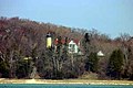
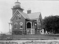
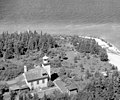
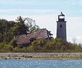
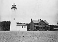
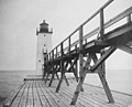
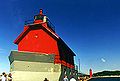
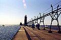
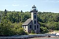
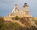
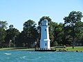
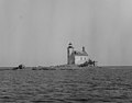
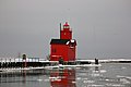
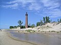
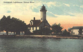
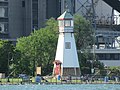
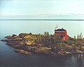
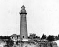
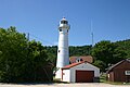
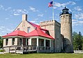
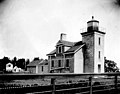
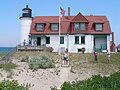
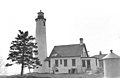
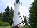
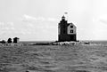
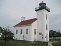
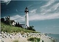
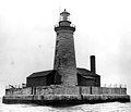
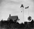
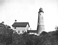
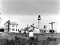
Name Waterway Location Coordinates Image Focal Built [ note 1] Automated Deactivated Status Alpena Light Lake Huron Alpena 45°03′38″N 83°25′22″W / 45.06042°N 83.4229°W / 45.06042; -83.4229 (Alpena Light ) 044 44 ft (13 m) 1877/1914 1974 Active Au Sable Light Lake Superior Burt Township, Alger County 46°40′23″N 86°08′22″W / 46.67306°N 86.13933°W / 46.67306; -86.13933 (Au Sable Light ) 100 100 ft (30 m) 1874 1958 Active Au Sable North Pierhead Light Lake Huron Au Sable 44°24′24″N 83°18′59″W / 44.40662°N 83.3165°W / 44.40662; -83.3165 (Au Sable North Pierhead Light ) 025 25 ft (7.6 m) Active Beaver Island Harbor Light Lake Michigan Beaver Island , northern end 45°44′34″N 85°30′31″W / 45.74278°N 85.50861°W / 45.74278; -85.50861 (Beaver Island Harbor Light ) 038 38 ft (12 m) 1856/1870 1927 Active [ note 2] Beaver Island Head Light Lake Michigan Beaver Island, southern tip 45°34′35″N 85°34′21″W / 45.57639°N 85.5725°W / 45.57639; -85.5725 (Beaver Island Head Light ) 103 103 ft (31 m) 1851 1962 Inactive [ note 3] Belle Isle Light Detroit River Belle Isle 000 Destroyed Big Bay Point Light Lake Superior Big Bay 46°50′25″N 87°40′55″W / 46.84028°N 87.68194°W / 46.84028; -87.68194 (Big Bay Point Light ) 089 89 ft (27 m) 1896 1941 1961–1990 Active [ note 4] Big Sable Point Light Lake Michigan Ludington 44°03′28″N 86°30′52″W / 44.05772°N 86.51444°W / 44.05772; -86.51444 (Big Sable Point Light ) 106 106 ft (32 m) 1867 Active Bois Blanc Light Lake Huron Bois Blanc Island 45°48′40″N 84°25′19″W / 45.811°N 84.422°W / 45.811; -84.422 (Bois Blanc Light ) 032 32 ft (9.8 m) 1867 1955 Inactive [ note 4] Caseville Harbor Light Lake Huron Caseville 43°56′36″N 83°16′22″W / 43.94347°N 83.27278°W / 43.94347; -83.27278 (Caseville Harbor Light ) 065 65 ft (20 m) Active Cedar River Light Lake Michigan Cedar River 45°24′26″N 87°21′04″W / 45.40735°N 87.35103°W / 45.40735; -87.35103 (Cedar River Light ) 026 26 ft (7.9 m) Active Charity Island Light Lake Huron Charity Island 44°01′53″N 83°26′08″W / 44.03139°N 83.43556°W / 44.03139; -83.43556 (Charity Island Light ) 045 45 ft (14 m) 1857 1939 Inactive [ note 4] Charlevoix South Pier Light Station Lake Michigan Charlevoix 45°19′22″N 85°16′11″W / 45.32278°N 85.26972°W / 45.32278; -85.26972 (Charlevoix South Pier Light Station ) 041 41 ft (12 m) 1914/1948 Active Cheboygan Crib Light Lake Huron Cheboygan 45°39′24″N 84°27′54″W / 45.6568°N 84.465°W / 45.6568; -84.465 (Cheboygan Crib Light ) 035 35 ft (11 m) 1857/1901 1920 1984 Inactive/Moved [ note 5] Cheboygan River Front Range Light Lake Huron Cheboygan 45°38′51″N 84°28′22″W / 45.64739°N 84.47276°W / 45.64739; -84.47276 (Cheboygan River Front Range Light ) 048 48 ft (15 m) 1880 Active Clinton River Light Lake St. Clair Mount Clemens 000 1847 1872 Destroyed [ 3] Copper Harbor Front Range Light Lake Superior Copper Harbor 47°28′52″N 87°52′00″W / 47.48111°N 87.86667°W / 47.48111; -87.86667 (Copper Harbor Front Range Light ) 028 28 ft (8.5 m) 1869 Active Copper Harbor Light Lake Superior Copper Harbor 47°28′28″N 87°51′37″W / 47.47447°N 87.86025°W / 47.47447; -87.86025 (Copper Harbor Light ) 090 90 ft (27 m) 1849/1933 1919 Active Crisp Point Light Lake Superior McMillan Township, Luce County 46°45′10″N 85°15′26″W / 46.75288°N 85.25733°W / 46.75288; -85.25733 (Crisp Point Light ) 062 62 ft (19 m) 1904 1947 Inactive/Museum DeTour Reef Light Lake Huron De Tour Village 45°56′56″N 83°54′11″W / 45.94892°N 83.90305°W / 45.94892; -83.90305 (DeTour Reef Light ) 074 74 ft (23 m) 1847/1931 1974 Active Detroit River Light Lake Erie Rockwood 42°00′03″N 83°08′26″W / 42.00075°N 83.14068°W / 42.00075; -83.14068 (Detroit River Light ) 055 55 ft (17 m) 1875/1885 1979 Active Eagle Harbor Light Lake Superior Eagle Harbor 47°27′35″N 88°09′33″W / 47.45972°N 88.15917°W / 47.45972; -88.15917 (Eagle Harbor Light ) 060 60 ft (18 m) 1851/1871 1980 Active Eagle Harbor Range Lights Lake Superior Eagle Harbor 47°27′20″N 88°09′12″W / 47.45562°N 88.15339°W / 47.45562; -88.15339 (Eagle Harbor Range Lights ) 000 1877 1911 Inactive [ note 6] [ 4] Eagle River Light Lake Superior Eagle River 47°24′49″N 88°17′54″W / 47.41369°N 88.29828°W / 47.41369; -88.29828 (Eagle River Light ) 000 1854/1857 1908 Inactive [ note 4] Ecorse Light Detroit River Ecorse 032 32 ft (9.8 m) 1895 Destroyed [ 5] Ecorse Range Rear Light Detroit River Ecorse 045 45 ft (14 m) 1894 Destroyed [ 6] Fort Gratiot Light Lake Huron Port Huron 43°00′23″N 82°25′21″W / 43.0063°N 82.42247°W / 43.0063; -82.42247 (Fort Gratiot Light ) 082 82 ft (25 m) 1825/1829 1933 Active Forty Mile Point Light Lake Huron Rogers Township, Presque Isle County 45°29′12″N 83°54′48″W / 45.48667°N 83.91333°W / 45.48667; -83.91333 (Forty Mile Point Light ) 066 66 ft (20 m) 1897 1969 Active Fourteen Foot Shoal Light Lake Huron Cheboygan County 45°40′47″N 84°26′06″W / 45.67981°N 84.435°W / 45.67981; -84.435 (Fourteen Foot Shoal Light ) 051 51 ft (16 m) 1930 Yes Active Fourteen Mile Point Light Lake Superior Ontonagon 46°59′34″N 89°07′33″W / 46.99285°N 89.12573°W / 46.99285; -89.12573 (Fourteen Mile Point Light ) 000 1894 1934 Inactive [ note 4] Frankfort Light Lake Michigan Frankfort 44°37′50″N 86°15′08″W / 44.6306°N 86.2522°W / 44.6306; -86.2522 (Frankfort Light ) 072 72 ft (22 m) 1873/1932 Yes Active Frankfort South Range Light Lake Michigan Frankfort 000 Destroyed Frying Pan Island Light St. Marys River De Tour Village 45°59′08″N 83°53′41″W / 45.98545°N 83.89471°W / 45.98545; -83.89471 (Frying Pan Island Light ) 000 1879/1882 Active [ note 7] Gibraltar Light Detroit River Gibraltar 000 1838/1873 1879 Destroyed [ 7] Grand Haven North Pierhead Light Lake Michigan Grand Haven 43°03′29″N 86°15′21″W / 43.05817°N 86.25589°W / 43.05817; -86.25589 (Grand Haven North Pierhead Light ) 036 36 ft (11 m) Active Grand Haven South Pierhead Entrance Light Lake Michigan Grand Haven 43°03′25″N 86°15′21″W / 43.05694°N 86.25592°W / 43.05694; -86.25592 (Grand Haven South Pierhead Entrance Light ) 042 42 ft (13 m) 1839/1905 1969 Active Grand Haven South Pierhead Inner Light Lake Michigan Grand Haven 43°03′26″N 86°15′14″W / 43.05725°N 86.25381°W / 43.05725; -86.25381 (Grand Haven South Pierhead Inner Light ) 052 52 ft (16 m) 1839/1905 1969 Active Grand Island East Channel Light Lake Superior Munising 46°27′01″N 86°37′21″W / 46.45017°N 86.62242°W / 46.45017; -86.62242 (Grand Island East Channel Light ) 000 1870 1913 Inactive Grand Island Harbor Rear Range Light Lake Superior Christmas 46°26′12″N 86°41′28″W / 46.43667°N 86.69111°W / 46.43667; -86.69111 (Grand Island Harbor Rear Range Light ) 070 70 ft (21 m) 1868/1914 1969 Inactive Grand Island North Light Lake Superior Grand Island 46°33′32″N 86°41′28″W / 46.55889°N 86.69111°W / 46.55889; -86.69111 (Grand Island North Light ) 000 1854/1867 1927 1961 Inactive [ note 4] Grand Marais Range Lights Lake Superior Grand Marais 46°41′02″N 85°58′20″W / 46.68389°N 85.97222°W / 46.68389; -85.97222 (Grand Marais Range Lights ) 054 54 ft (16 m) (inner)40 ft (12 m) (outer)1895 Active Grand Traverse Light Lake Michigan Leelanau Peninsula 45°13′N 85°33′W / 45.21°N 85.55°W / 45.21; -85.55 (Grand Traverse Light ) 047 47 ft (14 m) 1852/1858 1972 1972 Inactive/Museum Granite Island Light Lake Superior Granite Island 46°43′15″N 87°24′43″W / 46.72083°N 87.41194°W / 46.72083; -87.41194 (Granite Island Light ) 096 96 ft (29 m) 1868 1939 Active [ note 8] Grassy Island North Channel Range Lights Detroit River Grassy Island 000 1897 Destroyed Grassy Island South Channel Range Lights Grassy Island Light ) Detroit River Grassy Island 000 1849/1896 Destroyed Gravelly Shoal Light Lake Huron Saginaw Bay 44°01′06″N 83°32′14″W / 44.01833°N 83.53722°W / 44.01833; -83.53722 (Gravelly Shoal Light ) 075 75 ft (23 m) 1939 Active Grays Reef Light Lake Michigan Bliss Township, Emmet County 45°46′00″N 85°09′12″W / 45.76667°N 85.15333°W / 45.76667; -85.15333 (Grays Reef Light ) 082 82 ft (25 m) 1891/1936 1976 Active Grosse Ile North Channel Range Lights Detroit River Grosse Ile 000 1894/1906 1963 Destroyed (rear) [ note 4] Grosse Ile South Channel Range Lights Detroit River Grosse Ile 000 Active [ note 9] Gull Rock Light Lake Superior Manitou Island , offshore west 47°25′02″N 87°39′49″W / 47.41722°N 87.66361°W / 47.41722; -87.66361 (Gull Rock Light ) 050 50 ft (15 m) 1867 1913 Active Harbor Beach Light Lake Huron Harbor Beach, Michigan 43°50′42″N 82°37′54″W / 43.845°N 82.63167°W / 43.845; -82.63167 (Harbor Beach Light ) 054 54 ft (16 m) 1858/1885 1968 Active [ note 10] Harwood Point East Range Front Light St. Marys River Sugar Island 000 Destroyed Holland Harbor Light Lake Michigan Holland 42°46′22″N 86°12′45″W / 42.77269°N 86.21242°W / 42.77269; -86.21242 (Holland Harbor Light ) 052 52 ft (16 m) 1872/1936 1932 Active Huron Island Light Lake Superior Powell Township, Marquette County 46°57′48″N 87°59′54″W / 46.96333°N 87.99833°W / 46.96333; -87.99833 (Huron Island Light ) 197 197 ft (60 m) 1868/1877 1972 Active Ile Aux Galets Light Lake Michigan Emmet County 45°40′35″N 85°10′23″W / 45.67639°N 85.17306°W / 45.67639; -85.17306 (Ile Aux Galets Light ) 058 58 ft (18 m) 1850/1888 1969 Active Isle Royale Light Lake Superior Isle Royale 47°56′52″N 88°45′40″W / 47.9479°N 88.7612°W / 47.9479; -88.7612 (Isle Royale Light ) 072 72 ft (22 m) 1875 1913 Active Kalamazoo River Light Lake Michigan Saugatuck 000 1858 1914 Destroyed Keweenaw Waterway Lower Entrance Light Lake Superior Jacobsville 46°58′08″N 88°25′52″W / 46.96879°N 88.4311°W / 46.96879; -88.4311 (Keweenaw Waterway Lower Entrance Light ) 068 68 ft (21 m) 1868/1920 1973 Active Keweenaw Waterway Upper Entrance Light Lake Superior Stanton Township, Houghton County 47°14′04″N 88°37′49″W / 47.23454°N 88.63029°W / 47.23454; -88.63029 (Keweenaw Waterway Upper Entrance Light ) 082 82 ft (25 m) 1874/1950 1973 Active Lake St. Clair Light Lake St. Clair Harsens Island 42°30′31″N 82°41′54″W / 42.50854°N 82.69846°W / 42.50854; -82.69846 (Lake St. Clair Light ) 043 43 ft (13 m) 1941 Yes Active Lansing Shoals Light Lake Michigan Newton Township, Mackinac County 45°54′12″N 85°33′42″W / 45.90333°N 85.56167°W / 45.90333; -85.56167 (Lansing Shoals Light ) 069 69 ft (21 m) 1900/1928 1976 Active Little Sable Point Light Lake Michigan Golden Township, Oceana County 43°39′06″N 86°32′20″W / 43.65167°N 86.53889°W / 43.65167; -86.53889 (Little Sable Point Light ) 108 108 ft (33 m) 1874 1955 Active Little Traverse Light Lake Michigan Harbor Springs 45°25′09″N 84°58′39″W / 45.41919°N 84.97741°W / 45.41919; -84.97741 (Little Traverse Point Light ) 072 72 ft (22 m) 1884/1963 Active [ note 11] Ludington Light Lake Michigan Ludington 43°57′13″N 86°28′10″W / 43.95361°N 86.46937°W / 43.95361; -86.46937 (Ludington Point Light ) 055 55 ft (17 m) 1871/1924 1972 Active Mama Juda Light Detroit River Mamajuda Island 000 Destroyed Mama Juda Range Front Light Detroit River Mamajuda Island 000 Destroyed Manistee Main Light Lake Michigan Manistee 000 Destroyed Manistee Pierhead lights Lake Michigan Manistee 44°15′06″N 86°20′47″W / 44.2517°N 86.3464°W / 44.2517; -86.3464 (Manistee Pierhead lights ) 055 55 ft (17 m) (north)29 ft (8.8 m) (south)1875/1927 1927 Active Manistique East Breakwater Light Lake Michigan Manistique 45°56′41″N 86°14′52″W / 45.94478°N 86.24765°W / 45.94478; -86.24765 (Manistique East Breakwater Light ) 050 50 ft (15 m) 1915/1917 1969 Active Manitou Island Light Lake Superior Manitou Island 47°25′11″N 87°35′14″W / 47.41972°N 87.58722°W / 47.41972; -87.58722 (Manitou Island Light ) 081 81 ft (25 m) 1850/1861 1978 Active Manning Memorial Light Lake Michigan Empire 44°48′29″N 86°15′19″W / 44.80793°N 86.25521°W / 44.80793; -86.25521 (Manning Memorial Light ) 038 38 ft (12 m) 1990 Yes Active Mariners Memorial (River Rouge) Light Detroit River River Rouge 42°16′16″N 83°06′41″W / 42.27101°N 83.11128°W / 42.27101; -83.11128 (Mariners Memorial (River Rouge) Light ) 000 2003 [ 8] Active [ note 12] Marquette Breakwater Outer Light Lake Superior Marquette 46°32′02″N 87°22′29″W / 46.5338°N 87.37473°W / 46.5338; -87.37473 (Marquette Breakwater Outer Light ) 036 36 ft (11 m) 1875/1908 Active Marquette Harbor Light Lake Superior Marquette 46°32′48″N 87°22′34″W / 46.54669°N 87.37604°W / 46.54669; -87.37604 (Marquette Harbor Light ) 077 77 ft (23 m) 1853/1866 Active Martin Reef Light Lake Huron Clark Township, Mackinac County 45°54′48″N 84°08′54″W / 45.91333°N 84.14833°W / 45.91333; -84.14833 (Martin Reef Light ) 065 65 ft (20 m) 1927 Yes Active McGulpin Point Light Straits of Mackinac Wawatam Township, Emmet County 45°47′13″N 84°46′20″W / 45.7869°N 84.7722°W / 45.7869; -84.7722 (McGulpin Point Light ) 102 102 ft (31 m) 1869 Active Mendota (Bete Grise) Light Lake Superior Delaware 47°22′27″N 87°58′00″W / 47.37417°N 87.96667°W / 47.37417; -87.96667 (Mendota (Bete Grise) Light ) 044 44 ft (13 m) 1870/1895 1933 1960–1998 Active [ note 4] Menominee Pier Light Lake Michigan Menominee 45°06′50″N 87°35′10″W / 45.11392°N 87.58603°W / 45.11392; -87.58603 (Menominee Pier Light ) 046 46 ft (14 m) 1887/1927 1972 Active Middle Island Light Lake Huron Alpena Township, Alpena County 45°11′35″N 83°19′16″W / 45.19306°N 83.32111°W / 45.19306; -83.32111 (Middle Island Light ) 078 78 ft (24 m) 1905 Yes Active Middle Lake George Light St. Marys River Sugar Island 000 Destroyed Miller Memorial Light Lake St. Clair St. Clair Shores 42°27′50″N 82°52′45″W / 42.46375°N 82.87917°W / 42.46375; -82.87917 (Miller Memorial Light ) 270 270 ft (82 m) Active Minneapolis Shoal Light Lake Huron Big Bay de Noc 45°32′10″N 86°59′54″W / 45.53611°N 86.99833°W / 45.53611; -86.99833 (Minneapolis Shoal Light ) 082 82 ft (25 m) 1935 1979 Active Mission Point Light Lake Michigan Old Mission Point 44°59′29″N 85°28′46″W / 44.99131°N 85.47947°W / 44.99131; -85.47947 (Mission Point Light ) 047 47 ft (14 m) 1870 1933 Inactive Mission Point Light (1933) Lake Michigan Old Mission Point 45°01′06″N 85°30′22″W / 45.01823°N 85.50603°W / 45.01823; -85.50603 (Mission Point Light (1933) ) 041 41 ft (12 m) 1933 Inactive Monroe Pier Light Lake Erie Monroe 000 1849/1884 1916 Destroyed Munising Front Range Light Lake Superior Munising 46°24′54″N 86°39′40″W / 46.41512°N 86.66115°W / 46.41512; -86.66115 (Munising Front Range Light ) 079 79 ft (24 m) 1908 Yes Active Munising Rear Range Light Lake Superior Munising 46°24′45″N 86°39′50″W / 46.41254°N 86.66396°W / 46.41254; -86.66396 (Munising Rear Range Light ) 107 107 ft (33 m) 1908 Yes Active Muskegon Breakwater Light Lake Michigan Muskegon 45°11′27″N 83°20′49″W / 45.19075°N 83.34689°W / 45.19075; -83.34689 (Muskegon Breakwater Light ) 070 70 ft (21 m) 1851/1871 Active Muskegon Pier Light Lake Michigan Muskegon 43°13′36″N 86°20′29″W / 43.22665°N 86.34126°W / 43.22665; -86.34126 (Muskegon Pier Light ) 050 50 ft (15 m) 1903 Active Naubinway Island Light Lake Michigan Naubinway 46°04′32″N 85°26′42″W / 46.0756°N 85.44497°W / 46.0756; -85.44497 (Naubinway Island Light ) 032 32 ft (9.8 m) Active New Buffalo Light Lake Michigan New Buffalo 000 Destroyed North Manitou Island Light Lake Michigan North Manitou Island 45°03′47″N 85°57′50″W / 45.063°N 85.964°W / 45.063; -85.964 (North Manitou Island Light ) 000 1899 1935 Destroyed North Manitou Shoal Light Station Lake Michigan North Manitou Island 45°01′16″N 85°57′26″W / 45.021°N 85.95713°W / 45.021; -85.95713 (North Manitou Shoal Light ) 079 79 ft (24 m) 1935 1980 Active Old Mackinac Point Light Straits of Mackinac Mackinaw City 45°47′15″N 84°43′46″W / 45.7875°N 84.72944°W / 45.7875; -84.72944 (Old Mackinac Point Light ) 062 62 ft (19 m) 1889/1892 1957 Inactive Ontonagon Harbor West Breakwater Light Lake Superior Ontonagon 46°52′46″N 89°19′51″W / 46.87947°N 89.33084°W / 46.87947; -89.33084 (Ontonagon Harbor West Breakwater Light ) 031 31 ft (9.4 m) Active Ontonagon Light Lake Superior Ontonagon 46°52′25″N 89°19′07″W / 46.87361°N 89.31861°W / 46.87361; -89.31861 (Ontonagon Light ) 000 1852/1866 1964 Inactive Passage Island Light Lake Superior Isle Royale 48°13′25″N 88°21′56″W / 48.2237°N 88.36558°W / 48.2237; -88.36558 (Passage Island Light ) 078 78 ft (24 m) 1882 1978 Active Peche Island Rear Range Light Lake St. Clair Peche Island , offshore west 42°21′13″N 82°55′02″W / 42.3536°N 82.9172°W / 42.3536; -82.9172 (Peche Island Rear Range Light ) 114 114 ft (35 m) 1908/1983 Active [ note 13] Peninsula Point Light Lake Michigan Bay de Noc Township, Delta County 45°40′06″N 86°58′00″W / 45.6682°N 86.9666°W / 45.6682; -86.9666 (Peninsula Point Light ) 040 40 ft (12 m) 1856/1866 1922 1936 Inactive Pentwater North Pierhead Light Lake Michigan Pentwater 43°46′51″N 86°26′25″W / 43.78083°N 86.44028°W / 43.78083; -86.44028 (Pentwater North Pierhead Light ) 043 43 ft (13 m) Active Pipe Island Light St. Marys River Drummond Township, Chippewa County 46°00′59″N 83°53′57″W / 46.01633°N 83.8993°W / 46.01633; -83.8993 (Pipe Island Light ) 052 52 ft (16 m) 1888 1937 Active Poe Reef Light Lake Huron Bois Blanc Island, offshore 45°41′42″N 84°21′42″W / 45.695°N 84.36167°W / 45.695; -84.36167 (Poe Reef Light ) 071 71 ft (22 m) 1893/1929 1974 Active Point Betsie Light Lake Michigan Lake Township, Benzie County 44°41′29″N 86°15′19″W / 44.6913°N 86.2552°W / 44.6913; -86.2552 (Point Betsie Light ) 052 52 ft (16 m) 1854 1984 Active Point Iroquois Light Lake Superior Bay Mills Township, Chippewa County 46°29′01″N 84°37′32″W / 46.48368°N 84.62568°W / 46.48368; -84.62568 (Point Iroquois Light ) 072 72 ft (22 m) 1855/1871 1962 1971 Inactive Pointe aux Barques Light Lake Huron Port Hope 44°01′24″N 82°47′36″W / 44.02333°N 82.79333°W / 44.02333; -82.79333 (Pointe aux Barques Light ) 093 93 ft (28 m) 1848/1857 1958 Active Port Austin Light Lake Huron Port Austin , offshore 44°05′00″N 82°59′00″W / 44.08333°N 82.98333°W / 44.08333; -82.98333 (Port Austin Light ) 076 76 ft (23 m) 1878/1899 Yes Active Port Sanilac Light Lake Huron Port Sanilac 43°25′44″N 82°32′25″W / 43.42901°N 82.5402°W / 43.42901; -82.5402 (Port Sanilac Light ) 069 69 ft (21 m) 1886 1925 Active Portage Lake Light Lake Michigan Portage Lake 000 1891 Destroyed Portage River (Jacobsville) Light Lake Superior Torch Lake Township, Houghton County 46°58′41″N 88°24′50″W / 46.97803°N 88.41399°W / 46.97803; -88.41399 (Portage River (Jacobsville) Light ) 000 1856/1870 1920 Inactive [ note 4] Poverty Island Light Lake Michigan Poverty Island 45°31′38″N 86°39′49″W / 45.52722°N 86.66361°W / 45.52722; -86.66361 (Poverty Island Light ) 078 78 ft (24 m) 1874 1957 1976 Inactive Presque Isle Harbor Breakwater Light Lake Superior Marquette 46°34′27″N 87°22′28″W / 46.574144°N 87.374577°W / 46.574144; -87.374577 (Presque Isle Harbor Breakwater Light ) Presque Isle Light (new) Lake Huron Presque Isle Township, Presque Isle County 45°17′14″N 83°28′26″W / 45.28722°N 83.47389°W / 45.28722; -83.47389 (New Presque Isle Light ) 123 123 ft (37 m) 1871 1970 Active Presque Isle Light (old) Lake Huron Presque Isle Township, Presque Isle County 45°20′31″N 83°28′42″W / 45.34203°N 83.47828°W / 45.34203; -83.47828 (Old Presque Isle Light ) 036 36 ft (11 m) 1840 1871 Inactive/Museum Rock Harbor Light Lake Superior Rock Harbor 48°05′21″N 88°34′45″W / 48.08917°N 88.57917°W / 48.08917; -88.57917 (Rock Harbor Light ) 000 1855 1879 Inactive Rock of Ages Light Lake Superior Washington Island , offshore 47°52′00″N 89°18′48″W / 47.86667°N 89.31333°W / 47.86667; -89.31333 (Rock of Ages Light ) 130 130 ft (40 m) 1908 1978 Active Rouleau Point Range Front and Rear Lights Keweenaw Waterway Washington Island , offshore 47°11′44″N 88°36′58″W / 47.19549°N 88.61601°W / 47.19549; -88.61601 (Rouleau Point Range Rear Light ) 47°11′33″N 88°37′08″W / 47.19256°N 88.61885°W / 47.19256; -88.61885 (Rouleau Point Range Front Light ) 055 55 ft (17 m) (rear)26 ft (7.9 m) (front)1897/1937 Yes Active Round Island Light Straits of Mackinac Round Island 45°50′14″N 84°37′00″W / 45.83717°N 84.61658°W / 45.83717; -84.61658 (Round Island Light ) 053 53 ft (16 m) 1895 1924 1947–1996 Active Round Island Light (St. Mary's River) St. Marys River Round Island 46°06′32″N 84°01′12″W / 46.10897°N 84.01993°W / 46.10897; -84.01993 (Round Island Light (St. Mary's River) ) 000 1892 Inactive [ note 4] Round Island Passage Light Straits of Mackinac Round Island Channel 45°50′36″N 84°36′54″W / 45.84333°N 84.615°W / 45.84333; -84.615 (Round Island Passage Light ) 071 71 ft (22 m) 1947 1973 Active Saginaw Bay Light Lake Huron Bay City 000 1831 1876 Destroyed Saginaw River Rear Range Light Lake Huron Bay City 43°38′08″N 83°51′02″W / 43.6355°N 83.85056°W / 43.6355; -83.85056 (Saginaw River Rear Range Light ) 077 77 ft (23 m) 1876 1954 1962 Inactive [ note 4] Sand Beach North Entrance East Light Lake Huron 000 Destroyed Sand Hills Light Lake Superior Ahmeek 47°23′31″N 88°22′14″W / 47.39194°N 88.37042°W / 47.39194; -88.37042 (Sand Hills Light ) 093 93 ft (28 m) 1919 1939 1954 Inactive [ note 4] Sand Point Light Lake Michigan Escanaba 45°44′40″N 87°02′40″W / 45.74444°N 87.04444°W / 45.74444; -87.04444 (Sand Point Light ) 044 44 ft (13 m) 1867 1934 Inactive/Museum Sand Point Light (Baraga) Lake Superior Baraga 46°47′00″N 88°28′01″W / 46.78337°N 88.46685°W / 46.78337; -88.46685 (Sand Point Light (Baraga) ) 000 1878 1922 Inactive Seul Choix Light Lake Michigan Mueller Township, Schoolcraft County 45°55′17″N 85°54′43″W / 45.92139°N 85.91194°W / 45.92139; -85.91194 (Seul Choix Light ) 080 80 ft (24 m) 1892 1972 Active Six Mile Point Range Rear Light St. Marys River 000 Inactive/Moved [ note 14] South Fox Island Light Lake Michigan South Fox Island 45°22′43″N 85°50′14″W / 45.3785°N 85.8371°W / 45.3785; -85.8371 (South Fox Island Light ) 039 39 ft (12 m) 1867/1934 1969 Inactive South Haven Light Lake Michigan South Haven 42°24′08″N 86°17′04″W / 42.40222°N 86.28444°W / 42.40222; -86.28444 (South Haven Light ) 037 37 ft (11 m) 1872/1903 Yes Active South Manitou Island Light Lake Michigan South Manitou Island 45°00′28″N 86°05′38″W / 45.00768°N 86.09378°W / 45.00768; -86.09378 (South Manitou Island Light ) 054 54 ft (16 m) 1839/1872 1935 1967–2009 Active Spectacle Reef Light Lake Huron Cheboygan County 45°46′24″N 84°08′12″W / 45.77333°N 84.13667°W / 45.77333; -84.13667 (Spectacle Reef Light ) 086 86 ft (26 m) 1874 1972 Active Squaw Point Light Lake Michigan 000 Destroyed Squaw Island Light Lake Michigan Squaw Island 45°50′24″N 85°35′14″W / 45.8399°N 85.58713°W / 45.8399; -85.58713 (Squaw Island Light ) 000 1892 Inactive [ note 4] St. Clair Flats Front and Rear Range Light Lake St. Clair Harsens Island, offshore 42°32′15″N 82°41′41″W / 42.5375°N 82.69472°W / 42.5375; -82.69472 (St. Clair Flats Front and Rear Range Light ) 000 1859 Active [ note 15] St. Helena Island Light Straits of Mackinac St. Helena Island 45°51′18″N 84°51′48″W / 45.855°N 84.86333°W / 45.855; -84.86333 (St. Helena Island Light ) 071 71 ft (22 m) 1873 1922 Active St. Joseph North Pier Inner Light Lake Michigan St. Joseph 42°06′58″N 86°29′37″W / 42.1161°N 86.49348°W / 42.1161; -86.49348 (St. Joseph North Pier Inner Light ) 053 53 ft (16 m) 1832/1906 Active St. Joseph North Pier Outer Light Lake Michigan St. Joseph 42°06′59″N 86°29′40″W / 42.11633°N 86.49456°W / 42.11633; -86.49456 (St. Joseph North Pier Outer Light ) 031 31 ft (9.4 m) 1832/1906 Active St. Martin Island Light Lake Michigan St. Martin Island 45°30′10″N 86°45′27″W / 45.50278°N 86.7575°W / 45.50278; -86.7575 (St. Martin Island Light ) 081 81 ft (25 m) 1905 Inactive St. Mary's River Lower Range Front Light St. Marys River 000 Destroyed Stannard Rock Light Lake Superior Keweenaw Peninsula , offshore 47°11′01″N 87°13′30″W / 47.18351°N 87.22512°W / 47.18351; -87.22512 (Stannard Rock Light ) 102 102 ft (31 m) 1882 1962 Active Sturgeon Point Light Lake Huron Haynes Township, Michigan, Alcona County 44°42′46″N 83°16′22″W / 44.71269°N 83.27272°W / 44.71269; -83.27272 (Sturgeon Point Light ) 069 69 ft (21 m) 1869 1939 Active Tawas Point Light Lake Huron Baldwin Township, Iosco County 44°15′14″N 83°26′56″W / 44.254°N 83.449°W / 44.254; -83.449 (Tawas Point Light ) 070 70 ft (21 m) 1853/1876 2016 Inactive/Museum Thunder Bay Island Light Lake Huron Alpena County 45°02′30″N 83°12′00″W / 45.04167°N 83.2°W / 45.04167; -83.2 (Thunder Bay Island Light ) 063 63 ft (19 m) 1832 1983 Active Tri-Centennial Light of Detroit Detroit River Detroit 42°19′56″N 83°01′30″W / 42.33229°N 83.02509°W / 42.33229; -83.02509 (Tri-Centennial Light of Detroit ) 000 Active Vidal Shoals Channel Range Front and Rear Lights St. Marys River Sault Ste. Marie 46°30′16″N 84°21′49″W / 46.5045°N 84.36374°W / 46.5045; -84.36374 (Vidal Shoals Channel Range Rear Light ) 46°30′14″N 84°22′02″W / 46.50392°N 84.36715°W / 46.50392; -84.36715 (Vidal Shoals Channel Range Front Light ) 066 66 ft (20 m) (rear)32 ft (9.8 m) (front)Active Wawatam Lighthouse Lake Michigan Emmet County 45°51′57″N 84°42′55″W / 45.86583°N 84.71528°W / 45.86583; -84.71528 074 52 ft (16 m) 2006 Active Waugoshance Light Lake Michigan Emmet County 45°47′10″N 85°05′28″W / 45.78611°N 85.09111°W / 45.78611; -85.09111 (Waugoshance Light ) 074 74 ft (23 m) 1851 1912 Inactive White River Light Lake Michigan Whitehall 43°22′29″N 86°25′28″W / 43.37473°N 86.42433°W / 43.37473; -86.42433 (White River Light ) 000 1875 1945 1960 Inactive/Museum White Shoal Light Lake Michigan Emmet County 45°50′32″N 85°08′07″W / 45.84222°N 85.13528°W / 45.84222; -85.13528 (White Shoal Light ) 125 125 ft (38 m) 1891/1910 1976 Active Whitefish Point Light Lake Superior Whitefish Township, Chippewa County 46°46′14″N 84°57′24″W / 46.77056°N 84.95667°W / 46.77056; -84.95667 (Whitefish Point Light ) 080 80 ft (24 m) 1848/1861 1970 Active William Livingstone Memorial Light Detroit River Belle Isle 42°20′49″N 82°57′16″W / 42.34702°N 82.95431°W / 42.34702; -82.95431 (William Livingstone Memorial Light ) 058 58 ft (18 m) 1930 [ 9] Active Windmill Point Light Detroit River Detroit 42°21′27″N 82°55′48″W / 42.35756°N 82.92996°W / 42.35756; -82.92996 (Windmill Point Light ) 042 42 ft (13 m) 1933 [ 10] Active Windmill Point Range Front and Rear Lights Detroit River Detroit 000 Destroyed Winter Point Range Front Light St. Marys River 46°13′34″N 84°08′39″W / 46.22608°N 84.14409°W / 46.22608; -84.14409 (Winter Point Range Front Light ) 046 46 ft (14 m) Active