Harbor Beach, Michigan

Last updated
Harbor Beach, Michigan
Harbor Beach Light.jpg
Harbor Beach, MI location.png
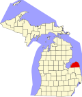
Location within Huron County
USA Michigan location map.svg
Red pog.svg
Harbor Beach
Location within the state of Michigan
Coordinates: 43°50′41″N82°39′05″W / 43.84472°N 82.65139°W / 43.84472; -82.65139
Country United States
State Michigan
County Huron
Settled1838
Incorporated1910 (city)
Government
   Mayor Kevin Guitar
Area
[1]
  Total2.06 sq mi (5.33 km2)
  Land1.72 sq mi (4.46 km2)
  Water0.34 sq mi (0.87 km2)
Elevation
600 ft (183 m)
Population
 (2020)
  Total1,604
  Density932.02/sq mi (359.90/km2)
Time zone UTC-5 (Eastern (EST))
  Summer (DST) UTC-4 (EDT)
ZIP code(s)
48441
Area code 989
FIPS code 26-36460 [2]
GNIS feature ID0627752 [3]
Website Harbor Beach

Harbor Beach is a city in Huron County in the U.S. state of Michigan. The population was 1,604 at the 2020 census.

Contents

History

The earliest settlers to this area arrived in 1837 and established a sawmill for processing lumber. The settlement eventually was named Barnettsville in 1855, as the settlement continued to grow, the town was renamed Sand Beach. In 1899, the village of Sand Beach changed its name to Harbor Beach, because of the impression that the area has nothing but sand. In 1910, it was officially incorporated into a city.

Located on the eastern shore of Lake Huron in the Thumb of Michigan, Harbor Beach is known as having the world's largest man-made fresh water harbor and boasts a fishing pier that is handicap accessible. The municipal marina provides transient services and shuttle services into the downtown area which has retained its old town charm.

The association known as HBRA was founded in 1896 as a summertime vacation spot in Harbor Beach. The resort is located roughly three hours north of Detroit, MI and is currently still operated, and frequented, by the 5th and 6th generation descendants of the original founding families.

Harbor Beach won the 2012 Division 8 State Football Championship. [4]

Geography

Demographics

Historical population
CensusPop.Note
1880 534
1890 1,04695.9%
1900 1,1499.8%
1910 1,55635.4%
1920 1,92723.8%
1930 1,892−1.8%
1940 2,18615.5%
1950 2,3497.5%
1960 2,282−2.9%
1970 2,134−6.5%
1980 2,000−6.3%
1990 2,0894.5%
2000 1,837−12.1%
2010 1,703−7.3%
2020 1,604−5.8%
U.S. Decennial Census [7]

2010 census

As of the census [8] of 2010, there were 1,703 people, 774 households, and 454 families residing in the city. The population density was 973.1 inhabitants per square mile (375.7/km2). There were 975 housing units at an average density of 557.1 per square mile (215.1/km2). The racial makeup of the city was 96.4% White, 0.2% African American, 0.4% Native American, 1.1% Asian, 0.2% from other races, and 1.8% from two or more races. Hispanic or Latino of any race were 0.6% of the population.

There were 774 households, of which 24.0% had children under the age of 18 living with them, 43.8% were married couples living together, 11.2% had a female householder with no husband present, 3.6% had a male householder with no wife present, and 41.3% were non-families. 37.9% of all households were made up of individuals, and 22.2% had someone living alone who was 65 years of age or older. The average household size was 2.14 and the average family size was 2.80.

The median age in the city was 47.7 years. 20.4% of residents were under the age of 18; 7.4% were between the ages of 18 and 24; 19.5% were from 25 to 44; 29.9% were from 45 to 64; and 22.7% were 65 years of age or older. The gender makeup of the city was 47.5% male and 52.5% female.

2000 census

As of the census [2] of 2000, there were 1,837 people, 774 households, and 503 families residing in the city. The population density was 1,036.3 inhabitants per square mile (400.1/km2). There were 928 housing units at an average density of 523.5 per square mile (202.1/km2). The racial makeup of the city was 96.35% White, 0.11% African American, 0.49% Native American, 1.36% Asian, 0.38% from other races, and 1.31% from two or more races. Hispanic or Latino of any race were 0.93% of the population.

There were 774 households, out of which 29.5% had children under the age of 18 living with them, 51.4% were married couples living together, 10.2% had a female householder with no husband present, and 34.9% were non-families. 32.3% of all households were made up of individuals, and 16.8% had someone living alone who was 65 years of age or older. The average household size was 2.31 and the average family size was 2.92.

In the city, the population was spread out, with 24.5% under the age of 18, 6.8% from 18 to 24, 23.8% from 25 to 44, 22.9% from 45 to 64, and 22.1% who were 65 years of age or older. The median age was 42 years. For every 100 females, there were 91.4 males. For every 100 females age 18 and over, there were 86.9 males.

The median income for a household in the city was $29,469, and the median income for a family was $35,263. Males had a median income of $29,938 versus $18,864 for females. The per capita income for the city was $14,917. About 11.2% of families and 15.1% of the population were below the poverty line, including 24.8% of those under age 18 and 12.2% of those age 65 or over.

Climate

Climate data for Harbor Beach, Michigan (1991–2020 normals, extremes 1899–present)
MonthJanFebMarAprMayJunJulAugSepOctNovDecYear
Record high °F (°C)62
(17)
68
(20)
84
(29)
89
(32)
92
(33)
100
(38)
105
(41)
102
(39)
98
(37)
88
(31)
80
(27)
65
(18)
105
(41)
Mean daily maximum °F (°C)28.7
(−1.8)
30.3
(−0.9)
38.5
(3.6)
49.1
(9.5)
60.5
(15.8)
70.6
(21.4)
76.6
(24.8)
75.9
(24.4)
69.9
(21.1)
57.7
(14.3)
45.0
(7.2)
34.2
(1.2)
53.1
(11.7)
Daily mean °F (°C)22.3
(−5.4)
22.9
(−5.1)
31.0
(−0.6)
41.1
(5.1)
52.2
(11.2)
62.2
(16.8)
68.1
(20.1)
67.4
(19.7)
61.0
(16.1)
49.7
(9.8)
38.4
(3.6)
28.6
(−1.9)
45.4
(7.4)
Mean daily minimum °F (°C)15.9
(−8.9)
15.6
(−9.1)
23.4
(−4.8)
33.1
(0.6)
43.8
(6.6)
53.9
(12.2)
59.6
(15.3)
58.9
(14.9)
52.0
(11.1)
41.6
(5.3)
31.7
(−0.2)
23.0
(−5.0)
37.7
(3.2)
Record low °F (°C)−19
(−28)
−22
(−30)
−12
(−24)
3
(−16)
24
(−4)
32
(0)
38
(3)
35
(2)
21
(−6)
10
(−12)
4
(−16)
−14
(−26)
−22
(−30)
Average precipitation inches (mm)2.40
(61)
2.05
(52)
1.90
(48)
3.60
(91)
3.20
(81)
3.34
(85)
3.03
(77)
3.30
(84)
3.19
(81)
3.05
(77)
2.64
(67)
2.27
(58)
33.97
(863)
Average snowfall inches (cm)15.4
(39)
11.2
(28)
6.0
(15)
1.4
(3.6)
0.0
(0.0)
0.0
(0.0)
0.0
(0.0)
0.0
(0.0)
0.0
(0.0)
0.0
(0.0)
1.7
(4.3)
11.5
(29)
47.2
(120)
Average precipitation days (≥ 0.01 in)16.411.19.711.511.510.29.09.69.513.813.014.5139.8
Average snowy days (≥ 0.1 in)10.07.63.81.00.00.00.00.00.00.11.57.031.0
Source: NOAA [9] [10]

Notable people

Government

The government of Harbor Beach is organized under the City Charter of 1965 and operates under a Mayor/Council form of government. The City Council consists of the Mayor, who is elected every two years, and four Council members, who are elected for four-year terms.

Attractions

Harbor Beach Light from Bathing Beach Park Harborbeachlight.jpg
Harbor Beach Light from Bathing Beach Park

Education

Registered Historic Places

See also

Notes

  1. "2020 U.S. Gazetteer Files". United States Census Bureau. Retrieved May 21, 2022.
  2. 1 2 "U.S. Census website". United States Census Bureau . Retrieved 2008-01-31.
  3. U.S. Geological Survey Geographic Names Information System: Harbor Beach, Michigan
  4. "Past Champions | Michigan High School Athletic Association".
  5. "US Gazetteer files 2010". United States Census Bureau. Archived from the original on 2012-07-02. Retrieved 2012-11-25.
  6. The marina at Harbor Beach Archived 2008-02-20 at the Wayback Machine
  7. "Census of Population and Housing". Census.gov. Retrieved June 4, 2015.
  8. "U.S. Census website". United States Census Bureau . Retrieved 2012-11-25.
  9. "NowData - NOAA Online Weather Data". National Oceanic and Atmospheric Administration. Retrieved September 3, 2021.
  10. "Station: Harbor Beach 1 SSE, MI". U.S. Climate Normals 2020: U.S. Monthly Climate Normals (1991-2020). National Oceanic and Atmospheric Administration. Retrieved September 3, 2021.
  11. "National Register of Historical Places - MICHIGAN (MI), Huron County". nationalregisterofhistoricplaces.com.

Related Research Articles

<span class="mw-page-title-main">Huron County, Michigan</span> County in Michigan, United States

Huron County is a county in the U.S. state of Michigan. As of the 2020 Census, the population was 31,407. The county seat is Bad Axe. Huron County is at the northern tip of the Thumb, which is a sub region of Mid Michigan. It is a peninsula, bordered by Saginaw Bay to the west and Lake Huron to the north and east, and has over 90 miles (140 km) of shoreline, from White Rock on Lake Huron to Sebewaing on the Saginaw Bay. Huron County's most prominent industry is agriculture, as with most of the other Thumb counties. Huron County enjoys seasonal tourism from large cities such as Detroit, Flint, and Saginaw. Much of the tourism is in the Port Austin and Caseville area.

<span class="mw-page-title-main">Harrisville, Michigan</span> City in Michigan, United States

Harrisville is a city in the U.S. state of Michigan and the county seat of Alcona County. The population was 437 at the 2020 census, making Harrisville the sixth-smallest city by population in the state of Michigan. The city is surrounded by Harrisville Township but is administratively autonomous. Located on Lake Huron, it is an official Michigan Department of Natural Resources Harbor of Refuge.

<span class="mw-page-title-main">Standish Township, Michigan</span> Civil township in Michigan, United States

Standish Township is a civil township of Arenac County in the U.S. state of Michigan. The population was 1,701 at the 2020 census. The city of Standish borders the township on the northwest but is administered autonomously.

<span class="mw-page-title-main">Benton Township, Cheboygan County, Michigan</span> Civil township in Michigan, United States

Benton Township is a civil township of Cheboygan County in the U.S. state of Michigan. As of the 2020 census, the township population was 3,133.

<span class="mw-page-title-main">Bloomfield Township, Huron County, Michigan</span> Civil township in Michigan, United States

Bloomfield Township is a civil township of Huron County in the U.S. state of Michigan. As of the 2020 census, the township population was 404.

<span class="mw-page-title-main">Caseville, Michigan</span> City in Michigan, United States

Caseville is a city in Huron County in the U.S. state of Michigan, located at the mouth of the Pigeon River on Saginaw Bay of Lake Huron. The population was 652 at the 2020 census. The city is surrounded by Caseville Township. A popular destination for summer tourists, it sponsors the 10-day Cheeseburger in Caseville festival, a tribute to Jimmy Buffett's song "Cheeseburger in Paradise". It has been also called the "Perch Capital of Michigan" for its extraordinary catches of the native fish yellow "perch".

<span class="mw-page-title-main">Huron Township, Michigan</span> Civil township in Michigan, United States

Huron Township is a civil township of Huron County in the U.S. state of Michigan. The population was 352 at the 2020 census.

<span class="mw-page-title-main">Sand Beach Township, Michigan</span> Civil township in Michigan, United States

Sand Beach Township is a civil township of Huron County in the U.S. state of Michigan. The population was 1,155 at the 2020 census.

<span class="mw-page-title-main">Sherman Township, Huron County, Michigan</span> Civil township in Michigan, United States

Sherman Township is a civil township of Huron County in the U.S. state of Michigan. The population was 999 at the 2020 census.

<span class="mw-page-title-main">Sigel Township, Michigan</span> Civil township in Michigan, United States

Sigel Township is a civil township of Huron County in the U.S. state of Michigan. The population was 437 at the 2020 census.

<span class="mw-page-title-main">Verona Township, Michigan</span> Civil township in Michigan, United States

Verona Township is a civil township of Huron County in the U.S. state of Michigan. The population was 1,210 at the 2020 census.

<span class="mw-page-title-main">Tawas City, Michigan</span> City in Michigan, United States

Tawas City is a city in and county seat of Iosco County in the U.S. state of Michigan. The population was 1,834 at the 2020 census. The city is mostly surrounded by Tawas Township, but the two areas are administered autonomously.

<span class="mw-page-title-main">Keego Harbor, Michigan</span> City in Michigan, United States

Keego Harbor is a city in Oakland County in the U.S. state of Michigan. A northern suburb of Detroit, Keego Harbor is located roughly 27 miles (43.5 km) from downtown Detroit, and about 3 miles (4.8 km) southwest of Pontiac. As of the 2010 census, the city had a population of 2,970. With a land area of 0.50 square miles (1.29 km2), Keego Harbor is the third-smallest city by land area in the state of Michigan, after Petersburg and Clarkston.

<span class="mw-page-title-main">Presque Isle Township, Michigan</span> Civil township in Michigan, United States

Presque Isle Township is a civil township of Presque Isle County in the U.S. state of Michigan. The population was 1,698 at the 2020 census.

Delaware Township is a civil township of Sanilac County in the U.S. state of Michigan. The population was 784 at the 2020 census.

<span class="mw-page-title-main">Forestville, Michigan</span> Village in Michigan, United States

Forestville is a village in Sanilac County in the U.S. state of Michigan. The population was 104 at the 2020 census, making it the least-populous village in Michigan. It does not have a true harbor onto Lake Huron, but the village does have a boat launch site. Forestville receives city water from nearby Harbor Beach. The village is within Delaware Township.

<span class="mw-page-title-main">Fort Gratiot Township, Michigan</span> Charter township in Michigan, United States

Fort Gratiot Township is a charter township of St. Clair County in the U.S. state of Michigan. The population was 11,242 at the 2020 Census. It is named for Fort Gratiot, an American fort located there off and on between 1814 and 1879.

<span class="mw-page-title-main">Port Huron Township, Michigan</span> Charter township in Michigan, United States

Port Huron Charter Township is a charter township of St. Clair County in the U.S. state of Michigan. The population was 10,792 at the 2020 Census. The city of Port Huron is adjacent to the township.

<span class="mw-page-title-main">Port Sanilac, Michigan</span> Village in Michigan, United States

Port Sanilac is a village in Sanilac Township, Sanilac County in the U.S. state of Michigan. The population was 567 at the 2020 census.

<span class="mw-page-title-main">Brown City, Michigan</span> City in Michigan, United States

Brown City is a city in Lapeer and Sanilac counties in the U.S. state of Michigan. The population was 1,325 at the 2010 census. The city is located almost exclusively in Sanilac County, with only a small portion of the city extending into Lapeer County.