Port Austin Township, Michigan

Last updated
Port Austin Township, Michigan
Port Austin Township, MI location.png
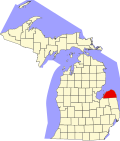
Location within Huron County (red) and the administered village of Port Austin (pink)
USA Michigan location map.svg
Red pog.svg
Port Austin Township
Location within the state of Michigan
Usa edcp location map.svg
Red pog.svg
Port Austin Township
Port Austin Township (the United States)
Coordinates: 44°02′35″N82°56′51″W / 44.04306°N 82.94750°W / 44.04306; -82.94750 Coordinates: 44°02′35″N82°56′51″W / 44.04306°N 82.94750°W / 44.04306; -82.94750
Country United States
State Michigan
County Huron
Government
  SupervisorBrandt Rousseaux
Area
  Total16.7 sq mi (43.2 km2)
  Land16.4 sq mi (42.5 km2)
  Water0.3 sq mi (0.7 km2)
Elevation
630 ft (192 m)
Population
 (2000)
  Total1,591
  Density97.0/sq mi (37.4/km2)
Time zone UTC-5 (Eastern (EST))
  Summer (DST) UTC-4 (EDT)
ZIP code(s)
48467
Area code 989
FIPS code 26-65700 [1]
GNIS feature ID1626928 [2]
Website Official website

Port Austin Township is a civil township of Huron County in the U.S. state of Michigan. The population was 1,591 at the 2000 census.

Contents

Communities

Geography

According to the United States Census Bureau, the township has a total area of 16.7 square miles (43 km2), of which 16.4 square miles (42 km2) is land and 0.3 square miles (0.78 km2) (1.56%) is water.

Demographics

As of the census [1] of 2000, there were 1,591 people, 760 households, and 471 families residing in the township. The population density was 97.0 inhabitants per square mile (37.5/km2). There were 1,690 housing units at an average density of 103.0 per square mile (39.8/km2). The racial makeup of the township was 98.49% White, 0.13% African American, 0.19% Native American, 0.19% Asian, 0.06% Pacific Islander, 0.19% from other races, and 0.75% from two or more races. Hispanic or Latino of any race were 1.38% of the population.

There were 760 households, out of which 17.9% had children under the age of 18 living with them, 52.6% were married couples living together, 7.1% had a female householder with no husband present, and 38.0% were non-families. 35.4% of all households were made up of individuals, and 18.7% had someone living alone who was 65 years of age or older. The average household size was 2.07 and the average family size was 2.63.

In the township the population was spread out, with 16.7% under the age of 18, 4.7% from 18 to 24, 17.9% from 25 to 44, 33.1% from 45 to 64, and 27.7% who were 65 years of age or older. The median age was 52 years. For every 100 females, there were 91.7 males. For every 100 females age 18 and over, there were 90.2 males.

The median income for a household in the township was $32,841, and the median income for a family was $39,554. Males had a median income of $30,563 versus $25,000 for females. The per capita income for the township was $19,219. About 11.1% of families and 12.9% of the population were below the poverty line, including 10.8% of those under age 18 and 12.1% of those age 65 or over.

Related Research Articles

Laketown Township is a civil township of Allegan County in the U.S. state of Michigan. The population was 5,505 at the 2010 census.

Watson Township is a civil township of Allegan County in the U.S. state of Michigan. The population was 2,063 at the 2010 census.

<span class="mw-page-title-main">Gilmore Township, Benzie County, Michigan</span> Civil township in Michigan, United States

Gilmore Township is a civil township of Benzie County in the U.S. state of Michigan. The population was 821 at the 2010 census. The L-shaped township contains the village of Elberta and is bordered on the north by the city of Frankfort. The narrow township is located between Crystal Lake Township to the north and Blaine Township to the south, as well as a short boundary with Benzonia Township to the east.

<span class="mw-page-title-main">Maple Ridge Township, Delta County, Michigan</span> Civil township in Michigan, United States

Maple Ridge Township is a civil township of Delta County in the U.S. state of Michigan. The population was 766 at the 2010 census, down from 808 at the 2000 census.

<span class="mw-page-title-main">Amboy Township, Michigan</span> Civil township in Michigan, United States

Amboy Township is a civil township of Hillsdale County in the U.S. state of Michigan. The population was 1,064 at the 2020 census.

<span class="mw-page-title-main">Wright Township, Hillsdale County, Michigan</span> Civil township in Michigan, United States

Wright Township is a civil township of Hillsdale County in the U.S. state of Michigan. The population was 1,542 at the 2020 census.

<span class="mw-page-title-main">Gore Township, Michigan</span> Civil township in Michigan, United States

Gore Township is a civil township of Huron County in the U.S. state of Michigan. The population was 139 at the 2000 census.

Orange Township is a civil township of Ionia County in the U.S. state of Michigan. The population was 1,040 at the 2000 census.

<span class="mw-page-title-main">Raisin Charter Township, Michigan</span> Charter township in Michigan, United States

Raisin Charter Township is a charter township of Lenawee County in the U.S. state of Michigan. The population was 7,559 at the 2010 census.

<span class="mw-page-title-main">St. Ignace Township, Michigan</span> Civil township in Michigan, United States

St. Ignace Township is a civil township of Mackinac County in the U.S. state of Michigan. As of the 2010 census, the township population was 939.

Brown Township is a civil township of Manistee County in the U.S. state of Michigan. As of the 2000 census, the township population was 712. It was organized in 1855.

<span class="mw-page-title-main">Victory Township, Michigan</span> Civil township in Michigan, United States

Victory Township is a civil township of Mason County in the U.S. state of Michigan. The population was 1,383 at the 2010 census.

Cato Township is a civil township of Montcalm County in the U.S. state of Michigan. The population was 2,920 at the 2000 census.

<span class="mw-page-title-main">Groveland Township, Michigan</span> Civil township in Michigan, United States

Groveland Township is a civil township of Oakland County in the U.S. state of Michigan. The population was 5,476 at the 2010 census. Groveland Township was established in 1835.

Greenwood Township is a civil township of Oceana County in the U.S. state of Michigan. As of the 2000 census, the township population was 1,154.

Lincoln Township is a civil township of Osceola County in the U.S. state of Michigan. As of the 2000 census, the township population was 1,629.

<span class="mw-page-title-main">Richfield Township, Roscommon County, Michigan</span> Civil township in Michigan, United States

Richfield Township is a civil township of Roscommon County in the U.S. state of Michigan. As of the 2010 census, the township had a total population of 3,731.

Park Township is a civil township of St. Joseph County in the U.S. state of Michigan. The population was 2,699 at the 2000 census.

Lockport Township is a civil township of St. Joseph County in the U.S. state of Michigan. The population was 3,814 at the 2000 census.

Blue Lake Township is a civil township of Muskegon County in the U.S. state of Michigan. As of the 2000 census, the township population was 1,990. One of the largest landowners in the township is the Chicago Area Council of the Boy Scouts of America, which owns Owasippe Scout Reservation. The township is also home to the Blue Lake Fine Arts Camp.

References

Notes

  1. 1 2 "U.S. Census website". United States Census Bureau . Retrieved 2008-01-31.
  2. U.S. Geological Survey Geographic Names Information System: Port Austin Township, Michigan
  3. U.S. Geological Survey Geographic Names Information System: Grind Stone City, Michigan
  4. Romig 1986, p. 241.

Sources