
Lake Michigan is one of the five Great Lakes of North America. It is the second-largest of the Great Lakes by volume and the third-largest by surface area, after Lake Superior and Lake Huron. To the east, its basin is conjoined with that of Lake Huron through the 3+1⁄2-mile (5.6-kilometre) wide, 295-foot deep, Straits of Mackinac, giving it the same surface elevation as its easterly counterpart; the two are technically a single lake.
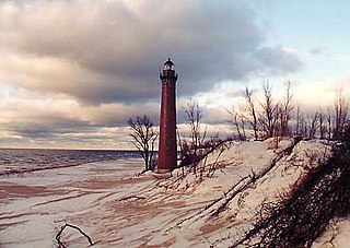
The Lower Peninsula of Michigan – also known as Lower Michigan – is the larger, southern and less elevated of the two major landmasses that make up the U.S. state of Michigan; the other being the Upper Peninsula, which is separated by the Straits of Mackinac. It is surrounded by water on all sides except its southern border, which it shares with Indiana and Ohio. Although the Upper Peninsula is commonly referred to as "the U.P.", it is uncommon for the Lower Peninsula to be called "the L.P."

The Upper Peninsulaof Michigan – also known as Upper Michigan or colloquially the U.P. – is the northern and more elevated of the two major landmasses that make up the U.S. state of Michigan; it is separated from the Lower Peninsula by the Straits of Mackinac. It is bounded primarily by Lake Superior to the north, separated from the Canadian province of Ontario at the east end by the St. Marys River, and flanked by Lake Huron and Lake Michigan along much of its south. Although the peninsula extends as a geographic feature into the state of Wisconsin, the state boundary follows the Montreal and Menominee rivers and a line connecting them.

Mackinac County is a county in the Upper Peninsula of the U.S. state of Michigan. As of the 2020 Census, the population was 10,834. The county seat is St. Ignace. Formerly known as Michilimackinac County, in 1818 it was one of the first counties of the Michigan Territory, as it had long been a center of French and British colonial fur trading, a Catholic church and Protestant mission, and associated settlement.
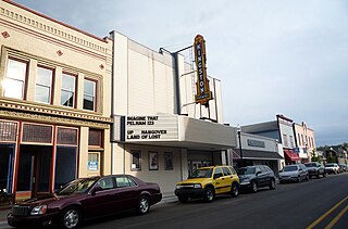
Cheboygan is a city in the U.S. state of Michigan. It is the county seat and largest settlement of Cheboygan County. At the 2020 census, Cheboygan had a population 4,770.
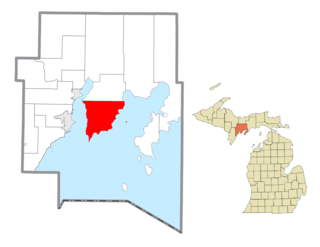
Bay de Noc Township is a civil township of Delta County in the U.S. state of Michigan. As of the 2010 census, the township population was 305, down from 329 at the 2000 census. The township covers the southern portion of the Stonington Peninsula separating Little Bay de Noc and Big Bay de Noc on Lake Michigan.

Escanaba, commonly shortened to Esky, is a port city and the county seat of Delta County in the U.S. state of Michigan, located on Little Bay de Noc in the state's Upper Peninsula. The population was 12,616 at the 2010 census, making it the third-largest city in the Upper Peninsula after Marquette and Sault Ste. Marie.
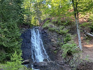
Grant Township is a civil township of Keweenaw County in the U.S. state of Michigan. The population was 275 at the 2020 census. Grant Township is one of the most isolated municipalities in Michigan, as it forms the tip of the Keweenaw Peninsula, which projects into Lake Superior.

Bois Blanc Township is a civil township of Mackinac County in the U.S. state of Michigan. The population was 100 at the 2020 census. The insular township occupies Bois Blanc Island, as well as some smaller outlying islands within Lake Huron. The nearby Round Island is administered by the city of Mackinac Island.

St. Ignace is a city in the U.S. state of Michigan and the county seat of Mackinac County. The city had a population of 2,452 at the 2010 census. St. Ignace Township is located just to the north of the city, but the two are administered autonomously.

Mackinaw City is a village at the northernmost point of the Lower Peninsula of Michigan. Divided between Cheboygan and Emmet counties, Mackinaw City is the located at the southern end of the Mackinac Bridge, which carries Interstate 75 over the Straits of Mackinac to the Upper Peninsula. Mackinaw City, along with St. Ignace, serves as an access point to Mackinac Island. For these reasons, Mackinaw City is considered one of Michigan's most popular tourist attractions.

Hiawatha National Forest is a 894,836-acre (362,127 ha) National Forest in the Upper Peninsula of the state of Michigan in the United States. Commercial logging is conducted in some areas. The United States Forest Service administers this National Forest; it is physically divided into two subunits, commonly called the Eastside 46°14′N84°50′W and Westside 46°08′N86°40′W.
Poverty Island is a 186 acre uninhabited island in northern Lake Michigan. It is one of an archipelago of islands across the entrance to Green Bay and Big Bay de Noc commonly called the Potawatomi Islands, which are an outcropping of the Niagara Escarpment. The island is within Delta County in the U.S. state of Michigan. The surface is a mixture of forest and rocky outcroppings. The only structures are the Poverty Island Light Station (1875), an abandoned lighthouse and outbuildings which are in disrepair. Poverty Island is currently owned by the federal government.
Gull Island is the name of a dozen small islands in the U.S. state of Michigan.
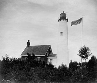
The buildings of the St Helena Light complex are the sole surviving structures on St. Helena Island, in Mackinac County in the U.S. state of Michigan. The lighthouse on the St. Helena Island's southeastern point was built in 1872-1873 and went into operation in September 1873. It became one of a series of lighthouses that guided vessels through the Straits of Mackinac, past a dangerous shoal that extends from the island.

The Sand Point Lighthouse is located in Escanaba, Michigan, United States, on Lake Michigan's northern shore. Since 1989, it has been an unofficial aid to navigation. Though it is an operational aid to navigation. The restored lighthouse is now open to the public during the summer months. It is also known as the Escanaba/Sand Point Light or the Escanaba Light.

Waugoshance Point is a 2.5-mile-long (4.0 km) cape or peninsula that juts into Lake Michigan from the northwest coast of the Lower Peninsula of the U.S. state of Michigan in Emmet County. It separates the Straits of Mackinac to its north from Sturgeon Bay to the south and is part of Wilderness State Park. The nearest town is Mackinaw City. Waugoshance is a hybrid word, that combines the Anishinaabemowin word wah'goosh and the French word anse.
Rabbit's Back, also called Rabbit Back, is an elevated promontory, or peninsula, that extends eastward into Lake Huron. It is located 4 miles (6.4 km) north of St. Ignace in the U.S. state of Michigan.

Wawatam Lighthouse is an automated, modern lighthouse that guards the harbor of St. Ignace, Michigan, in the Straits of Mackinac. Originally completely nonfunctional, it was erected in 1998 by the Michigan Department of Transportation (MDOT) near Monroe, Michigan as an iconic roadside attraction at a welcome center that greeted northbound drivers on Interstate 75 (I-75). After serving in this capacity for six years, the structure was threatened in 2004 when MDOT decided to rebuild the welcome center and demolish the tower.


