
Door County is the easternmost county in the U.S. state of Wisconsin. As of the 2020 census, the population was 30,066. Its county seat is Sturgeon Bay. It is named after the strait between the Door Peninsula and Washington Island. The dangerous passage, known as Death's Door, contains shipwrecks and was known to Native Americans and early French explorers. The county was created in 1851 and organized in 1861. Nicknamed the “Cape Cod of the Midwest,” Door County is a popular Upper Midwest vacation destination. It is also home to a small Walloon population.

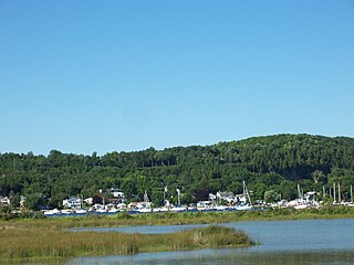
Ephraim is a village in Door County, Wisconsin, United States. It is located across Eagle Harbor from Peninsula State Park. The population was 288 at the 2010 census. The village is known for its white buildings, its views of the bluffs across Eagle Harbor, and its shoreline along Green Bay.

Egg Harbor is a town in Door County, Wisconsin, United States. The population was 1,194 at the 2000 census. The Village of Egg Harbor and the unincorporated community of Carlsville are located within the town. The Town of Egg Harbor was hit by an F3 tornado in 1998.

Chambers Island, named in honor of Col. Talbot Chambers, is a 2,834 acre island in Green Bay, about 7 miles (11 km) off the coast of the Door Peninsula, near Gibraltar, Wisconsin. It is part of the Town of Gibraltar in Door County.

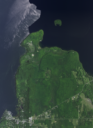
Washington Island is an island of the state of Wisconsin situated in Lake Michigan. Lying about 7 miles (11 km) northeast of the tip of the Door Peninsula, it is part of Door County, Wisconsin. The island has a year-round population of 708 people according to the 2010 census. It has a land area of 60.9 km² and comprises over 92 percent of the land area of the town of Washington, as well as all of its population. The unincorporated community of Detroit Harbor is situated on the island. It is the largest in a group of islands that includes Plum, Detroit, Hog, Pilot, Fish, and Rock Islands. These islands form the Town of Washington. Detroit Harbor bay is on the south side of the island. A large part of Washington Island's economy is based on tourism.

State Trunk Highway 42 is a state highway in the U.S. state of Wisconsin. It runs for 135 miles (217 km) north–south in northeast Wisconsin from Sheboygan to the ferry dock in Northport. Much of the highway is part of the Lake Michigan Circle Tour from the eastern junction with U.S. Highway 10 (US 10) in Manitowoc to its junction with WIS 57 in Sister Bay. WIS 42 parallels I-43 from Sheboygan to Manitowoc, and parallels WIS 57 throughout much of the route, particularly from Manitowoc to Sturgeon Bay, meeting the northern terminus of WIS 57 in Sister Bay.
Fish Creek is an unincorporated community located in Door County, Wisconsin, United States, within the town of Gibraltar and is located on Highway 42 along Green Bay.

Detroit Island is an island in Lake Michigan in the southern part of the town of Washington in Door County, Wisconsin, United States. The island has a land area of 2.578 km², out of which 27.6% is open to the public. The northern end of the island borders the waters of Detroit Harbor.

Plum Island is an island in Lake Michigan in the southern part of the town of Washington in Door County, off the tip of the Door Peninsula in the U.S. state of Wisconsin. The uninhabited island has a land area of 1.179 square kilometres (0.455 sq mi) or 117.87 hectares. Carp Lake is located on the northwestern side. During years when Lake Michigan's water levels are high, it is a lagoon of Lake Michigan, but it gets cut off as a separate lake during low water years.
Peninsula State Park is a 3,776-acre (1,528 ha) Wisconsin state park with eight miles (13 km) of Green Bay shoreline in Door County. Peninsula is the third largest state park in Wisconsin and is visited by an estimated one million visitors annually.

Newport State Park is a 2,373-acre (960 ha) Wisconsin state park at the tip of Door Peninsula near Europe Lake. Protecting 11 miles (18 km) of shoreline on Lake Michigan, Newport is Wisconsin's only wilderness-designated state park. The park is open year-round and can be accessed via WIS 42.

Rocky Arbor State Park is a 244-acre (99 ha) Wisconsin state park in the Wisconsin Dells region. The park was established in 1932 to protect sandstone outcrops eroded into picturesque walls and ledges.

Wisconsin, a state in the Midwestern United States, has a vast and diverse geography famous for its landforms created by glaciers during the Wisconsin glaciation 17,000 years ago. The state can be generally divided into five geographic regions—Lake Superior Lowland, Northern Highland, Central Plain, Eastern Ridges & Lowlands, and Western Upland. The southwestern part of the state, which was not covered by glaciers during the most recent ice age, is known as the Driftless Area. The Wisconsin glaciation formed the Wisconsin Dells, Devil's Lake, and the Baraboo Range. A number of areas are protected in the state, including Devil's Lake State Park, the Apostle Islands National Lakeshore, and the Chequamegon–Nicolet National Forest.

Potawatomi State Park is a 1,225-acre (496 ha) Wisconsin state park northwest of the city of Sturgeon Bay, Wisconsin in the Town of Nasewaupee. It is located in Door County along Sturgeon Bay, a bay within the bay of Green Bay. Potawatomi State Park was established in 1928.
North Bay is a small Unincorporated community located on Lake Michigan in the town of Liberty Grove in northern Door County, Wisconsin. The North Bay State Natural Area along with a few resorts are located within the vicinity of the community. A Native American name for North Bay is "Wah-Sa-Ke-Ta-Ta-Wong", or "Burning Island".

The Strawberry Islands are a small chain of four islands located on the Wisconsin side of Green Bay between Chambers Island and Peninsula State Park. The islands are part of the Town of Gibraltar, Wisconsin.
The flora of Door County, Wisconsin comprise a variety of plant species. Geobotanically, Door County belongs to the North American Atlantic Region.
The Gardner Swamp Wildlife Area is a 1,180 acres (480 ha) tract of protected land located in Door County, Wisconsin, managed by the Wisconsin Department of Natural Resources. Land to be used for the Wildlife Area was first acquired in 1958, and the master plan for the Wildlife Area was completed in 1980.
The Amberg Wildlife Area (AWA) is a 1,190-acre (480 ha) tract of protected land located in Marinette County, Wisconsin, managed by the Wisconsin Department of Natural Resources (WDNR). The wildlife area is surrounded by other protected areas, operated by either the county or other WDNR lands. The property was established in 1948, primarily to protect rare swamp conifer land, made up of 90-100 year old white cedar. The wildlife area is split up into two land management areas, the 909-acre (368 ha) native community management area of the Amberg Swamp Conifers and the eponymous 299-acre (121 ha) habitat management area.
 Horseshoe Island from mainland in Peninsula State Park.
 Horseshoe Island from Ephraim.
 A map of the northwestern shore of Door County. Horseshoe Island can be seen on the right, north of Peninsula State Park.


