
South Manitou Island is located in Lake Michigan, approximately 16 miles (26 km) west of Leland, Michigan. It is part of Leelanau County and the Sleeping Bear Dunes National Lakeshore. The uninhabited island is 8.277 sq mi (21.44 km2) in land area and can be accessed by a ferry service from Leland. Guided tours on open-air vehicles are available to visitors, but most traffic is on foot. Larger North Manitou Island lies to its north.

The Two Harbors Light is the oldest operating lighthouse in the US state of Minnesota. Overlooking Lake Superior's Agate Bay, the lighthouse is located in Two Harbors, Minnesota. The construction of the lighthouse began in 1891 and was completed the following year, with the light being lit for the first time on April 14, 1892. The first Two Harbors keeper was Charles Lederle and there were normally three keepers assigned to make sure the light was lit every day. The Lighthouse was built to provide safe passage into the Agate Bay Harbor during the early 20th century, as Two Harbors was a major shipping point for the iron ore of the Mesabi Range.

Ile Aux Galets Light, also known as Skillagalee Island Light, is located on Ile Aux Galets, a gravelly, low-lying island in northeast Lake Michigan, between Beaver Island and the mainland, approximately 7 miles (11 km) northwest of Cross Village in Emmet County, Michigan. Along with nearby Grays Reef, Waugoshance, and White Shoal Lights, it warns shipping away from the reefs and shoals of Waugoshance Point, which pose an imminent hazard to navigation.
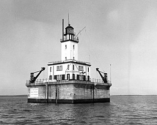
The DeTour Reef Light is a non-profit-operated lighthouse marking the southern entrance of the DeTour Passage between the eastern end of Michigan's Upper Peninsula and Drummond Island. The light is an automated active aid to navigation. It marks the northern end of Lake Huron. The passage is used by almost all of the Great Lakes commercial freighter traffic moving to and from Lake Superior, with approximately 5,000 vessel movements annually. It is said to be "the gateway to Lake Superior." In addition, many recreational boaters use the passage. The Light is located in Lake Huron, three miles (5 km) south of the nearest town, DeTour Village, Michigan.
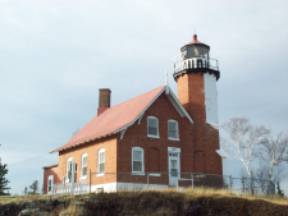
Eagle Harbor Light is an operational lighthouse at Eagle Harbor, in Keweenaw County in the state of Michigan. It sits on the rocky entrance to Eagle Harbor and is one of several light stations that guide mariners on Lake Superior across the northern edge of the Keweenaw Peninsula. The original lighthouse, built in 1851, was replaced in 1871 by the present red brick structure, which is a Michigan State Historic Site and listed on the National Register of Historic Places.

Old Mackinac Point Light is a deactivated lighthouse located at the northern tip of the Lower Peninsula in the U.S. state of Michigan. The lighthouse is part of Fort Michilimackinac State Park in the village of Mackinaw City just east of the Mackinac Bridge.

Au Sable Light is an active lighthouse in the Pictured Rocks National Lakeshore west of Grand Marais, Michigan off H-58. Until 1910, this aid to navigation was called "Big Sable Light".
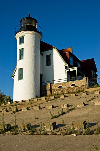
Point Betsie Light is located on the northeast shore of Lake Michigan — at the southern entrance to the Manitou Passage — north of Frankfort in Benzie County in Northern Michigan. Construction began in 1854, but it was not completed until 1858, and began service in the shipping season of 1859. The lighthouse cost $5,000 to build. In 1875, a life saving station was built for $3,000.
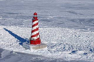
The White Shoal Light is a lighthouse located 20 miles (32 km) west of the Mackinac Bridge in Lake Michigan. It is an active aid to navigation. It is also the tallest lighthouse on the Great Lakes.

The Harbor Beach Lighthouse is a "sparkplug lighthouse" located at the end of the north breakwall entrance to the harbor of refuge on Lake Huron. The breakwall and light were created by the United States Army Corps of Engineers to protect the harbor of Harbor Beach, Michigan, which is the largest man-made freshwater harbor in the world. Harbor Beach is located on the eastern edge of the Thumb of Huron County, in the state of Michigan.

South Manitou Island Lighthouse is located on South Manitou Island in Lake Michigan, 16 miles (26 km) west of Leland, Michigan. It is in Leelanau County in western Northern Michigan.

The Marquette Harbor Light is located on Lake Superior in Marquette, Michigan, a part of the Upper Peninsula. It is an active aid to navigation.
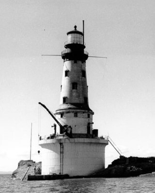
The Rock of Ages Light is a U.S. Coast Guard lighthouse on a small rock outcropping approximately 2.25 miles (3.62 km) west of Washington Island and 3.5 miles (5.6 km) west of Isle Royale, in Eagle Harbor Township, Keweenaw County, Michigan. It is an active aid to navigation.

The Gull Rock Light Station is an active lighthouse located on Gull Rock, just west of Manitou Island, off the tip of Michigan's Keweenaw Peninsula in Lake Superior. The light was listed on the National Register of Historic Places in 1984, even as its condition deteriorated, resulting in its placement on the Lighthouse Digest Doomsday List.

The Passage Island Light Station is a lighthouse located 3.25 mi (5.23 km) NE of Isle Royale, in NW Lake Superior, Michigan on Passage Island. It was listed on the National Register of Historic Places in 2006.
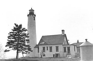
The Poverty Island Light is a light house located on Poverty Island in northwestern Lake Michigan, 5.8 miles (9.3 km) south of Garden Peninsula. It was listed on the National Register of Historic Places in 2005 as the Poverty Island Light Station.

The South Fox Island Light was a light station located on South Fox Island in the north end of Lake Michigan. There are two towers standing at the site: the first is the original brick keeper's house and tower, while the second is a skeletal tower moved to this site from Sapelo Island, Georgia in 1934. Neither is operational. The station was listed on the National Register of Historic Places in 2021.
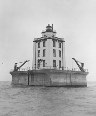
The Martin Reef Light Station is a lighthouse located in northern Lake Huron, 4.3 miles (6.9 km) south of Cadogan Point in Clark Township, Michigan. It was listed on the National Register of Historic Places in 2005.
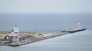
The Grand Marais Harbor of Refuge Inner and Outer Lights are a pair of lighthouses located on the west pier at the entry to Grand Marais Harbor of Refuge, in Grand Marais, Michigan. They were listed on the National Register of Historic Places in 2012.

The Middle Island Light is a lighthouse located on Middle Island in Lake Huron, about 10 miles (16 km) north of Alpena, Michigan. It was listed on the National Register of Historic Places in 2006.


