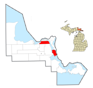
Mackinac County is a county in the Upper Peninsula of the U.S. state of Michigan. As of the 2020 census, the population was 10,834. The county seat is St. Ignace. Formerly known as Michilimackinac County, in 1818 it was one of the first counties of the Michigan Territory, as it had long been a center of French and British colonial fur trading, a Catholic church and Protestant mission, and associated settlement.

Luce County is a county located in the Upper Peninsula in the U.S. state of Michigan. As of the 2020 census, the population was 5,339, making it the second-least populous county in Michigan. The county seat is Newberry, Luce County's only incorporated community. The county was set off and organized in 1887 and named after former Michigan Governor Cyrus G. Luce.

Chippewa County is a county in the eastern Upper Peninsula of the U.S. state of Michigan. As of the 2020 census, the population was 36,785. The county seat is Sault Ste. Marie. The county is named for the Ojibwe (Chippewa) people, and was set off and organized in 1826. Chippewa County comprises the Sault Ste. Marie, MI micropolitan statistical area.

Alger County is a county in the Upper Peninsula of the U.S. state of Michigan. As of the 2020 Census, the population was 8,842. It is the state's second-largest county by area, including the waters of Lake Superior. The county seat is Munising.

L'Anse Township is a civil township of Baraga County in the U.S. state of Michigan. As of the 2020 census, the township population was 3,551. The township contains Mount Arvon and Mount Curwood, Michigans highest and second-highest points, as well as the village of L'Anse.

Bruce Township is a civil township of Chippewa County in the U.S. state of Michigan. As of the 2020 census, the township population was 2,000.

DeTour Village is a village in Chippewa County in the U.S. state of Michigan. The population was 263 at the 2020 census.

Kinross Charter Township is a charter township of Chippewa County in the U.S. state of Michigan. The population was 6,139 at the 2020 census, down from 7,561 at the 2010 census.

Rudyard Township is a civil township of Chippewa County in the U.S. state of Michigan. As of the 2020 census, the township population was 1,289. In 2023, Rudyard Township was designated the "Snowy Owl Capital of Michigan".

Sault Ste. Marie is a city in the Upper Peninsula of the U.S. state of Michigan. It is the county seat of Chippewa County and is the only city within the county. With a population of 13,337 at the 2020 census, it is the second-most populated city in the Upper Peninsula, behind Marquette. It is the primary city of the Sault Ste. Marie, MI Micropolitan Statistical Area, which encompasses all of Chippewa County and had a population of 36,785 at the 2020 census. Sault Ste. Marie was settled by mostly French colonists in 1668, making it the oldest city in Michigan.

Soo Township is a civil township of Chippewa County in the U.S. state of Michigan. The population was 2,966 at the 2020 census.

Sugar Island Township is a civil township of Chippewa County in the U.S. state of Michigan. The population was 653 at the 2020 census. The township consists of Sugar Island, several smaller islands, and the surrounding waters in the St. Marys River.

Hudson Township is a civil township of Mackinac County in the U.S. state of Michigan. As of the 2020 census, its population was 193.

St. Ignace is a city in the U.S. state of Michigan and the county seat of Mackinac County. The city had a population of 2,306 at the 2020 census. St. Ignace Township is located just to the north of the city; the two are administered separately.

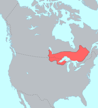
The Ojibwe are an Anishinaabe people whose homeland covers much of the Great Lakes region and the northern plains, extending into the subarctic and throughout the northeastern woodlands. The Ojibwe, being Indigenous peoples of the Northeastern Woodlands and of the subarctic, are known by several names, including Ojibway or Chippewa. As a large ethnic group, several distinct nations also consider themselves Ojibwe, including the Saulteaux, Nipissings, and Oji-Cree.

The Bay Mills Indian Community (BMIC), is an Indian reservation forming the land base of one of the many federally recognized Sault Ste. Marie bands of Ojibwe.

The Sault Ste. Marie Tribe of Chippewa Indians, commonly shortened to Sault Tribe of Chippewa Indians or the more colloquial Soo Tribe, is a federally recognized Native American tribe in what is now known as Michigan's Upper Peninsula. The tribal headquarters is located within Sault Ste. Marie, the major city in the region, which is located on the St. Marys River.

Chase Salmon Osborn was an American politician, newspaper reporter and publisher, and explorer. He served as the 27th governor of Michigan from 1911 to 1913. The governor spent time at Possum Poke in Georgia, using it as a retreat and a place to write. He died there on April 11, 1949, aged 89.
Neebish Island is located in the U.S. state of Michigan, in the St. Marys River, which connects Lake Superior and Lake Huron at the easternmost point of Michigan's upper peninsula.
The Treaty of Detroit of 1855 was a treaty between the United States Government and the Ottawa and Chippewa Nations of Indians of Michigan. The treaty contained provisions to allot individual tracts of land to Native people consisting of 40-acre (16 ha) plots for single individuals and 80-acre (32 ha) plots for families, outlined specific tracts which were assigned to the various bands and provided for the severance of the government consolidation of the Ottawa and Chippewa.


