Vandemere, North Carolina

Last updated

Vandemere, North Carolina
Coordinates: 35°11′19″N76°39′54″W / 35.18861°N 76.66500°W / 35.18861; -76.66500
Country United States
State North Carolina
County Pamlico
Area
[1]
  Total1.63 sq mi (4.23 km2)
  Land1.52 sq mi (3.94 km2)
  Water0.11 sq mi (0.28 km2)
Elevation
[2]
3 ft (0.9 m)
Population
 (2020)
  Total246
  Density161.63/sq mi (62.39/km2)
Time zone UTC-5 (Eastern (EST))
  Summer (DST) UTC-4 (EDT)
ZIP code
28587
Area code 252
FIPS code 37-69720 [3]
GNIS feature ID2406790 [2]

Vandemere is a town in Pamlico County, North Carolina, United States. As of the 2010 census, the town population was 254. It is part of the New Bern, North Carolina Micropolitan Statistical Area.

Contents

Geography

According to the United States Census Bureau, the town has a total area of 1.6 square miles (4.1 km2), of which 1.5 square miles (3.9 km2) is land and 0.1 square miles (0.26 km2) (7.41%) is water.

Demographics

Historical population
CensusPop.Note
1890 90
1900 16987.8%
1910 29675.1%
1920 3084.1%
1930 36016.9%
1940 43621.1%
1950 4758.9%
1960 452−4.8%
1970 379−16.2%
1980 335−11.6%
1990 299−10.7%
2000 289−3.3%
2010 254−12.1%
2020 246−3.1%
U.S. Decennial Census [4]

2020 census

Vandemere racial composition [5]
RaceNumberPercentage
White (non-Hispanic)10542.68%
Black or African American (non-Hispanic)12550.81%
Native American 10.41%
Asian 31.22%
Other/Mixed 124.88%

As of the 2020 United States census, there were 246 people, 102 households, and 70 families residing in the town.

2000 census

As of the census [3] of 2000, there were 289 people, 123 households, and 78 families residing in the town. The population density was 192.7 people per square mile (74.4 people/km2). There were 153 housing units at an average density of 102.0 per square mile (39.4/km2). The racial makeup of the town was 46.37% White, 52.94% African American, 0.35% Native American, and 0.35% from two or more races. Hispanic or Latino of any race were 2.08% of the population.

There were 123 households, out of which 21.1% had children under the age of 18 living with them, 41.5% were married couples living together, 17.9% had a female householder with no husband present, and 35.8% were non-families. 35.8% of all households were made up of individuals, and 14.6% had someone living alone who was 65 years of age or older. The average household size was 2.35 and the average family size was 3.05.

In the town, the population was spread out, with 21.5% under the age of 18, 7.3% from 18 to 24, 21.5% from 25 to 44, 29.1% from 45 to 64, and 20.8% who were 65 years of age or older. The median age was 45 years. For every 100 females, there were 80.6 males. For every 100 females age 18 and over, there were 76.0 males.

The median income for a household in the town was $32,917, and the median income for a family was $40,556. Males had a median income of $26,250 versus $19,250 for females. The per capita income for the town was $13,570. About 11.6% of families and 21.6% of the population were below the poverty line, including 25.9% of those under the age of eighteen and 35.2% of those 65 or over.

History

Vandemere is situated on a point where Vandemere Creek flows into the Bay River. It was incorporated in 1874 and was the county seat from 1872 (when Pamlico County was formed) to 1876.

Many of the descendants of the first colonists in North Carolina are still living in Vandemere today and many of the names live on, both in the names of the people and the places.

In 1699, a treaty was forged between the English Crown and the "Bay River Indians". Early settlers came from England, but there are also reports of French Huguenots and others including Dutch and Flemish.

By the 18th century, there are written records of some European habitation in the Vandemere area. Records show that there was a Native American people who lived "at the head of Vandemore's Creek." These early records show various spellings of the name of Vandemere, most showing Dutch or Flemish origin.

As early as 1679, there are records showing a "Tho. Vandermoller" being witness to a will, and in 1882 a land grant record that refers to ""Jno. Vandemore."

Recent events

Vandemere kitchen gutted as a consequence of Hurricane Irene, removing mold Coastal Storm ^ Flooding ^ Hurricane-Tropical Storm ^ Severe Storm - Vandemere, N. C. , September 14, 2011 -- A kitchen is gutted by volunteers to remove the mold. FEMA works with v - DPLA - 47cc8f77c700b793eda12e7d7e145eda.jpg
Vandemere kitchen gutted as a consequence of Hurricane Irene, removing mold

On August 27, 2011, there was a devastating flood caused by Hurricane Irene, demolishing just over 100 homes. Local contractors aided the attempt to repair, and in some cases, even build new houses. Officials have upped the standards on flood regulations, requiring such items as higher outlets and raised houses.[ citation needed ]

Related Research Articles

<span class="mw-page-title-main">Pamlico County, North Carolina</span> County in North Carolina, United States

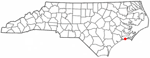
PamlicoCounty is a county located in the U.S. state of North Carolina. As of the 2020 census, the population was 12,276. Its county seat is Bayboro.

<span class="mw-page-title-main">Beaufort County, North Carolina</span> County in North Carolina, United States

Beaufort County is a county located in the U.S. state of North Carolina. As of the 2020 census, the population was 44,652. Its county seat is Washington. The county was founded in 1705 as Pamptecough Precinct. Originally included in Bath County, it was renamed Beaufort Precinct in 1712 and became Beaufort County in 1739.

<span class="mw-page-title-main">Morven, North Carolina</span> Town in North Carolina, United States

Morven is a town in Anson County, North Carolina, United States. The population was 329 at the 2020 census. The town was named after a town in Argyllshire, Scotland.

<span class="mw-page-title-main">Aurora, North Carolina</span> Town in North Carolina, United States

Aurora is a town in Beaufort County, North Carolina, United States. The population was 520 at the 2010 Census.

River Road is a census-designated place (CDP) in Beaufort County, North Carolina, United States. The population was 4,048 at the 2020 Census.

<span class="mw-page-title-main">Mount Pleasant, North Carolina</span> Town in North Carolina, United States

Mount Pleasant is a town located in eastern Cabarrus County, North Carolina, United States. As of the 2010 census, the town population was 1,652. The town center is located at the crossroads of Mount Pleasant Road and North Carolina Highway 73. NC Highway 49 skirts the town to the north on its way from Charlotte to Asheboro.

<span class="mw-page-title-main">Indian Beach, North Carolina</span> Town in North Carolina, United States

Indian Beach is a town in Carteret County, North Carolina, United States. The population was 223 as of the 2020 census.

<span class="mw-page-title-main">Stanley, North Carolina</span> Town in North Carolina, United States

Stanley is a town in Gaston County, North Carolina, United States. The population was 3,556 at the 2010 census.

<span class="mw-page-title-main">West Smithfield, North Carolina</span> Former census-designated place in North Carolina, United States

West Smithfield was an unincorporated community and census-designated place and is now a district of Smithfield, North Carolina in Johnston County, North Carolina, United States. The population was last recorded separately from Smithfield in 2000, when 59 people resided in the CDP.

<span class="mw-page-title-main">Alliance, North Carolina</span> Town in North Carolina, United States

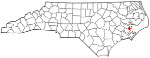
Alliance is a town in Pamlico County, North Carolina, United States. Its name is derived from the Farmers Alliance Movement from around 1874, two years after Pamlico was founded. Alliance was incorporated in 1965. The majority of land in Alliance is farmland. The population was 776 at the 2010 census. It is part of the New Bern, North Carolina Micropolitan Statistical Area.

<span class="mw-page-title-main">Bayboro, North Carolina</span> Town in North Carolina, United States

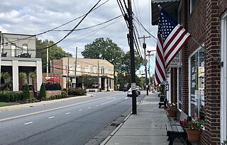
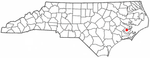
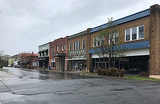
Bayboro is a town in Pamlico County, North Carolina, United States. The population was 1,161 at the 2020 U.S. census. It is the county seat of Pamlico County.

<span class="mw-page-title-main">Mesic, North Carolina</span> Town in North Carolina, United States

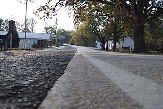
Mesic is a town in Pamlico County, North Carolina, United States. The population was 220 at the 2010 census. It is part of the New Bern, North Carolina Micropolitan Statistical Area.

<span class="mw-page-title-main">Minnesott Beach, North Carolina</span> Town in North Carolina, United States

Minnesott Beach is a town in Pamlico County, North Carolina, United States. The population was 440 at the 2010 census. It is part of the New Bern, North Carolina Metropolitan Statistical Area.

<span class="mw-page-title-main">Stonewall, North Carolina</span> Town in North Carolina, United States

Stonewall is a town in Pamlico County, North Carolina, United States. The population was 281 at the 2010 census. It is part of the New Bern, North Carolina Micropolitan Statistical Area.

<span class="mw-page-title-main">Falkland, North Carolina</span> Town in North Carolina, United States

Falkland is a town in Pitt County, North Carolina, United States. The population was 96 at the 2010 census, making it the least populous town in Pitt County. The town is a part of the Greenville Metropolitan Area located in North Carolina's Inner Banks region.

<span class="mw-page-title-main">Fountain, North Carolina</span> Town in North Carolina, United States

Fountain is a town in Pitt County, North Carolina, United States. The population was 427 at the 2010 census. The town is a part of the Greenville Metropolitan Area located in North Carolina's Inner Banks region.

<span class="mw-page-title-main">Columbia, North Carolina</span> Town in North Carolina, United States

Columbia is a town in Tyrrell County, North Carolina, United States. The population was 610 at the 2020 census. It is the county seat of Tyrrell County.

<span class="mw-page-title-main">South Congaree, South Carolina</span> Town in South Carolina, United States

South Congaree is a town in Lexington County, South Carolina, United States. The population was 2,306 at the 2010 census. It is part of the Columbia, South Carolina Metropolitan Statistical Area.

<span class="mw-page-title-main">Parksville, South Carolina</span> Town in South Carolina, United States

Parksville is a town in McCormick County, South Carolina, United States. The population was 117 at the 2010 census.

<span class="mw-page-title-main">Smyrna, South Carolina</span> Town in South Carolina, United States

Smyrna is a small town in York and Cherokee counties in the U.S. state of South Carolina. The population was 45 at the 2010 United States Census,..

References

  1. "ArcGIS REST Services Directory". United States Census Bureau. Retrieved September 20, 2022.
  2. 1 2 U.S. Geological Survey Geographic Names Information System: Vandemere, North Carolina
  3. 1 2 "U.S. Census website". United States Census Bureau . Retrieved January 31, 2008.
  4. "Census of Population and Housing". Census.gov. Retrieved June 4, 2015.
  5. "Explore Census Data". data.census.gov. Retrieved December 23, 2021.