Hudson is a town in Penobscot County, Maine, United States. The population was 1,416 at the 2020 census.

East Machias is a town in Washington County, Maine, United States on the East Machias River. At the 2020 census, the town population was 1,326. It is the home of Washington Academy, a private school founded in 1792.

Stonewall is a town in Clarke County, Mississippi, United States. The population was 1,088 at the 2010 census.

White Lake is a town in Bladen County, North Carolina, United States. The population was 802 at the 2010 census, up from 529 in 2000.
Shallotte is a town in Brunswick County, North Carolina, United States. The population was 3,675 at the 2010 census. The Shallotte River passes through the town.
Varnamtown is a town in Brunswick County, North Carolina, United States situated on the banks of the Lockwood Folly River. The population was 541 at the 2010 census. It is part of the Wilmington, NC Metropolitan Statistical Area.
Indian Beach is a town in Carteret County, North Carolina, United States. The population was 223 as of the 2020 census.
Casar is a small town in northern Cleveland County, North Carolina, United States. The population was 297 at the 2010 census.

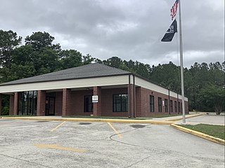
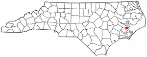
Bayboro is a town in Pamlico County, North Carolina, United States. The population was 1,161 at the 2020 U.S. census. It is the county seat of Pamlico County.
Mesic is a town in Pamlico County, North Carolina, United States. The population was 220 at the 2010 census. It is part of the New Bern, North Carolina Micropolitan Statistical Area.

Macon is a town located in Warren County, North Carolina, United States. As of the 2010 census, the town had a total population of 119. It is named for Nathaniel Macon, long-time Speaker of the U.S. House of Representatives.

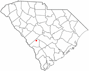
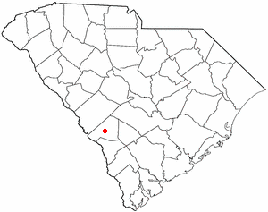
Stonewall is a town in Pontotoc County, Oklahoma, United States. Named for Confederate General Stonewall Jackson, the settlement's post office was established in December 1874.
Ulmer is a town in Allendale County, South Carolina, United States. The population was 65 at the 2020 census.
Elko is a town in Barnwell County, South Carolina, United States. According to the 2010 census the population was 193.

Hilda is a town in Barnwell County, South Carolina, United States. The population was 447 at the 2010 census..
Snelling is a town in Barnwell County, South Carolina, United States. The population was 274 at the 2010 census.
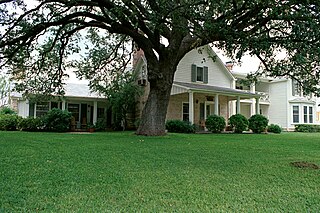
Stonewall is an unincorporated community and census-designated place (CDP) in Gillespie County, Texas, United States. The population was 525 at the 2010 census. It was named for Confederate General Thomas J. (Stonewall) Jackson, by Israel P. Nunez, who established a stage station near the site in 1870.

Stonewood is a city in Harrison County, West Virginia, United States. The population was 1,810 at the 2020 census.

Worthington is a town in Marion County, West Virginia, United States. The population was 158 at the 2010 census. Worthington was incorporated in 1893 and named for Colonel George Worthington, an early settler. U.S. Route 19 passes through the town.

Weddington is a suburban town in Union County, North Carolina, United States. The population was 9,459 at the 2010 census. It is a suburb in the Charlotte metropolitan area. The current mayor of Weddington is Jim Bell.