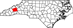
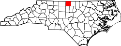
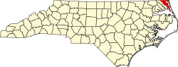
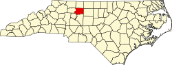
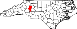
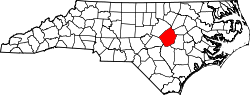
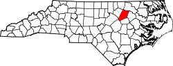
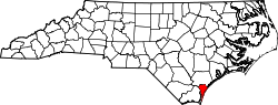
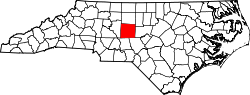
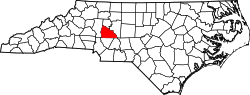
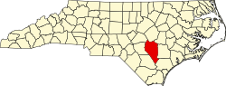
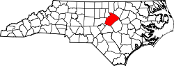
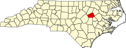
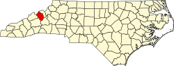
County FIPS code [ 3] County seat [ 5] Est. [ 5] Origin [ 6] Etymology [ 6] Pop. [ 7] Area [ 8] Map Alamance 001 Graham 1849 Orange County The Battle of Alamance which was derived from the local Indian word meaning "blue clay " found in the Great Alamance Creek 183,040 434 sq mi1,124 km2 ) Alexander 003 Taylorsville 1847 Caldwell County, Iredell County, and Wilkes County William J. Alexander (1797–1857) , member of the legislature and Speaker of the North Carolina House of Commons 36,693 264 sq mi684 km2 ) Alleghany 005 Sparta 1859 Ashe County Derived from a corruption of the Delaware Indian name for the Allegheny and Ohio Rivers and is said to have meant "a fine stream" 11,379 236 sq mi611 km2 ) Anson 007 Wadesboro 1750 Bladen County George, Lord Anson (1697–1762) , a celebrated English admiral who circumnavigated the globe 22,432 537 sq mi1,391 km2 ) Ashe 009 Jefferson 1799 Wilkes County Samuel Ashe (1725–1813) , a Revolutionary patriot, superior court judge and governor of North Carolina 27,266 429 sq mi1,111 km2 ) Avery 011 Newland 1911 Caldwell County, Mitchell County, and Watauga County Waightstill Avery (1741–1821) , a soldier of the Revolution and Attorney General of North Carolina 17,811 248 sq mi642 km2 ) Beaufort 013 Washington 1712 Bath County Henry Somerset, 2nd Duke of Beaufort , who in 1709 became one of the Lords Proprietor 44,576 963 sq mi2,494 km2 ) Bertie 015 Windsor 1722 Chowan County James or Henry Bertie , two Lords Proprietor of colonial North Carolina 16,939 741 sq mi1,919 km2 ) Bladen 017 Elizabethtown 1734 New Hanover County Martin Bladen (1680–1746) , a member of the Board of Trade 29,777 888 sq mi2,300 km2 ) Brunswick 019 Bolivia 1764 Bladen County and New Hanover County George I of Great Britain (1660–1727) , Duke of Brunswick and Lüneburg 167,112 1,050 sq mi2,719 km2 ) Buncombe 021 Asheville 1791 Burke County and Rutherford County Edward Buncombe (1742–1778) , a Revolutionary soldier, who was wounded and captured at the Battle of Germantown , and died a paroled prisoner in Philadelphia 279,210 660 sq mi1,709 km2 ) Burke 023 Morganton 1777 Rowan County Thomas Burke (1747–1783) , a member of the Continental Congress and governor of North Carolina 88,545 514 sq mi1,331 km2 ) Cabarrus 025 Concord 1792 Mecklenburg County Stephen Cabarrus (1754–1808) , member of the legislature and Speaker of the North Carolina House of Commons 244,925 364 sq mi943 km2 ) Caldwell 027 Lenoir 1841 Burke County and Wilkes County Joseph Caldwell (1773–1835) , the first president of the University of North Carolina 80,739 475 sq mi1,230 km2 ) Camden 029 Camden 1777 Pasquotank County Charles Pratt, 1st Earl Camden (1714–1794) , who opposed the taxation of the American colonists 11,184 310 sq mi803 km2 ) Carteret 031 Beaufort 1722 Craven County John Carteret, 2nd Earl Granville (1690–1763) , who inherited one-eighth share in the Province of Carolina through his great-grandfather George Carteret 70,259 1,330 sq mi3,445 km2 ) Caswell 033 Yanceyville 1777 Orange County Richard Caswell (1729–1789) , member of the first Continental Congress and first governor of North Carolina after the Declaration of Independence 22,363 429 sq mi1,111 km2 ) Catawba 035 Newton 1842 Lincoln County Catawba Indians 167,054 416 sq mi1,077 km2 ) Chatham 037 Pittsboro 1771 Orange County William Pitt, 1st Earl of Chatham (1708–1778) , Secretary of State during the French and Indian War and was later Prime Minister of Great Britain 83,874 709 sq mi1,836 km2 ) Cherokee 039 Murphy 1839 Macon County Cherokee Indians 30,373 467 sq mi1,210 km2 ) Chowan 041 Edenton 1668 Albemarle County Chowan Indian tribe 13,891 234 sq mi606 km2 ) Clay 043 Hayesville 1861 Cherokee County Henry Clay (1777–1852) , statesman and orator who represented Kentucky in both the House of Representatives and Senate 12,042 221 sq mi572 km2 ) Cleveland 045 Shelby 1841 Lincoln County and Rutherford County Benjamin Cleveland (1738–1806) , a colonel in the American Revolutionary War who took part in the Battle of Kings Mountain 102,194 468 sq mi1,212 km2 ) Columbus 047 Whiteville 1808 Bladen County and Brunswick County Christopher Columbus (1451–1507) , navigator , explorer , and one of the first Europeans to explore the Americas 50,054 955 sq mi2,473 km2 ) Craven 049 New Bern 1705 Bath County William, Earl of Craven (1608–1697) , who was a Lords Proprietor of colonial North Carolina 104,167 773 sq mi2,002 km2 ) Cumberland 051 Fayetteville 1754 Bladen County Prince William, Duke of Cumberland (1721–1765) , a military leader and son of George II 338,430 658 sq mi1,704 km2 ) Currituck 053 Currituck 1668 Albemarle County Traditionally said to be an Indian word for wild geese , also rendered "Coratank" 32,278 526 sq mi1,362 km2 ) Dare 055 Manteo 1870 Currituck County, Hyde County, and Tyrrell County Virginia Dare (b. 1587) , the first child born of English parents in America 38,183 1,542 sq mi3,994 km2 ) Davidson 057 Lexington 1822 Rowan County William Lee Davidson (1746–1781) , an American Revolutionary War general who was mortally wounded at Cowan's Ford 177,809 568 sq mi1,471 km2 ) Davie 059 Mocksville 1836 Rowan County William Richardson Davie (1756–1820) , a member of the Federal Convention and governor of North Carolina 45,383 266 sq mi689 km2 ) Duplin 061 Kenansville 1750 New Hanover County Thomas Hay, Viscount Dupplin (1710–1787) , who was the 9th Earl of Kinnoull 50,539 820 sq mi2,124 km2 ) Durham 063 Durham 1881 Orange County and Wake County The city of Durham , which was named in honor of Dr. Bartlett Snipes Durham , who donated the land on which the earliest parts of the city were built 343,628 298 sq mi772 km2 ) Edgecombe 065 Tarboro 1741 Bertie County Richard Edgcumbe, 1st Baron Edgcumbe (1680–1758) , a Lord High Treasurer and Paymaster General for Ireland 49,124 507 sq mi1,313 km2 ) Forsyth 067 Winston-Salem 1849 Stokes County Benjamin Forsyth (d. 1814) , an American officer during the War of 1812 398,143 412 sq mi1,067 km2 ) Franklin 069 Louisburg 1779 Bute County Benjamin Franklin (1706–1790) , an author, politician, statesman , and Founding Father of the United States 79,771 494 sq mi1,279 km2 ) Gaston 071 Gastonia 1846 Lincoln County William Gaston (1778–1844) , a United States Congressman and justice of the North Carolina Supreme Court 242,010 364 sq mi943 km2 ) Gates 073 Gatesville 1779 Chowan County, Hertford County, and Perquimans County Horatio Gates (1727–1806) , an American general during the Revolution at the Battle of Saratoga 10,299 346 sq mi896 km2 ) Graham 075 Robbinsville 1872 Cherokee County William Alexander Graham (1804–1875) , a United States Senator , governor of North Carolina , and United States Secretary of the Navy 8,179 302 sq mi782 km2 ) Granville 077 Oxford 1746 Edgecombe County John Carteret, 2nd Earl Granville (1690–1763) , who inherited one-eighth share in the Province of Carolina through his great-grandfather George Carteret 61,544 538 sq mi1,393 km2 ) Greene 079 Snow Hill 1799 Dobbs County Originally named Glasgow County Nathanael Greene (1742–1786) , a major general of the Continental Army in the American Revolutionary War 20,671 267 sq mi692 km2 ) Guilford 081 Greensboro 1771 Orange County and Rowan County Francis North, 1st Earl of Guilford (1704–1790) , a British politician and father of Prime Minister of Great Britain Frederick North 558,816 658 sq mi1,704 km2 ) Halifax 083 Halifax 1758 Edgecombe County George Montagu-Dunk, 2nd Earl of Halifax (1716–1771) , a British statesman and President of the Board of Trade 46,992 730 sq mi1,891 km2 ) Harnett 085 Lillington 1855 Cumberland County Cornelius Harnett (1723–1781) , an American Revolutionary and delegate in the Continental Congress 146,096 601 sq mi1,557 km2 ) Haywood 087 Waynesville 1808 Buncombe County John Haywood (1754–1827) , a North Carolina State Treasurer 63,048 555 sq mi1,437 km2 ) Henderson 089 Hendersonville 1838 Buncombe County Leonard Henderson (1772–1833) , Chief Justice of the North Carolina Supreme Court 120,771 375 sq mi971 km2 ) Hertford 091 Winton 1759 Bertie County, Chowan County, and Northampton County Francis Seymour-Conway, 1st Marquess of Hertford (1718–1794) , who was Lord of the Bedchamber to George II and George III 19,169 360 sq mi932 km2 ) Hoke 093 Raeford 1911 Cumberland County and Robeson County Robert Hoke (1837–1912) , a Confederate general during the American Civil War 55,382 392 sq mi1,015 km2 ) Hyde 095 Swan Quarter 1712 Bath County Edward Hyde (1667–1712) , a governor of colonial North Carolina 4,583 1,459 sq mi3,779 km2 ) Iredell 097 Statesville 1788 Rowan County James Iredell (1751–1799) , a comptroller at the port of Edenton and one of the original justices of the Supreme Court of the United States 206,361 597 sq mi1,546 km2 ) Jackson 099 Sylva 1851 Haywood County and Macon County Andrew Jackson (1767–1845) , the 7th President of the United States 45,281 495 sq mi1,282 km2 ) Johnston 101 Smithfield 1746 Craven County Gabriel Johnston (1699–1752) , a governor of colonial North Carolina 249,794 796 sq mi2,062 km2 ) Jones 103 Trenton 1779 Craven County Willie Jones (1740–1801) , opposed the ratification of the United States Constitution and declined an invitation to the Constitutional Convention 9,462 474 sq mi1,228 km2 ) Lee 105 Sanford 1907 Chatham County and Moore County Robert E. Lee (1807–1870) , a career United States Army officer and general of the Confederate forces during the American Civil War 68,537 259 sq mi671 km2 ) Lenoir 107 Kinston 1791 Dobbs County William Lenoir (1751–1839) , a captain in the American Revolutionary War who took part in the Battle of Kings Mountain 55,332 401 sq mi1,039 km2 ) Lincoln 109 Lincolnton 1779 Tryon County Benjamin Lincoln (1733–1810) , a major general during the American Revolutionary War who participated in the Siege of Yorktown 97,611 305 sq mi790 km2 ) Macon 113 Franklin 1828 Haywood County Nathaniel Macon (1758–1837) , a member and Speaker of the United States House of Representatives 38,717 520 sq mi1,347 km2 ) Madison 115 Marshall 1851 Buncombe County and Yancey County James Madison (1751–1836) , the 4th President of the United States 22,352 451 sq mi1,168 km2 ) Martin 117 Williamston 1774 Halifax County and Tyrrell County Josiah Martin (1737–1786) , the last governor of colonial North Carolina 21,523 457 sq mi1,184 km2 ) McDowell 111 Marion 1842 Burke County and Rutherford County Joseph McDowell (1756–1801) , a soldier in the American Revolutionary War who took part in the Battle of Kings Mountain 45,269 445 sq mi1,153 km2 ) Mecklenburg 119 Charlotte 1762 Anson County Charlotte of Mecklenburg-Strelitz (1744–1818) , the queen consort of George III of the United Kingdom 1,206,285 546 sq mi1,414 km2 ) Mitchell 121 Bakersville 1861 Burke County, Caldwell County, McDowell County, Watauga County, and Yancey County Elisha Mitchell (1793–1857) , a professor at the University of North Carolina who measured the height of Mount Mitchell 15,030 222 sq mi575 km2 ) Montgomery 123 Troy 1779 Anson County Richard Montgomery (1738–1775) , a major general during the Revolutionary War who was killed at the Battle of Quebec 26,364 502 sq mi1,300 km2 ) Moore 125 Carthage 1784 Cumberland County Alfred Moore (1755–1810) , a captain in the Revolutionary War and justice of the Supreme Court of the United States 108,417 706 sq mi1,829 km2 ) Nash 127 Nashville 1777 Edgecombe County Francis Nash (1742–1777) , a brigadier general in the Revolutionary War who was mortally wounded at the Battle of Germantown 97,990 543 sq mi1,406 km2 ) New Hanover 129 Wilmington 1729 Craven County The royal family of England, members of the House of Hanover 243,333 329 sq mi852 km2 ) Northampton 131 Jackson 1741 Bertie County James Compton, 5th Earl of Northampton (1687–1754) , a British peer and politician 16,580 551 sq mi1,427 km2 ) Onslow 133 Jacksonville 1734 New Hanover County Arthur Onslow (1691–1768) , Speaker of the House of Commons 212,954 905 sq mi2,344 km2 ) Orange 135 Hillsborough 1752 Bladen County, Granville County, and Johnston County Unknown; possibly Prince William V of Orange (1748–1806) , the last Stadtholder of the Dutch Republic ; or William of Orange (1650–1702) , who became King of England after the Glorious Revolution [ 9] 152,877 401 sq mi1,039 km2 ) Pamlico 137 Bayboro 1872 Beaufort County and Craven County Pamlico Sound and the Pamlico Indian tribe 12,550 562 sq mi1,456 km2 ) Pasquotank 139 Elizabeth City 1668 Albemarle County Derived from the Indian word "pasketanki" which meant "where the current of the stream divides or forks" 41,418 289 sq mi749 km2 ) Pender 141 Burgaw 1875 New Hanover County William Dorsey Pender (1834–1863) , Confederate soldier who was mortally wounded at the Battle of Gettysburg of the American Civil War 70,077 934 sq mi2,419 km2 ) Perquimans 143 Hertford 1668 Albemarle County The Indian word "perquimans" means "land of beautiful women" and was coined by a sect of the Yeopim tribe, later becoming the 'Perquiman' 13,460 329 sq mi852 km2 ) Person 145 Roxboro 1791 Caswell County Thomas Person (1733–1800) , an American Revolutionary War patriot 40,143 404 sq mi1,046 km2 ) Pitt 147 Greenville 1760 Beaufort County William Pitt, 1st Earl of Chatham (1708–1778) , Secretary of State during the French and Indian War and was later Prime Minister of Great Britain 180,783 656 sq mi1,699 km2 ) Polk 149 Columbus 1855 Henderson County and Rutherford County William Polk (1758–1834) , officer in the American Revolutionary War and first president of the State Bank of North Carolina 20,320 238 sq mi616 km2 ) Randolph 151 Asheboro 1779 Guilford County Peyton Randolph (c. 1721 , the first President of the Continental Congress 148,389 790 sq mi2,046 km2 ) Richmond 153 Rockingham 1779 Anson County Charles Lennox, 3rd Duke of Richmond (1735–1806) , a firm supporter of the American colonists and advocated removal of British troops 41,990 480 sq mi1,243 km2 ) Robeson 155 Lumberton 1787 Bladen County Thomas Robeson (1740–1785) , an officer in the American Revolutionary War 118,624 949 sq mi2,458 km2 ) Rockingham 157 Wentworth 1785 Guilford County Charles Watson-Wentworth, 2nd Marquess of Rockingham (1730–1782) , a British statesmen and two-time Prime Minister of Great Britain 93,517 573 sq mi1,484 km2 ) Rowan 159 Salisbury 1753 Anson County Matthew Rowan (d. 1769) , was the acting Governor of colonial North Carolina following the death of Governor Nathaniel Rice 153,384 524 sq mi1,357 km2 ) Rutherford 161 Rutherfordton 1779 Tryon County Griffith Rutherford (c. 1721 , an officer in the American Revolutionary War and a political leader in North Carolina 65,587 567 sq mi1,469 km2 ) Sampson 163 Clinton 1784 Duplin County John Sampson (1719–1784) , a member of Josiah Martin 's council 60,404 948 sq mi2,455 km2 ) Scotland 165 Laurinburg 1899 Richmond County The country Scotland , part of the United Kingdom 33,898 321 sq mi831 km2 ) Stanly 167 Albemarle 1841 Montgomery County John Stanly (1774–1834) , a United States Congressman and Speaker of the North Carolina House of Commons 67,326 405 sq mi1,049 km2 ) Stokes 169 Danbury 1789 Surry County John Stokes (1756–1790) , a soldier of the Revolution who was seriously wounded at the Waxhaw massacre 45,857 456 sq mi1,181 km2 ) Surry 171 Dobson 1771 Rowan County The county of Surrey in England, birthplace of then governor William Tryon 71,547 537 sq mi1,391 km2 ) Swain 173 Bryson City 1871 Jackson County and Macon County David Lowry Swain (1801–1868) , a governor of North Carolina and president of the University of North Carolina 13,945 540 sq mi1,399 km2 ) Transylvania 175 Brevard 1861 Henderson County and Jackson County Derived from the Latin words, trans sylva 34,103 380 sq mi984 km2 ) Tyrrell 177 Columbia 1729 Chowan County, Currituck County, and Pasquotank County John Tyrrell (1685–1729) , at one time was a Lords Proprietor 3,517 597 sq mi1,546 km2 ) Union 179 Monroe 1842 Anson County and Mecklenburg County Created as a compromise after a dispute between local Whigs and Democrats as to whether it should be named Clay or Jackson county 263,386 640 sq mi1,658 km2 ) Vance 181 Henderson 1881 Franklin County, Granville County, and Warren County Zebulon Baird Vance (1830–1894) , a Confederate military officer in the American Civil War , twice governor of North Carolina , and United States Senator 42,337 269 sq mi697 km2 ) Wake 183 Raleigh 1771 Cumberland County, Johnston County, and Orange County Margaret Wake (c.1732–1819) , the wife of British colonial governor William Tryon 1,232,444 857 sq mi2,220 km2 ) Warren 185 Warrenton 1779 Bute County Joseph Warren (1741–1775) , a Patriot and volunteer private who was mortally wounded at the Battle of Bunker Hill 19,081 444 sq mi1,150 km2 ) Washington 187 Plymouth 1799 Tyrrell County George Washington (1732–1799) , the 1st president of the United States 10,654 422 sq mi1,093 km2 ) Watauga 189 Boone 1849 Ashe County, Caldwell County, Wilkes County, and Yancey County The Watauga River , which came from an Indian word meaning "beautiful water" 54,997 313 sq mi811 km2 ) Wayne 191 Goldsboro 1779 Dobbs County Anthony Wayne (1745–1796) , a general in the American Revolutionary War 120,338 558 sq mi1,445 km2 ) Wilkes 193 Wilkesboro 1778 Surry County John Wilkes (1725–1797) , an English radical , journalist, and politician 66,186 756 sq mi1,958 km2 ) Wilson 195 Wilson 1855 Edgecombe County, Johnston County, Nash County, and Wayne County Louis D. Wilson (1789–1847) , a state legislator from Edgecombe County who died of fever at Veracruz during the Mexican–American War 79,958 373 sq mi966 km2 ) Yadkin 197 Yadkinville 1850 Surry County The Yadkin River 37,995 338 sq mi875 km2 ) Yancey 199 Burnsville 1833 Buncombe County and Burke County Bartlett Yancey (1785–1828) , a United States Congressman , Speaker of the North Carolina Senate , and early advocate for the North Carolina Public School System 18,993 313 sq mi811 km2 )