The town of Rutherfordton was founded in 1787 to serve as the new seat of Rutherford County, taking over from Gilbert Town. Its foundation was planned by a committee appointed by the General Assembly of North Carolina. The committee purchased 50 acres of land[6] on Cleghorn Creek from landowner James Adair. The plots included a hill safe from flooding, making it a perfect site for building the town courthouse. By 1791, the main streets of Rutherfordton had been laid out on a grid plan. Next was the construction of the U.S. Post Office in 1798, and the establishment of the Rutherfordton Academy in 1806.[7]
Rutherfordton was at the center of the flourishing North Carolina gold industry between 1790 and 1840.[8] During that period, 70% of the American gold supply came from western North Carolina.[9] German-born goldsmith Christopher Bechtler minted the first U.S. gold dollars in Rutherfordton.[8]
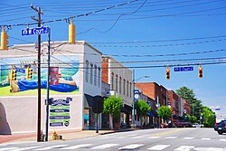
Geography
Rutherfordton is concentrated around the intersection of U.S. Route 221 and North Carolina Highway 108. The town of Ruth borders Rutherfordton to the north, and the town of Spindale borders Rutherfordton to the east.
According to the United States Census Bureau, the town has a total area of 4.2square miles (10.8km2), all land.
As of the 2020 United States census, there were 3,640 people, 1,882 households, and 893 families residing in the town.
2000 census
As of the census[3] of 2000, there were 4,131 people, 1,602 households, and 1,047 families residing in the town. The population density was 990.1 inhabitants per square mile (382.3/km2). There were 1,765 housing units at an average density of 423.0 per square mile (163.3/km2). The racial makeup of the town was 84.17% White, 13.60% African American, 0.12% Native American, 0.73% Asian, 0.73% from other races, and 0.65% from two or more races. Hispanic or Latino of any race were 1.28% of the population.
There were 1,602 households, out of which 30.0% had children under the age of 18 living with them, 48.9% were married couples living together, 13.2% had a female householder with no husband present, and 34.6% were non-families. 31.5% of all households were made up of individuals, and 16.1% had someone living alone who was 65 years of age or older. The average household size was 2.33 and the average family size was 2.91.
In the town, the population was spread out, with 22.6% under the age of 18, 6.9% from 18 to 24, 28.0% from 25 to 44, 22.0% from 45 to 64, and 20.5% who were 65 years of age or older. The median age was 40 years. For every 100 females, there were 89.4 males. For every 100 females age 18 and over, there were 85.5 males.
The median income for a household in the town was $37,941, and the median income for a family was $47,381. Males had a median income of $34,592 versus $23,371 for females. The per capita income for the town was $21,742. About 8.8% of families and 10.8% of the population were below the poverty line, including 15.4% of those under age 18 and 12.6% of those age 65 or over.
This page is based on this Wikipedia article Text is available under the CC BY-SA 4.0 license; additional terms may apply. Images, videos and audio are available under their respective licenses.