Jacksonville | |
|---|---|
 Clockwise from top left: waterfront along New River, LP Willingham Riverfront Park, Court Street, Onslow County Courthouse | |
 Flag  Seal | |
| Nicknames: J-Ville, J-Vegas, Marine Town | |
| Motto: "A Caring Community" | |
 Location within North Carolina | |
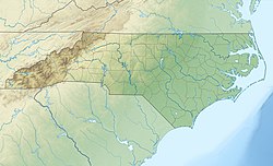 Jacksonville | |
| Coordinates: 34°45′35″N77°24′35″W / 34.75972°N 77.40972°W | |
| Country | United States |
| State | North Carolina |
| County | Onslow |
| Founded | 1757 |
| Incorporated | 1842 |
| Named For | Andrew Jackson |
| Government | |
| • Mayor | Sammy Phillips [1] |
| Area | |
• Total | 56.42 sq mi (146.14 km2) |
| • Land | 48.80 sq mi (126.40 km2) |
| • Water | 7.62 sq mi (19.74 km2) 13.51% |
| Elevation | 0 ft (0 m) |
| Population (2020) | |
• Total | 72,723 |
• Estimate (2023) | 72,879 |
| • Density | 1,490.1/sq mi (575.35/km2) |
| • Urban | 111,224 (US: 302nd) [4] |
| • Urban density | 1,470/sq mi (567.6/km2) |
| • Metro | 213,676 (US: 219th) |
| Time zone | UTC−05:00 (EST) |
| • Summer (DST) | UTC−04:00 (EDT) |
| ZIP Codes | 28540, 28541, 28546 |
| Area codes | 910, 472 |
| FIPS code | 37-34200 [6] |
| GNIS feature ID | 2404784 [3] |
| Website | jacksonvillenc |
Jacksonville is the county seat of and the most populous community in Onslow County, North Carolina, which is coterminous with the Jacksonville, NC Metropolitan Statistical Area. As of the 2020 census, the population was 72,723, which makes Jacksonville the 14th-most populous city in North Carolina. [7] Demographically, Jacksonville is the youngest city in the United States, with an average age of 22.8 years old, which can be attributed to the large military presence. The low age may also be in part due to the population drastically increasing over the past 80 years, from 783 in the 1930 census to 72,723 in the 2020 census. [8] [7]
Contents
- History
- Geography
- Climate
- Demographics
- 2020 census
- 2000 census
- Economy
- Top employers
- Law and government
- City Council
- Education
- Public schools
- Private schools
- Public magnet schools
- Higher education
- Charter school
- Transportation
- Notable people
- See also
- References
- Further reading
- External links
It is the home of the United States Marine Corps' Camp Lejeune and New River Air Station. Jacksonville is located adjacent to North Carolina's Crystal Coast area.


