Brunswick County | |
|---|---|
 Brunswick County Courthouse | |
 Flag  Seal | |
 Location within the U.S. state of North Carolina | |
 North Carolina's location within the U.S. | |
| Coordinates: 34°02′20″N78°13′40″W / 34.038754°N 78.227765°W | |
| Country | |
| State | |
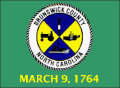
| Founded | March 9, 1764 |
| Named after | Duchy of Brunswick-Lüneburg |
| Seat | Bolivia |
| Largest community | Leland |
| Area | |
• Total | 1,049.543 sq mi (2,718.30 km2) |
| • Land | 850.069 sq mi (2,201.67 km2) |
| • Water | 199.474 sq mi (516.64 km2) 19.00% |
| Population (2020) | |
• Total | 136,693 |
• Estimate (2024) | 167,112 |
| • Density | 160.8/sq mi (62.1/km2) |
| Time zone | UTC−5 (Eastern) |
| • Summer (DST) | UTC−4 (EDT) |
| Congressional district | 7th |
| Website | www |
Brunswick County is a county located in the U.S. state of North Carolina. It is the southernmost county in the state. As of the 2020 census, the population was 136,693. [1] Its population was only 73,143 in 2000, making it one of the fastest-growing counties in the state. [2] With a nominal growth rate of approximately 47% in ten years, much of the growth is centered in the eastern section of the county in the suburbs of Wilmington such as Leland, Belville and Southport. The county seat is Bolivia, which at a population of around 150 people is among the least populous county seats in the state. [3]
Contents
- History
- Geography
- Hydrogeology
- State and local protected area/sites
- Major water bodies
- Major islands
- Major beaches
- Adjacent counties
- Major highways
- Major infrastructure
- Demographics
- 2020 census
- 2010 census
- 2000 census
- Government and politics
- Economy
- Culture
- Communities
- Cities
- Towns
- Village
- Townships
- Unincorporated communities
- Education
- See also
- References
- External links
Brunswick County is part of the Wilmington, NC Metropolitan Statistical Area. From 2013 to 2023, the county was part of the Myrtle Beach-Conway-North Myrtle Beach, SC Metropolitan Statistical Area. During that time, Brunswick County and Wilmington area leaders disputed the change, including many government leaders like Senator Richard Burr. Ultimately, their efforts were a success because the county was added back into the MSA after a 2023 realignment. [4] [5] [6] [7]
Much of the economy of the county is built around tourism, with beach communities lying along the south-facing beaches past Cape Fear such as Bald Head Island (the southernmost point of North Carolina) and Oak Island being popular destinations. Calabash, on the border of South Carolina, is renowned for its fried seafood, with "Calabash-style" restaurants dotting the region. The proximity to Cinespace Wilmington in nearby Wilmington has made Brunswick County a popular filming location for many movies and TV shows.


