Related Research Articles

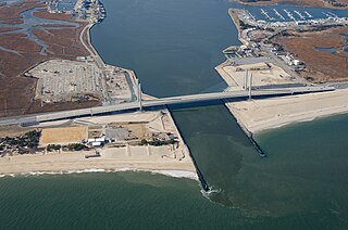
The Cape Cod Canal is an artificial waterway in Massachusetts connecting Cape Cod Bay in the north to Buzzards Bay in the south, and is part of the Atlantic Intracoastal Waterway. The approximately 7.4-mile-long (11.9 km) canal traverses the neck of land joining Cape Cod to the state's mainland. It mostly follows tidal rivers widened to 480 feet (150 m) and deepened to 32 feet (9.8 m) at mean low water, shaving up to 135 miles (217 km) off the journey around the cape for its approximately 14,000 annual users.

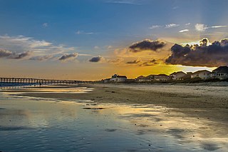
Holden Beach is a seaside town in Brunswick County, North Carolina. The population was 575 at the time of the 2010 census. It is part of the Wilmington, NC Metropolitan Statistical Area.

Ocean Isle Beach is a small seaside town in Brunswick County, North Carolina, United States. It was incorporated as a town in 1959 and is part of the Wilmington, NC Metropolitan Statistical Area. The population was 867 at the 2020 census. Located at the southern end of North Carolina's Atlantic coastline, along the Atlantic Intracoastal Waterway, Ocean Isle Beach has private homes, seasonal rentals, and tourist attractions.

The Intracoastal Waterway (ICW) is a 3,000-mile (4,800 km) inland waterway along the Atlantic and Gulf of Mexico coasts of the United States, running from Massachusetts southward along the Atlantic Seaboard and around the southern tip of Florida, then following the Gulf Coast to Brownsville, Texas. Some sections of the waterway consist of natural inlets, saltwater rivers, bays, and sounds, while others are artificial canals. It provides a navigable route along its length without many of the hazards of travel on the open sea.

Biscayne Bay is a lagoon with characteristics of an estuary located on the Atlantic coast of South Florida. The northern end of the lagoon is surrounded by the densely developed heart of the Miami metropolitan area while the southern end is largely undeveloped with a large portion of the lagoon included in Biscayne National Park.

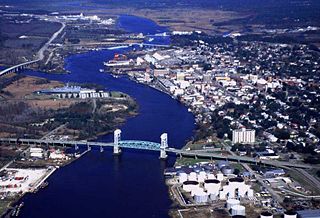
The New River is a 50-mile (80-km) long river in southeastern North Carolina in the United States. It empties into the Atlantic Ocean. The river has been plagued in more recent years by pollution by solid waste. It rises in northwestern Onslow County and flows east-southeast past Jacksonville, where it widens into a tidal estuary approximately two miles (3.2 km) wide. As an estuary it meanders through Marine Corps Base Camp Lejeune and enters the Atlantic in Onslow Bay, via the New River Inlet between two barrier islands. The Atlantic Intracoastal Waterway crosses the entrance of the river between the coast and the barrier island.

The Indian River is a river and estuary, approximately 15 mi (24 km) long, in Sussex County in southern Delaware in the United States. The river is named after a Native American reservation that was located on its upper reaches.
The Mississippi River–Gulf Outlet Canal is a 76 mi (122 km) channel constructed by the United States Army Corps of Engineers at the direction of Congress in the mid-20th century that provided a shorter route between the Gulf of Mexico and New Orleans' inner harbor Industrial Canal via the Intracoastal Waterway. In 2005, the MRGO channeled Hurricane Katrina's storm surge into the heart of Greater New Orleans, contributing significantly to the subsequent multiple engineering failures experienced by the region's hurricane protection network. In the aftermath the channel was closed. A permanent storm surge barrier was constructed in the MRGO in 2009, and the channel has been closed to maritime shipping.

Oak Island is located on the Atlantic Ocean coast in Brunswick County, North Carolina near the South Carolina border. A barrier island, it contains the towns of Oak Island and Caswell Beach, Fort Caswell and the Oak Island Coast Guard Station which is co-located with the Oak Island Lighthouse. Almost 13 miles long, the island averages about one mile wide. As of 2020 the island had 8,791 permanent residents, while the summertime population can swell to nearly 50,000.

The Canaveral Barge Canal is an active canal in Brevard County, Florida, cutting east-west across northern Merritt Island just south of Cape Canaveral. It connects the Atlantic Ocean and Port Canaveral with the Indian River and wider Indian River Lagoon, part of the Intracoastal Waterway. The canal consists of two segments separated by the Banana River.

The St. Lucie Inlet, Florida is located between Hutchinson Island and Jupiter Island in Martin County, Florida, at coordinates 27°09′58″N80°09′24″W. The St. Lucie Inlet is one of six inlets into the Indian River Lagoon.

The inland waterways of the United States include more than 25,000 mi (40,000 km) of navigable waters. Much of the commercially important waterways of the United States consist of the Mississippi River System—the Mississippi River and connecting waterways.

The Cape May Canal is a 2.9-nautical-mile waterway connecting Cape May Harbor to the Delaware Bay, at the southern tip of Cape May County, New Jersey. There is a long history of unfulfilled plans for a canal across Cape May. The canal was finally constructed by the United States Army Corps of Engineers during World War II to provide a protected route to avoid German U-boats operating off Cape May Point and to become part of the Intracoastal Waterway. The canal was dredged as a wartime emergency measure in 1942 and was the final link in a protected waterway intended to allow coastal shipping to travel along the coast with a greatly reduced risk of attack from German submarines.

Supply is a small unincorporated community in Brunswick County, North Carolina, United States, located around the intersection of US 17 and NC 211. Its name is derived from the use of the Lockwoods Folly River as a trade route in the 18th and 19th centuries. Residents of the nearby beach communities of Holden Beach, Oak Island, Ocean Isle, Caswell Beach, and Sunset Beach often formerly commuted to Supply for goods and other materials. This practice is still common, but development in the town of Southport and in the Intracoastal Waterway commercial districts has made traveling to Supply unnecessary.

The Charleston Harbor is an inlet of the Atlantic Ocean at Charleston, South Carolina. The inlet is formed by the junction of Ashley and Cooper rivers at 32°49′7.10″N79°55′40.41″W. Morris and Sullivan's Islands shelter the entrance. Charleston Harbor forms part of the Intracoastal Waterway.

Cape Fear is a coastal plain and Tidewater region of North Carolina centered about the city of Wilmington. The region takes its name from the adjacent Cape Fear headland, as does the Cape Fear River which flows through the region and empties into the Atlantic Ocean near the cape. Much of the region's populated areas are found along the Atlantic beaches and the Atlantic Intracoastal Waterway, while the rural areas are dominated by farms and swampland like that of the Green Swamp. The general area can be also identified by the titles "Lower Cape Fear", "Wilmington, NC Metropolitan Statistical Area", "Southeastern North Carolina", and "Azalea Coast". The latter name is derived from the North Carolina Azalea Festival held annually in Wilmington. Municipalities in the area belong to the Cape Fear Council of Governments.
Lockwood Folly River or Lockwood's Folly River is a short tidal river in Brunswick County, North Carolina, United States. Waters from the Green Swamp drain into the river near Supply and flow southward to empty into the Atlantic Intracoastal Waterway near Sunset Harbor. The Lockwood Folly Country Club in Varnamtown takes its name from the river.

Sunset Harbor is an unincorporated community on the banks of the Lockwood Folly River and the Atlantic Intracoastal Waterway in Brunswick County, North Carolina, United States. It is bordered by the city limits of Oak Island and is situated across the river from Varnamtown. By road, the community can only be accessed by Sunset Harbor Road, which feeds into North Carolina Highway 211.
Great Egg Harbor Bay is a bay between Atlantic and Cape May counties along the southern New Jersey coast. The name derives from Dutch explorer Cornelius Jacobsen May's description of the plentiful birds laying eggs, naming the waters Eyren Haven, which translates to Egg Harbor in English. The bay has a total area of 8.5 sq mi (22 km2). Its depth ranges from shallow waters in the southern extension, called Peck Bay, to a 33 ft (10 m) deep channel.

Port Mansfield Channel or Mansfield Cut is an artificial waterway encompassing the Laguna Madre positioned at the 97th meridian west on the earth's longest barrier island known as Padre Island. During Post–World War II, the tidal inlet was dredged as a private channel differentiating North Padre Island better known as Padre Island National Seashore and South Padre Island. The navigable waterway was channeled during the late 1950s ceremoniously cresting the intertidal zone of the Gulf of Mexico by September 1957 on the Texas Gulf Coast.
References
- 1 2 3 4 5 6 "Shallotte River". Capefear-NC.com. Retrieved 2024-08-08.
- 1 2 3 Shallotte and Lockwoods Folly Rivers Maintenance: Environmental Impact Statement. Wilmington, North Carolina: U.S. Army Corps of Engineers. December 1975. pp. iv–v – via Google Books.
- ↑ Shallotte and Lockwoods Folly Rivers Maintenance: Environmental Impact Statement. Wilmington, North Carolina: U.S. Army Corps of Engineers. December 1975. p. 5 – via Google Books.
- 1 2 "Shallotte". Star-News. May 24, 1998. p. 34. Retrieved 1 November 2015.
- 1 2 Shallotte and Lockwoods Folly Rivers Maintenance: Environmental Impact Statement. Wilmington, North Carolina: United States. Army. Corps of Engineers. December 1975. pp. 9 and 13 – via Newspapers.com.
- 1 2 Griffes, Peter L. (2001). 2002 Navigation Rules -Boating Almanac: North Carolina, South Carolina, and Georgia. ProStar Publications. p. 426. ISBN 978-1-57785-503-3 – via Google Books.
- ↑ Town of Shallotte: Welcome to Shallotte
33°54′21″N78°22′43″W / 33.90583°N 78.37861°W