Clayton, North Carolina

Last updated

Clayton, North Carolina
East Main Street, Clayton, North Carolina.jpg
East Main Street in Clayton
Official Seal of Town of Clayton NC.tif
Motto: 
"The Premier Community for Active Families"
NCMap-doton-Clayton.PNG
Location of Clayton, North Carolina
USA North Carolina location map.svg
Red pog.svg
Clayton
Usa edcp location map.svg
Red pog.svg
Clayton
Coordinates: 35°39′30″N78°26′55″W / 35.65833°N 78.44861°W / 35.65833; -78.44861
CountryUnited States
State North Carolina
Counties Johnston, Wake
Established1868
Government
   Mayor Jody McLeod [1]
Area
[2]
   Town 16.14 sq mi (41.80 km2)
  Land16.12 sq mi (41.74 km2)
  Water0.02 sq mi (0.06 km2)
Elevation
[3]
276 ft (84 m)
Population
 (2020)
   Town 26,307
  Density1,632.25/sq mi (630.20/km2)
   Urban
51,898 (US: 492nd) [4]
  Urban density1,431.2/sq mi (552.6/km2)
Time zone UTC−5 (Eastern (EST))
  Summer (DST) UTC−4 (EDT)
ZIP codes
27520, 27527
Area code 919
FIPS code 37-12860 [5]
GNIS feature ID2406276 [3]
Website www.townofclaytonnc.org

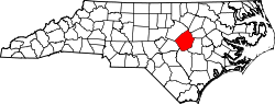
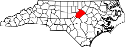
Clayton is a town in Johnston County, North Carolina, United States, and is considered a satellite town of Raleigh. As of 2010, Clayton's population was 16,116, [6] up from 6,973 at the 2000 census. By 2019 the town's estimated population was 24,887. [7] Much of that growth can be attributed to the town's proximity to the Research Triangle area and access to major highways such as I-40 and US 70.

Contents

Geography

Clayton is in northern Johnston County, with a small portion extending northwest along US 70 Business into Wake County. In 2006, construction began on the Highway 70 Clayton Bypass, a 10.5-mile (16.9 km) stretch from Interstate 40 along the southern portion of Clayton to Highway 70 business southeast of town. It was completed in June 2008. US 70 leads southeast 13 miles (21 km) to Interstate 95 at Smithfield. Downtown Raleigh is 16 miles (26 km) northwest of Clayton via US 70 Business and Interstate 40. Many local unincorporated communities outside of the town limits use Clayton mailing addresses, including Cleveland, Powhatan, and Flowers.

According to the U.S. Census Bureau, as of the 2010 census the town had an area of 13.53 square miles (35.05 km2), of which 13.51 square miles (34.99 km2) were land and 0.02 square miles (0.06 km2), or 0.16%, were water. [6] The town is part of the Neuse River watershed. The town limits now extend northeast to the Neuse River and beyond.

Town Hall is located at 111 East Second Street and is shared with The Clayton Center, a performing arts and conference center.

Climate

According to the Köppen Climate Classification system, Clayton has a humid subtropical climate, abbreviated "Cfa" on climate maps. The hottest temperature recorded in Clayton was 107 °F (41.7 °C) on August 18, 1988, while the coldest temperature recorded was −10 °F (−23.3 °C) on January 21, 1985. [8]

Climate data for Clayton, North Carolina, 1991–2020 normals, extremes 1955–present
MonthJanFebMarAprMayJunJulAugSepOctNovDecYear
Record high °F (°C)81
(27)
83
(28)
91
(33)
97
(36)
96
(36)
103
(39)
103
(39)
107
(42)
98
(37)
96
(36)
86
(30)
81
(27)
107
(42)
Mean maximum °F (°C)71.4
(21.9)
74.4
(23.6)
81.1
(27.3)
86.2
(30.1)
90.6
(32.6)
94.6
(34.8)
96.0
(35.6)
94.8
(34.9)
90.7
(32.6)
85.4
(29.7)
78.8
(26.0)
72.6
(22.6)
97.3
(36.3)
Mean daily maximum °F (°C)52.0
(11.1)
55.6
(13.1)
63.2
(17.3)
72.7
(22.6)
79.2
(26.2)
85.7
(29.8)
89.0
(31.7)
87.4
(30.8)
82.0
(27.8)
72.5
(22.5)
62.9
(17.2)
55.1
(12.8)
71.4
(21.9)
Daily mean °F (°C)40.7
(4.8)
43.2
(6.2)
50.2
(10.1)
59.2
(15.1)
67.7
(19.8)
75.1
(23.9)
79.0
(26.1)
77.5
(25.3)
71.8
(22.1)
60.6
(15.9)
50.5
(10.3)
43.6
(6.4)
59.9
(15.5)
Mean daily minimum °F (°C)29.5
(−1.4)
30.8
(−0.7)
37.2
(2.9)
45.8
(7.7)
56.2
(13.4)
64.6
(18.1)
69.0
(20.6)
67.6
(19.8)
61.6
(16.4)
48.7
(9.3)
38.0
(3.3)
32.2
(0.1)
48.4
(9.1)
Mean minimum °F (°C)14.3
(−9.8)
18.8
(−7.3)
23.9
(−4.5)
32.8
(0.4)
43.4
(6.3)
54.3
(12.4)
61.7
(16.5)
59.8
(15.4)
49.9
(9.9)
35.1
(1.7)
25.2
(−3.8)
20.4
(−6.4)
13.0
(−10.6)
Record low °F (°C)−10
(−23)
4
(−16)
11
(−12)
24
(−4)
33
(1)
44
(7)
52
(11)
48
(9)
40
(4)
20
(−7)
12
(−11)
5
(−15)
−10
(−23)
Average precipitation inches (mm)4.28
(109)
3.07
(78)
4.10
(104)
3.64
(92)
4.06
(103)
4.21
(107)
6.14
(156)
5.86
(149)
5.89
(150)
3.47
(88)
3.59
(91)
3.82
(97)
52.13
(1,324)
Average snowfall inches (cm)2.2
(5.6)
0.1
(0.25)
0.1
(0.25)
0.0
(0.0)
0.0
(0.0)
0.0
(0.0)
0.0
(0.0)
0.0
(0.0)
0.0
(0.0)
0.0
(0.0)
0.0
(0.0)
0.8
(2.0)
3.2
(8.1)
Average precipitation days (≥ 0.01 in)10.39.010.18.610.110.111.410.38.27.78.310.6114.7
Average snowy days (≥ 0.1 in)1.20.40.10.00.00.00.00.00.00.00.10.42.2
Source 1: NOAA [9]
Source 2: National Weather Service [8]

Demographics

Historical population
CensusPop.Note
1880 352
1890 47835.8%
1900 75457.7%
1910 1,44191.1%
1920 1,423−1.2%
1930 1,5337.7%
1940 1,71111.6%
1950 2,22930.3%
1960 3,30248.1%
1970 3,103−6.0%
1980 4,09131.8%
1990 4,75616.3%
2000 6,97346.6%
2010 16,116131.1%
2020 26,30763.2%
U.S. Decennial Census [10]

2020 census

Clayton racial composition [11]
RaceNumberPercentage
White (non-Hispanic)14,52255.2%
Black or African American (non-Hispanic)6,09723.18%
Native American 780.3%
Asian 4071.55%
Pacific Islander 70.03%
Other/Mixed 1,4405.47%
Hispanic or Latino 3,75614.28%

As of the 2020 United States census, there were 26,307 people, 7,488 households, and 5,294 families residing in the town.

2010 census

As of the 2010 census, [12] there were 16,116 residents living within the Town of Clayton. There were 5,944 households, with an average of 2.57 persons per household. The population density was 1,192.8 inhabitants per square mile (460.5/km2) with an inventory of 6,648 housing units at an average density of 492 per square mile (190/km2). The racial makeup of the town was 69.5% White, 21.8% African American, 10.7% Hispanic or Latino 0.4% American Indian, 1.4% Asian, 0% Pacific Islander.

Of the 5,944 households in the 2010 census, 44% had children under the age of 18 living with them, 50.6% were married couples living together, 15.2% had a female householder with no husband present, and 30% were non-families. 25.4% of non-family households were made up of householders living alone. 16.3% of households had individuals 65 years of age or older.

The age demographics of the 2010 census determined that 32.9% were under the age of 19, 4.9% were aged 20 to 24, 32.8% aged 25 to 44, 20.8% aged 45 to 64, and 8.5% were 65 years of age or older. The median age was 34.9 years. Females made up 52.5% of the population while males made up 47.5% of the population.

The median income for a household in the town was $53,101, and the median income for a family was $64,856. Males had a median income of $46,108 versus $40,839 for females. The per capita income for the town was $26,234. These figures put Town of Clayton well ahead of the North Carolina averages for the same categories.

Arts and culture

Sites listed on the National Register of Historic Places include: [13]

Parks and recreation

East Clayton Community Park features soccer and baseball fields, a disc golf course, picnic areas, a walking trail, and a playground. [14]

Government

Town Council

NameOfficeTerm startTerm endReference
Jody McLeodMayorDecember 20032023 [15]
Ruth AndersonCouncilwomanDecember 20232027
Gretchen WilliamsCouncilwomanDecember 20232027
Michael SimsMayor Pro TeamDecember 20212025
Andria ArcherCouncilwomanDecember 20212025
Porter CaseyCouncilmanDecember 20212025

Education

Notable people

Related Research Articles

<span class="mw-page-title-main">Washington County, North Carolina</span> County in North Carolina, United States

Washington County is a county located in the U.S. state of North Carolina. At the 2020 census, the population was 11,003. In 2022, the population was estimated to be 10,828, making it the sixth-least populous county in North Carolina. Its county seat is Plymouth. The county was formed in 1799 from the western third of Tyrrell County. It was named for George Washington.

<span class="mw-page-title-main">Johnston County, North Carolina</span> County in North Carolina, United States

Johnston County is a county located in the U.S. state of North Carolina. As of the 2020 census, the population was 215,999. Its county seat is Smithfield.

<span class="mw-page-title-main">Cleveland County, North Carolina</span> County in North Carolina, United States

Cleveland County is a county located in the foothills of the Blue Ridge Mountains and the western Piedmont, on the southern border of the U.S. state of North Carolina. As of the 2020 census, the population was 99,519. Its county seat is Shelby. Cleveland County comprises the Shelby-Kings Mountain, NC Micropolitan Statistical Area, which is also included in the Charlotte-Concord, NC-SC Combined Statistical Area.

<span class="mw-page-title-main">Forest Park, Georgia</span> City in Georgia, United States

Forest Park is a city in Clayton County, Georgia, United States. It is located approximately nine miles (14 km) south of Atlanta and is part of the Atlanta–Sandy Springs–Marietta Metropolitan Statistical Area. As of the 2020 census, the city had a population of 19,932.

<span class="mw-page-title-main">Riverwoods, Illinois</span> Village in Illinois, United States

Riverwoods is a village in Lake County, Illinois, United States. It was established on the banks of the Des Plaines River in 1959 by local steel magnate Jay Peterson. Per the 2020 census, the population was 3,790. The corporate headquarters of Discover Financial and CCH are located there, as well as Orphans of the Storm, an animal shelter founded in 1928 by famous dancer Irene Castle. The village used to host the annual "Arts & Riverwoods" festival.

<span class="mw-page-title-main">Clayton, Indiana</span> Town in Indiana, United States

Clayton is a small town in Liberty Township, Hendricks County, Indiana, United States. The population was 972 at the 2010 census, up from 693 at the 2000 census.

<span class="mw-page-title-main">Town and Country, Missouri</span> City in Missouri, United States

Town and Country is a city in west St. Louis County, Missouri, United States with a population of 11,640 as of the 2020 census. It is home to Missouri Baptist Medical Center,.

<span class="mw-page-title-main">Icard, North Carolina</span> Census-designated place in North Carolina, United States

Icard is a census-designated place (CDP) in Burke County, North Carolina, United States. The population was 2,664 at the 2010 census. It is part of the Hickory–Lenoir–Morganton Metropolitan Statistical Area.

<span class="mw-page-title-main">Stanley, North Carolina</span> Town in North Carolina, United States

Stanley is a town in Gaston County, North Carolina, United States. The population was 3,556 at the 2010 census.

<span class="mw-page-title-main">Smithfield, North Carolina</span> Town in North Carolina, United States

Smithfield is a town in and the county seat of Johnston County, North Carolina, United States. As of the 2010 census, its population was 10,966, and in 2019 the estimated population was 12,985. Smithfield is home to the Ava Gardner Museum and is situated along the Neuse River, where visitors enjoy the annual Smithfield Ham and Yam Festival, walks along the Buffalo Creek Greenway, and the historic downtown district. The town is located near North Carolina's Research Triangle and is about 30 miles (48 km) southeast of downtown Raleigh. The Raleigh-Durham-Cary combined statistical area has a population over 2 million residents.

<span class="mw-page-title-main">La Grange, North Carolina</span> Town in North Carolina, United States

La Grange is a town in Lenoir County, North Carolina, United States. The population was 2,873 based on the 2010 census. La Grange is located in North Carolina's Inner Banks region.

<span class="mw-page-title-main">Winterville, North Carolina</span> Town in North Carolina, United States

Winterville is a town in Pitt County, North Carolina, United States. The population was 10,591 as of the 2020 census. The town is a part of the Greenville Metropolitan Area.

<span class="mw-page-title-main">Garner, North Carolina</span> Town in North Carolina, United States

Garner is a town in Wake County, North Carolina, United States and a suburb of Raleigh. The population is 31,159 as of the 2020 census. The city limits are entirely within Wake County, though portions of unincorporated Wake County, as well as the Cleveland community in northern Johnston County, have Garner mailing addresses. It is part of the Research Triangle region of North Carolina and serves as a bedroom community for the region.

<span class="mw-page-title-main">Knightdale, North Carolina</span> Town in North Carolina, United States

Knightdale is a town in Wake County, North Carolina, United States. As of the 2020 census, Knightdale has a population of 19,435, up from 11,401 in 2010. The U.S. Census Bureau estimates the town's population to be 17,843, as of July 1, 2019. Knightdale's population grew 10.4% from 2010 to 2013, making it the second fastest-growing community in the Research Triangle region for that time period.

<span class="mw-page-title-main">Goldsboro, North Carolina</span> City in North Carolina, United States

Goldsboro, originally Goldsborough, is a city in and the county seat of Wayne County, North Carolina, United States. The population was 33,657 at the 2020 census. It is the principal city of and is included in the Goldsboro, North Carolina Metropolitan Statistical Area. The nearby town of Waynesboro was founded in 1787, and Goldsboro was incorporated in 1847. It is the county seat of Wayne County.

<span class="mw-page-title-main">Clayton, Ohio</span> City in Ohio, United States

Clayton is a city in Montgomery County, Ohio, United States. The population was 13,310 at the 2020 census. A suburb of Dayton, it is part of the Dayton metropolitan area.

<span class="mw-page-title-main">Pendleton, South Carolina</span> Town in South Carolina, United States

Pendleton is a town in Anderson County, South Carolina, United States. The population was 3,489 at the 2020 census. It is a sister city of Stornoway in the Outer Hebrides of Scotland.

<span class="mw-page-title-main">Swansea, South Carolina</span> Town in South Carolina, United States

Swansea is a town in Lexington County, South Carolina, United States. The population was 827 at the 2010 census. It is part of the Columbia, South Carolina Metropolitan Statistical Area.

<span class="mw-page-title-main">Ridgefield, Washington</span> City in Washington, United States

Ridgefield is a city in northern Clark County, Washington, United States. The population was 10,319 at the time of the 2020 census, up from 4,763 in 2010, making it the fastest growing city in the state of Washington.

<span class="mw-page-title-main">Kenly, North Carolina</span> Town in North Carolina, United States

Kenly is a town in Johnston and Wilson counties in the U.S. state of North Carolina. It was named for John R. Kenly, Northern Division Superintendent of the Atlantic Coast Line Railroad, who later became president of the railroad in 1913. The population was 1,339 at the 2010 census, down from 1,569 in 2000.

References

  1. "Mayor Jody McLeod". townofclaytonnc.org. Archived from the original on December 22, 2019. Retrieved December 27, 2019.
  2. "ArcGIS REST Services Directory". United States Census Bureau. Retrieved September 20, 2022.
  3. 1 2 U.S. Geological Survey Geographic Names Information System: Clayton, North Carolina
  4. United States Census Bureau (December 29, 2022). "2020 Census Qualifying Urban Areas and Final Criteria Clarifications". Federal Register.
  5. "U.S. Census website". United States Census Bureau . Retrieved January 31, 2008.
  6. 1 2 "Geographic Identifiers: 2010 Census Summary File 1 (G001): Clayton town, North Carolina". American Factfinder. U.S. Census Bureau. Archived from the original on February 13, 2020. Retrieved October 11, 2018.
  7. "Population and Housing Unit Estimates" . Retrieved May 21, 2020.
  8. 1 2 "NOAA Online Weather Data – NWS Raleigh". National Weather Service. Retrieved February 27, 2023.
  9. "U.S. Climate Normals Quick Access – Station: Clayton WTP, NC". National Oceanic and Atmospheric Administration. Retrieved February 27, 2023.
  10. "Census of Population and Housing". Census.gov. Retrieved June 4, 2015.
  11. "Explore Census Data". data.census.gov. Retrieved December 23, 2021.
  12. "Clayton (Town) QuickFacts from the US Census Bureau". Archived from the original on August 16, 2013. Retrieved August 14, 2013.
  13. "National Register Information System". National Register of Historic Places . National Park Service. July 9, 2010.
  14. "East Clayton Community Park". Town of Clayton, North Carolina. Retrieved July 2, 2023.
  15. "Mayor Jody McLeod". Town of Clayton, North Carolina. Archived from the original on December 22, 2019. Retrieved December 22, 2019.
  16. "Chris Archer Stats, News, Bio".
  17. Trinity Dean Valerie Ashby Appointed to Second Five-Year Term. Duke Today. Retrieved October 29, 2020.
  18. Sam Beddingfield. Retrieved October 29, 2020.
  19. Gary Clark Stats. Basketball-Reference. Retrieved October 29, 2020.
  20. Vern Duncan Stats. Baseball-Reference. Retrieved October 29, 2020.
  21. Douglas Ellington: Asheville's Boomtown Architect. Retrieved October 29, 2020.
  22. "Lt. Eric Lamar Ellington 1889-1913". Houston Post. October–November 1957. Retrieved September 12, 2013.
  23. "Clayton's Keni Harrison bounces back with world record hurdle run" . Retrieved September 13, 2016.
  24. Rodney Rowe | USA Track & Field. Retrieved October 29, 2020.
  25. Kodi Whitley. Baseball-Reference. Retrieved October 29, 2020.