
Georgetown County is a county located in the U.S. state of South Carolina. As of the 2020 census, the population was 63,404. Its county seat is Georgetown. The county was founded in 1769. It is named for George III of the United Kingdom.
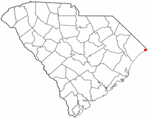
Little River is a census-designated place (CDP) in Horry County, South Carolina, United States. The population was 11,711 at the 2020 census.

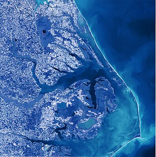
The Intracoastal Waterway (ICW) is a 3,000-mile (4,800 km) inland waterway along the Atlantic and Gulf of Mexico coasts of the United States, running from Massachusetts southward along the Atlantic Seaboard and around the southern tip of Florida, then following the Gulf Coast to Brownsville, Texas. Some sections of the waterway consist of natural inlets, saltwater rivers, bays, and sounds, while others are artificial canals. It provides a navigable route along its length without many of the hazards of travel on the open sea.
Albemarle Sound is a large estuary on the coast of North Carolina in the United States located at the confluence of a group of rivers, including the Chowan and Roanoke. It is separated from the Atlantic Ocean by the Currituck Banks, a barrier peninsula upon which the town of Kitty Hawk is located, at the eastern edge of the sound, and part of the greater Outer Banks region. Roanoke Island is situated at the southeastern corner of the sound, where it connects to Pamlico Sound. Much of the water in the Albemarle Sound is brackish or fresh, as opposed to the saltwater of the ocean, as a result of river water pouring into the sound.

Biscayne Bay is a lagoon with characteristics of an estuary located on the Atlantic coast of South Florida. The northern end of the lagoon is surrounded by the densely developed heart of the Miami metropolitan area while the southern end is largely undeveloped with a large portion of the lagoon included in Biscayne National Park.
Sebastian Inlet State Park is a Florida state park located 10 miles south of Melbourne Beach and 6 miles north of Vero Beach in Florida. The park lies on both sides of the Sebastian Inlet, which forms the boundary between Brevard and Indian River counties. The land for the park was acquired by the state of Florida in 1971. In 2010, it was the second most visited state park in Florida.

The New River is a 50-mile (80-km) long river in southeastern North Carolina in the United States. It empties into the Atlantic Ocean. The river has been plagued in more recent years by pollution by solid waste. It rises in northwestern Onslow County and flows east-southeast past Jacksonville, where it widens into a tidal estuary approximately two miles (3.2 km) wide. As an estuary it meanders through Marine Corps Base Camp Lejeune and enters the Atlantic in Onslow Bay, via the New River Inlet between two barrier islands. The Atlantic Intracoastal Waterway crosses the entrance of the river between the coast and the barrier island.

The Edisto River is one of the longest free-flowing blackwater rivers in North America, flowing over 250 meandering miles from its sources in Saluda and Edgefield counties, to its Atlantic Ocean mouth at Edisto Beach, South Carolina. It rises in two main tributaries from springs under the Sandhills region of West Central South Carolina, just to the south of the Piedmont Fall Line. It is the longest and largest river system completely contained within the borders of South Carolina. Its name comes from the Edisto subtribe of the Cusabo Indians.
The Canaveral Barge Canal is an active canal in Brevard County, Florida, cutting east-west across northern Merritt Island just south of Cape Canaveral. It connects the Atlantic Ocean and Port Canaveral with the Indian River and wider Indian River Lagoon, part of the Intracoastal Waterway. The canal consists of two segments separated by the Banana River.

Currituck Sound is a lagoon located in northeastern part of North Carolina and extreme southeastern Virginia.

Saint Helena Sound is a coastal inlet in the Lowcountry region of South Carolina, located along the Atlantic Ocean between Beaufort and Colleton counties. Located within the relatively undeveloped ACE Basin, the sound consists of the mouths of the Ashepoo, Combahee, and the south branch of the Edisto rivers, of which the ACE moniker derives from. The inlet is located 15-mile (24 km)east of Beaufort, between Edisto Island and Hunting Island. At its widest point, Saint Helena Sound is 7.5-mile (12.1 km) across. The Intracoastal Waterway crosses the sound. Much of the land surrounding St. Helena Sound has been preserved through the St. Helena Sound Heritage Preserve and the larger ACE Basin project.

The Stono River or Creek is a tidal channel in southeast South Carolina, located southwest of Charleston. The channel runs southwest to northeast between the mainland and Wadmalaw Island and Johns Island, from north Edisto River between Johns (West) and James (East) Islands. The Intracoastal Waterway runs through southwest–northeast section of the channel.
The Charleston Harbor is an inlet of the Atlantic Ocean at Charleston, South Carolina. The inlet is formed by the junction of Ashley and Cooper rivers at 32°49′7.10″N79°55′40.41″W. Morris and Sullivan's Islands shelter the entrance. Charleston Harbor forms part of the Intracoastal Waterway.

The Great Loop is a system of waterways that encompasses the eastern portion of the United States and part of Canada. It is made up of both natural and man-made waterways, including the Atlantic and Gulf Intracoastal Waterways, the Great Lakes, the Erie Canal, and the Mississippi and Tennessee-Tombigbee Waterway. The entire loop stretches about 6,000 miles (9,700 km).
Lockwood Folly River or Lockwood's Folly River is a short tidal river in Brunswick County, North Carolina, United States. Waters from the Green Swamp drain into the river near Supply and flow southward to empty into the Atlantic Intracoastal Waterway near Sunset Harbor. The Lockwood Folly Country Club in Varnamtown takes its name from the river.
The Shallotte River is a tidal river in Brunswick County, North Carolina, United States.
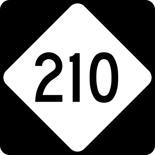
North Carolina Highway 210 is a 192-mile-long (309 km) primary state highway in the U.S. state of North Carolina that connects settlements in the Atlantic Coastal Plain region. Due to its meandering route NC 210 changes directional orientation twice, changing from east-west to north-south at Old Stage Road east of Angier, then changing from north-south to west-east at the Bladen–Pender county line. The route traverses through central Fayetteville and the Fort Liberty Army installation and crosses both Topsail Island access bridges over the Atlantic Intracoastal Waterway. Owing primarily to its meandering route, NC 210 is the sixth longest state highway in North Carolina.

Capers Island is a state-owned barrier island on the Atlantic Ocean in Charleston County, South Carolina about 15 miles north of the city of Charleston. It is separated from the mainland by salt marshes and the Intracoastal Waterway. To the southwest it is separated from the barrier island Dewees Island by Capers Inlet. To the northwest, it is separated from the barrier island Bulls Island by Price Inlet.

Port Mansfield Channel or Mansfield Cut is an artificial waterway encompassing the Laguna Madre positioned at the 97th meridian west on the earth's longest barrier island known as Padre Island. During Post–World War II, the tidal inlet was dredged as a private channel differentiating North Padre Island better known as Padre Island National Seashore and South Padre Island. The navigable waterway was channeled during the late 1950s ceremoniously cresting the intertidal zone of the Gulf of Mexico by September 1957 on the Texas Gulf Coast.
