Graham, North Carolina

Last updated

Graham, North Carolina
Alamance County Courthouse from NE Corner.jpg
Graham, NC City Seal.jpg
NCMap-doton-Graham.PNG
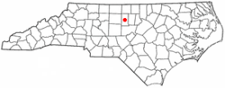
Location of Graham, North Carolina
USA North Carolina location map.svg
Red pog.svg
Graham, North Carolina
Usa edcp location map.svg
Red pog.svg
Graham, North Carolina
Coordinates: 36°03′30″N79°23′20″W / 36.05833°N 79.38889°W / 36.05833; -79.38889
CountryUnited States
State North Carolina
County Alamance
Founded1849
Incorporated1851
Named for William A. Graham [1]
Area
[2]
  Total10.49 sq mi (27.17 km2)
  Land10.42 sq mi (26.99 km2)
  Water0.07 sq mi (0.18 km2)
Elevation
[3]
594 ft (181 m)
Population
 (2020)
  Total17,157
  Density1,646.39/sq mi (635.66/km2)
Time zone UTC−5 (Eastern (EST))
  Summer (DST) UTC−4 (EDT)
ZIP code
27253
Area code 336
FIPS code 37-27280 [4]
GNIS feature ID2403722 [3]
Website www.cityofgraham.com

Graham is a city in Alamance County, North Carolina, United States. It is part of the Burlington, North Carolina Metropolitan Statistical Area. As of the 2020 census the population was 17,153. [5] It is the county seat of Alamance County. [6]

Contents

History

Graham was laid out in 1849 as the county seat of the newly formed Alamance County, and was incorporated as a town in 1851; it became a city in 1961. It was named for William Alexander Graham, U.S. senator from North Carolina (1840–1843) and governor of North Carolina (1845–1849).

The lynching of Wyatt Outlaw, the first African-American Town Commissioner and Constable of Graham, on February 26, 1870, by the Ku Klux Klan, along with the assassination of State Senator John W. Stephens at the Caswell County Courthouse, provoked Governor William Woods Holden to declare martial law in Alamance and Caswell Counties, resulting in the Kirk-Holden War of 1870. [7] [8]

National Register of Historic Places

Alamance County Courthouse, Cedarock Park Historic District, Graham Historic District, William P. Morrow House, North Main Street Historic District, and Oneida Cotton Mills and Scott-Mebane Manufacturing Company Complex are listed on the National Register of Historic Places. [9] [10]

Geography

Graham is bordered to the north and the west by the city of Burlington and to the northeast by the town of Haw River. The Haw River runs along the east edge of Graham, and the city extends south as far as Alamance Creek. Interstate 85 runs through the city, leading east to Durham and west to Greensboro.

According to the United States Census Bureau, the city has a total area of 9.7 square miles (25.1 km2), of which 9.6 square miles (24.9 km2) is land and 0.077 square miles (0.2 km2), or 0.67%, is water. [11]

Climate

The climate in this area is characterized by relatively high temperatures and evenly distributed precipitation throughout the year. According to the Köppen Climate Classification system, Graham has a Humid subtropical climate, abbreviated "Cfa" on climate maps. [12]

Education

The local school system is known as the Alamance-Burlington School System, which was created by a merger between the Alamance County School System and the Burlington City School System in 1996.

Local public schools in Graham include:

Private schools include:

Graham is also home to Alamance Community College, a two-year technical college.

Demographics

Historical population
CensusPop.Note
1870 502
1880 379−24.5%
1890 991161.5%
1900 2,052107.1%
1910 2,50422.0%
1920 2,366−5.5%
1930 2,97225.6%
1940 4,33946.0%
1950 5,02615.8%
1960 7,72353.7%
1970 8,1725.8%
1980 8,6746.1%
1990 10,42620.2%
2000 12,83323.1%
2010 14,15310.3%
2020 17,15321.2%
2022 (est.)17,856 [13] 4.1%
U.S. Decennial Census [14] [15]

2020 census

Graham racial composition [16]
RaceNumberPercentage
White (non-Hispanic)8,42049.08%
Black or African American (non-Hispanic)4,42625.8%
Native American 820.48%
Asian 2221.29%
Pacific Islander 60.03%
Other/Mixed 7884.59%
Hispanic or Latino 3,21318.73%

As of the 2020 United States census, there were 17,157 people, 6,412 households, and 3,962 families residing in the city.

2000 census

At the 2000 census there were 12,833 people, 5,241 households, and 3,385 families living in the city. The population density was 1,579.3 inhabitants per square mile (609.8/km2). There were 5,685 housing units at an average density of 699.6 per square mile (270.1/km2). The racial composition of the city was: 72.88% White, 21.64% Black or African American, 10.14% Hispanic or Latino American, 0.73% Asian American, 0.44% Native American, 0.0% Native Hawaiian or Other Pacific Islander, 3.19% some other race, and 1.12% two or more races. [4] Of the 5,241 households 29.9% had children under the age of 18 living with them, 44.0% were married couples living together, 16.2% had a female householder with no husband present, and 35.4% were non-families. 30.1% of households were one person and 11.8% were one person aged 65 or older. The average household size was 2.37 and the average family size was 2.91.

The age distribution was 24.0% under the age of 18, 9.9% from 18 to 24, 31.8% from 25 to 44, 20.1% from 45 to 64, and 14.1% 65 or older. The median age was 34 years. For every 100 females, there were 90.1 males. For every 100 females age 18 and over, there were 86.4 males.

The median household income was $35,706 and the median family income was $40,769. Males had a median income of $27,844 versus $22,163 for females. The per capita income for the city was $17,865. About 11.9% of families and 14.9% of the population were below the poverty line, including 19.8% of those under age 18 and 14.9% of those age 65 or over.

Related Research Articles

<span class="mw-page-title-main">Alamance County, North Carolina</span> County in North Carolina, United States

Alamance County is a county in North Carolina. As of the 2020 census, the population was 171,415. Its county seat is Graham. Formed in 1849 from Orange County to the east, Alamance County has been the site of significant historical events, textile manufacturing, and agriculture.

<span class="mw-page-title-main">Burlington, Kansas</span> City in Coffey County, Kansas, United States

Burlington is a city in and the county seat of Coffey County, Kansas, United States. As of the 2020 census, the population of the city was 2,634.

<span class="mw-page-title-main">Newton, Kansas</span> City in Harvey County, Kansas

Newton is a city in and the county seat of Harvey County, Kansas, United States. As of the 2020 census, the population of the city was 18,602. Newton is located 25 miles (40 km) north of Wichita. The city of North Newton is located immediately north and exists as a separate political entity. Newton is located at the intersection of Interstate 135, U.S. Route 50, and U.S. Route 81 highways.

<span class="mw-page-title-main">Damar, Kansas</span> City in Rooks County, Kansas

Damar is a city in Rooks County, Kansas, United States. As of the 2020 census, the population of the city was 112.

<span class="mw-page-title-main">Burlington, Kentucky</span> Census-designated place in Boone County, Kentucky, United States

Burlington is a census-designated place (CDP) in and the county seat of Boone County, Kentucky, United States. The population was 17,318 at the 2020 census.

<span class="mw-page-title-main">Alamance, North Carolina</span> Village in North Carolina, United States

Alamance is a village in Alamance County, North Carolina, United States. It is part of the Burlington, North Carolina Metropolitan Statistical Area. The population was 951 at the 2010 census, up from 310 at the 2000 census.

<span class="mw-page-title-main">Altamahaw, North Carolina</span> Census-designated place in North Carolina, United States

Altamahaw is a census-designated place (CDP) in Alamance County, North Carolina, United States. It is part of the Burlington, North Carolina Metropolitan Statistical Area. As of the 2010 census it had a population of 347. The community was listed as Altamahaw-Ossipee at the 2000 census, at which time the population was 996. The town of Ossipee incorporated in 2002 and currently has a population of 543. The remainder of the territory was reassigned as the Altamahaw CDP.

<span class="mw-page-title-main">Burlington, North Carolina</span> City in North Carolina, United States

Burlington is a city in Alamance and Guilford counties in the U.S. state of North Carolina. It is the principal city of the Burlington, NC Metropolitan Statistical Area, which encompasses all of Alamance County, in which most of the city is located, and is a part of the Greensboro–Winston-Salem–High Point, NC Combined Statistical Area. The population was 57,303 at the 2020 census, which makes Burlington the 18th-most populous city in North Carolina.

<span class="mw-page-title-main">Elon, North Carolina</span> Town in North Carolina, United States

Elon is a town in Alamance County, North Carolina, United States. It is part of the Burlington metropolitan statistical area. The population as of the 2020 census was 11,324. The town of Elon is home to Elon University.

<span class="mw-page-title-main">Glen Raven, North Carolina</span> Census-designated place in North Carolina, United States

Glen Raven is a census-designated place (CDP) in Alamance County, North Carolina, United States. It is part of the Burlington, North Carolina Metropolitan Statistical Area. The population was 2,750 at the 2010 census.

<span class="mw-page-title-main">Green Level, North Carolina</span> Town in North Carolina, United States

Green Level is a town in Alamance County, North Carolina, United States. It is part of the Burlington, North Carolina Metropolitan Statistical Area. As of the 2020 census, the population was 3,156.

<span class="mw-page-title-main">Haw River, North Carolina</span> Town in North Carolina, United States

Haw River is a town in Alamance County, North Carolina, United States. It is part of the Burlington, North Carolina Metropolitan Statistical Area. At the 2010 census, the population was 2,298.

<span class="mw-page-title-main">Saxapahaw, North Carolina</span> Census-designated place in North Carolina, United States

Saxapahaw is a census-designated place (CDP) and unincorporated area in Alamance County, North Carolina, United States. It is part of the Burlington, North Carolina Metropolitan Statistical Area. The population was 1,648 at the 2010 census.

<span class="mw-page-title-main">Clyde, North Carolina</span> Town in North Carolina, United States

Clyde is a town in Haywood County, North Carolina, United States. The 2010 census recorded the population at 1,223 people. It is part of the Asheville Metropolitan Statistical Area.

<span class="mw-page-title-main">Sanford, North Carolina</span> City in North Carolina, United States

Sanford is a city in Lee County, North Carolina, United States. The population was 30,261 at the 2020 census. It is the county seat of Lee County. The geographic center of North Carolina is located northwest of the city, in Chatham County.

<span class="mw-page-title-main">Jackson, North Carolina</span> Town in North Carolina, United States

Jackson is a town in Northampton County, North Carolina, United States. The population was 513 at the 2010 census. It is the county seat of Northampton County.

<span class="mw-page-title-main">Pickens, South Carolina</span> City in South Carolina, United States

Pickens, formerly called Pickens Courthouse, is a city in and the county seat of Pickens County, South Carolina, United States. The population was 3,126 at the 2010 census. Pickens changed its classification from a town to a city in 1998, but it was not reported to the Census Bureau until 2001. It was named after Andrew Pickens (1739–1817), an American revolutionary soldier and US Congressman for South Carolina.

<span class="mw-page-title-main">Gibsonville, North Carolina</span> Town in North Carolina, United States

Gibsonville is a town in both Alamance and Guilford counties in the U.S. state of North Carolina. Most of Gibsonville is situated in the Greensboro-Winston-Salem-High Point Combined Statistical Area and the eastern portion is in the Burlington, North Carolina Metropolitan Statistical Area, encompassing all of Alamance County. According to the 2020 census, the population of Gibsonville was 8,971.

<span class="mw-page-title-main">Mebane, North Carolina</span> City in North Carolina, United States

Mebane is a city located mostly in Alamance County, North Carolina, United States, and partly in Orange County. The town was named for Alexander Mebane, an American Revolutionary War general and member of the U.S. Congress. It was incorporated as "Mebanesville" in 1881, and in 1883 the name was changed to "Mebane". It was incorporated as a city in 1987. The population as of the 2020 census was 17,768. Mebane is one of the fastest-growing municipalities in North Carolina. Mebane straddles the Research Triangle and Piedmont Triad Regions of North Carolina. The bulk of the city is in Alamance County, which comprises the Burlington Metropolitan Statistical Area, itself a component of the Greensboro-Winston-Salem-High Point Combined Statistical Area. Two slivers in the eastern portion of the city are in Orange County, which is part of the Durham-Chapel Hill Metropolitan Statistical Area, itself a component of the Raleigh-Durham-Chapel Hill Combined Statistical Area.

<span class="mw-page-title-main">Tobaccoville, North Carolina</span> Village in North Carolina, United States

Tobaccoville is a village in Forsyth and Stokes counties in the U.S. state of North Carolina. The population was 2,209 at the 2020 census. While a Tobaccoville post office was established in 1879, the village was not incorporated until 1991, as a defense against forced annexation of the area by the nearby city of King.

References

  1. "North Carolina Gazetteer" . Retrieved November 24, 2023.
  2. "ArcGIS REST Services Directory". United States Census Bureau. Retrieved September 20, 2022.
  3. 1 2 U.S. Geological Survey Geographic Names Information System: Graham, North Carolina
  4. 1 2 "U.S. Census website". United States Census Bureau . Retrieved January 31, 2008.
  5. "City and Town Population Totals: 2020-2021". Census.gov. US Census Bureau. Retrieved July 9, 2022.
  6. "Find a County". National Association of Counties. Archived from the original on May 31, 2011. Retrieved June 7, 2011.
  7. Troxler, Carole Watterson and William Murray Vincent (1999). Shuttle & Plow: A History of Alamance County, North Carolina. Alamance County Historical Association.
  8. The Hillsboro Recorder, April 6, 1870.
  9. "National Register Information System". National Register of Historic Places . National Park Service. July 9, 2010.
  10. "National Register of Historic Places Listings". Weekly List of Actions Taken on Properties: 6/09/14 through 6/13/14. National Park Service. June 20, 2014.
  11. "Geographic Identifiers: 2010 Demographic Profile Data (G001): Graham city, North Carolina". U.S. Census Bureau, American Factfinder. Archived from the original on February 12, 2020. Retrieved June 28, 2013.
  12. Climate Summary for Graham, North Carolina
  13. "Annual Estimates of the Resident Population for Incorporated Places in North Carolina: April 1, 2020 to July 1, 2022". Census.gov. Retrieved April 19, 2024.
  14. "Census of Population and Housing". Census.gov. Retrieved June 4, 2015.
  15. "Census of Population and Housing". Census.gov. Retrieved June 4, 2016.
  16. "Explore Census Data". data.census.gov. Retrieved December 20, 2021.