Glen Raven, North Carolina

Last updated

Glen Raven, North Carolina
NCMap-doton-GlenRaven.PNG
Location of Glen Raven, North Carolina
Coordinates: 36°07′29″N79°27′53″W / 36.12472°N 79.46472°W / 36.12472; -79.46472
Country United States
State North Carolina
County Alamance
Area
[1]
  Total3.59 sq mi (9.30 km2)
  Land3.51 sq mi (9.09 km2)
  Water0.08 sq mi (0.21 km2)
Elevation
[2]
640 ft (200 m)
Population
 (2020)
  Total3,239
  Density923.06/sq mi (356.44/km2)
Time zone UTC-5 (Eastern (EST))
  Summer (DST) UTC-4 (EDT)
ZIP code
27215
Area code 336
FIPS code 37-26460 [3]
GNIS feature ID2402527 [2]

Glen Raven is a census-designated place (CDP) in Alamance County, North Carolina, United States. It is part of the Burlington, North Carolina Metropolitan Statistical Area. The population was 2,750 at the 2010 census. [4]

Contents

History

The area of current Glen Raven was once occupied by Altamahaw-Ossipee Native American people.

A fabric manufacturer by the name of John Quinten Gant used the land as the headquarters of present-day Glen Raven Fabrics.

Accolades

Glen Raven Fabrics created the fabric used to make the first American flag that was planted on the moon.[ citation needed ]

Glen Raven Inc. were awarded the "International Seal of Recommendation for Fabrics/Umbrellas/Awnings" by the Skin Cancer Foundation.[ citation needed ]

Geography

According to the United States Census Bureau, the CDP has a total area of 9.3 square kilometres (3.6 sq mi), of which 3.5 square miles (9.1 km2) is land and 0.077 square miles (0.2 km2), or 2.25%, is water. [4]

Topography

Glen Raven is in the Piedmont Triad region of North Carolina and is located at an elevation of 700 feet (210 m) directly north of the city of Burlington. Glen Raven extends north to the Haw River at an elevation of about 540 feet (160 m).

Business and economy

Glen Raven, Inc. constitutes a major part of the town's economy. The company was founded in 1880, starting out as a cotton mill making only apparel. The company has grown tremendously since, performing, dying, spinning, weaving and finishing, all the way down to distribution and logistics. [5]

Education

The closest school to Glen Raven is a two-minute drive to Hillcrest Elementary School in Burlington. The students in Glen Raven go to Hillcrest as their elementary school, Turrentine as their middle school, and Walter M. Williams as their high school, all located in Burlington. [ citation needed ]

Demographics

Historical population
CensusPop.Note
2020 3,239
U.S. Decennial Census [6]

As of the census of 2010, there were 2,750 people, 1,038 households, and 779 families residing in the CDP. The population density was 785.7 inhabitants per square mile (303.4/km2). There was 1,152 housing units at an average density of 329.1 per square mile (127.1/km2). The racial makeup of the CDP was 78.7% White, 12.5% Black or African-American, 0.6% Native American, 0.6% Asian, 0.04% Native Hawaiian or other Pacific Islander, 5.5% some other race, and 2.1% two or more races. Persons of Hispanic or Latino ethnicity (of any race) made up 12.4% of the population. [7]

There were 1,038 households, out of which 36.9% had children under the age of 18 living with them. 53.9% of households were headed by married couples, while 15.1% had a female householder with no husband present. [7]

Related Research Articles

<span class="mw-page-title-main">Warm Mineral Springs, Florida</span> Census-designated place in Florida, United States

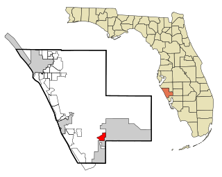
Warm Mineral Springs is a census-designated place (CDP) in Sarasota County, Florida, United States. The population was 5,061 at the 2010 census. It is part of the Bradenton–Sarasota–Venice Metropolitan Statistical Area.

<span class="mw-page-title-main">Pasadena, Maryland</span> Census-designated place in Maryland, United States

Pasadena is a census-designated place (CDP) in Anne Arundel County, Maryland, United States. The population was 24,287 at the 2010 census.

<span class="mw-page-title-main">Mastic, New York</span> Hamlet and census-designated place in New York, United States

Mastic is a hamlet and a census-designated place (CDP) in the southeastern part of the town of Brookhaven in central Suffolk County, New York, United States. The population was 15,481 at the 2010 census.

<span class="mw-page-title-main">North Patchogue, New York</span> Hamlet and census-designated place in New York, United States

North Patchogue is a hamlet and census-designated place (CDP) located within the Town of Brookhaven on Long Island, in Suffolk County, New York, United States. The CDP population was 7,246 at the 2010 census.

<span class="mw-page-title-main">Altamahaw, North Carolina</span> Census-designated place in North Carolina, United States

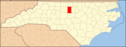
Altamahaw is a census-designated place (CDP) in Alamance County, North Carolina, United States. It is part of the Burlington, North Carolina Metropolitan Statistical Area. As of the 2010 census it had a population of 347. The community was listed as Altamahaw-Ossipee at the 2000 census, at which time the population was 996. The town of Ossipee incorporated in 2002 and currently has a population of 543. The remainder of the territory was reassigned as the Altamahaw CDP.

<span class="mw-page-title-main">Elon, North Carolina</span> Town in North Carolina, United States

Elon is a town in Alamance County, North Carolina, United States. It is part of the Burlington metropolitan statistical area. The population as of the 2020 census was 11,324. The town of Elon is home to Elon University.

<span class="mw-page-title-main">Graham, North Carolina</span> City in North Carolina, United States

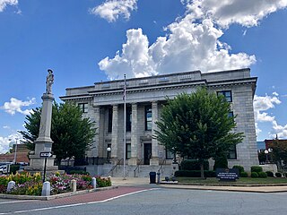
Graham is a city in Alamance County, North Carolina, United States. It is part of the Burlington, North Carolina Metropolitan Statistical Area. As of the 2020 census the population was 17,153. It is the county seat of Alamance County.

<span class="mw-page-title-main">Saxapahaw, North Carolina</span> Census-designated place in North Carolina, United States

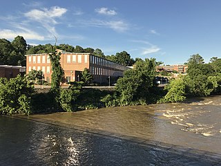
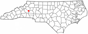
Saxapahaw is a census-designated place (CDP) and unincorporated area in Alamance County, North Carolina, United States. It is part of the Burlington, North Carolina Metropolitan Statistical Area. The population was 1,648 at the 2010 census.

<span class="mw-page-title-main">Woodlawn, North Carolina</span> Census-designated place in North Carolina, United States

Woodlawn is a census-designated place in Alamance County, North Carolina, United States.

<span class="mw-page-title-main">Bethlehem, Alexander County, North Carolina</span> Census-designated place in North Carolina, United States

Bethlehem is a census-designated place (CDP) in Alexander County, North Carolina, United States. The population was 4,214 at the 2010 census. It is part of the Hickory–Lenoir–Morganton Metropolitan Statistical Area.

<span class="mw-page-title-main">Avery Creek, North Carolina</span> Census-designated place in North Carolina, United States

Avery Creek is a census-designated place (CDP) in Buncombe County, North Carolina, United States. The population was 1,950 at the 2010 census. It is part of the Asheville Metropolitan Statistical Area.

<span class="mw-page-title-main">Icard, North Carolina</span> Census-designated place in North Carolina, United States

Icard is a census-designated place (CDP) in Burke County, North Carolina, United States. The population was 2,664 at the 2010 census. It is part of the Hickory–Lenoir–Morganton Metropolitan Statistical Area.

<span class="mw-page-title-main">St. Stephens, North Carolina</span> Census-designated place in North Carolina, United States

St. Stephens is a census-designated place (CDP) in Catawba County, North Carolina, United States. The population was 8,759 at the 2010 census, down from 9,439 in 2000. It is part of the Hickory–Lenoir–Morganton Metropolitan Statistical Area.

Light Oak is an unincorporated area and census-designated place (CDP) in Cleveland County, North Carolina, United States. The population was 691 at the 2010 census.

<span class="mw-page-title-main">Eastover, North Carolina</span> Town in North Carolina, United States

Eastover is a town in Cumberland County, North Carolina, United States. The population was 3,628 at the 2010 census. It was incorporated on July 25, 2007.

<span class="mw-page-title-main">McLeansville, North Carolina</span> Census-designated place in North Carolina, United States

McLeansville is an unincorporated community and census-designated place (CDP) in Guilford County, North Carolina, United States. The population was 1,021 at the 2010 census.

<span class="mw-page-title-main">Centerville, South Carolina</span> CDP in South Carolina, United States

Centerville is a census-designated place (CDP) in Anderson County, South Carolina. The population was 7,185 at the 2020 census.

Wade Hampton is a census-designated place (CDP) in Greenville County, South Carolina, United States. The population was 20,622 at the 2010 census. It is named for American Civil War general and South Carolina governor Wade Hampton.

<span class="mw-page-title-main">Jaffrey (CDP), New Hampshire</span> Census-designated place in New Hampshire, United States

Jaffrey is a census-designated place (CDP) and the main village in the town of Jaffrey in Cheshire County, New Hampshire, United States. The population of the CDP was 3,058 at the 2020 census, out of 5,320 in the entire town of Jaffrey.

Beaverdale is an unincorporated community and census-designated place (CDP) in Flint River Township, Des Moines County, Iowa, United States. As of the 2010 census it had a population of 952. It is part of the Burlington, Iowa micropolitan area.

References

  1. "ArcGIS REST Services Directory". United States Census Bureau. Retrieved September 20, 2022.
  2. 1 2 U.S. Geological Survey Geographic Names Information System: Glen Raven, North Carolina
  3. "U.S. Census website". United States Census Bureau . Retrieved January 31, 2008.
  4. 1 2 "Geographic Identifiers: 2010 Demographic Profile Data (G001): Glen Raven CDP, North Carolina". U.S. Census Bureau, American Factfinder. Archived from the original on February 12, 2020. Retrieved July 1, 2013.
  5. "Our Company : Glen Raven". www.glenraven.com. Retrieved April 15, 2020.
  6. "Census of Population and Housing". Census.gov. Retrieved June 4, 2016.
  7. 1 2 "Profile of General Population and Housing Characteristics: 2010 Demographic Profile Data (DP-1): Glen Raven CDP, North Carolina". U.S. Census Bureau, American Factfinder. Archived from the original on February 12, 2020. Retrieved July 1, 2013.