Newland, North Carolina | |
|---|---|
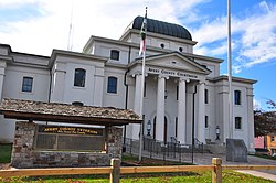 Avery County Courthouse | |
 Seal | |
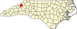
 Location of Newland, North Carolina | |
| Coordinates: 36°05′17″N81°55′38″W / 36.08806°N 81.92722°W | |
| Country | |
| State | |
| County | Avery |
| Founded | 1911 |
| Incorporated | 1913 [1] |
| Named after | William C. Newland |
| Government | |
| • Type | Mayor-council |
| • Mayor | Derek A. Roberts |
| Area | |
• Total | 0.75 sq mi (1.94 km2) |
| • Land | 0.75 sq mi (1.94 km2) |
| • Water | 0.00 sq mi (0.00 km2) |
| Elevation | 3,609 ft (1,100 m) |
| Population (2020) | |
• Total | 715 |
| • Density | 955.88/sq mi (369.20/km2) |
| Time zone | UTC-5 (Eastern (EST)) |
| • Summer (DST) | UTC-4 (EDT) |
| ZIP code | 28657 |
| Area code | 828 |
| FIPS code | 37-46740 [4] |
| GNIS feature ID | 2406987 [3] |
| Website | www |
Newland is a town in and the county seat of Avery County, North Carolina, United States. [5] The population was 715 at the 2020 census. By elevation, Newland is the highest county seat located east of the Mississippi River. [6] [7]