Wilkesboro, North Carolina

Last updated

Wilkesboro
Wilkesboro NC Old Courthouse.jpg
Former Wilkes County Courthouse, now the Wilkes Heritage Museum
Wilkesboro, NC Town Flag.png
Wilkesboro, North Carolina seal.png
Motto: 
Where the Mountains Begin
NCMap-doton-Wilkesboro.PNG
Location of Wilkesboro, North Carolina
Coordinates: 36°08′33″N81°10′30″W / 36.14250°N 81.17500°W / 36.14250; -81.17500 [1]
County Wilkes
State North Carolina
Country United States
Named for John Wilkes
Government
  Typemunicipal
Area
[2]
  Total6.43 sq mi (16.64 km2)
  Land6.43 sq mi (16.64 km2)
  Water0.00 sq mi (0.00 km2)
Elevation
[1]
991 ft (302 m)
Population
 (2020)
  Total3,687
  Density573.76/sq mi (221.52/km2)
Time zone UTC-5 (Eastern (EST))
  Summer (DST) UTC-4 (EDT)
ZIP code
28697
Area code 336
FIPS code 37-74020 [3]
GNIS feature ID2406886 [1]
Website wilkesboronc.org

Wilkesboro is a town in and the county seat of Wilkes County, North Carolina, United States. [4] The population was 3,687 at the 2020 census. [5] The town is located along the south bank of the Yadkin River, directly opposite the town of North Wilkesboro. Wilkesboro is a Small Town Main Street community and has recently revitalized its historic downtown to include the Carolina West Wireless Community Commons, Wilkes Communications Pavilion, Heritage Square and Splash Pad. Cub Creek Park is adjacent to the downtown and contains many amenities, which include baseball, walking trails, mountain biking trails, trout fishing, dog park, basketball, tennis, and pickleball courts, picnic shelters, etc. Wilkesboro is also the home of the annual MerleFest, Carolina in the Fall, and Brushy Mountain Peach & Heritage festivals.

Contents

History

Wilkesboro was founded in 1800 and quickly designated as the county seat. The town is built atop a low, broad ridge which runs for over a mile along the south bank of the Yadkin River. For many decades a popular historic spot in Wilkesboro was the "Tory Oak", a large oak tree from which Colonel Benjamin Cleveland, a well-known Wilkes County patriot during the American Revolutionary War, hanged Loyalist militia leaders who supported the British King and opposed American independence from Britain. The oak was located behind the old Wilkes County courthouse. During the Civil War, many of Wilkesboro's residents remained loyal to the Union and opposed the Confederacy. In March 1865 General George Stoneman, a Union cavalry leader, led a raid through the town. Shortly after the war ended, Tom Dula (Dooley), a Confederate veteran, was tried and hanged for the murder of his fiancée, Laura Foster. Many people were convinced that one of Dula's jealous ex-girlfriends murdered Foster, and that Dula was innocent of the crime. Dula's story was turned into a top-selling ballad in 1958 by The Kingston Trio, the title of which was Tom Dooley. The story was subsequently turned into a 1959 movie starring Michael Landon as Dula, and each summer the Wilkes Playmakers present a popular play based on the story.

The Robert Cleveland Log House, Downtown Wilkesboro Historic District, Federal Building, J. T. Ferguson Store, Thomas B. Finley Law Office, J. L. Hemphill House, Johnson-Hubbard House, Old Wilkes County Jail, St. Paul's Episcopal Church and Cemetery, Wilkes County Courthouse, Wilkesboro Presbyterian Church, and Wilkesboro-Smithey Hotel are listed on the National Register of Historic Places. [6]

Demographics

2020 census

Wilkesboro racial composition [7]
RaceNumberPercentage
White (non-Hispanic)2,72573.91%
Black or African American (non-Hispanic)3278.87%
Native American 60.16%
Asian 1223.31%
Other/Mixed 1654.48%
Hispanic or Latino 3429.28%

As of the 2020 United States census, there were 3,687 people, 1,386 households, and 808 families residing in the town.

2010 census

As of the 2010 census, there were 3,413 people living in Wilkesboro. The population density was 622.5 inhabitants per square mile (240.3/km2). The racial makeup of Wilkesboro was 81.5% White, 8.9% African American, 3.0% Asian, 0.2% Native American, 0.2% Pacific Islander, 4.0% from other races, and 2.3% from two or more races. [8]

The population of Wilkesboro was spread out, with 21.7% being under the age of 20, 6.1% from 20-24, 21.9% from 25-44, 25.6% from 45-64, and 24.5% being 65 and over. The median age was 45.2 years old, more specifically 40.8 for males and 49.5 for females. [8]

Historical population
CensusPop.Note
1880 200
1890 33668.0%
1900 63488.7%
1910 79926.0%
1920 8141.9%
1930 1,04228.0%
1940 1,30925.6%
1950 1,3704.7%
1960 1,56814.5%
1970 2,03830.0%
1980 2,33514.6%
1990 2,57310.2%
2000 3,15922.8%
2010 3,4138.0%
2020 3,6878.0%
U.S. Decennial Census [9]

Economy

Wilkesboro's largest industry is the Tyson Foods poultry processing plant; it is one of the largest poultry plants east of the Mississippi River. [10]

Local communication companies, Wilkes Communications and Carolina West Wireless are based in Wilkesboro. [11]

Education

Wilkesboro is served by the Wilkes County Schools system. Most of Wilkesboro's high school students attend Wilkes Central High School; it is located in the adjacent community of Moravian Falls. Wilkes Early College, based at Wilkes Community College, and one charter school, Bridges Charter School in State Road, North Carolina, offer other high-school options to Wilkesboro's students. [12] Middle school students in Wilkesboro attend Central Wilkes Middle School, located in Moravian Falls, while the elementary schools that serve the town are Wilkesboro Elementary, Moravian Falls Elementary, and CC Wright Elementary.

Wilkesboro is the home of Wilkes Community College, a public, coed, two-year college within the North Carolina Community College System. The college's enrollment is typically around 3,500 students.

Media

Wilkesboro Town Hall Wilkesboro Town Hall.jpg
Wilkesboro Town Hall

Wilkesboro is served by a few media sources based in nearby North Wilkesboro. The Record of Wilkes is published weekly and Journal-Patroit is also published weekly. Wilkes County's two largest radio stations are broadcast from North Wilkesboro: WKBC-FM (97.3 FM) broadcasts Adult Contemporary (hot AC) and WKBC (AM) (800 AM) broadcasts American Country music.

Transportation

Public transportation

WTA, Wilkes Transportation Authority, is a local shuttle service based in Wilkesboro that utilizes vans and buses to serve Wilkes County. Fares range from $2-$24, but are typically around $4. [13] There is scheduled shuttle service that runs every hour roughly and unscheduled service that allows for riders to request a van pick up in any part of the county.

Intercity Bus

Daily bus service is available on Greyhound. Sunway buses are advertised as Greyhound Express buses and the bus stop is in front of the Former Federal Building located at 207 West Main Street, Wilkesboro. Bus service goes to Boone, NC and Greensboro, NC, known as the Mountaineer East/West line with prices as low as $4. Passengers can connect to Greyhound services throughout the East Coast via the J. Douglas Galyon Depot where the line ends. [14]

Major highways

Politics and religion

Like most of Wilkes County, Wilkesboro has long been a bastion of the Republican Party. Wilkesboro's largest religious group are the Southern Baptists, but the town does contain substantial numbers of Methodists, Presbyterians, Lutherans, and Episcopalians. The first two churches to be established in Wilkes County were built in Wilkesboro; they were missionary churches for the Episcopal and Presbyterian denominations. The nearby town of North Wilkesboro contains Wilkes County's only Roman Catholic church: a parish church named for Saint John Baptist de la Salle, and part of the Roman Catholic Diocese of Charlotte.

Attractions

Notable people

Related Research Articles

<span class="mw-page-title-main">Yadkin County, North Carolina</span> County in North Carolina, United States

Yadkin County is located in the U.S. state of North Carolina. As of the 2020 census, the population was 37,214. Its county seat is Yadkinville. Yadkin County is included in the Winston-Salem, NC Metropolitan Statistical Area, which is also included in the Greensboro–Winston-Salem–High Point, NC Combined Statistical Area.

<span class="mw-page-title-main">Wilkes County, North Carolina</span> County in North Carolina, United States

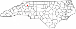
Wilkes County is a county located in the U.S. state of North Carolina. It is a part of the state's western mountain region. As of the 2020 census the population was 65,969. Its county seat is Wilkesboro, and its largest community is North Wilkesboro. Wilkes County comprises the North Wilkesboro, NC Micropolitan Statistical Area.

<span class="mw-page-title-main">Surry County, North Carolina</span> County in North Carolina, United States

Surry County is a county located in the U.S. state of North Carolina. As of the 2020 census, the population was 71,359. Its county seat is Dobson, and its largest community is Mount Airy.

<span class="mw-page-title-main">Iredell County, North Carolina</span> County in North Carolina, United States

Iredell County is a county located in the U.S. state of North Carolina. As of the 2020 census, the population was 186,693. Its county seat is Statesville, and its largest community is Mooresville. The county was formed in 1788, subtracted from Rowan County. It is named for James Iredell, one of the first justices of the Supreme Court. Iredell County is included in the Charlotte-Concord-Gastonia, NC-SC Metropolitan Statistical Area, as defined by the Office of Management and Budget, with data from the U.S. Census Bureau.

<span class="mw-page-title-main">Caldwell County, North Carolina</span> County in North Carolina, United States

Caldwell County is a county in the U.S. state of North Carolina. It is located in the foothills of the Blue Ridge Mountains. As of the 2020 census, the population was 80,652. Its county seat is Lenoir. Caldwell County is part of the Hickory-Lenoir-Morganton, NC Metropolitan Statistical Area.

<span class="mw-page-title-main">Sanford, North Carolina</span> City in North Carolina, United States

Sanford is a city in Lee County, North Carolina, United States. The population was 30,261 at the 2020 census. It is the county seat of Lee County. The geographic center of North Carolina is located northwest of the city, in Chatham County.

<span class="mw-page-title-main">Moravian Falls, North Carolina</span> CDP in North Carolina, United States

Moravian Falls is a census-designated place (CDP) in Wilkes County, North Carolina, United States. The population was 1,712 as of the 2020 census.

<span class="mw-page-title-main">North Wilkesboro, North Carolina</span> Town in North Carolina, United States

North Wilkesboro is a town in Wilkes County, North Carolina, United States. The population was 4,131 at the 2020 US Census. North Wilkesboro is the birthplace and original home of Lowe's Home Improvement, which continues to have a major presence in the community. The town is also known as one of the birthplaces of the sport of stock-car racing, and the North Wilkesboro Speedway was the first NASCAR-sanctioned track. Due to the town's proximity to the nearby Blue Ridge Mountains and its numerous tourist venues, North Wilkesboro has been nicknamed the "Key to the Blue Ridge".

<span class="mw-page-title-main">Elkin, North Carolina</span> Town in North Carolina, United States

Elkin is a town in Surry and Wilkes counties in the U.S. state of North Carolina, along the Yadkin River. Elkin shares its name with the surrounding township of Elkin Township. The population was 4,122 at the time of the 2020 census.

<span class="mw-page-title-main">Piedmont Triad</span> Region in North Carolina

The Piedmont Triad is a metropolitan region in the north-central part of the U.S. state of North Carolina anchored by three cities: Greensboro, Winston-Salem, and High Point. This close group of cities lies in the Piedmont geographical region of the United States and forms the basis of the Greensboro–Winston-Salem–High Point, NC Combined Statistical Area. As of 2012, the Piedmont Triad has an estimated population of 1,611,243 making it the 33rd largest combined statistical area in the United States.

<span class="mw-page-title-main">Yadkin River</span> River in North Carolina, United States

The Yadkin River is one of the longest rivers in the US state of North Carolina, flowing 215 miles (346 km). It rises in the northwestern portion of the state near the Blue Ridge Parkway's Thunder Hill Overlook. Several parts of the river are impounded by dams for water, power, and flood control. The river becomes the Pee Dee River at the confluence of the Uwharrie River south of the community of Badin and east of the town of Albemarle. The river then flows into South Carolina near Cheraw, which is at the Fall Line. The entirety of the Yadkin River and the Great Pee Dee River is part of the Yadkin-Pee Dee River Basin.

Advance is an unincorporated community and census-designated place (CDP) in Davie County, North Carolina, United States. It is seventy-five miles northeast of Charlotte. As of the 2010 census it had a population of 1,138. It is located along North Carolina Highway 801 just south of Bermuda Run. Advance is part of the Piedmont Triad region of North Carolina.

WKBC is a radio station in North Wilkesboro, North Carolina, United States. WKBC is licensed to broadcast with 1,000 watts in the daytime and 308 watts at night. The station is operated by Wilkes Broadcasting Company, Inc.

<span class="mw-page-title-main">Western North Carolina</span> Geographic region of the U.S. state of North Carolina

Western North Carolina is the region of North Carolina which includes the Appalachian Mountains; it is often known geographically as the state's Mountain Region. It contains the highest mountains in the Eastern United States, with 125 peaks rising to over 5,000 feet in elevation. Mount Mitchell at 6,684 feet, is the highest peak of the Appalachian Mountains and mainland eastern North America. The population of the 23 most commonly associated counties for the region, as measured by the 2020 U.S. Census, is 1,149,405. The region accounts for approximately 11% of North Carolina's total population.

<span class="mw-page-title-main">North Carolina Highway 18</span> State highway in North Carolina, US

North Carolina Highway 18 (NC 18) is a primary state highway in the U.S. state of North Carolina. Traveling north–south through the Foothills region, it connects the cities of Shelby, Morganton, Lenoir, Wilkesboro and North Wilkesboro.

Wilkes Central High School is a public high school located in Moravian Falls, North Carolina. It is a part of the Wilkes County Schools system. The school's enrollment is typically around 1,000 students. The school's district includes the towns of Wilkesboro and North Wilkesboro as well as the southern regions of Wilkes County. The current principal of the school is Dr. Heather Freeman. Wilkes Central has the largest enrollment of Wilkes County's four public high schools.

Hamptonville is an unincorporated community located in southwestern Yadkin County, North Carolina, United States. Hamptonville is named for Henry Hampton (1750–1832), a colonel in the Revolutionary Army. Hampton set aside land for a town in 1806.

<span class="mw-page-title-main">North Carolina Highway 268</span> State highway in North Carolina, US

North Carolina Highway 268 (NC 268) is a primary state highway in the U.S. state of North Carolina. It connects many communities as it traverses through the northwestern North Carolina mountains and foothills.

The Wilkes County Schools system is a PK–12 graded school district in North Carolina covering nearly all of Wilkes County. The third-largest employer in the county, the district manages 22 schools that serve 10,374 students as of 2010–11.

Ferguson is an unincorporated community in Wilkes County, North Carolina, United States. Ferguson is located on North Carolina Highway 268, 12.3 miles (19.8 km) west-southwest of Wilkesboro. Ferguson has a post office with ZIP code 28624.

References

  1. 1 2 3 U.S. Geological Survey Geographic Names Information System: Wilkesboro, North Carolina
  2. "ArcGIS REST Services Directory". United States Census Bureau. Retrieved September 20, 2022.
  3. "U.S. Census website". United States Census Bureau . Retrieved January 31, 2008.
  4. "Find a County". National Association of Counties. Retrieved June 7, 2011.
  5. "2020 Census, North Carolina - Total Population by Municipality" (PDF). Archived from the original (PDF) on December 1, 2021. Retrieved October 16, 2023.
  6. "National Register Information System". National Register of Historic Places . National Park Service. July 9, 2010.
  7. "Explore Census Data". data.census.gov. Retrieved December 21, 2021.
  8. 1 2 [ dead link ]
  9. "Census of Population and Housing". Census.gov. Retrieved June 4, 2015.
  10. Staff (May 9, 2020). "Wilkesboro Tyson Chicken plant shut down after COVID-19 outbreak". WBTV. Retrieved May 9, 2020.
  11. "About Us". Carolina West Wireless. Retrieved May 3, 2012.
  12. "Wilkes County". Office of Charter Schools website. North Carolina Department of Public Instruction. Retrieved April 28, 2012.
  13. "Wilkes Transportation Authority". wta1.org. Retrieved October 13, 2017.
  14. "Daily Line Runs". www.sunwaycharters.com. Retrieved October 13, 2017.
  15. United States Congress. "HACKETT, Richard Nathaniel (id: H000004)". Biographical Directory of the United States Congress . Retrieved June 6, 2012.
  16. Jim Hamby Profile. The Baseball Cube. Retrieved March 21, 2019.