Mocksville, North Carolina

Last updated

Mocksville, North Carolina
DavieCourt1.JPG
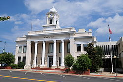
Davie County Courthouse, Courthouse Square, September 2013
Mocksville, NC Town Seal.jpg
Motto: 
"Time Well Spent"
NCMap-doton-Mocksville.PNG
Location of Mocksville, North Carolina
Coordinates: 35°54′02″N80°33′48″W / 35.90056°N 80.56333°W / 35.90056; -80.56333 [1]
Country United States
State North Carolina
County Davie
Government
  MayorWilliam J. Marklin III [2]
Area
[3]
  Total7.79 sq mi (20.17 km2)
  Land7.77 sq mi (20.12 km2)
  Water0.02 sq mi (0.05 km2)
Elevation
[1]
810 ft (250 m)
Population
 (2020)
  Total5,900
  Density759.53/sq mi (293.25/km2)
Time zone UTC-5 (Eastern (EST))
  Summer (DST) UTC-4 (EDT)
ZIP code
27028
Area code 336
FIPS code 37-43720 [4]
GNIS feature ID1021506 [1]
Website mocksvillenc.org

Mocksville is a town in Davie County, North Carolina, United States. The population was 5,900 at the 2020 census. I-40 leads west to Statesville and Hickory, and east to Winston-Salem and Greensboro. Route 64 heads east to Lexington, and west towards Statesville and Taylorsville. [5] It is the county seat of Davie County. [6]

Contents

History

Mocksville was incorporated as a town in 1839. [7] The town was named for the original owner of the town site. [8]

George E. Barnhardt House, Boxwood Lodge, Cana Store and Post Office, Jesse Clement House, Cooleemee, Davie County Courthouse, Davie County Jail, Downtown Mocksville Historic District, Hinton Rowan Helper House, Hodges Business College, McGuire-Setzer House, North Main Street Historic District, and Salisbury Street Historic District are listed on the National Register of Historic Places. [9]

Geography and geology

Mocksville is located south of the center of Davie County. [10] U.S. Routes 64 and 601 pass through the town, while U.S. Route 158 has its western terminus in the town center. US 64 leads east 19 miles (31 km) to Lexington and west 24 miles (39 km) to Statesville, while US 601 leads north 19 miles (31 km) to Yadkinville and south 17 miles (27 km) to Salisbury. US 158 leads northeast 26 miles (42 km) to Winston-Salem. Interstate 40 passes 3 miles (5 km) northwest of the center of town, with access from Exit 168 (US 64) and Exit 170 (US 601).

According to the United States Census Bureau, the town has a total area of 7.6 square miles (19.6 km2), of which 0.01 square miles (0.03 km2), or 0.17%, is water. [5]

Located in Mocksville is the Mocksville complex that is made up of metamorphosed and unmetamorphosed gabbros including Farmington Gabbro [11]

Climate

According to the Köppen Climate Classification system, Mocksville has a humid subtropical climate, abbreviated "Cfa" on climate maps. The hottest temperature recorded in Mocksville was 103 °F (39.4 °C) on August 2021, 1983 and August 10, 2007, while the coldest temperature recorded was −7 °F (−21.7 °C) on February 5, 1996. [12]

Climate data for Mocksville, North Carolina, 1991–2020 normals, extremes 1893–present
MonthJanFebMarAprMayJunJulAugSepOctNovDecYear
Record high °F (°C)77
(25)
81
(27)
89
(32)
97
(36)
98
(37)
99
(37)
101
(38)
103
(39)
97
(36)
96
(36)
83
(28)
80
(27)
103
(39)
Mean maximum °F (°C)69.7
(20.9)
72.8
(22.7)
80.3
(26.8)
85.7
(29.8)
89.6
(32.0)
93.7
(34.3)
95.7
(35.4)
94.9
(34.9)
91.1
(32.8)
85.6
(29.8)
77.8
(25.4)
70.9
(21.6)
96.8
(36.0)
Mean daily maximum °F (°C)49.3
(9.6)
53.1
(11.7)
61.0
(16.1)
70.5
(21.4)
77.2
(25.1)
84.2
(29.0)
87.7
(30.9)
86.2
(30.1)
80.4
(26.9)
71.2
(21.8)
61.3
(16.3)
52.6
(11.4)
69.6
(20.9)
Daily mean °F (°C)37.1
(2.8)
40.1
(4.5)
47.1
(8.4)
56.3
(13.5)
64.8
(18.2)
72.8
(22.7)
76.7
(24.8)
75.5
(24.2)
69.1
(20.6)
57.7
(14.3)
47.3
(8.5)
40.4
(4.7)
57.1
(13.9)
Mean daily minimum °F (°C)24.8
(−4.0)
27.0
(−2.8)
33.2
(0.7)
42.2
(5.7)
52.5
(11.4)
61.3
(16.3)
65.7
(18.7)
64.8
(18.2)
57.8
(14.3)
44.2
(6.8)
33.3
(0.7)
28.1
(−2.2)
44.6
(7.0)
Mean minimum °F (°C)8.5
(−13.1)
12.5
(−10.8)
17.7
(−7.9)
26.8
(−2.9)
36.8
(2.7)
49.4
(9.7)
56.8
(13.8)
54.9
(12.7)
44.2
(6.8)
28.6
(−1.9)
19.1
(−7.2)
14.9
(−9.5)
6.7
(−14.1)
Record low °F (°C)−6
(−21)
−7
(−22)
4
(−16)
12
(−11)
29
(−2)
40
(4)
50
(10)
42
(6)
35
(2)
21
(−6)
11
(−12)
1
(−17)
−7
(−22)
Average precipitation inches (mm)3.75
(95)
3.27
(83)
4.20
(107)
4.11
(104)
3.61
(92)
4.10
(104)
4.27
(108)
4.63
(118)
4.07
(103)
3.31
(84)
3.58
(91)
3.98
(101)
46.88
(1,190)
Average snowfall inches (cm)1.9
(4.8)
0.5
(1.3)
0.4
(1.0)
0.0
(0.0)
0.0
(0.0)
0.0
(0.0)
0.0
(0.0)
0.0
(0.0)
0.0
(0.0)
0.0
(0.0)
0.1
(0.25)
1.6
(4.1)
4.5
(11.45)
Average precipitation days (≥ 0.01 in)8.78.510.19.610.510.69.810.48.67.07.89.1110.7
Average snowy days (≥ 0.1 in)0.80.60.30.00.00.00.00.00.00.00.00.42.1
Source 1: NOAA [13]
Source 2: National Weather Service [12]

Demographics

Historical population
CensusPop.Note
1860 710
1870 300−57.7%
1880 56287.3%
1900 745
1910 1,06342.7%
1920 1,1467.8%
1930 1,50331.2%
1940 1,6076.9%
1950 1,90918.8%
1960 2,37924.6%
1970 2,5296.3%
1980 2,6374.3%
1990 3,39928.9%
2000 4,17822.9%
2010 5,05120.9%
2020 5,90016.8%
U.S. Decennial Census [14]

2020 census

Mocksville racial composition [15]
RaceNumberPercentage
White (non-Hispanic)3,79064.24%
Black or African American (non-Hispanic)83414.14%
Native American 160.27%
Asian 581.15%
Pacific Islander 10.02%
Other/Mixed 3055.17%
Hispanic or Latino 88615.02%

As of the 2020 United States census, there were 5,900 people, 2,062 households, and 1,307 families residing in the town.

2000 census

As of the census [4] of 2000, there were 4,178 people, 1,627 households, and 1,067 families residing in the town. The population density was 607.2 inhabitants per square mile (234.4/km2). There were 1,781 housing units at an average density of 258.8 per square mile (99.9/km2). The racial makeup of the town was 76.14% White, 17.76% African American, 0.19% Native American, 0.67% Asian, 0.05% Pacific Islander, 3.83% from other races, and 1.36% from two or more races. Hispanic or Latino of any race were 8.07% of the population.

There were 1,627 households, out of which 30.4% had children under the age of 18 living with them, 46.7% were married couples living together, 14.6% had a female householder with no husband present, and 34.4% were non-families. 30.7% of all households were made up of individuals, and 14.8% had someone living alone who was 65 years of age or older. The average household size was 2.42 and the average family size was 2.97.

In the town, the population was well distributed by age, with 23.5% under the age of 18, 8.9% from 18 to 24, 27.7% from 25 to 44, 21.4% from 45 to 64, and 18.6% who were 65 years of age or older. The median age was 37 years. For every 100 females, there were 90.3 males. For every 100 females age 18 and over, there were 83.3 males.

The median income for a household in the town was $35,407, and the median income for a family was $42,357. Males had a median income of $31,540 versus $23,375 for females. The per capita income for the town was $18,703. About 9.3% of families and 12.6% of the population were below the poverty line, including 12.8% of those under age 18 and 14.3% of those age 65 or over.

Notable people

Related Research Articles

<span class="mw-page-title-main">Iredell County, North Carolina</span> County in North Carolina, United States

Iredell County is a county located in the U.S. state of North Carolina. As of the 2020 census, the population was 186,693. Its county seat is Statesville, and its largest community is Mooresville. The county was formed in 1788, subtracted from Rowan County. It is named for James Iredell, one of the first justices of the Supreme Court. Iredell County is included in the Charlotte-Concord-Gastonia, NC-SC Metropolitan Statistical Area, as defined by the Office of Management and Budget, with data from the U.S. Census Bureau.

<span class="mw-page-title-main">Davie County, North Carolina</span> County in North Carolina, United States

Davie County is a county located in the U.S. state of North Carolina. As of the 2020 census, the population was 42,712. Its county seat is Mocksville.

<span class="mw-page-title-main">Davidson County, North Carolina</span> County in North Carolina, United States

Davidson County is a county located in the U.S. state of North Carolina. As of the 2020 census, the population was 168,930. Its county seat is Lexington, and its largest community is Thomasville.

<span class="mw-page-title-main">Danielson, Connecticut</span> Borough in Connecticut, United States

Danielson is a borough in the town of Killingly in Windham County, Connecticut, United States. The population was 4,155 at the 2020 census.

<span class="mw-page-title-main">Catawba, North Carolina</span> Town in North Carolina, United States

Catawba is a town in Catawba County, North Carolina, United States. The population was 603 at the 2010 census. It is part of the Hickory–Lenoir–Morganton Metropolitan Statistical Area. As with the county, the name recalls the Catawba people, the indigenous people who once inhabited the area.

<span class="mw-page-title-main">Claremont, North Carolina</span> City in North Carolina, United States

Claremont is a city in Catawba County, North Carolina, United States. The population was 1,352 at the 2010 census. It is part of the Hickory–Lenoir–Morganton Metropolitan Statistical Area.

Bermuda Run is a town in Davie County, North Carolina, United States. As of the 2020 census, the population of the town was 3,120. It was incorporated in 1999 as a fully gated residential community near country clubs and golf courses like the Bermuda Run Country Club, Oak Valley Golf Club, and Tanglewood Park. In 2000, the town annexed into neighboring Hillsdale, picking up a commercial district. The town rests on the western bank of the Yadkin River along U.S. Route 158 and North Carolina Highway 801. Interstate 40 provides express access to Winston-Salem, the town's nearest urban center. In 2012, Kinderton Village was voluntarily annexed by the town of Bermuda Run. Bermuda Run is considered by the locals to be a mid-high class community and the second-most influential, behind nearby Oak Valley.

<span class="mw-page-title-main">Clemmons, North Carolina</span> Village in North Carolina

Clemmons is a village in Forsyth County, North Carolina, United States and a suburb of Winston-Salem. The population was 21,177 at the 2020 census, with an estimated population of 21,517 in 2021.

<span class="mw-page-title-main">Harmony, North Carolina</span> Town in North Carolina, United States

Harmony is a town in Iredell County, North Carolina, United States. The town was incorporated in 1927 and is located in northeastern Iredell County and lies in the eastern portion of the North Carolina High Country. It is primarily located in Turnersburg Township, with its northernmost portion in Eagle Mills Township. The population was 531 at the 2010 census.

Love Valley is a town in Iredell County, North Carolina, United States. It also extends into Alexander County on its western end. The population was 90 at the 2010 census, and in 2020 the estimated population was 154.

<span class="mw-page-title-main">Mooresville, North Carolina</span> Town in North Carolina, United States

Mooresville is a town located in the southwestern section of Iredell County, North Carolina, United States, and is a part of the fast-growing Charlotte metropolitan area. The population was 50,193 at the 2020 census, making it the most populous municipality in Iredell County. It is located approximately 25 miles (40 km) north of Charlotte.

<span class="mw-page-title-main">Statesville, North Carolina</span> City in North Carolina, United States

Statesville is a city in and the county seat of Iredell County, North Carolina, United States, and it is part of the Charlotte metropolitan area. Statesville was established in 1789 by an act of the North Carolina Legislature. The population was 28,419 at the time of the 2020 census.

<span class="mw-page-title-main">Troutman, North Carolina</span> Town in North Carolina, United States

Troutman is a town in Iredell County, North Carolina, United States. The town is located roughly 35 miles (56 km) north of Charlotte. As of the 2020 census the town's population was 3,698. Due to substantial residential growth in the area, as well as neighborhood annexation, the town is experiencing dramatic population growth. Approved residential developments, when completed, are forecast to increase town population to more than 11,000 residents.

<span class="mw-page-title-main">Spencer, North Carolina</span> Town in North Carolina, United States

Spencer is a town in Rowan County, North Carolina, United States, incorporated in 1905. As of the 2010 census, the town population was 3,267.

<span class="mw-page-title-main">Ehrhardt, South Carolina</span> Town in South Carolina, United States

Ehrhardt is a town in Bamberg County, South Carolina, United States. As of the 2010 census, the town population was 545.

<span class="mw-page-title-main">St. Matthews, South Carolina</span> Town in South Carolina, United States

St. Matthews is a town in Calhoun County, South Carolina, United States. The population was 2,021 at the 2010 census, a decline from 2,107 in 2000. It is the county seat of Calhoun County.

<span class="mw-page-title-main">Chesterfield, South Carolina</span> Town in South Carolina, United States

Chesterfield is a town in Chesterfield County, South Carolina, United States. The population was 1,472 at the 2010 census. It is the county seat of Chesterfield County. At the time of the 2010 census, Chesterfield was the least populous of all of South Carolina's county seats.

<span class="mw-page-title-main">Kershaw, South Carolina</span> Town in South Carolina, United States

Kershaw is a town in Lancaster County, South Carolina, United States. It was incorporated in 1888. As of the 2010 census, the population was 1,803, and as of 2019 the estimated population was 2,321. The Haile Gold Mine, where gold was discovered in 1825, is 3 miles (5 km) from town and was at one time the largest single producer of gold in the Appalachian region.

<span class="mw-page-title-main">Stony Point, North Carolina</span> Census-designated place in North Carolina, United States

Stony Point is a census-designated place (CDP) in Alexander and Iredell counties in the U.S. state of North Carolina. The population was 1,317 at the 2010 census. It is part of the Hickory–Lenoir–Morganton Metropolitan Statistical Area.

Advance is an unincorporated community and census-designated place (CDP) in Davie County, North Carolina, United States. It is seventy-five miles northeast of Charlotte. As of the 2010 census it had a population of 1,138. It is located along North Carolina Highway 801 just south of Bermuda Run. Advance is part of the Piedmont Triad region of North Carolina.

References

  1. 1 2 3 U.S. Geological Survey Geographic Names Information System: Mocksville, North Carolina
  2. "Elected Officials". Mocksville NC. Retrieved February 23, 2021.
  3. "ArcGIS REST Services Directory". United States Census Bureau. Retrieved September 20, 2022.
  4. 1 2 "U.S. Census website". United States Census Bureau . Retrieved January 31, 2008.
  5. 1 2 "Geographic Identifiers: 2010 Demographic Profile Data (G001): Mocksville town, North Carolina". U.S. Census Bureau, American Factfinder. Archived from the original on February 13, 2020. Retrieved November 30, 2015.
  6. "Find a County". National Association of Counties. Retrieved June 7, 2011.
  7. McAllister, Jane Satchell; Dotson, Debra Leigh (2009). Davie County. Arcadia Publishing. p. 9. ISBN   978-0-7385-6797-6.
  8. Gannett, Henry (1905). The Origin of Certain Place Names in the United States. U.S. Government Printing Office. p.  211.
  9. "National Register Information System". National Register of Historic Places . National Park Service. July 9, 2010.
  10. "US Gazetteer files: 2010, 2000, and 1990". United States Census Bureau. February 12, 2011. Retrieved April 23, 2011.
  11. Esawi, E. K. (January 2012). "The mafic and ultramafic rocks of the Mocksville complex of Central North Carolina: Petrogenetic and tectonic implications". Mineralogy and Petrology. 104 (1–2): 15–27. doi:10.1007/s00710-011-0180-8. ISSN   0930-0708. S2CID   140740572.
  12. 1 2 "NOAA Online Weather Data – NWS Greenville". National Weather Service. Retrieved February 27, 2023.
  13. "U.S. Climate Normals Quick Access – Station: Mocksville 5SE, NC". National Oceanic and Atmospheric Administration. Retrieved February 27, 2023.
  14. "Census of Population and Housing". Census.gov. Retrieved June 4, 2015.
  15. "Explore Census Data". data.census.gov. Retrieved December 20, 2021.
  16. Representative Julia C. Howard. ncleg.gov. Retrieved December 14, 2020.
  17. Whit Merrifield Stats. Baseball-Reference. Retrieved December 14, 2020.