Jackson, North Carolina

Last updated

Jackson, North Carolina
Buildings in Jackson, North Carolina.jpg
Jackson Town Hall on West Jefferson Street
NCMap-doton-Jackson.PNG
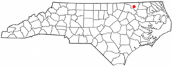
Location of Jackson, North Carolina
Coordinates: 36°23′24″N77°25′10″W / 36.39000°N 77.41944°W / 36.39000; -77.41944
Country United States
State North Carolina
County Northampton
Area
[1]
  Total1.01 sq mi (2.62 km2)
  Land1.01 sq mi (2.62 km2)
  Water0.00 sq mi (0.00 km2)
Elevation
[2]
108 ft (33 m)
Population
 (2020)
  Total430
  Density425.74/sq mi (164.39/km2)
Time zone UTC-5 (Eastern (EST))
  Summer (DST) UTC-4 (EDT)
ZIP code
27845
Area code 252
FIPS code 37-34000 [3]
GNIS feature ID2405900 [2]

Jackson is a town in Northampton County, North Carolina, United States. The population was 513 at the 2010 census. It is the county seat of Northampton County. [4]

Contents

Jackson is part of the Roanoke Rapids, North Carolina Micropolitan Statistical Area.

History

The town of Jackson traces it's origins to the creation of Northampton County in 1741 by the Colonial Assembly of North Carolina. The location was chosen to be a central site for the courthouse. [5] Initially known as Northampton Courthouse, the area began to develop around the courthouse square. By 1762, Jeptha Atherton had purchased the courthouse lands, and by 1798, the area had a tavern and a storehouse. [5]

In 1826, the town was renamed Jackson in honour of General Andrew Jackson, a hero of the Battle of New Orleans and later President of the United States. [5] Jackson became a political hub with intense debates between Whigs and Democrats. In 1825, General Lafayette, a Revolutionary War hero, visited the town. [5] By the early 19th century, horse racing and breeding brought national attention to Northampton County. The famous thoroughbred sire Sir Archie was brought to Mowfield Plantation near Jackson in 1816. [5]

The Amis-Bragg House, Church of the Saviour and Cemetery, Jackson Historic District, Mowfield, Northampton County Courthouse Square, and Verona are listed on the National Register of Historic Places. [6]

Geography

According to the United States Census Bureau, the town has a total area of 1.0 square mile (2.6 km2), all land.

Climate

Climate data for Jackson, North Carolina (1991–2020 normals, extremes 1948–present)
MonthJanFebMarAprMayJunJulAugSepOctNovDecYear
Record high °F (°C)80
(27)
84
(29)
92
(33)
97
(36)
98
(37)
102
(39)
105
(41)
105
(41)
105
(41)
101
(38)
86
(30)
81
(27)
105
(41)
Mean daily maximum °F (°C)50.1
(10.1)
53.6
(12.0)
61.2
(16.2)
71.3
(21.8)
78.1
(25.6)
85.7
(29.8)
89.2
(31.8)
87.3
(30.7)
81.6
(27.6)
71.5
(21.9)
61.3
(16.3)
53.3
(11.8)
70.3
(21.3)
Daily mean °F (°C)39.5
(4.2)
41.9
(5.5)
48.6
(9.2)
58.0
(14.4)
66.4
(19.1)
74.7
(23.7)
78.7
(25.9)
77.0
(25.0)
71.0
(21.7)
59.7
(15.4)
49.6
(9.8)
42.6
(5.9)
59.0
(15.0)
Mean daily minimum °F (°C)28.8
(−1.8)
30.2
(−1.0)
35.9
(2.2)
44.8
(7.1)
54.6
(12.6)
63.7
(17.6)
68.1
(20.1)
66.6
(19.2)
60.5
(15.8)
47.9
(8.8)
38.0
(3.3)
31.8
(−0.1)
47.6
(8.7)
Record low °F (°C)−8
(−22)
−4
(−20)
12
(−11)
19
(−7)
31
(−1)
43
(6)
50
(10)
44
(7)
39
(4)
22
(−6)
15
(−9)
−1
(−18)
−8
(−22)
Average precipitation inches (mm)3.74
(95)
2.89
(73)
4.39
(112)
3.64
(92)
4.02
(102)
4.74
(120)
5.99
(152)
5.16
(131)
5.23
(133)
3.82
(97)
3.56
(90)
3.71
(94)
50.89
(1,293)
Average snowfall inches (cm)2.8
(7.1)
0.8
(2.0)
0.2
(0.51)
0.0
(0.0)
0.0
(0.0)
0.0
(0.0)
0.0
(0.0)
0.0
(0.0)
0.0
(0.0)
0.0
(0.0)
0.1
(0.25)
1.1
(2.8)
5.0
(13)
Average precipitation days (≥ 0.01 in)9.58.29.68.29.29.29.88.98.36.67.68.7103.8
Average snowy days (≥ 0.1 in)1.20.90.20.00.00.00.00.00.00.00.10.63.0
Source: NOAA [7] [8]

Demographics

Historical population
CensusPop.Note
1850 300
1870 181
1880 25540.9%
1890 750194.1%
1900 441−41.2%
1910 52719.5%
1920 5799.9%
1930 67716.9%
1940 75812.0%
1950 85312.5%
1960 765−10.3%
1970 762−0.4%
1980 720−5.5%
1990 592−17.8%
2000 69517.4%
2010 513−26.2%
2020 430−16.2%
U.S. Decennial Census [9]

2020 census

Jackson racial composition [10]
RaceNumberPercentage
White (non-Hispanic)23654.88%
Black or African American (non-Hispanic)15335.58%
Native American 20.47%
Asian 61.4%
Other/Mixed 266.05%
Hispanic or Latino 71.63%

As of the 2020 United States census, there were 430 people, 245 households, and 142 families residing in the town.

2000 census

As of the census [3] of 2000, there were 695 people, 218 households, and 148 families residing in the town. The population density was 683.8 inhabitants per square mile (264.0/km2). There were 243 housing units at an average density of 239.1 per square mile (92.3/km2). The racial makeup of the town was 51.94% White, 47.63% African American, 0.14% Asian, 0.14% from other races, and 0.14% from two or more races. Hispanic or Latino of any race were 0.29% of the population.

There were 218 households, out of which 27.5% had children under the age of 18 living with them, 48.2% were married couples living together, 15.6% had a female householder with no husband present, and 31.7% were non-families. 28.9% of all households were made up of individuals, and 18.3% had someone living alone who was 65 years of age or older. The average household size was 2.41 and the average family size was 2.97.

In the town, the population was spread out, with 18.4% under the age of 18, 7.2% from 18 to 24, 24.5% from 25 to 44, 22.3% from 45 to 64, and 27.6% who were 65 years of age or older. The median age was 45 years. For every 100 females, there were 97.4 males. For every 100 females age 18 and over, there were 96.2 males.

The median income for a household in the town was $29,375, and the median income for a family was $34,000. Males had a median income of $27,917 versus $18,875 for females. The per capita income for the town was $14,588. About 18.6% of families and 19.8% of the population were below the poverty line, including 31.3% of those under age 18 and 10.8% of those age 65 or over.

Education

The elementary school serving Jackson is Central Elementary School. CES is the newest school in Northampton County; it opened it doors for the 2006-2007 school year. It combined Seaboard Coates Elementary and Jackson Eastside Elementary schools.[ citation needed ]

Also housed in Jackson is the Central Services building for Northampton County Schools. Northampton County Schools is the local educational agency for the district. The system includes seven schools.[ citation needed ]

Related Research Articles

<span class="mw-page-title-main">Marion County, Alabama</span> County in Alabama, United States

Marion County is a county of the U.S. state of Alabama. As of the 2020 census the population was 29,341. The county seat is Hamilton. The county was created by an act of the Alabama Territorial General Assembly on February 13, 1818. The county seat was originally established in Pikeville in 1820, and moved to Hamilton in 1881. The county was named by planter and US Indian agent John Dabney Terrell, Sr., in recognition of General Francis Marion of South Carolina.

<span class="mw-page-title-main">Northampton County, North Carolina</span> County in North Carolina, United States

Northampton County is a county located in the U.S. state of North Carolina. As of the 2020 census, the population was 17,471. Its county seat is Jackson.

<span class="mw-page-title-main">Homer, Georgia</span> Town in Georgia, United States

Homer is a town in Banks County, Georgia, United States. The population was 1,141 at the 2010 census. The town is the county seat of Banks County.

<span class="mw-page-title-main">Brownstown, Indiana</span> Town in Indiana, United States

Brownstown is a town within Brownstown Township and the county seat of Jackson County, Indiana, United States. The population was 2,947 at the 2010 census. It was named for Jacob Brown, a general of the War of 1812.

<span class="mw-page-title-main">Clinton, Louisiana</span> Town in Louisiana, United States

Clinton is a town in, and the parish seat of, East Feliciana Parish, Louisiana, United States. The town was named for New York Governor DeWitt Clinton. The population was 1,653 at the 2010 census. It is part of the Baton Rouge Metropolitan Statistical Area.

<span class="mw-page-title-main">Jackson, Missouri</span> City in Missouri, United States

Jackson is a city in and the county seat of Cape Girardeau County, Missouri, United States. It is a principal city of the Cape Girardeau–Jackson, MO-IL Metropolitan Statistical Area. The population of Jackson was 15,481 at the 2020 census.

<span class="mw-page-title-main">Graham, North Carolina</span> City in North Carolina, United States

Graham is a city and the county seat of Alamance County, North Carolina, United States. It is part of the Burlington, North Carolina Metropolitan Statistical Area. As of the 2020 census the population was 17,153.

<span class="mw-page-title-main">Gatesville, North Carolina</span> Town in North Carolina, United States

Gatesville is a town in Gates County, North Carolina, United States. The population was 321 at the 2010 census. It is the county seat of Gates County.

<span class="mw-page-title-main">Sylva, North Carolina</span> Town in North Carolina, United States

Sylva is an incorporated town located in central Jackson County, in the Plott Balsam Mountains of Western North Carolina, United States. As of the 2010 census, the town had a total population of 2,588. It is the county seat, taking over the role from nearby Webster in 1913.

<span class="mw-page-title-main">Webster, North Carolina</span> Town in North Carolina, United States

Webster is a town in Jackson County, North Carolina, United States. As of the 2010 census, the population was 363, down from 486 in 2000.

<span class="mw-page-title-main">Troy, North Carolina</span> Town in North Carolina, United States

Troy is a town in Montgomery County, North Carolina, United States. The population was 3,188 at the 2010 census. It is the county seat of Montgomery County. A short story by Charles W. Chesnutt, The Sheriff's Children, is set in Troy.

<span class="mw-page-title-main">Gaston, North Carolina</span> Town in North Carolina, United States

Gaston is a town in Northampton County, North Carolina, United States. The population was 1,152 at the 2010 census. It is part of the Roanoke Rapids, North Carolina Micropolitan Statistical Area.

<span class="mw-page-title-main">Wentworth, North Carolina</span> Town in Rockingham County

Wentworth is a town in Rockingham County, North Carolina, United States. The population was 2,646 at the 2020 census. Wentworth is the county seat of Rockingham County and is part of the Greensboro-High Point metropolitan area of the Piedmont Triad. On May 6, 2022, an EF-1 Tornado hit Wentworth. The storm traveled as a supercell with crazy structure from the Pilot Mountain, North Carolina, and Pinnacle, North Carolina, area across central Stokes County and into Rockingham County. It took out trees, damaged homes, and blocked roads before it lifted off southwest of Reidsville.

<span class="mw-page-title-main">Dobson, North Carolina</span> Town in North Carolina, United States

Dobson is a town in Dobson Township, Surry County, North Carolina, United States. As of the 2020 census, the town population was 1,396. It is the county seat of Surry County. Dobson is the home of the Shelton Vineyards, the largest winery in North Carolina. It is also home to a significant Latino population due to the large number of farms in the area. The main crops in the area are corn, tobacco and soy beans.

<span class="mw-page-title-main">Allendale, South Carolina</span> Town in South Carolina, United States

Allendale is a town in and the county seat of Allendale County, South Carolina, United States. The population was 3,482 at the 2010 census, a decline from 4,052 in 2000. The majority of residents are African American.

<span class="mw-page-title-main">Hampton, South Carolina</span> Town in South Carolina, United States

Hampton is a town in Hampton County, South Carolina, United States. The population was 2,808 at the 2010 census. It is the county seat of Hampton County. The town and the county are named after Wade Hampton III, a Confederate general in the Civil War.

<span class="mw-page-title-main">Lancaster, South Carolina</span> City in South Carolina, United States

The city of Lancaster is the county seat of Lancaster County, South Carolina, United States, located in the Charlotte Metropolitan Area. As of the United States Census of 2010, the city population was 8,526. The city was named after the famous House of Lancaster.

<span class="mw-page-title-main">Pickens, South Carolina</span> City in South Carolina, United States

Pickens, formerly called Pickens Courthouse, is a city in and the county seat of Pickens County, South Carolina, United States. The population was 3,126 at the 2010 census. Pickens changed its classification from a town to a city in 1998, but it was not reported to the Census Bureau until 2001. It was named after Andrew Pickens (1739–1817), an American revolutionary soldier and US Congressman for South Carolina.

<span class="mw-page-title-main">York, South Carolina</span> City in South Carolina, United States

York is a city in and county seat of York County, South Carolina, United States. The population was approximately 6,985 at the 2000 census and up to 7,736 at the 2010 census. York is located approximately 27 miles (43 km) southwest of Charlotte, North Carolina and 13 miles (21 km) west of Rock Hill, South Carolina.

<span class="mw-page-title-main">Ripley, West Virginia</span> City in West Virginia, United States

Ripley is a city in and the county seat of Jackson County, West Virginia, United States. The population was 3,074 at the 2020 census.

References

  1. "ArcGIS REST Services Directory". United States Census Bureau. Retrieved September 20, 2022.
  2. 1 2 U.S. Geological Survey Geographic Names Information System: Jackson, North Carolina
  3. 1 2 "U.S. Census website". United States Census Bureau . Retrieved January 31, 2008.
  4. "Find a County". National Association of Counties. Archived from the original on May 31, 2011. Retrieved June 7, 2011.
  5. 1 2 3 4 5 "Town of Jackson, North Carolina History". historicjacksonnc.com. Retrieved August 22, 2024.
  6. "National Register Information System". National Register of Historic Places . National Park Service. July 9, 2010.
  7. "NowData – NOAA Online Weather Data". National Oceanic and Atmospheric Administration. Retrieved July 5, 2021.
  8. "Station: Jackson, NC". U.S. Climate Normals 2020: U.S. Monthly Climate Normals (1991-2020). National Oceanic and Atmospheric Administration. Retrieved July 5, 2021.
  9. "Census of Population and Housing". Census.gov. Retrieved June 4, 2015.
  10. "Explore Census Data". data.census.gov. Retrieved December 24, 2021.