Severn, North Carolina

Last updated

Severn, North Carolina
Severn, North Carolina 01.jpg
Main Street
NCMap-doton-Severn.PNG
Location of Severn, North Carolina
Coordinates: 36°30′51″N77°11′21″W / 36.51417°N 77.18917°W / 36.51417; -77.18917
Country United States
State North Carolina
County Northampton
Area
[1]
  Total1.01 sq mi (2.62 km2)
  Land1.01 sq mi (2.62 km2)
  Water0.00 sq mi (0.00 km2)
Elevation
[2]
56 ft (17 m)
Population
 (2020)
  Total191
  Density188.92/sq mi (72.94/km2)
Time zone UTC-5 (Eastern (EST))
  Summer (DST) UTC-4 (EDT)
ZIP code
27877
Area code 252
FIPS code 37-60560 [3]
GNIS feature ID2407315 [2]

Severn is a town in Northampton County, North Carolina, United States. The population was 276 at the 2010 census. It is part of the Roanoke Rapids, North Carolina Micropolitan Statistical Area. Severn is the home of Severn Peanut Corporation, the owners of the Hampton Farms brand of roasted peanuts. [4]

Contents

History

The community was settled in about 1833 and named Meherrin after a local Native American tribe. [5] In 1887 a branch rail line was built through Meherrin. [6] It was incorporated in 1919 and named for Severn Ayers, a stockholder of the Seaboard Airline Railroad. [5]

Geography

According to the United States Census Bureau, the town has a total area of 1.0 square mile (2.6 km2), all land.

Demographics

Historical population
CensusPop.Note
1920 284
1930 35424.6%
1940 323−8.8%
1950 3405.3%
1960 310−8.8%
1970 35614.8%
1980 309−13.2%
1990 260−15.9%
2000 2631.2%
2010 2764.9%
2020 191−30.8%
U.S. Decennial Census [7]

As of the census [3] of 2000, there were 263 people, 103 households, and 70 families residing in the town. The population density was 261.1 inhabitants per square mile (100.8/km2). There were 117 housing units at an average density of 116.2 per square mile (44.9/km2). The racial makeup of the town was 59.32% White, 35.74% African American, 1.90% Native American, 2.28% from other races, and 0.76% from two or more races. Hispanic or Latino of any race were 2.28% of the population.

There were 103 households, out of which 20.4% had children under the age of 18 living with them, 51.5% were married couples living together, 13.6% had a female householder with no husband present, and 32.0% were non-families. 30.1% of all households were made up of individuals, and 16.5% had someone living alone who was 65 years of age or older. The average household size was 2.55 and the average family size was 3.19.

In the town, the population was spread out, with 20.9% under the age of 18, 6.8% from 18 to 24, 27.8% from 25 to 44, 24.7% from 45 to 64, and 19.8% who were 65 years of age or older. The median age was 41 years. For every 100 females, there were 92.0 males. For every 100 females age 18 and over, there were 98.1 males.

The median income for a household in the town was $32,969, and the median income for a family was $41,458. Males had a median income of $26,607 versus $15,000 for females. The per capita income for the town was $16,227. About 11.6% of families and 13.5% of the population were below the poverty line, including 4.3% of those under the age of eighteen and 30.0% of those 65 or over.

Related Research Articles

<span class="mw-page-title-main">Greensville County, Virginia</span> County in Virginia, United States

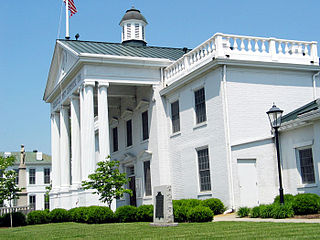
Greensville County is a county located in the Commonwealth of Virginia. As of the 2020 census, the population was 11,391. Its county seat is Emporia.

<span class="mw-page-title-main">Northampton County, North Carolina</span> County in North Carolina, United States

Northampton County is a county located in the U.S. state of North Carolina. As of the 2020 census, the population was 17,471. Its county seat is Jackson.

<span class="mw-page-title-main">Hertford County, North Carolina</span> County in North Carolina, United States

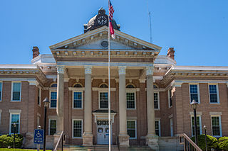
Hertford County is a county located in the U.S. state of North Carolina. As of the 2020 census, the population was 21,552. Its county seat is Winton. It is classified within the region known in the 21st century as the Inner Banks.

<span class="mw-page-title-main">Bertie County, North Carolina</span> County in North Carolina, United States

Bertie County is a county located in the northeast area of the U.S. state of North Carolina. As of the 2020 census, the population was 17,934. Its county seat is Windsor. The county was created in 1722 as Bertie Precinct and gained county status in 1739.

<span class="mw-page-title-main">Halifax, North Carolina</span> Town in North Carolina, United States

Halifax is a town in Halifax County, North Carolina, United States. The population was 234 at the 2010 census. It is the county seat of Halifax County. It is known as "The Birthplace of Freedom" for being the location for the April 12, 1776, adoption of the Halifax Resolves, which was the first official action by a colony calling for independence. Halifax is also home to the Halifax Historic District, a historic site operated by the North Carolina Department of Cultural Resources. Halifax is part of the Roanoke Rapids, North Carolina Micropolitan Statistical Area.

<span class="mw-page-title-main">Hobgood, North Carolina</span> Town in North Carolina, United States

Hobgood is a town in Halifax County, North Carolina, United States. As of the 2010 census, the town had a total population of 348. It is part of the Roanoke Rapids, North Carolina Micropolitan Statistical Area.

<span class="mw-page-title-main">Littleton, North Carolina</span> Town in North Carolina, United States

Littleton is a town in Halifax County, North Carolina, United States. The population was 674 at the 2010 census. It is part of the Roanoke Rapids, North Carolina Micropolitan Statistical Area.

<span class="mw-page-title-main">Roanoke Rapids, North Carolina</span> City in North Carolina, United States

Roanoke Rapids is a city in Halifax County, North Carolina, United States. The population was 15,754 at the 2010 census. It is the principal city of the Roanoke Rapids Micropolitan Statistical Area, and is also an anchor city of the Rocky Mount-Wilson-Roanoke Rapids CSA, with a total population of 297,726 as of 2018.

<span class="mw-page-title-main">South Rosemary, North Carolina</span> Census-designated place in North Carolina, United States

South Rosemary is an unincorporated area and census-designated place (CDP) in Halifax County, North Carolina, United States. The population was 2,836 at the 2010 census. It is part of the Roanoke Rapids, North Carolina Micropolitan Statistical Area.

<span class="mw-page-title-main">Weldon, North Carolina</span> Town in North Carolina, United States

Weldon is a town in Halifax County, North Carolina, United States. The population was 1,655 at the 2010 census. It is part of the Roanoke Rapids, North Carolina Micropolitan Statistical Area.

<span class="mw-page-title-main">Winton, North Carolina</span> Town in North Carolina, United States

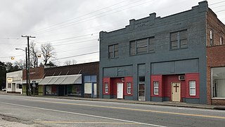
Winton is a town and the county seat of Hertford County, North Carolina, United States. It is governed by the Town Council which consists of a Mayor and five Council members. The population was 769 at the 2010 census.

<span class="mw-page-title-main">Hamilton, North Carolina</span> Town in North Carolina, United States

Hamilton is a town in Martin County, North Carolina, United States. The population was 408 at the 2010 census.

<span class="mw-page-title-main">Conway, North Carolina</span> Town in North Carolina, United States

Conway is a town in Northampton County, North Carolina, United States. The population was 836 at the 2010 census. It is part of the Roanoke Rapids, North Carolina Micropolitan Statistical Area.

<span class="mw-page-title-main">Garysburg, North Carolina</span> Town in North Carolina, United States

Garysburg is a town in Northampton County, North Carolina, United States. The population was 1,057 at the 2010 census. It is part of the Roanoke Rapids, North Carolina Micropolitan Statistical Area.

<span class="mw-page-title-main">Gaston, North Carolina</span> Town in North Carolina, United States

Gaston is a town in Northampton County, North Carolina, United States. The population was 1,152 at the 2010 census. It is part of the Roanoke Rapids, North Carolina Micropolitan Statistical Area.

<span class="mw-page-title-main">Jackson, North Carolina</span> Town in North Carolina, United States

Jackson is a town in Northampton County, North Carolina, United States. The population was 513 at the 2010 census. It is the county seat of Northampton County.

<span class="mw-page-title-main">Lasker, North Carolina</span> Town in North Carolina, United States

Lasker is a town in Northampton County, North Carolina, United States. The population was 122 at the 2010 census. It is part of the Roanoke Rapids, North Carolina Micropolitan Statistical Area.

<span class="mw-page-title-main">Seaboard, North Carolina</span> Town in North Carolina, United States

Seaboard is a township in Northampton County, North Carolina, United States, created as a company town by the Seaboard and Roanoke Railroad, approximately 10 miles northeast of Weldon in the mid-1840s as a place for railroad employees to live.

<span class="mw-page-title-main">Woodland, North Carolina</span> Town in North Carolina, United States

Woodland is a town in Northampton County, North Carolina, United States. The population was 809 at the 2010 census. It is part of the Roanoke Rapids, North Carolina Micropolitan Statistical Area.

<span class="mw-page-title-main">Virgilina, Virginia</span> Town in Virginia, United States

Virgilina is a town in Halifax County, Virginia, United States. The population was 154 at the 2010 census. Virgilina was once a copper mining town. It was a stop on the Atlantic and Danville Railway as recently as the 1950s. It is named "Virgilina" because it is located on the Virginia and North Carolina border.

References

  1. "ArcGIS REST Services Directory". United States Census Bureau. Retrieved September 20, 2022.
  2. 1 2 U.S. Geological Survey Geographic Names Information System: Severn, North Carolina
  3. 1 2 "U.S. Census website". United States Census Bureau . Retrieved January 31, 2008.
  4. Bryant, Cal (November 9, 2022). "Goodness grows here!". Roanoke-Chowan News-Herald. Retrieved February 21, 2024.
  5. 1 2 Powell 1976, p. 446.
  6. Footprints in Northampton 1976, p. 171.
  7. "Census of Population and Housing". Census.gov. Retrieved June 4, 2015.

Works cited