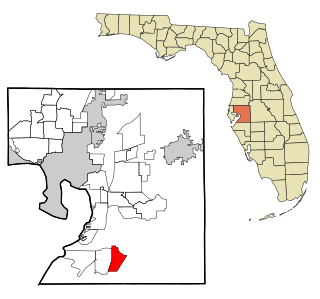
Seaboard, North Carolina

Last updated

Seaboard, North Carolina
NCMap-doton-Seaboard.PNG
Location of Seaboard, North Carolina
Coordinates: 36°29′26″N77°26′31″W / 36.49056°N 77.44194°W / 36.49056; -77.44194
Country United States
State North Carolina
County Northampton
Area
[1]
  Total0.96 sq mi (2.49 km2)
  Land0.96 sq mi (2.49 km2)
  Water0.00 sq mi (0.00 km2)
Elevation
[2]
125 ft (38 m)
Population
 (2020)
  Total542
  Density562.82/sq mi (217.31/km2)
Time zone UTC-5 (Eastern (EST))
  Summer (DST) UTC-4 (EDT)
ZIP code
27876
Area code 252
FIPS code 37-59980 [3]
GNIS feature ID2407302 [2]

Seaboard is a township in Northampton County, North Carolina, United States, created as a company town by the Seaboard and Roanoke Railroad, approximately 10 miles northeast of Weldon in the mid-1840s as a place for railroad employees to live. [4]

Contents

The population was 632 at the 2010 census. It is part of the Roanoke Rapids, North Carolina Micropolitan Statistical Area.

History

The Seaboard Historic District was listed on the National Register of Historic Places in 2005. [5]

Geography

According to the United States Census Bureau, the town has a total area of 1.0 square mile (2.6 km2), all land.

The town is located along North Carolina Highway 186, near the North Carolina-Virginia border, and serves as the northern terminus of North Carolina Highway 305.

Demographics

Historical population
CensusPop.Note
1880 167
1890 20120.4%
1900 28742.8%
1910 280−2.4%
1930 534
1940 5625.2%
1950 74532.6%
1960 624−16.2%
1970 611−2.1%
1980 68712.4%
1990 79115.1%
2000 695−12.1%
2010 632−9.1%
2020 542−14.2%
U.S. Decennial Census [6]

2020 census

Seaboard racial composition [7]
RaceNumberPercentage
White (non-Hispanic)9116.79%
Black or African American (non-Hispanic)42778.78%
Native American 10.18%
Other/Mixed 183.32%
Hispanic or Latino 50.92%

As of the 2020 United States census, there were 542 people, 295 households, and 189 families residing in the town.

2000 census

As of the census [3] of 2000, there were 695 people, 300 households, and 183 families residing in the town. The population density was 676.6 inhabitants per square mile (261.2/km2). There were 338 housing units at an average density of 329.1 per square mile (127.1/km2). The racial makeup of the town was 27.48% White, 71.22% African American, 0.29% Asian, 0.14% Pacific Islander, and 0.86% from two or more races. Hispanic or Latino of any race were 0.43% of the population.

There were 300 households, out of which 28.0% had children under the age of 18 living with them, 32.7% were married couples living together, 23.3% had a female householder with no husband present, and 38.7% were non-families. 36.3% of all households were made up of individuals, and 23.3% had someone living alone who was 65 years of age or older. The average household size was 2.32 and the average family size was 3.04.

In the town, the population was spread out, with 28.8% under the age of 18, 7.1% from 18 to 24, 20.7% from 25 to 44, 24.2% from 45 to 64, and 19.3% who were 65 years of age or older. The median age was 40 years. For every 100 females, there were 75.5 males. For every 100 females age 18 and over, there were 63.9 males.

The median income for a household in the town was $20,500, and the median income for a family was $31,719. Males had a median income of $30,938 versus $20,104 for females. The per capita income for the town was $17,973. About 24.0% of families and 27.5% of the population were below the poverty line, including 35.1% of those under age 18 and 31.4% of those age 65 or over.

Notable people

Related Research Articles

<span class="mw-page-title-main">Northampton County, North Carolina</span> County in North Carolina, United States

Northampton County is a county located in the U.S. state of North Carolina. As of the 2020 census, the population was 17,471. Its county seat is Jackson.

<span class="mw-page-title-main">Youngsville, North Carolina</span> Town in North Carolina, United States

Youngsville is a town in Franklin County, North Carolina, United States. The population was 2,016 at the 2020 census.

<span class="mw-page-title-main">Halifax, North Carolina</span> Town in North Carolina, United States

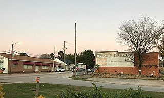
Halifax is a town in Halifax County, North Carolina, United States. The population was 234 at the 2010 census. It is the county seat of Halifax County. It is known as "The Birthplace of Freedom" for being the location for the April 12, 1776, adoption of the Halifax Resolves, which was the first official action by a colony calling for independence. Halifax is also home to the Halifax Historic District, a historic site operated by the North Carolina Department of Cultural Resources. Halifax is part of the Roanoke Rapids, North Carolina Micropolitan Statistical Area.

<span class="mw-page-title-main">Hobgood, North Carolina</span> Town in North Carolina, United States

Hobgood is a town in Halifax County, North Carolina, United States. As of the 2010 census, the town had a total population of 348. It is part of the Roanoke Rapids, North Carolina Micropolitan Statistical Area.

<span class="mw-page-title-main">South Rosemary, North Carolina</span> Census-designated place in North Carolina, United States

South Rosemary is an unincorporated area and census-designated place (CDP) in Halifax County, North Carolina, United States. The population was 2,836 at the 2010 census. It is part of the Roanoke Rapids, North Carolina Micropolitan Statistical Area.

<span class="mw-page-title-main">Weldon, North Carolina</span> Town in North Carolina, United States

Weldon is a town in Halifax County, North Carolina, United States. The population was 1,655 at the 2010 census. It is part of the Roanoke Rapids, North Carolina Micropolitan Statistical Area.

<span class="mw-page-title-main">Hamilton, North Carolina</span> Town in North Carolina, United States

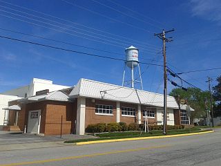
Hamilton is a town in Martin County, North Carolina, United States. The population was 408 at the 2010 census.

<span class="mw-page-title-main">Vass, North Carolina</span> Town in North Carolina, United States

Vass is a town in Moore County, North Carolina, United States. The population was 720 at the 2010 census. Vass grew up along the railroad in the late 19th century. It was originally named Bynum and later Winder before being established as Vass in 1892. The town was incorporated in 1907.

<span class="mw-page-title-main">Conway, North Carolina</span> Town in North Carolina, United States

Conway is a town in Northampton County, North Carolina, United States. The population was 836 at the 2010 census. It is part of the Roanoke Rapids, North Carolina Micropolitan Statistical Area.

<span class="mw-page-title-main">Garysburg, North Carolina</span> Town in North Carolina, United States

Garysburg is a town in Northampton County, North Carolina, United States. The population was 1,057 at the 2010 census. It is part of the Roanoke Rapids, North Carolina Micropolitan Statistical Area.

<span class="mw-page-title-main">Jackson, North Carolina</span> Town in North Carolina, United States

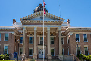
Jackson is a town in Northampton County, North Carolina, United States. The population was 513 at the 2010 census. It is the county seat of Northampton County.

<span class="mw-page-title-main">Severn, North Carolina</span> Town in North Carolina, United States

Severn is a town in Northampton County, North Carolina, United States. The population was 276 at the 2010 census. It is part of the Roanoke Rapids, North Carolina Micropolitan Statistical Area. Severn is the home of Severn Peanut Corporation, the owners of the Hampton Farms brand of roasted peanuts.

<span class="mw-page-title-main">Woodland, North Carolina</span> Town in North Carolina, United States

Woodland is a town in Northampton County, North Carolina, United States. The population was 809 at the 2010 census. It is part of the Roanoke Rapids, North Carolina Micropolitan Statistical Area.

<span class="mw-page-title-main">Bostic, North Carolina</span> Town in North Carolina, United States

Bostic is a town in Rutherford County, North Carolina, United States. The population was 386 at the 2010 census.

<span class="mw-page-title-main">Ellenboro, North Carolina</span> Town in North Carolina, United States

Ellenboro is a town in Rutherford County, North Carolina, United States. The population was 873 at the 2010 census.

<span class="mw-page-title-main">Norlina, North Carolina</span> Town in North Carolina, United States

Norlina is a town in Warren County, North Carolina, United States. The population was 1,118 at the 2010 census.

<span class="mw-page-title-main">Alberta, Virginia</span> Town in Virginia, United States

Alberta is a town in Brunswick County, Virginia, United States. The population was 298 at the 2010 census. It is home to the Christanna Campus of Southside Virginia Community College.

<span class="mw-page-title-main">McKenney, Virginia</span> Town in Virginia, United States

McKenney is an incorporated town in Dinwiddie County, Virginia, United States. The population was 483 at the 2010 census.

<span class="mw-page-title-main">Virgilina, Virginia</span> Town in Virginia, United States

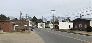
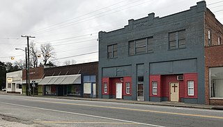
Virgilina is a town in Halifax County, Virginia, United States. The population was 154 at the 2010 census. Virgilina was once a copper mining town. It was a stop on the Atlantic and Danville Railway as recently as the 1950s. It is named "Virgilina" because it is located on the Virginia and North Carolina border.

<span class="mw-page-title-main">Clarksville, Virginia</span> Town in Virginia, United States

Clarksville is a town in Mecklenburg county in the U.S. state of Virginia, near the southern border of the commonwealth. The population was 1,139 at the 2010 census. Since the town has numerous buildings of the 18th-, 19th-, and early 20th-century architecture, the downtown area of Clarksville has been designated a Historic District on the National Register of Historic Places and Virginia's Historic Register. Clarksville claims the title of Virginia's only Lakeside town. Nearby the town of Clarksville is Occoneechee State Park.

References

  1. "ArcGIS REST Services Directory". United States Census Bureau. Retrieved September 20, 2022.
  2. 1 2 U.S. Geological Survey Geographic Names Information System: Seaboard, North Carolina
  3. 1 2 "U.S. Census website". United States Census Bureau . Retrieved January 31, 2008.
  4. "The Seaboard Air Line Railroad, Through The Heart Of The South".
  5. "National Register Information System  (#05001032)". National Register of Historic Places . National Park Service. July 9, 2010.
  6. "Census of Population and Housing". Census.gov. Retrieved June 4, 2015.
  7. "Explore Census Data". data.census.gov. Retrieved December 24, 2021.