Franklin, North Carolina | |
|---|---|
 Buildings on Main Street in Downtown Franklin | |
 Seal | |
| Motto: "Discover Us" | |
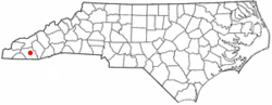 Location of Franklin, North Carolina | |
| Coordinates: 35°10′47″N83°22′52″W / 35.17972°N 83.38111°W | |
| Country | United States |
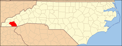
| State | North Carolina |
| County | Macon |
| Area | |
• Total | 4.99 sq mi (12.92 km2) |
| • Land | 4.90 sq mi (12.68 km2) |
| • Water | 0.09 sq mi (0.23 km2) |
| Elevation | 2,047 ft (624 m) |
| Population (2020) | |
• Total | 4,175 |
| • Density | 852.56/sq mi (329.18/km2) |
| Time zone | UTC-5 (Eastern (EST)) |
| • Summer (DST) | UTC-4 (EDT) |
| ZIP codes | 28734, 28744 |
| Area code | 828 |
| FIPS code | 37-24640 [3] |
| GNIS feature ID | 2406519 [2] |
| Website | www.franklinnc.com |
Franklin is a town in and the county seat of Macon County, North Carolina, United States. [4] It is situated within the Nantahala National Forest. The population was reported to be 4,175 in the 2020 census, an increase from the total of 3,845 tabulated in 2010.
Contents
- History
- Cherokee influence
- European settlement
- Geography
- Demographics
- 2020 census
- 2010 census
- Growth and cost of living
- Climate
- Recreation
- Hiking
- Gem mining
- Waterfalls
- Scottish Tartans Museum
- Education
- Media
- Library
- Macon County Airport
- Notable people
- References
- External links
The town developed around a 1,000-year-old platform mound, the center of the historic Cherokee town of Nikwasi.

Franklin is a popular destination for hikers and outdoor enthusiasts, specifically in relation to the Nantahala National Forest, the Great Smoky Mountains, and the Appalachian Trail. [5] The town and the surrounding area is rich in gems and minerals, and is known locally as the "Gem Capital of The World." [6]