Cooleemee, North Carolina

Last updated • 2 min readFrom Wikipedia, The Free Encyclopedia

Cooleemee, North Carolina
Seal of Cooleemee, North Carolina.png
NCMap-doton-Cooleemee.PNG
Location of Cooleemee, North Carolina
Coordinates: 35°48′45″N80°33′23″W / 35.81250°N 80.55639°W / 35.81250; -80.55639
Country United States
State North Carolina
County Davie
Government
  MayorJessica Almond
Area
[1]
  Total0.77 sq mi (2.00 km2)
  Land0.75 sq mi (1.95 km2)
  Water0.02 sq mi (0.05 km2)
Elevation
[2]
725 ft (221 m)
Population
 (2020)
  Total940
  Density1,250.00/sq mi (482.42/km2)
Time zone UTC-5 (Eastern (EST))
  Summer (DST) UTC-4 (EDT)
ZIP code
27014
Area code 336
FIPS code 37-14460 [3]
GNIS feature ID2406308 [2]
Website Town of Cooleemee Official website

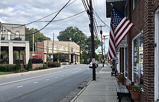
Cooleemee ( /ˈkləmi/ KOO-lə-mee) [4] is a town in Davie County, North Carolina, United States. The population was 940 at the 2020 census.

Contents

History

Cooleemee Mill Town Historic District and the Foard-Tatum House are listed on the National Register of Historic Places. [5] [6]

Geography

According to the United States Census Bureau, the town has a total area of 0.8 square miles (2.1 km2), all land.

Demographics

Historical population
CensusPop.Note
1990 971
2000 905−6.8%
2010 9606.1%
2020 940−2.1%
U.S. Decennial Census [7]

2020 census

Cooleemee racial composition [8]
RaceNumberPercentage
White (non-Hispanic)68773.09%
Black or African American (non-Hispanic)848.94%
Native American 10.11%
Asian 20.21%
Other/Mixed 869.15%
Hispanic or Latino 808.51%

As of the 2020 United States census, there were 940 people, 379 households, and 270 families residing in the town.

2000 census

As of the census [3] of 2000, there were 905 people, 400 households, and 254 families residing in the town. The population density was 1,166.6 inhabitants per square mile (450.4/km2). There were 456 housing units at an average density of 587.8 per square mile (227.0/km2). The racial makeup of the town was 91.71% White, 5.41% African American, 0.33% Native American, 1.10% from other races, and 1.44% from two or more races. Hispanic or Latino of any race were 4.09% of the population.

There were 400 households, out of which 25.5% had children under the age of 18 living with them, 49.3% were married couples living together, 8.5% had a female householder with no husband present, and 36.5% were non-families. 32.8% of all households were made up of individuals, and 18.3% had someone living alone who was 65 years of age or older. The average household size was 2.26 and the average family size was 2.85.

In the town, the population was spread out, with 22.0% under the age of 18, 7.4% from 18 to 24, 26.7% from 25 to 44, 22.7% from 45 to 64, and 21.2% who were 65 years of age or older. The median age was 40 years. For every 100 females, there were 103.8 males. For every 100 females age 18 and over, there were 97.2 males.

The median income for a household in the town was $29,833, and the median income for a family was $37,875. Males had a median income of $26,705 versus $20,813 for females. The per capita income for the town was $17,148. About 9.6% of families and 12.4% of the population were below the poverty line, including 18.6% of those under age 18 and 8.2% of those age 65 or over.

Notable people

See also

Related Research Articles

<span class="mw-page-title-main">Mount Pleasant, North Carolina</span> Town in North Carolina, United States

Mount Pleasant is a town located in eastern Cabarrus County, North Carolina, United States. As of the 2010 census, the town population was 1,652. The town center is located at the crossroads of Mount Pleasant Road and North Carolina Highway 73. NC Highway 49 skirts the town to the north on its way from Charlotte to Asheboro.

<span class="mw-page-title-main">Catawba, North Carolina</span> Town in North Carolina, United States

Catawba is a town in Catawba County, North Carolina, United States. The population was 603 at the 2010 census. It is part of the Hickory–Lenoir–Morganton Metropolitan Statistical Area. As with the county, the name recalls the Catawba people, the indigenous people who once inhabited the area.

<span class="mw-page-title-main">Mooresboro, North Carolina</span> Town in North Carolina, United States

Mooresboro is a town in Cleveland County, North Carolina, United States. The population was 311 at the 2010 census.

<span class="mw-page-title-main">Hope Mills, North Carolina</span> Town in North Carolina, United States

Hope Mills is a town in Cumberland County, North Carolina, United States. Its population was 15,176 at the 2010 census.

<span class="mw-page-title-main">Welcome, North Carolina</span> Census-designated place in North Carolina, United States

Welcome is a census-designated place (CDP) in Davidson County, North Carolina, United States. The population was 4,162 at the 2010 census. It is nationally known as the home of Richard Childress Racing. In addition, Walker and Associates, Inc., a nationwide communication value-add distribution is headquartered here. The town motto is "Welcome to Welcome, A Friendly Place," as posted on the welcoming sign. Neighboring communities and municipalities include Midway, Arcadia, and Lexington.

<span class="mw-page-title-main">Conetoe, North Carolina</span> Town in North Carolina, United States

Conetoe is a town in Edgecombe County, North Carolina, United States. It is part of the Rocky Mount, North Carolina Metropolitan Statistical Area. The population was 294 at the 2010 census.

<span class="mw-page-title-main">Leggett, North Carolina</span> Town in North Carolina, United States

Leggett is a town in Edgecombe County, North Carolina, United States. It is part of the Rocky Mount, North Carolina Metropolitan Statistical Area. The population was 37 in the 2020 Census.

<span class="mw-page-title-main">Buies Creek, North Carolina</span> Census-designated place in North Carolina, United States

Buies Creek is a census-designated place (CDP) located in the Neills Creek Township of Harnett County, North Carolina, United States. It is the home of Campbell University. The population was 3,253 at the 2020 census, up from 2,942 in 2010. Buies Creek is a part of the Dunn Micropolitan Area, which is also a part of the greater Raleigh–Durham–Cary Combined Statistical Area (CSA) as defined by the United States Census Bureau.

<span class="mw-page-title-main">Falkland, North Carolina</span> Town in North Carolina, United States

Falkland is a town in Pitt County, North Carolina, United States. The population was 96 at the 2010 census, making it the least populous town in Pitt County. The town is a part of the Greenville Metropolitan Area located in North Carolina's Inner Banks region.

<span class="mw-page-title-main">Winterville, North Carolina</span> Town in North Carolina, United States

Winterville is a town in Pitt County, North Carolina, United States. The population was 10,591 as of the 2020 census. The town is a part of the Greenville Metropolitan Area.

<span class="mw-page-title-main">Staley, North Carolina</span> Town in North Carolina, United States

Staley is a town in Randolph County, North Carolina, United States. The population was 393 at the 2010 census.

<span class="mw-page-title-main">Proctorville, North Carolina</span> Town in North Carolina, United States

Proctorville is a town in Robeson County, North Carolina, United States. The population was 117 at the 2010 census.
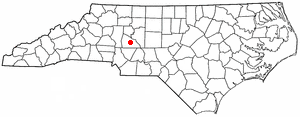
<span class="mw-page-title-main">Granite Quarry, North Carolina</span> Town in North Carolina, United States

Granite Quarry is a town in Rowan County, North Carolina, United States. The population was 2,984 at the 2020 census.

<span class="mw-page-title-main">Wingate, North Carolina</span> Town in North Carolina, United States

Wingate is a town in Union County, North Carolina, United States. The population was 3,491 at the 2010 census.

<span class="mw-page-title-main">Ronda, North Carolina</span> Town in North Carolina, United States

Ronda is a town in Wilkes County, North Carolina, United States. The population was 417 at the 2010 census, and 413 at the 2020 census. Ronda was named after a nearby estate called "Roundabout", which was the residence of Benjamin Cleveland, a locally prominent planter and a colonel in the North Carolina militia during the Revolutionary War. The town is home to East Wilkes High School, one of Wilkes County's five public high schools.

<span class="mw-page-title-main">Jackson, South Carolina</span> Town in South Carolina, United States of America

Jackson is a town in Aiken County, South Carolina, United States. The population was 1,700 at the 2010 census. It is part of the Augusta, Georgia metropolitan area.

<span class="mw-page-title-main">Fairfax, South Carolina</span> Town in South Carolina, United States

Fairfax is a town in Allendale and Hampton counties, South Carolina, United States. The population was 2,025 at the 2010 census, a decline of over one-third of its population of 3,206 from 2000.

<span class="mw-page-title-main">Great Falls, South Carolina</span> Town in South Carolina, United States

Great Falls is a town in Chester County, South Carolina, United States and is located fourteen miles southwest of Lancaster, South Carolina. The population was 1,951 at the 2020 census.
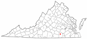
<span class="mw-page-title-main">Alberta, Virginia</span> Town in Virginia, United States

Alberta is a town in Brunswick County, Virginia, United States. The population was 302 at the 2020 census. It is home to the Christanna Campus of Southside Virginia Community College.
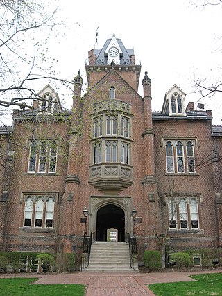
<span class="mw-page-title-main">Bethany, West Virginia</span> Town in West Virginia, United States

Bethany is a town in southern Brooke County, West Virginia, United States. The population was 756 at the 2020 census. It is part of the Weirton–Steubenville metropolitan area. It is best known as the home of Bethany College, a private liberal arts college that was the first institution of higher education in what is now West Virginia.

References

  1. "ArcGIS REST Services Directory". United States Census Bureau. Retrieved September 20, 2022.
  2. 1 2 U.S. Geological Survey Geographic Names Information System: Cooleemee, North Carolina
  3. 1 2 "U.S. Census website". United States Census Bureau . Retrieved January 31, 2008.
  4. Talk Like A Tarheel Archived June 22, 2013, at the Wayback Machine , from the North Carolina Collection's website at the University of North Carolina at Chapel Hill. Retrieved September 25, 2012.
  5. "National Register Information System". National Register of Historic Places . National Park Service. July 9, 2010.
  6. "National Register of Historic Places Listings". Weekly List of Actions Taken on Properties: 9/22/14 through 9/26/14. National Park Service. October 3, 2014.
  7. "Census of Population and Housing". Census.gov. Retrieved June 4, 2015.
  8. "Explore Census Data". data.census.gov. Retrieved December 20, 2021.