Davie County, North Carolina | |
|---|---|
 | |
 Flag  Seal Logo | |
| Motto: "You Belong Here" | |
 Location within the U.S. state of North Carolina | |
 Interactive map of Davie County, North Carolina | |
| Coordinates: 35°56′N80°32′W / 35.93°N 80.54°W | |
| Country | |
| State | |
| Founded | 1836 |
| Named after | William R. Davie |
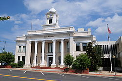
| Seat | Mocksville |
| Largest community | Mocksville |
| Area | |
• Total | 266.60 sq mi (690.5 km2) |
| • Land | 263.70 sq mi (683.0 km2) |
| • Water | 2.90 sq mi (7.5 km2) 1.09% |
| Population (2020) | |
• Total | 42,712 |
• Estimate (2024) | 45,383 |
| • Density | 161.97/sq mi (62.54/km2) |
| Time zone | UTC−5 (Eastern) |
| • Summer (DST) | UTC−4 (EDT) |
| Congressional district | 6th |
| Website | www |
Davie County is a county located in the U.S. state of North Carolina. As of the 2020 census, the population was 42,712. [1] Its county seat is Mocksville. [2]
Contents
- History
- Geography
- State and local protected areas
- Major water bodies
- Adjacent counties
- Major highways
- Demographics
- 2020 census
- 2000 census
- Government and politics
- Yadkin Valley wine region
- Communities
- Towns
- Townships
- Unincorporated communities
- Census-designated places
- Post offices
- See also
- References
- External links
Davie County is included in the Winston-Salem, NC Metropolitan Statistical Area, which is also included in the Greensboro–Winston-Salem–High Point, NC Combined Statistical Area.

