Clemmons, North Carolina

Last updated

Clemmons, North Carolina
Forsyth County North Carolina incorporated and unincorporated areas Clemmons highlighted.svg
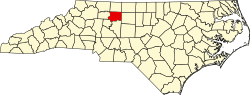
Location in Forsyth County and the state of North Carolina
Coordinates: 36°01′55″N80°23′10″W / 36.03194°N 80.38611°W / 36.03194; -80.38611
Country Flag of the United States.svg  United States
State Flag of North Carolina.svg  North Carolina
County Forsyth
Founded1802
Incorporated1824, 1986
Named for Peter Clemmons [1]
Government
  MayorMichael Rogers
  Mayor Pro TemporeMichael Combest
Area
[2]
  Total12.15 sq mi (31.46 km2)
  Land11.94 sq mi (30.93 km2)
  Water0.21 sq mi (0.54 km2)
Elevation
[3]
820 ft (250 m)
Population
 (2020)
  Total21,163
  Density1,772.15/sq mi (684.24/km2)
Time zone UTC-5 (Eastern (EST))
  Summer (DST) UTC-4 (EDT)
ZIP code
27012
Area code(s) 336, 743
FIPS code 37-12960 [4]
GNIS feature ID2407434 [3]
Website clemmons.org

Clemmons is a village in Forsyth County, North Carolina, United States and a suburb of Winston-Salem. The population was 21,177 at the 2020 census, with an estimated population of 21,517 in 2021. [5]

Contents

Geography

Clemmons is located in southwestern Forsyth County. It is bordered to the northeast by the city of Winston-Salem, to the north by the town of Lewisville, and to the southwest, across the Yadkin River, by the town of Bermuda Run in Davie County.

Interstate 40 passes through the village, with access from Exits 182 and 184. Downtown Winston-Salem is 10 miles (16 km) northeast via I-40 and U.S. Route 421, and I-40 leads southwest 34 miles (55 km) to Statesville.

According to the United States Census Bureau, Clemmons has a total area of 12.0 square miles (31.1 km2), of which 11.8 square miles (30.6 km2) is land and 0.2 square miles (0.5 km2), or 1.74%, is water. [6]

Demographics

Historical population
CensusPop.Note
1990 6,020
2000 13,827129.7%
2010 18,62734.7%
2020 21,17713.7%
2021 (est.)21,517 [5] 1.6%
U.S. Decennial Census [7]

2020 census

Clemmons racial composition [8]
RaceNumberPercentage
White (non-Hispanic)15,46673.08%
Black or African American (non-Hispanic)1,7158.1%
Native American 360.17%
Asian 9194.34%
Pacific Islander 90.04%
Other/Mixed 8293.92%
Hispanic or Latino 2,18910.34%

As of the 2020 United States census, there were 21,163 people, 7,733 households, and 5,400 families residing in the village.

2000 census

As of the census [4] of 2000, there were 13,827 people, 5,291 households, and 3,947 families residing in the village. The population density was 1,291.2 inhabitants per square mile (498.5/km2). There were 5,614 housing units at an average density of 524.2 per square mile (202.4/km2). The racial makeup of the village was 89.87% White, 5.21% African American, 0.09% Native American, 2.10% Asian, 0.02% Pacific Islander, 1.76% from other races, and 0.95% from two or more races. Hispanic or Latino of any race were 3.54% of the population.

Clemmons Town Hall Clemmonstownhall.jpg
Clemmons Town Hall

There were 5,291 households, out of which 36.3% had children under the age of 18 living with them, 64.5% were married couples living together, 7.7% had a female householder with no husband present, and 25.4% were non-families. 5.6% of households had someone living alone who was 65 years of age or older. The average household size was 2.56 and the average family size was 2.97.

In the village, the population was spread out, with 25.7% under the age of 18, 6.1% from 18 to 24, 30.6% from 25 to 44, 26.0% from 45 to 64, and 11.7% who were 65 years of age or older. The median age was 38 years. For every 100 females, there were 92.7 males. For every 100 females age 18 and over, there were 90.0 males.

The median income for a household in the village was $60,486, and the median income for a family was $70,029. Males had a median income of $49,892 versus $32,558 for females. The per capita income for the village was $27,679. About 2.8% of families and 3.5% of the population were below the poverty line, including 3.6% of those under age 18 and 8.5% of those age 65 or over.

Village facts

Points of interest

Related Research Articles

<span class="mw-page-title-main">Yadkin County, North Carolina</span> County in North Carolina, United States

Yadkin County is located in the U.S. state of North Carolina. As of the 2020 census, the population was 37,214. Its county seat is Yadkinville. Yadkin County is included in the Winston-Salem, NC Metropolitan Statistical Area, which is also included in the Greensboro–Winston-Salem–High Point, NC Combined Statistical Area.

<span class="mw-page-title-main">Stokes County, North Carolina</span> County in North Carolina, United States

Stokes County is a county located in the U.S. state of North Carolina. As of the 2020 census, the population was 44,520. Its county seat is Danbury.

<span class="mw-page-title-main">Forsyth County, North Carolina</span> County in North Carolina, United States

Forsyth County is located in the northwest Piedmont of the U.S. state of North Carolina. As of the 2020 census, the population was 382,590, making it the fourth-most populous county in North Carolina. Its county seat is Winston-Salem. Forsyth County is part of the Winston-Salem, NC, Metropolitan Statistical Area, which is also included in the Greensboro–Winston-Salem–High Point, NC, Combined Statistical Area. Portions of Forsyth County are in the Yadkin Valley wine region.

<span class="mw-page-title-main">Davie County, North Carolina</span> County in North Carolina, United States

Davie County is a county located in the U.S. state of North Carolina. As of the 2020 census, the population was 42,712. Its county seat is Mocksville.

Bermuda Run is a town in Davie County, North Carolina, United States. As of the 2020 census, the population of the town was 3,120. It was incorporated in 1999 as a fully gated residential community near country clubs and golf courses like the Bermuda Run Country Club, Oak Valley Golf Club, and Tanglewood Park. In 2000, the town annexed into neighboring Hillsdale, picking up a commercial district. The town rests on the western bank of the Yadkin River along U.S. Route 158 and North Carolina Highway 801. Interstate 40 provides express access to Winston-Salem, the town's nearest urban center. In 2012, Kinderton Village was voluntarily annexed by the town of Bermuda Run.

<span class="mw-page-title-main">Bethania, North Carolina</span> Town in North Carolina, United States

Bethania is the oldest municipality in Forsyth County, North Carolina, United States, and was most recently incorporated in 1995, upon the reactivation of the original 1838/1839 town charter. In 2009, Bethania celebrated the 250th anniversary of its establishment in 1759. As of the 2020 census, the town population was 341.

<span class="mw-page-title-main">Lewisville, North Carolina</span> Town in North Carolina, United States

Lewisville is a town in Forsyth County, North Carolina, United States. The population was 13,388 at the 2020 census, up from 12,639 in 2010. It is a Piedmont Triad community.

<span class="mw-page-title-main">Rural Hall, North Carolina</span> Town in North Carolina, United States

Rural Hall is a town in Forsyth County, North Carolina, United States. It is a part of the Piedmont Triad. The population was 3,360 at the 2020 census. The town has one public park: Covington Memorial Park.

<span class="mw-page-title-main">Walkertown, North Carolina</span> Town in North Carolina, United States

Walkertown is a town in Forsyth County, North Carolina, United States and a rural area outside of Winston-Salem. It is part of the Piedmont Triad. The population was 5,695 at the 2020 census.

<span class="mw-page-title-main">Winston-Salem, North Carolina</span> City in North Carolina, United States

Winston-Salem is a city in and the county seat of Forsyth County, North Carolina, United States. In the 2020 census, the population was 249,545, making it the second-largest municipality in the Piedmont Triad region, the fifth-most populous city in North Carolina, and the 90th-most populous city in the United States. Winston-Salem is home to the tallest office building in the region, 100 North Main Street, formerly known as the Wachovia Building and now known locally as the Wells Fargo Center.

Love Valley is a town in Iredell County, North Carolina, United States. It also extends into Alexander County on its western end. The population was 90 at the 2010 census, and in 2020 the estimated population was 154.

<span class="mw-page-title-main">Marshall, North Carolina</span> Town in North Carolina, United States

Marshall is a town in Madison County, North Carolina, United States. The population was 872 at the 2010 census. It is the county seat of Madison County.

<span class="mw-page-title-main">Wentworth, North Carolina</span> Town in North Carolina, United States

Wentworth is a town in Rockingham County, North Carolina, United States. The population was 2,646 at the 2020 census. Wentworth is the county seat of Rockingham County and is part of the Greensboro–High Point metropolitan area of the Piedmont Triad. On May 6, 2022, an EF-1 Tornado hit Wentworth. The storm traveled as a supercell with crazy structure from the Pilot Mountain, North Carolina, and Pinnacle, North Carolina, area across central Stokes County and into Rockingham County. It took out trees, damaged homes, and blocked roads before it lifted off southwest of Reidsville.

<span class="mw-page-title-main">Danbury, North Carolina</span> City in North Carolina, United States

Danbury is a city located in Danbury Township, Stokes County, North Carolina, United States. As of the 2020 census, the city had a total population of 142. It is the county seat of Stokes County. Danbury is located on North Carolina Highway 8/89 approximately 20 miles (32 km) north of Winston-Salem and is the "Gateway to Hanging Rock". The Stokes County Government Center, Arts Council, school board, county jail, a public library, a post office, and other public services are found within the town limits. LifeBrite Community Hospital of Stokes is located about a half mile northwest of the town. North Stokes High School, a big part of town, is located 7.4 miles to the northwest.

<span class="mw-page-title-main">Walnut Cove, North Carolina</span> Town in North Carolina, United States

Walnut Cove is a town in Stokes County, North Carolina, United States. The population was 1,536 at the 2020 census.

<span class="mw-page-title-main">East Bend, North Carolina</span> Town in North Carolina, United States

East Bend is a town in northeastern Yadkin County, North Carolina, United States. The population is 634 at the 2020 census. It is a Piedmont Triad community.

<span class="mw-page-title-main">Summitville, Ohio</span> Village in Ohio, United States

Summitville is a village in southwestern Columbiana County, Ohio, United States. The population was 110 at the 2020 census. It is part of the Salem micropolitan area, 27 miles (43 km) miles southeast of Canton and 32 miles (51 km) southwest of Youngstown.

<span class="mw-page-title-main">Kernersville, North Carolina</span> Town in North Carolina, United States

Kernersville is a town in Forsyth County and the largest suburb of Winston-Salem. The town is located in the U.S. state of North Carolina. A small portion of the town is also in Guilford County. The population was 26,481 at the 2020 census, up from 23,123 in 2010. Kernersville is located at the center of the Piedmont Triad metropolitan area, between Greensboro to the east, High Point to the south, and Winston-Salem to the west. Some of the farmland surrounding the town has been sold and turned into large middle-to-upper-class housing developments.

<span class="mw-page-title-main">Tobaccoville, North Carolina</span> Village in North Carolina, United States

Tobaccoville is a village in Forsyth and Stokes counties in the U.S. state of North Carolina. The population was 2,209 at the 2020 census. While a Tobaccoville post office was established in 1879, the village was not incorporated until 1991, as a defense against forced annexation of the area by the nearby city of King.

<span class="mw-page-title-main">Archdale, North Carolina</span> City in North Carolina, United States

Archdale is a city in Guilford and Randolph counties in the U.S. state of North Carolina. Located 15 miles southwest of Greensboro, it is part of the Greensboro-High Point Metropolitan Statistical Area of the Piedmont Triad metro region. The population of the city was 11,907 at the 2020 census.

References

  1. "North Carolina Gazetteer" . Retrieved November 24, 2023.
  2. "ArcGIS REST Services Directory". United States Census Bureau. Retrieved September 20, 2022.
  3. 1 2 U.S. Geological Survey Geographic Names Information System: Clemmons, North Carolina
  4. 1 2 "U.S. Census website". United States Census Bureau . Retrieved January 31, 2008.
  5. 1 2 Bureau, US Census. "City and Town Population Totals: 2020-2021". Census.gov. US Census Bureau. Retrieved July 9, 2022.
  6. "Geographic Identifiers: 2010 Census Summary File 1 (G001), Clemmons village, North Carolina". American FactFinder. U.S. Census Bureau. Archived from the original on February 13, 2020. Retrieved June 27, 2016.
  7. "Census of Population and Housing". Census.gov. Retrieved June 4, 2016.
  8. "Explore Census Data". data.census.gov. Retrieved December 20, 2021.
  9. "Village Facts | Clemmons, NC". www.clemmons.org. Retrieved August 25, 2023.