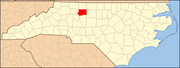
Forsyth County is a county located in the U.S. state of North Carolina. As of the 2010 census, the population was 350,670, making it the fourth-most populous county in North Carolina. Its county seat is Winston-Salem.
Fulton County is a county located in the U.S. state of Arkansas. As of the 2010 census, the population was 12,245. The county seat is Salem. Fulton County was formed on December 21, 1842, and named for William Fulton, the last governor of the Arkansas Territory. It is an alcohol prohibition or dry county.

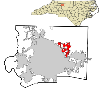
Clemmons is a village in Forsyth County, North Carolina and a suburb of Winston-Salem. The population was 18,627 at the 2010 census, with an estimated population of 20,563 in 2018.

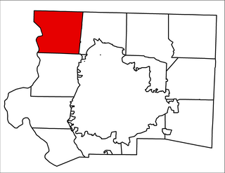
Rural Hall is a town in Forsyth County, North Carolina, United States. It is a part of the Piedmont Triad. The population was 2,937 at the 2010 census. The town has two public parks: Horizons Park, and Covington Memorial Park.
Walkertown is a town in Forsyth County, North Carolina, United States. It is part of the Piedmont Triad. The population was 4,675 at the 2010 census.

Tobaccoville is a village in Forsyth and Stokes counties in the U.S. state of North Carolina. The population was 2,441 at the 2010 census. While a Tobaccoville post office was established in 1887, the village was not incorporated until 1991, as a defense against forced annexation of the area by the nearby city of King.

Union Township is one of eleven townships in Randolph County, Indiana, which contains the towns of Modoc and Losantville. As of the 2010 census, its population was 2,142 and it contained 960 housing units.

Old Town Township is one of fifteen townships in Forsyth County, North Carolina, United States. The township had a population of 149 according to the 2010 census.

Abbotts Creek Township is one of fifteen townships in Forsyth County, North Carolina, United States. The township had a population of 11,310 according to the 2010 census.

Winston Township is one of fifteen townships in Forsyth County, North Carolina, United States. The township had a population of 229,617, according to the 2010 census.
Old Richmond Township is one of fifteen townships in Forsyth County, North Carolina, United States. The township had a population of 5,236 according to the 2010 census.
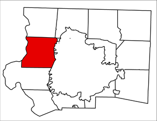
Bethania Township is one of fifteen townships in Forsyth County, North Carolina, United States. The township had a population of 9,200 according to the 2010 census.

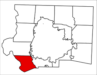
South Fork Township is one of fifteen townships in Forsyth County, North Carolina, United States. The township had a population of 2,576 according to the 2010 census.
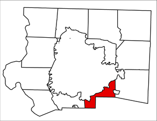
Clemmonsville Township is one of fifteen townships in Forsyth County, North Carolina, United States. The township had a population of 14,927 according to the 2010 census.

Lewisville Township is one of fifteen townships in Forsyth County, North Carolina, United States. The township had a population of 17,707 according to the 2010 census.
Vienna Township is one of fifteen townships in Forsyth County, North Carolina, United States. The township had a population of 10,243 according to the 2010 census.
Broadbay Township is one of fifteen townships in Forsyth County, North Carolina, United States. The township had a population of 2,002 according to the 2010 census.

Kernersville Township is one of fifteen townships in Forsyth County, North Carolina, United States. The township had a population of 30,386 according to the 2010 census.

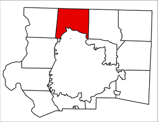
Belews Creek Township is one of fifteen townships in Forsyth County, North Carolina, United States. The township had a population of 2,647 according to the 2010 census.

Chambersburg Township is a township in Iredell County, North Carolina. The 2010 United States Census reported a total population of 11,344.