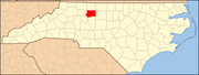
Forsyth County is located in the northwest Piedmont of the U.S. state of North Carolina. As of the 2020 census, the population was 382,590, making it the fourth-most populous county in North Carolina. Its county seat is Winston-Salem. Forsyth County is part of the Winston-Salem, NC, Metropolitan Statistical Area, which is also included in the Greensboro-Winston-Salem-High Point, NC, Combined Statistical Area. Portions of Forsyth County are in the Yadkin Valley wine region.

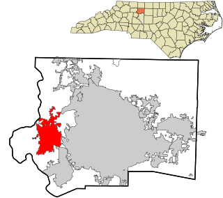
Clemmons is a village in Forsyth County, North Carolina, United States and a suburb of Winston-Salem. The population was 18,627 at the 2010 census, with an estimated population of 20,867 in 2019.
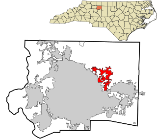
Lewisville is a town in Forsyth County, North Carolina, United States. The population was 12,639 at the 2010 census, up from 8,826 in 2000. It is a Piedmont Triad community.
Walkertown is a town in Forsyth County, North Carolina, United States and a rural area outside of Winston-Salem. It is part of the Piedmont Triad. The population was 4,675 at the 2010 census.

Tobaccoville is a village in Forsyth and Stokes counties in the U.S. state of North Carolina. The population was 2,441 at the 2010 census. While a Tobaccoville post office was established in 1887, the village was not incorporated until 1991, as a defense against forced annexation of the area by the nearby city of King.

Wallburg is a town in Davidson County, North Carolina, United States. It was incorporated in 2004. As of the 2010 census it had a population of 3,047.

Old Town Township is one of fifteen townships in Forsyth County, North Carolina, United States. The township had a population of 149 according to the 2010 census.

Abbotts Creek Township is one of fifteen townships in Forsyth County, North Carolina, United States. The township had a population of 11,310 according to the 2010 census.
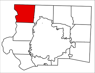
Old Richmond Township is one of fifteen townships in Forsyth County, North Carolina, United States. The township had a population of 5,236 according to the 2010 census.
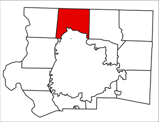
Bethania Township is one of fifteen townships in Forsyth County, North Carolina, United States. The township had a population of 9,200 according to the 2010 census.

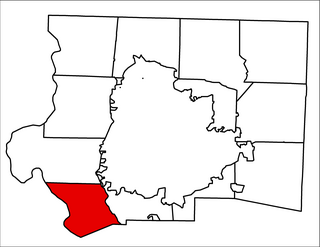
South Fork Township is one of fifteen townships in Forsyth County, North Carolina, United States. The township had a population of 2,576 according to the 2010 census.
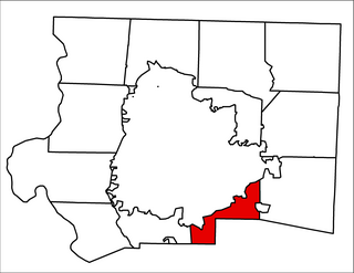
Clemmonsville Township is one of fifteen townships in Forsyth County, North Carolina, United States. The township had a population of 14,927 according to the 2010 census.

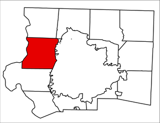
Lewisville Township is one of fifteen townships in Forsyth County, North Carolina, United States. The township had a population of 17,707 according to the 2010 census.
Vienna Township is one of fifteen townships in Forsyth County, North Carolina, United States. The township had a population of 10,243 according to the 2010 census.

Middle Fork Township is a former township in Forsyth County, North Carolina, United States. The township had a population of 6,779 according to the 2000 census. In 2003, Middle Fork Township split into Middle Fork I Township and Middle Fork II Township.
Broadbay Township is one of fifteen townships in Forsyth County, North Carolina, United States. The township had a population of 2,002 according to the 2010 census.

Kernersville Township is one of fifteen townships in Forsyth County, North Carolina, United States. The township had a population of 30,386 according to the 2010 census.

Salem Chapel Township is one of fifteen townships in Forsyth County, North Carolina, United States. The township had a population of 6,808 according to the 2010 census.

Belews Creek Township is one of fifteen townships in Forsyth County, North Carolina, United States. The township had a population of 2,647 according to the 2010 census.
Middle Fork II Township is a township in Forsyth County, North Carolina, United States. As of the 2010 Census, it had a population of 2,639. The township covers an area of 6.315 square miles (16.36 km2). Middle Fork II Township was formed in April 2003, when Middle Fork Township was split into Middle Fork II Township and Middle Fork I Township.