Southern Pines, North Carolina | |
|---|---|
 | |
 Seal | |
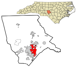 Location in Moore County (bottom) and the state of North Carolina (top) | |
| Coordinates: 35°11′36″N79°24′14″W / 35.19333°N 79.40389°W | |
| Country | United States |
| State | North Carolina |
| County | Moore |
| Named after | Its location on the edge of the longleaf pine belt [1] |
| Government | |
| • Mayor | Taylor Clement |
| Area | |
| 18.6 sq mi (48 km2) | |
| • Land | 18.4 sq mi (48 km2) |
| • Water | 0.2 sq mi (0.52 km2) |
| Elevation | 512 ft (156 m) |
| Population | |
| 15,545 | |
| • Density | 846.4/sq mi (326.8/km2) |
| • Urban | 50,319 (Pinehurst–Southern Pines) (US: 505th) [5] |
| • Urban density | 1,059.6/sq mi (409.1/km2) |
| Time zone | UTC−5 (Eastern (EST)) |
| • Summer (DST) | UTC−4 (EDT) |
| ZIP Codes | |
| Area codes | 910, 472 |
| FIPS code | 37-63120 [6] |
| GNIS feature ID | 2407374 [3] |
| Website | www |
Southern Pines is a town in Moore County, North Carolina, United States. The population was 15,545 as of the 2020 census, [4] up from 12,334 in 2010.

